- Thornton, Iowa
Infobox Settlement
official_name = Thornton, Iowa
settlement_type =City
nickname =
motto =
imagesize =
image_caption =
image_
imagesize =
image_caption =
image_
mapsize = 250px
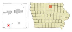
map_caption = Location of Thornton, Iowa
mapsize1 =
map_caption1 =subdivision_type = Country
subdivision_name =
subdivision_type1 = State
subdivision_name1 =
subdivision_type2 = County
subdivision_name2 = Cerro Gordo
government_footnotes =
government_type =
leader_title =
leader_name =
leader_title1 =
leader_name1 =
established_title =
established_date =unit_pref = Imperial
area_footnotes =area_magnitude =
area_total_km2 = 3.2
area_land_km2 = 3.2
area_water_km2 = 0.0
area_total_sq_mi = 1.2
area_land_sq_mi = 1.2
area_water_sq_mi = 0.0population_as_of = 2000
population_footnotes =
population_total = 422
population_density_km2 = 130.7
population_density_sq_mi = 338.6timezone = Central (CST)
utc_offset = -6
timezone_DST = CDT
utc_offset_DST = -5
elevation_footnotes =
elevation_m = 362
elevation_ft = 1188
latd = 42 |latm = 56 |lats = 42 |latNS = N
longd = 93 |longm = 23 |longs = 3 |longEW = Wpostal_code_type =
ZIP code
postal_code = 50479
area_code = 641
blank_name = FIPS code
blank_info = 19-77880
blank1_name = GNIS feature ID
blank1_info = 0462227
website =
footnotes =Thornton is a city in Cerro Gordo County,
Iowa ,United States . The population was 422 at the 2000 census. It is part of the Mason City Micropolitan Statistical Area.Geography
Thornton is located at coor dms|42|56|42|N|93|23|3|W|city (42.944972, -93.384115)GR|1.
According to the
United States Census Bureau , the city has a total area of 1.2square mile s (3.2km² ), all of it land.Demographics
As of the
census GR|2 of 2000, there were 422 people, 183 households, and 124 families residing in the city. Thepopulation density was 338.6 people per square mile (130.3/km²). There were 193 housing units at an average density of 154.8/sq mi (59.6/km²). The racial makeup of the city was 98.58% White, 0.24% Native American, 0.71% from other races, and 0.47% from two or more races. Hispanic or Latino of any race were 1.18% of the population.There were 183 households out of which 24.0% had children under the age of 18 living with them, 59.6% were married couples living together, 5.5% had a female householder with no husband present, and 31.7% were non-families. 29.5% of all households were made up of individuals and 16.9% had someone living alone who was 65 years of age or older. The average household size was 2.31 and the average family size was 2.81.
In the city the population was spread out with 21.3% under the age of 18, 9.0% from 18 to 24, 24.9% from 25 to 44, 19.0% from 45 to 64, and 25.8% who were 65 years of age or older. The median age was 42 years. For every 100 females there were 98.1 males. For every 100 females age 18 and over, there were 98.8 males.
The median income for a household in the city was $35,125, and the median income for a family was $43,750. Males had a median income of $30,893 versus $19,000 for females. The
per capita income for the city was $16,622. About 5.0% of families and 11.0% of the population were below thepoverty line , including 14.1% of those under age 18 and 6.5% of those age 65 or over.chools
As of the 2008-2009 school year, Thornton is part of West Fork Schools, along with students from then neighboring towns of Meservey, Sheffield, Chapin, Rockwell, Swaledale, and the surrounding area.
The Thornton school building was built in 1936 after the previous school burned in a large fire. In 1955, a large addition, including a gymnasium, library, offices, and additional classrooms was added. In 1963, the building became the high school, and later the Jr.-Sr. High, for the combined Meservey-Thornton school district. Due to declining enrollments, in 1983 the Meservey building was closed and the Thornton facility was again used for grades K-12. In 1988, Meservey-Thornton began whole-grade sharing with Sheffield-Chapin school district, and the building was used as an elementary and middle-school.
The Meservey-Thornton mascot was the "Lancers". When the high school classes moved to Sheffield in 1988, the Lancer mascot was retained for the middle-school sports teams. However, with the S-C and M-T districts formally merging in 2007, the Lancer mascot was officially retired with a parade in July, 2007.
Due to declining enrollment, the former S-C, M-T, and neighboring Rockwell-Swaledale school districts entered a whole-grade sharing agreement to become the West Fork school district in 2008, with the "Warhawks" as the new mascott. The Thornton building closed after the 2007-08 season after 72 years of service, and all students now attend Sheffield and Rockwell. Each remaining school will have K - 3, Rockwell will house 4 - 8 and Sheffield 9 - 12.
On
July 5 ,2008 , an all-school reunion was held to commemorate the closing of the Thornton School.References
External links
Wikimedia Foundation. 2010.


