- National Register of Historic Places listings in Hughes County, Oklahoma
-
 Location of Hughes County in Oklahoma
This is a list of the National Register of Historic Places listings in Hughes County, Oklahoma.
This is intended to be a complete list of the properties on the National Register of Historic Places in Hughes County, Oklahoma, United States. The locations of National Register properties for which the latitude and longitude coordinates are included below, may be seen in a Google map.[1]
There are 10 properties listed on the National Register in the county.
-
- This National Park Service list is complete through NPS recent listings posted November 10, 2011.[2]
Current listings
[3] Landmark name [4] Image Date listed Location City or town Summary 1 Dustin Agricultural Building September 8, 1988 Rutherford and 4th Sts.
35°16′10″N 96°01′45″W / 35.269444°N 96.029167°WDustin 2 Holdenville Armory September 8, 1988 U.S. Route 270 and N. Butts St.
35°05′11″N 96°23′01″W / 35.086389°N 96.383611°WHoldenville 3 Holdenville City Hall September 11, 1981 102 Creek St.
35°05′01″N 96°24′07″W / 35.083611°N 96.401944°WHoldenville 4 Levering Mission May 16, 1974 Northeast of Wetumka
35°14′55″N 96°11′34″W / 35.248611°N 96.192778°WWetumka 5 Moss School Gymnasium September 8, 1988 Off the intersection of U.S. Routes 75 and 270
35°04′18″N 96°13′48″W / 35.071667°N 96.23°WHoldenville 6 Spaulding School Gymnasium-Auditorium September 8, 1988 Section Line Highway and 2nd St.
35°00′42″N 96°26′30″W / 35.011667°N 96.441667°WSpaulding 7 Stuart Hotel October 7, 1982 Off U.S. Route 270
34°54′12″N 96°05′55″W / 34.903333°N 96.098611°WStuart 8 John E. Turner House January 27, 1983 401 E. 10th St.
35°04′59″N 96°23′42″W / 35.083056°N 96.395°WHoldenville 9 Wetumka Armory September 8, 1988 St. Louis and Wetumka Sts.
35°14′08″N 96°14′38″W / 35.235556°N 96.243889°WWetumka 10 Wetumka Cemetery Pavilion and Fence September 8, 1988 East of Wetumka
35°14′12″N 96°12′36″W / 35.236667°N 96.21°WWetumka See also
- List of National Historic Landmarks in Oklahoma
- National Register of Historic Places listings in Oklahoma
References
- ^ The latitude and longitude information provided in this table was derived originally from the National Register Information System, which has been found to be fairly accurate for about 99% of listings. For about 1% of NRIS original coordinates, experience has shown that one or both coordinates are typos or otherwise extremely far off; some corrections may have been made. A more subtle problem causes many locations to be off by up to 150 yards, depending on location in the country: most NRIS coordinates were derived from tracing out latitude and longitudes off of USGS topographical quadrant maps created under the North American Datum of 1927, which differs from the current, highly accurate WGS84 GPS system used by Google maps. Chicago is about right, but NRIS longitudes in Washington are higher by about 4.5 seconds, and are lower by about 2.0 seconds in Maine. Latitudes differ by about 1.0 second in Florida. Some locations in this table may have been corrected to current GPS standards.
- ^ "National Register of Historic Places: Weekly List Actions". National Park Service, United States Department of the Interior. Retrieved on November 10, 2011.
- ^ Numbers represent an ordering by significant words. Various colorings, defined here, differentiate National Historic Landmark sites and National Register of Historic Places Districts from other NRHP buildings, structures, sites or objects.
- ^ "National Register Information System". National Register of Historic Places. National Park Service. . http://nrhp.focus.nps.gov/natreg/docs/All_Data.html.
U.S. National Register of Historic Places Topics Lists by states Alabama • Alaska • Arizona • Arkansas • California • Colorado • Connecticut • Delaware • Florida • Georgia • Hawaii • Idaho • Illinois • Indiana • Iowa • Kansas • Kentucky • Louisiana • Maine • Maryland • Massachusetts • Michigan • Minnesota • Mississippi • Missouri • Montana • Nebraska • Nevada • New Hampshire • New Jersey • New Mexico • New York • North Carolina • North Dakota • Ohio • Oklahoma • Oregon • Pennsylvania • Rhode Island • South Carolina • South Dakota • Tennessee • Texas • Utah • Vermont • Virginia • Washington • West Virginia • Wisconsin • WyomingLists by territories Lists by associated states Other Municipalities and communities of Hughes County, Oklahoma Cities 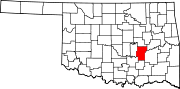
Towns Unincorporated
communitiesBig Spring | Carson | Citra | Hill Top | Non
Footnotes ‡This populated place also has portions in an adjacent county or counties
Categories:- Hughes County, Oklahoma
- National Register of Historic Places in Oklahoma by county
- Buildings and structures in Hughes County, Oklahoma
-

Wikimedia Foundation. 2010.