- Faith, South Dakota
Infobox Settlement
official_name = Faith, South Dakota
other_name =
native_name =
nickname =
settlement_type =City
motto =
imagesize =
image_caption =
flag_size =
image_
seal_size =
image_shield =
shield_size =
image_blank_emblem =
blank_emblem_type =
blank_emblem_size =
imagesize =
image_caption =
flag_size =
image_
seal_size =
image_shield =
shield_size =
image_blank_emblem =
blank_emblem_type =
blank_emblem_size =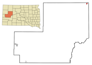
mapsize = 250px
map_caption = Location in Meade County and the state ofSouth Dakota
mapsize1 =
map_caption1 =
image_dot_
dot_mapsize =
dot_map_caption =
dot_x =
dot_y =
pushpin_
pushpin_label_position =
pushpin_map_caption =
pushpin_mapsize =
subdivision_type = Country
subdivision_name =United States
subdivision_type1 = State
subdivision_name1 =South Dakota
subdivision_type2 = County
subdivision_name2 = Meade
subdivision_type3 =
subdivision_name3 =
subdivision_type4 =
subdivision_name4 =
government_footnotes =
government_type =
leader_title =
leader_name =
leader_title1 =
leader_name1 =
leader_title2 =
leader_name2 =
leader_title3 =
leader_name3 =
leader_title4 =
leader_name4 =
established_title =
established_date =
established_title2 =
established_date2 =
established_title3 =
established_date3 =
area_magnitude =
unit_pref = Imperial
area_footnotes =
area_total_km2 = 3.1
area_land_km2 = 3.1
area_water_km2 = 0
area_total_sq_mi = 1.2
area_land_sq_mi = 1.2
area_water_sq_mi = 0
area_water_percent =
area_urban_km2 =
area_urban_sq_mi =
area_metro_km2 =
area_metro_sq_mi =
area_blank1_title =
area_blank1_km2 =
area_blank1_sq_mi =
population_as_of = 2000
population_footnotes =
population_note =
population_total = 489
population_density_km2 = 157.7
population_density_sq_mi = 407.5
population_metro =
population_density_metro_km2 =
population_density_metro_sq_mi =
population_urban =
population_density_urban_km2 =
population_density_urban_sq_mi =
population_blank1_title =
population_blank1 =
population_density_blank1_km2 =
population_density_blank1_sq_mi =
timezone = Mountain (MST)
utc_offset = -7
timezone_DST = MDT
utc_offset_DST = -6
latd = 45 |latm = 1 |lats = 18 |latNS = N
longd = 102 |longm = 2 |longs = 22 |longEW = W
elevation_footnotes =
elevation_m = 791
elevation_ft = 2595
postal_code_type =ZIP code
postal_code = 57626Faith is home to Faith High School
area_code = 605
blank_name = FIPS code
blank_info = 46-20980GR|2
blank1_name = GNIS feature ID
blank1_info = 1255004GR|3
website =
footnotes =Faith is a city in Meade County,
South Dakota ,United States . The population was 489 at the 2000 census. Sue, the most complete "Tyrannosaurus rex" skeleton known, was discovered about 15 miles north and east of Faith in June 1990.Geography
Faith is located at coor dms|45|1|18|N|102|2|22|W|city (45.021648, -102.039502)GR|1.
According to the
United States Census Bureau , the city has a total area of 1.2square mile s (3.1km² ), all of it land.Faith has been assigned the
ZIP code 57626 and theFIPS place code 20980.History
Local residents have been known to say the town was named because it took
faith to live out on theprairie .Fact|date=April 2008 However, the story of the city as documented in various informal, locally published histories, is that the town was named for Faith Rockefeller, one of the daughters of a major investor in the railroad responsible for founding the town. This is in keeping with the names of other towns on the route of the old railroad (now abandoned), such asIsabel, South Dakota . Faith was the permanent end of the railroad, a local spur off the Great Northern Railway across the Dakotas and Montana.Demographics
As of the
census GR|2 of 2000, there were 489 people, 201 households, and 139 families residing in the city. Thepopulation density was 408.0 people per square mile (157.3/km²). There were 274 housing units at an average density of 228.6/sq mi (88.2/km²). The racial makeup of the city was 89.78% White, 0.20% African American, 6.13% Native American, and 3.89% from two or more races.There were 201 households out of which 32.8% had children under the age of 18 living with them, 59.2% were married couples living together, 7.0% had a female householder with no husband present, and 30.8% were non-families. 29.4% of all households were made up of individuals and 16.4% had someone living alone who was 65 years of age or older. The average household size was 2.43 and the average family size was 3.02.
In the city the population was spread out with 26.8% under the age of 18, 6.1% from 18 to 24, 21.5% from 25 to 44, 24.9% from 45 to 64, and 20.7% who were 65 years of age or older. The median age was 42 years. For every 100 females there were 100.4 males. For every 100 females age 18 and over, there were 97.8 males.
The median income for a household in the city was $27,708, and the median income for a family was $38,333. Males had a median income of $22,250 versus $17,222 for females. The
per capita income for the city was $16,276. About 7.5% of families and 10.8% of the population were below thepoverty line , including 19.8% of those under age 18 and 7.7% of those age 65 or over.Transportation
Faith is accessed from
U.S. Route 212 , and South Dakota state highway 73. The nearest commercial airports are located at Pierre, the state capital, and Rapid City, the major market city of the region, located 100 miles to the southwest. The railroad was constructed in 1910 and abandoned in the 1960s; there is presently no scheduled passenger bus service or freight service to the city.Region
Faith is located in the
West River region ofSouth Dakota , that part of the state located west of theMissouri River , and in theNorthern Great Plains , on a ridge dividing theCheyenne River to the south and theGrand River and its major tributary, theMoreau River to the north (both are tributaries of the Missouri). Faith is the center of a vast cattle and sheep ranching area, and is the community center for hundreds of scattered ranchsteads. It is located in the extreme northeast corner of Meade County, South Dakota's largest: it is approximately 75 miles to Sturgis, the county seat. It is also located immediately west of the boundary of theCheyenne River Indian Reservation , home to severalLakota bands organized into theCheyenne River Sioux Tribe or CRST. The region is well-known for deer hunting and also offers pheasant, elk, and recently, prairie mountain lion hunting. A small reservoir, Durkee Lake, is approximately three miles south and offers a local recreation venue, with its boating, fishing, golf course, beach, and camping.Past and Future
Founded as the town at the end of the railroad, Faith was originally the hub of a homestead boom in the period 1910-1920; but the drought conditions of the 1920s that led to the
Dust Bowl of the 1930s quickly replaced abnormally wet conditions of the early 20th Century, and the harsh winters of the Northern Plains quickly drove many sodbusters to more hospitable regions. The town's location allows for ranch families in the area to have schools and stores closer than Sturgis, Fort Pierre, or other regional market towns, but early expectations of steady growth were never realized. Faith is still well-known for its rodeos and livestock sales. The town's location made it a necessary stop on theSunset Trail also known as theYellowstone Trail .Although like most small rural cities of the Great Plains, Faith has declined in population, its distance from alternative locations for schools and businesses and its geographic location near county and reservation boundaries mean that it is unlikely to become a ghost town or see its institutions consolidated out of existence.
Notable residents
*
Catherine Bach , actress
*Boyd Raeburn , jazz bandleader and bass saxophonist (1913-1966)References
External links
Wikimedia Foundation. 2010.