- Mud Butte, South Dakota
-
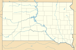
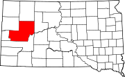
Mud Butte — Unincorporated community — Location within the state of South Dakota Coordinates: 45°0′17″N 102°52′40″W / 45.00472°N 102.87778°WCoordinates: 45°0′17″N 102°52′40″W / 45.00472°N 102.87778°W Country United States State South Dakota County Meade Elevation 2,871 ft (875 m) Time zone Mountain (MST) (UTC-7) - Summer (DST) MDT (UTC-6) ZIP codes 57758 FIPS code GNIS feature ID 1256574[1] Mud Butte is an unincorporated community in northern Meade County, South Dakota, United States. It lies along U.S. Route 212 northeast of the city of Sturgis, the county seat of Meade County.[2] Its elevation is 2,871 feet (875 m).[1] Although it is unincorporated, it has a post office, with the ZIP code of 57758.[3]
References
- ^ a b "Mud Butte, South Dakota". Geographic Names Information System, U.S. Geological Survey. http://geonames.usgs.gov/pls/gnispublic/f?p=gnispq:3:::NO::P3_FID:1256574. Retrieved 2008-03-04.
- ^ Rand McNally. The Road Atlas '05. Chicago: Rand McNally, 2005, p. 93.
- ^ Zip Code Lookup
Municipalities and communities of Meade County, South Dakota County seat: Sturgis Cities CDPs Unincorporated
communitiesElm Springs | Enning | Howes | Mud Butte | White Owl
Indian reservations Footnotes ‡This populated place also has portions in an adjacent county or counties
Categories:- South Dakota geography stubs
- Populated places in Meade County, South Dakota
- Unincorporated communities in South Dakota
Wikimedia Foundation. 2010.


