- Muldraugh, Kentucky
-
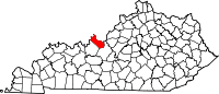
Muldraugh, Kentucky — City — Location of Muldraugh, Kentucky
Coordinates: 37°56′13″N 85°59′29″W / 37.93694°N 85.99139°WCoordinates: 37°56′13″N 85°59′29″W / 37.93694°N 85.99139°W Country United States State Kentucky Counties Meade, Hardin Area – Total 0.6 sq mi (1.5 km2) – Land 0.6 sq mi (1.5 km2) – Water 0.0 sq mi (0.0 km2) Elevation 738 ft (225 m) Population (2000) – Total 1,298 – Density 2,264.6/sq mi (874.4/km2) Time zone Eastern (EST) (UTC-5) – Summer (DST) EDT (UTC-4) ZIP code 40155 Area code(s) 502 FIPS code 21-54480 GNIS feature ID 0499075 Muldraugh is a city in Hardin and Meade Counties in the U.S. state of Kentucky. It lies on U.S. Route 31W, approximately halfway between Louisville and Elizabethtown. The city's limits are completely encompassed by the Fort Knox Army base. The population was 1,298 at the 2000 census.
The Meade County portion of Muldraugh is part of the Louisville–Jefferson County Metropolitan Statistical Area, while the Hardin County portion is included in the Elizabethtown Metropolitan Statistical Area.
Geography
Muldraugh is located just north of Muldraugh Hill. The road coming to the town from the north, now US 31W & 60, is very steep, which is the source of the town's name, since the only way to get up the hill before automobiles was with a "mule drawn" wagon.
Muldraugh is located at 37°56′13″N 85°59′29″W / 37.93694°N 85.99139°W (37.936975, -85.991414)[1].
According to the United States Census Bureau, the city has a total area of 0.6 square miles (1.5 km²), all land.
Muldraugh has the distinction as being the only one-sided town in the United States. With Ft. Knox territory on one side of US 31W, the town was forced to build on the parallel side.
Demographics
As of the census[2] of 2000, there were 1,298 people, 519 households, and 319 families residing in the city. The population density was 2,264.6 people per square mile (879.2/km²). There were 635 housing units at an average density of 1,107.9 per square mile (430.1/km²). The racial makeup of the city was 82.36% White, 9.94% African American, 1.39% Native American, 1.00% Asian, 0.08% Pacific Islander, 2.16% from other races, and 3.08% from two or more races. Hispanics or Latinos of any race were 7.01% of the population.
 The Meade County Bank in Muldraugh resembles the bullion depository's exterior design at Fort Knox
There were 519 households out of which 34.7% had children under the age of 18 living with them, 38.2% were married couples living together, 17.0% had a female householder with no husband present, and 38.5% were non-families. 30.8% of all households were made up of individuals and 6.0% had someone living alone who was 65 years of age or older. The average household size was 2.50 and the average family size was 3.12.
The age distribution was 28.2% under the age of 18, 13.6% from 18 to 24, 34.7% from 25 to 44, 16.4% from 45 to 64, and 7.1% who were 65 years of age or older. The median age was 29 years. For every 100 females there were 104.4 males. For every 100 females age 18 and over, there were 107.6 males.
The median income for a household in the city was $29,712, and the median income for a family was $31,625. Males had a median income of $27,955 versus $20,450 for females. The per capita income for the city was $13,318. About 19.5% of families and 20.7% of the population were below the poverty line, including 27.6% of those under age 18 and 23.9% of those age 65 or over.
References
- ^ "US Gazetteer files: 2010, 2000, and 1990". United States Census Bureau. 2011-02-12. http://www.census.gov/geo/www/gazetteer/gazette.html. Retrieved 2011-04-23.
- ^ "American FactFinder". United States Census Bureau. http://factfinder.census.gov. Retrieved 2008-01-31.
Municipalities and communities of Hardin County, Kentucky Cities Elizabethtown | Muldraugh‡ | Radcliff | Sonora | Upton‡ | Vine Grove | West Point

CDP Communities Footnotes ‡This populated place also has portions in an adjacent county or counties
Municipalities and communities of Meade County, Kentucky Cities Brandenburg | Ekron | Muldraugh‡
CDP Unincorporated
communitiesBattletown | Flaherty | Guston | Payneville | Rhodelia
Footnotes ‡This populated place also has portions in an adjacent county or counties
Categories:- Populated places in Hardin County, Kentucky
- Populated places in Meade County, Kentucky
- Cities in Kentucky
- Elizabethtown metropolitan area
- Louisville metropolitan area


Wikimedia Foundation. 2010.