- National Register of Historic Places listings in Oktibbeha County, Mississippi
-
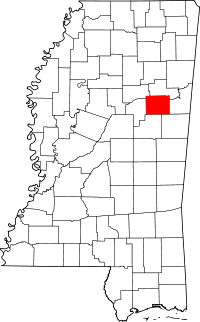 Location of Oktibbeha County in Mississippi
This is a list of the National Register of Historic Places listings in Oktibbeha County, Mississippi.
This is intended to be a complete list of the properties and districts on the National Register of Historic Places in Oktibbeha County, Mississippi, United States. Latitude and longitude coordinates are provided for many National Register properties and districts; these locations may be seen together in a Google map.[1]
There are 21 properties and districts listed on the National Register in the county.
-
- This National Park Service list is complete through NPS recent listings posted November 10, 2011.[2]
Current listings
[3] Landmark name [4] Image Date listed Location City or town Summary 1 Bardwell House July 16, 1992 309 Blackjack Rd.
33°26′53″N 88°46′56″W / 33.448056°N 88.782222°WStarkville 2 Bell House October 29, 1992 1280 Mississippi Highway 25, S.
33°26′11″N 88°49′06″W / 33.436389°N 88.818333°WStarkville 3 Thomas Battle Carroll House May 1, 1991 304 S. Jackson St.
33°27′36″N 88°48′51″W / 33.46°N 88.814167°WStarkville 4 The Cedars October 10, 1985 Old W. Point Rd.
33°28′31″N 88°48′04″W / 33.475278°N 88.801111°WStarkville 5 C. E. Gay House January 3, 1991 110 E. Gillespie St.
33°27′28″N 88°48′55″W / 33.457778°N 88.815278°WStarkville 6 Gillespie-Jackson House November 6, 1986 Southeastern corner of the junction of Mississippi Highways 12 and 25
33°27′13″N 88°49′17″W / 33.453611°N 88.821389°WStarkville 7 Greensboro Street Historic District June 14, 1982 Greensboro St.; also Ernest Jones Jr. Dr., Greensboro St., Louisville St., Main St., W., Raymond St., and Yeates St.
33°27′42″N 88°49′29″W / 33.461667°N 88.824722°WStarkville Second set of boundaries represents a boundary increase of July 10, 2008 8 Herman Mound and Village Site March 17, 1993 Address Restricted Starkville 9 Hotel Chester January 18, 1985 217-223 E. Main St.
33°27′50″N 88°48′51″W / 33.463889°N 88.814167°WStarkville 10 Lampkin-Owens House November 24, 1980 117 N. Montgomery St.
33°27′56″N 88°48′38″W / 33.465556°N 88.810556°WStarkville 11 Lyon's Bluff Site April 22, 1976 Address Restricted Starkville 12 Magruder-Newsom House August 30, 1984 306 S. Jackson St.
33°27′36″N 88°48′51″W / 33.46°N 88.814167°WStarkville 13 Meadow Woods Plantation House September 7, 2001 2479 Oktoc Rd.
33°22′04″N 88°45′43″W / 33.367778°N 88.761944°WStarkville 14 Montgomery Hall 
March 26, 1975 Mississippi State University campus
33°27′13″N 88°47′29″W / 33.453611°N 88.791389°WStarkville 15 Nash Street Historic District June 24, 1993 525 University Dr. and 101-117 N. Nash St.
33°27′47″N 88°48′14″W / 33.463056°N 88.803889°WStarkville 16 Odd Fellows Cemetery July 24, 1990 Junction of U.S. Route 82 and Henderson St.
33°28′00″N 88°49′15″W / 33.466667°N 88.820833°WStarkville 17 Dossey A. Outlaw Plantation April 11, 2002 2173 Oktoc Rd.
33°23′07″N 88°46′27″W / 33.385278°N 88.774167°WStarkville 18 Overstreet School Historic District October 23, 1992 Roughly bounded by Hogan, Montgomery, Gillespie, Jackson, Wood, and Washington Sts. and the Illinois Central railroad tracks
33°27′34″N 88°48′48″W / 33.459444°N 88.813333°WStarkville 19 John M. Stone Cotton Mill April 29, 1975 Gillespie St.
33°27′26″N 88°48′09″W / 33.457222°N 88.8025°WStarkville 20 Textile Building 
May 12, 1975 South of Starkville on the Mississippi State University campus
33°27′08″N 88°47′30″W / 33.452222°N 88.791667°WStarkville 21 Walker-Critz House March 22, 1989 414 Chapin St.
33°28′01″N 88°48′29″W / 33.466944°N 88.808056°WStarkville See also
- List of National Historic Landmarks in Mississippi
- National Register of Historic Places listings in Mississippi
References
- ^ The latitude and longitude information provided in this table was derived originally from the National Register Information System, which has been found to be fairly accurate for about 99% of listings. For about 1% of NRIS original coordinates, experience has shown that one or both coordinates are typos or otherwise extremely far off; some corrections may have been made. A more subtle problem causes many locations to be off by up to 150 yards, depending on location in the country: most NRIS coordinates were derived from tracing out latitude and longitudes off of USGS topographical quadrant maps created under the North American Datum of 1927, which differs from the current, highly accurate WGS84 GPS system used by Google maps. Chicago is about right, but NRIS longitudes in Washington are higher by about 4.5 seconds, and are lower by about 2.0 seconds in Maine. Latitudes differ by about 1.0 second in Florida. Some locations in this table may have been corrected to current GPS standards.
- ^ "National Register of Historic Places: Weekly List Actions". National Park Service, United States Department of the Interior. Retrieved on November 10, 2011.
- ^ Numbers represent an ordering by significant words. Various colorings, defined here, differentiate National Historic Landmark sites and National Register of Historic Places Districts from other NRHP buildings, structures, sites or objects.
- ^ "National Register Information System". National Register of Historic Places. National Park Service. . http://nrhp.focus.nps.gov/natreg/docs/All_Data.html.
U.S. National Register of Historic Places Topics Lists by states Alabama • Alaska • Arizona • Arkansas • California • Colorado • Connecticut • Delaware • Florida • Georgia • Hawaii • Idaho • Illinois • Indiana • Iowa • Kansas • Kentucky • Louisiana • Maine • Maryland • Massachusetts • Michigan • Minnesota • Mississippi • Missouri • Montana • Nebraska • Nevada • New Hampshire • New Jersey • New Mexico • New York • North Carolina • North Dakota • Ohio • Oklahoma • Oregon • Pennsylvania • Rhode Island • South Carolina • South Dakota • Tennessee • Texas • Utah • Vermont • Virginia • Washington • West Virginia • Wisconsin • WyomingLists by territories Lists by associated states Other Municipalities and communities of Oktibbeha County, Mississippi City 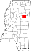
Towns Unincorporated
communitiesBradley | Clayton Village | Hickory Grove | Hickory Grove Estates | Longview | Oktoc | Osborn | Sessums
Footnotes ‡This populated place also has portions in an adjacent county or counties
Categories:- Oktibbeha County, Mississippi
- National Register of Historic Places in Mississippi by county
- Buildings and structures in Oktibbeha County, Mississippi
-


Wikimedia Foundation. 2010.