- National Register of Historic Places listings in Caldwell County, Kentucky
-
 Location of Caldwell County in Kentucky
This is a list of the National Register of Historic Places listings in Caldwell County, Kentucky.
It is intended to be a complete list of the properties and districts on the National Register of Historic Places in Caldwell County, Kentucky, United States. The locations of National Register properties and districts for which the latitude and longitude coordinates are included below, may be seen in a Google map.[1]
There are 9 properties and districts listed on the National Register in the county.
-
- This National Park Service list is complete through NPS recent listings posted November 10, 2011.[2]
Current listings
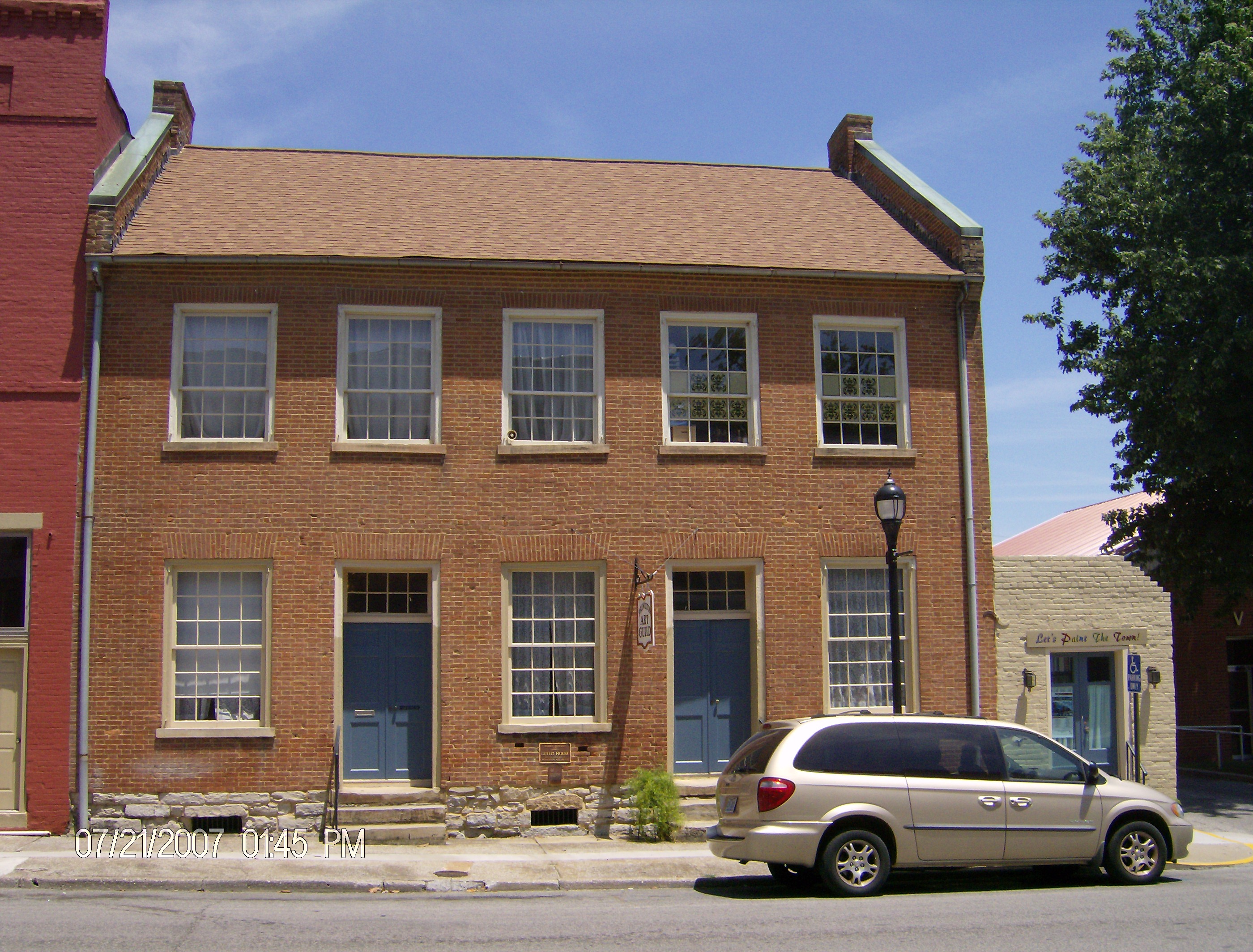
[3] Landmark name Image Date listed Location City or town Summary 1 Adsmore 
October 25, 1973 304 N. Jefferson St.
37°06′37″N 87°52′49″W / 37.110278°N 87.880278°WPrinceton 2 Champion-Shepherdson House 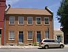
December 28, 1978 115 E. Main St.
37°06′31″N 87°52′52″W / 37.108611°N 87.881111°WPrinceton 3 Confederate Soldier Monument in Caldwell 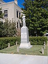
July 17, 1997 Junction of Kentucky Route 91 and N. Jefferson St.
37°06′30″N 87°52′52″W / 37.108333°N 87.881111°WPrinceton 4 Fredonia Cumberland Presbyterian Church August 8, 1985 U.S. Route 641
37°12′36″N 88°03′30″W / 37.21°N 88.058333°WFredonia 5 Halleck's Chapel and Halleck's School August 2, 2001 0.5 miles north of the junction of Kentucky Route 293 and Caldwell Chapel Rd.
37°04′26″N 87°57′43″W / 37.073889°N 87.961944°WPrinceton 6 Knott House October 13, 1999 302 Nichols St.
37°06′06″N 87°52′39″W / 37.101667°N 87.8775°WPrinceton 7 L.B. Overby House March 22, 1990 317 S. Jefferson St.
37°06′19″N 87°53′02″W / 37.105278°N 87.883889°WPrinceton 8 William S. Powell House May 26, 1995 501 Washington St.
37°06′34″N 87°53′16″W / 37.109444°N 87.887778°WPrinceton 9 Princeton Downtown Commercial District 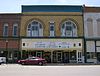
September 19, 1988 Roughly along Main St., E. and W. Court Sq. Sts.
37°06′31″N 87°52′56″W / 37.108611°N 87.882222°WPrinceton See also
- List of National Historic Landmarks in Kentucky
- National Register of Historic Places listings in Kentucky
References
- ^ The latitude and longitude information provided in this table was derived originally from the National Register Information System, which has been found to be fairly accurate for about 99% of listings. For about 1% of NRIS original coordinates, experience has shown that one or both coordinates are typos or otherwise extremely far off; some corrections may have been made. A more subtle problem causes many locations to be off by up to 150 yards, depending on location in the country: most NRIS coordinates were derived from tracing out latitude and longitudes off of USGS topographical quadrant maps created under the North American Datum of 1927, which differs from the current, highly accurate WGS84 GPS system used by Google maps. Chicago is about right, but NRIS longitudes in Washington are higher by about 4.5 seconds, and are lower by about 2.0 seconds in Maine. Latitudes differ by about 1.0 second in Florida. Some locations in this table may have been corrected to current GPS standards.
- ^ "National Register of Historic Places: Weekly List Actions". National Park Service, United States Department of the Interior. Retrieved on November 10, 2011.
- ^ Numbers represent an ordering by significant words. Various colorings, defined here, differentiate National Historic Landmark sites and National Register of Historic Places Districts from other NRHP buildings, structures, sites or objects.
U.S. National Register of Historic Places Topics Lists by states Alabama • Alaska • Arizona • Arkansas • California • Colorado • Connecticut • Delaware • Florida • Georgia • Hawaii • Idaho • Illinois • Indiana • Iowa • Kansas • Kentucky • Louisiana • Maine • Maryland • Massachusetts • Michigan • Minnesota • Mississippi • Missouri • Montana • Nebraska • Nevada • New Hampshire • New Jersey • New Mexico • New York • North Carolina • North Dakota • Ohio • Oklahoma • Oregon • Pennsylvania • Rhode Island • South Carolina • South Dakota • Tennessee • Texas • Utah • Vermont • Virginia • Washington • West Virginia • Wisconsin • WyomingLists by territories Lists by associated states Other Municipalities and communities of Caldwell County, Kentucky Cities 
Footnotes ‡This populated place also has portions in an adjacent county or counties
Categories:- National Register of Historic Places in Kentucky by county
- Caldwell County, Kentucky
-


Wikimedia Foundation. 2010.