- National Register of Historic Places listings in Albany County, Wyoming
-
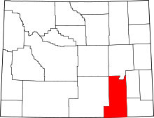 Location of Albany County in Wyoming
This is a list of the National Register of Historic Places listings in Albany County, Wyoming. It is intended to be a complete list of the properties and districts on the National Register of Historic Places in Albany County, Wyoming, United States. The locations of National Register properties and districts for which the latitude and longitude coordinates are included below, may be seen in a Google map.[1]
There are 40 properties and districts listed on the National Register in the county.
-
- This National Park Service list is complete through NPS recent listings posted November 10, 2011.[2]
Contents: Counties in Wyoming Albany - Big Horn - Campbell - Carbon - Converse - Crook - Fremont - Goshen - Hot Springs - Johnson - Laramie - Lincoln - Natrona - Niobrara - Park - Platte - Sheridan - Sublette - Sweetwater - Teton - Uinta - Washakie - Weston Current listings
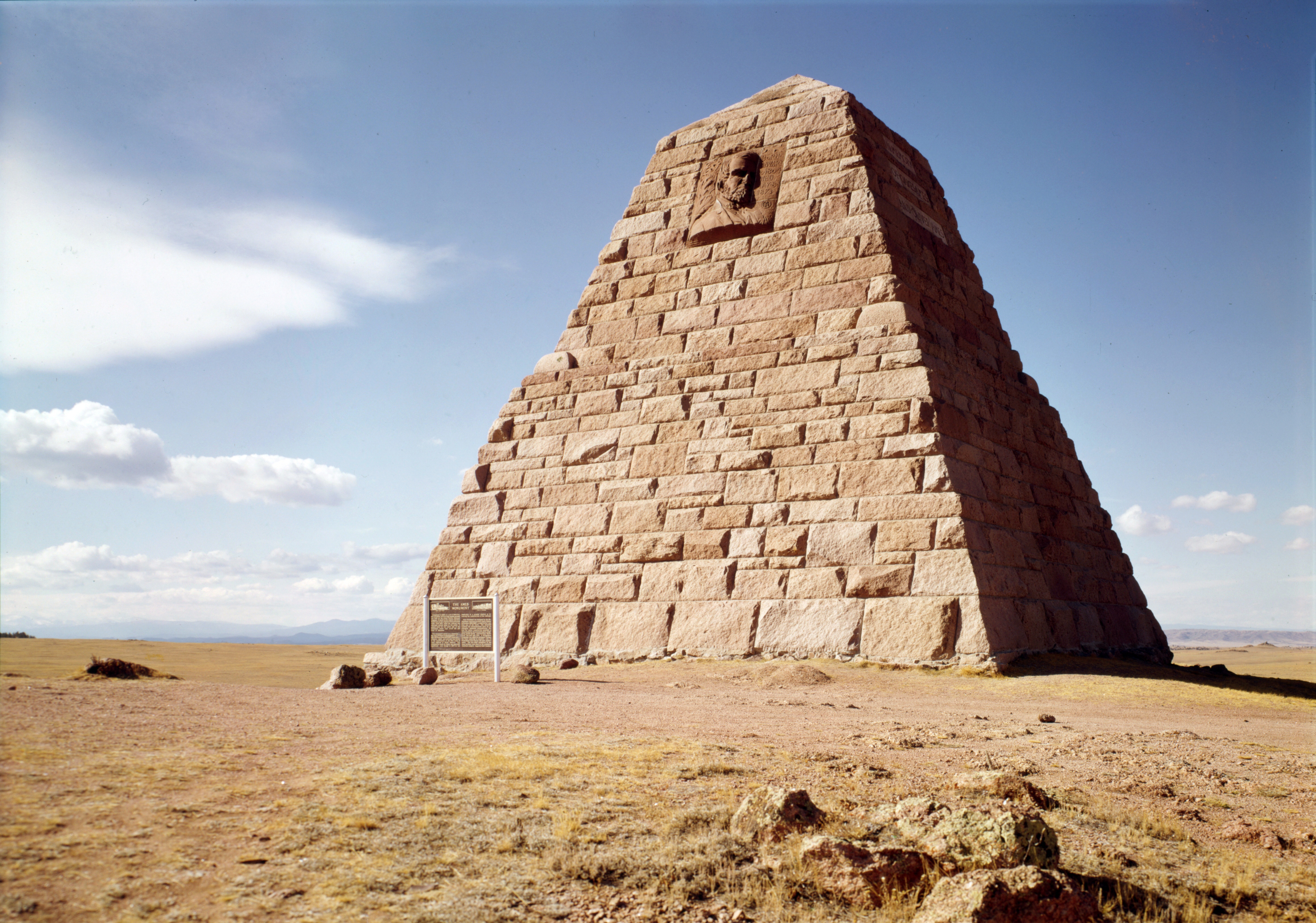
[3] Landmark name Image Date listed Location City or town Summary 1 Ames Monument 
July 24, 1972 3 miles northwest of Sherman
41°07′53″N 105°23′51″W / 41.131389°N 105.3975°WSherman 2 Barn at Oxford Horse Ranch June 25, 1986 868 U.S. Route 287
41°11′18″N 105°35′32″W / 41.188333°N 105.592222°WLaramie 3 Bath Ranch December 13, 1985 Herrick Lane Rd.
41°24′16″N 105°49′33″W / 41.404444°N 105.825833°WLaramie 4 Bath Row May 8, 1986 155, 157, and 159 N. 6th St. and 611 University Ave.
41°18′46″N 105°35′19″W / 41.312778°N 105.588611°WLaramie 5 Charles E. Blair House October 31, 1980 170 N. 5th St.
41°18′49″N 105°35′26″W / 41.313611°N 105.590556°WLaramie 6 N.K. Boswell Ranch July 21, 1977 South of Woods Landing off Wyoming Highway 230
41°00′46″N 106°01′39″W / 41.012778°N 106.0275°WWoods Landing 7 Brooklyn Lodge October 24, 1989 Wyoming Highway 130, 7.5 miles west of Centennial
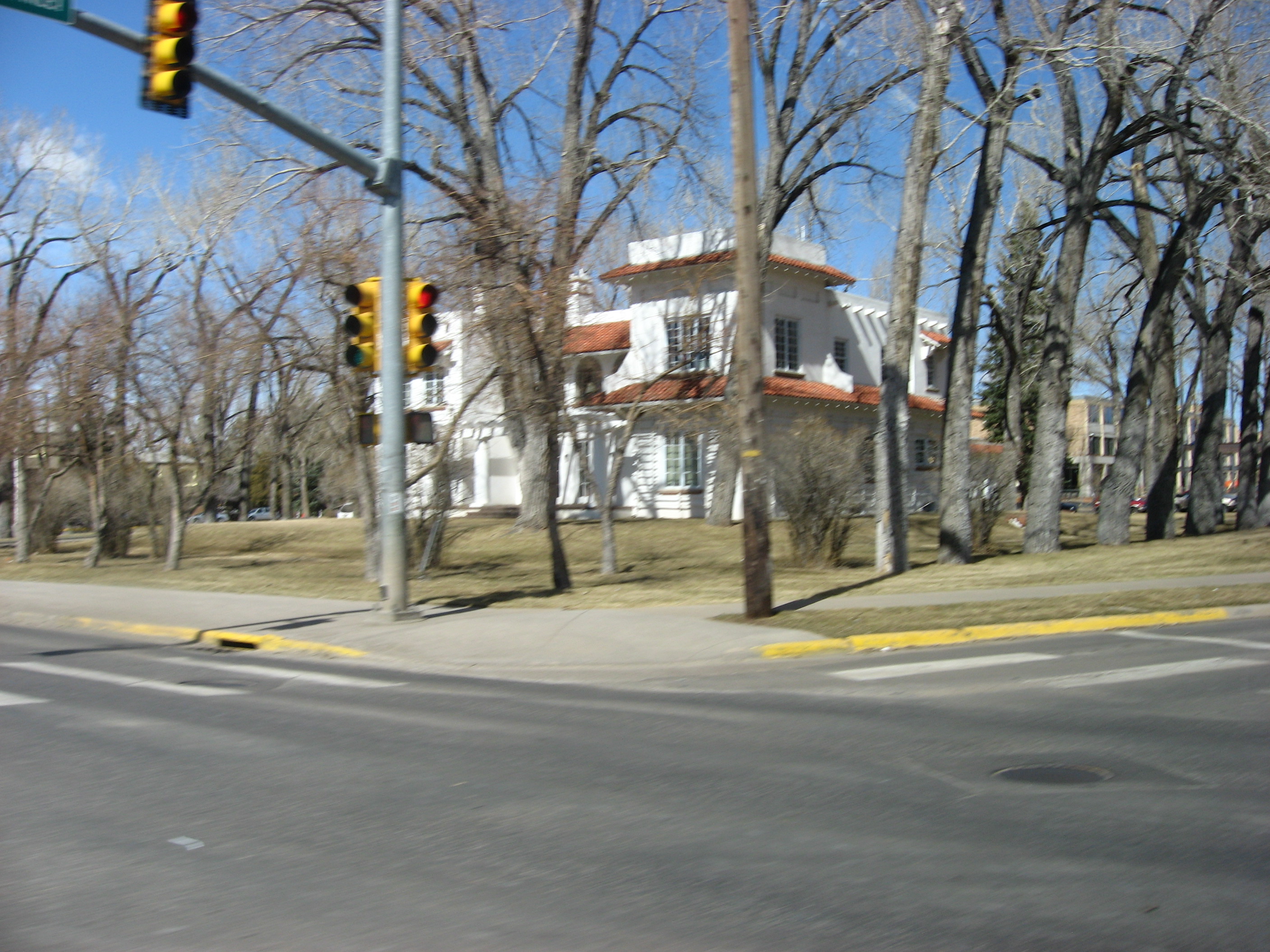
41°21′21″N 106°13′57″W / 41.355833°N 106.2325°WCentennial 8 Centennial Depot November 8, 1982 Wyoming Highway 130
41°17′49″N 106°08′13″W / 41.296944°N 106.136944°WCentennial 9 Centennial Work Center April 11, 1994 Off Wyoming Highway 130 northwest of Centennial, Medicine Bow National Forest
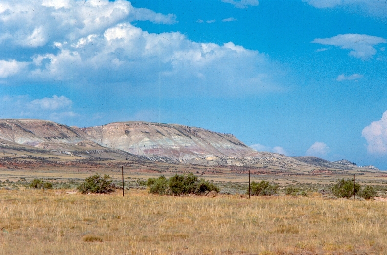
41°18′28″N 106°09′25″W / 41.307778°N 106.156944°WCentennial 10 Como Bluff 
January 18, 1973 On U.S. Route 30, along Como Ridge
41°53′13″N 106°03′24″W / 41.886944°N 106.056667°WRock River Extends into Carbon County 11 John D. Conley House May 15, 1980 718 Ivinson St.
41°18′41″N 105°35′14″W / 41.311389°N 105.587222°WLaramie 12 Cooper Mansion 
August 8, 1983 1411 Grand Ave.
41°18′38″N 105°34′38″W / 41.310556°N 105.577222°WLaramie 13 Dale Creek Crossing (48AB145) May 9, 1986 4 miles west of Sherman
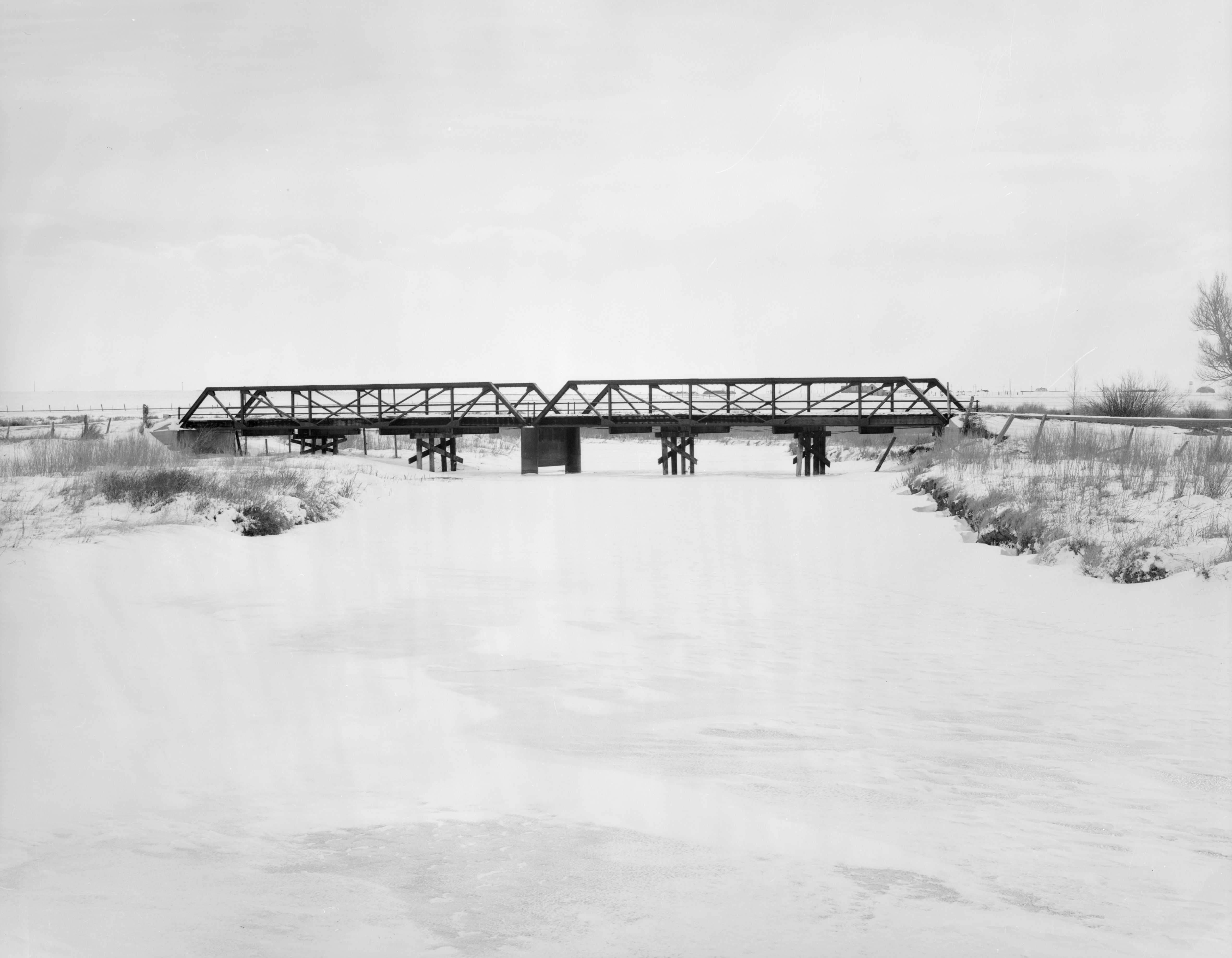
41°06′15″N 105°27′17″W / 41.104167°N 105.454722°WAmes Monument 14 DOE Bridge over Laramie River 
February 22, 1985 County Road CNA-740
41°35′32″N 105°39′23″W / 41.592222°N 105.656389°WBosler 15 Durlacher House March 21, 2011 501 S. 5th St.
41°18′32″N 105°35′28″W / 41.308889°N 105.591111°WLaramie 16 East Side School March 17, 1981 Off U.S. Route 30
41°18′33″N 105°35′14″W / 41.309167°N 105.587222°WLaramie 17 First National Bank of Rock River November 21, 1988 131 Ave. C
41°44′36″N 105°58′41″W / 41.743333°N 105.978056°WRock River 18 Flying Horseshoe Ranch October 12, 2000 156 Dinwiddie Rd.
41°16′13″N 106°06′53″W / 41.270278°N 106.114722°WCentennial 19 Fort Sanders Guardhouse May 1, 1980 Kiowa St.
41°16′27″N 105°35′56″W / 41.274167°N 105.598889°WLaramie 20 William Goodale House August 5, 1991 214 S. 14th St.
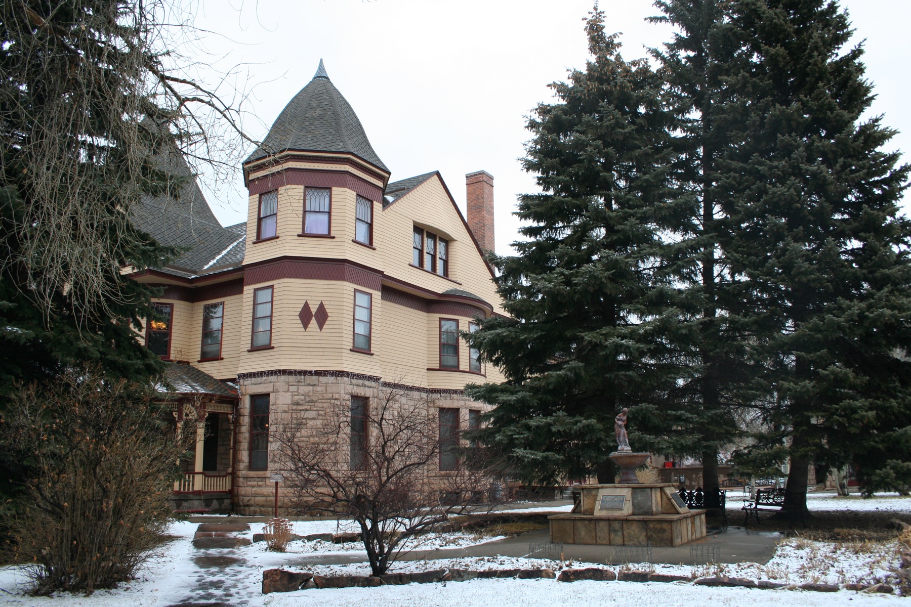
41°18′37″N 105°34′48″W / 41.310278°N 105.58°WLaramie 21 Ivinson Mansion and Grounds 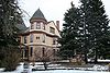
February 23, 1972 603 Ivinson Ave.
41°18′44″N 105°35′18″W / 41.31222°N 105.58833°W[4]Laramie 22 Jelm-Frank Smith Ranch Historic District August 31, 1978 South of Woods Landing
41°03′33″N 106°00′41″W / 41.059167°N 106.011389°WWoods Landing 23 Keystone Work Center April 11, 1994 West of Albany, Medicine Bow National Forest
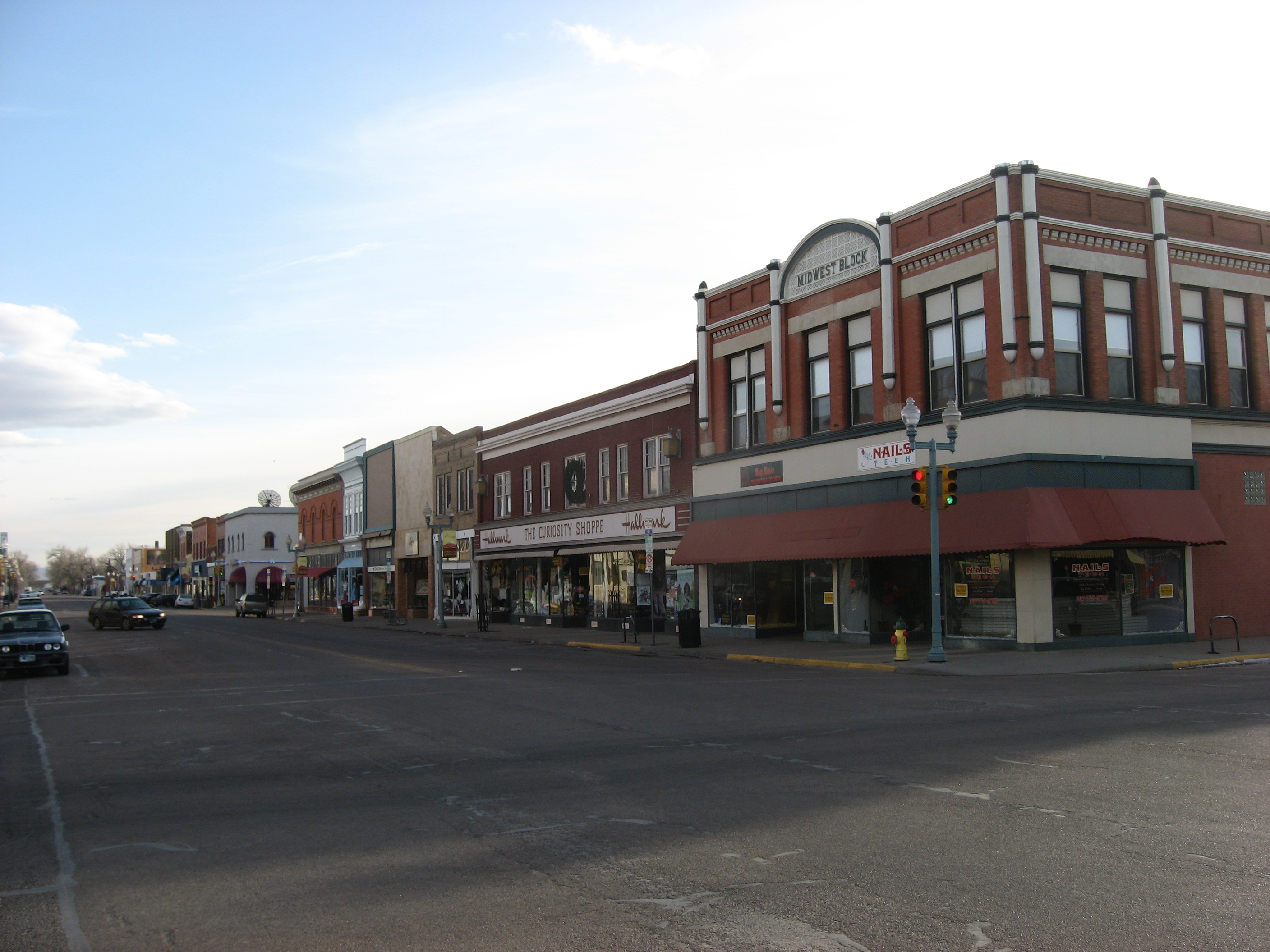
41°10′09″N 106°14′55″W / 41.169167°N 106.248611°WAlbany 24 F.S. King Brothers Ranch Historic District September 21, 2006 Address Restricted Laramie 25 Laramie Downtown Historic District 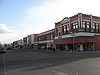
November 10, 1988 Roughly bounded by University Ave., 6th St., Grand Ave., 3rd St., Garfield Ave., and 1st Ave.
41°18′35″N 105°35′38″W / 41.309722°N 105.593889°WLaramie 26 Lehman-Tunnell Mansion November 8, 1982 618 Grand Ave.
41°18′38″N 105°35′18″W / 41.310556°N 105.588333°WLaramie 27 Libby Lodge September 30, 1976 Northwest of Centennial on Wyoming Highway 130
41°19′20″N 106°10′19″W / 41.322222°N 106.171944°WCentennial 28 Lincoln School December 5, 2003 209 S. Cedar St.
41°18′43″N 105°35′58″W / 41.311944°N 105.599444°WLaramie 29 Mountain View Hotel June 7, 2007 2747 Wyoming Highway 130
41°17′52″N 106°08′24″W / 41.297778°N 106.14°WCentennial 30 North Albany Clubhouse July 23, 1998 Address Restricted
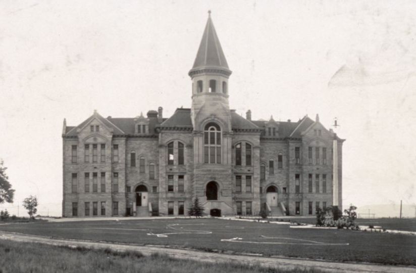
41°57′40″N 105°33′59″W / 41.961111°N 105.566389°WGarrett Provided coordinates show a small building at the intersection of Garrett and Tunnel Roads 31 Old Main 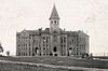
July 11, 1986 University of Wyoming campus, 9th St. and Ivinson Ave.
41°18′43″N 105°35′02″W / 41.311944°N 105.583889°WLaramie 32 Parker Ranch House December 13, 1985 Address Restricted Laramie Peak 33 Richardson's Overland Trail Ranch March 5, 1992 111 Hart Rd.
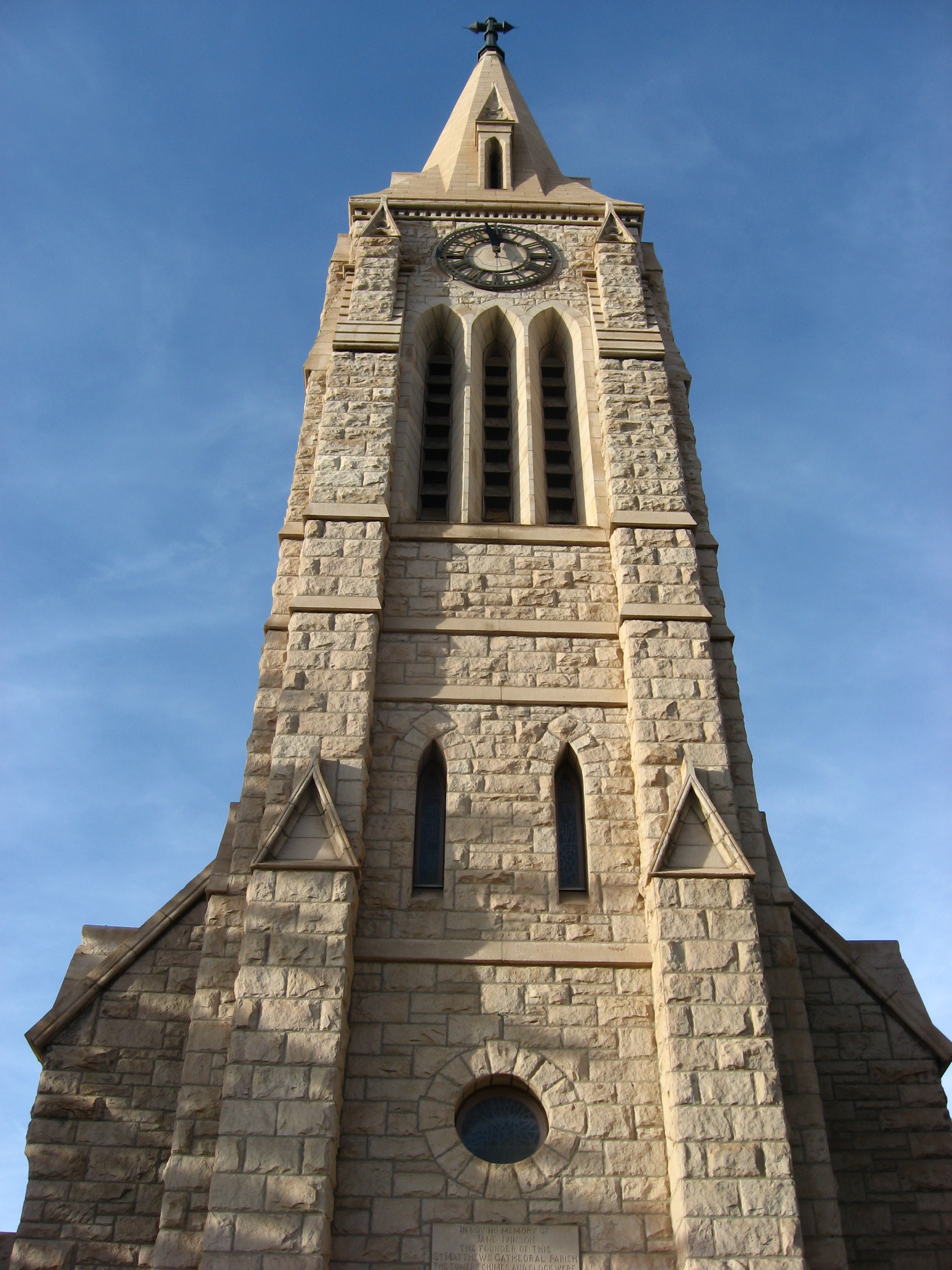
41°14′29″N 105°42′06″W / 41.241389°N 105.701667°WLaramie 34 St. Matthew's Cathedral Close 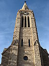
April 12, 1984 104 S. 4th St.
41°18′45″N 105°35′33″W / 41.3125°N 105.5925°WLaramie 35 St. Paulus Kirche 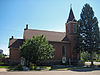
November 25, 1983 602 Garfield
41°18′35″N 105°35′20″W / 41.309722°N 105.588889°WLaramie Now known as St. Paul's United Church of Christ of Laramie 36 Union Pacific Athletic Club September 13, 1978 Off U.S. Route 30
41°19′16″N 105°32′49″W / 41.321111°N 105.546944°WLaramie 37 University Neighborhood Historic District December 18, 2009 Roughly bounded by 6th St., 15th St., University Ave., and Custer St.
41°18′37″N 105°34′59″W / 41.3104°N 105.583119°WLaramie 38 Vee Bar Ranch Lodge June 30, 1986 2087 Wyoming Highway 130
41°17′49″N 106°00′42″W / 41.296944°N 106.011667°WLaramie 39 Woods Landing Dance Hall December 13, 1985 2731 Wyoming Highway 230
41°06′37″N 106°00′44″W / 41.110278°N 106.012222°WWoods Landing 40 Wyoming Territorial Penitentiary 
March 29, 1978 Off Wyoming Highway 130
41°18′45″N 105°36′32″W / 41.3125°N 105.608889°WLaramie See also
- List of National Historic Landmarks in Wyoming
- National Register of Historic Places listings in Wyoming
References
- ^ The latitude and longitude information provided in this table was derived originally from the National Register Information System, which has been found to be fairly accurate for about 99% of listings. For about 1% of NRIS original coordinates, experience has shown that one or both coordinates are typos or otherwise extremely far off; some corrections may have been made. A more subtle problem causes many locations to be off by up to 150 yards, depending on location in the country: most NRIS coordinates were derived from tracing out latitude and longitudes off of USGS topographical quadrant maps created under the North American Datum of 1927, which differs from the current, highly accurate WGS84 GPS system used by Google maps. Chicago is about right, but NRIS longitudes in Washington are higher by about 4.5 seconds, and are lower by about 2.0 seconds in Maine. Latitudes differ by about 1.0 second in Florida. Some locations in this table may have been corrected to current GPS standards.
- ^ "National Register of Historic Places: Weekly List Actions". National Park Service, United States Department of the Interior. Retrieved on November 10, 2011.
- ^ Numbers represent an ordering by significant words. Various colorings, defined here, differentiate National Historic Landmark sites and National Register of Historic Places Districts from other NRHP buildings, structures, sites or objects.
- ^ Location derived from its HABS listing; the NRIS gives its address as "Lots 1-8, block 178"
U.S. National Register of Historic Places Topics Lists by states Alabama • Alaska • Arizona • Arkansas • California • Colorado • Connecticut • Delaware • Florida • Georgia • Hawaii • Idaho • Illinois • Indiana • Iowa • Kansas • Kentucky • Louisiana • Maine • Maryland • Massachusetts • Michigan • Minnesota • Mississippi • Missouri • Montana • Nebraska • Nevada • New Hampshire • New Jersey • New Mexico • New York • North Carolina • North Dakota • Ohio • Oklahoma • Oregon • Pennsylvania • Rhode Island • South Carolina • South Dakota • Tennessee • Texas • Utah • Vermont • Virginia • Washington • West Virginia • Wisconsin • WyomingLists by territories Lists by associated states Other Municipalities and communities of Albany County, Wyoming City 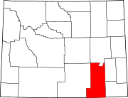
Town CDPs Unincorporated
communitiesBosler | Buford | Garrett | Harmony | Tie Siding
Categories:- National Register of Historic Places in Wyoming by county
- Albany County, Wyoming
-


Wikimedia Foundation. 2010.