- National Register of Historic Places listings in Big Horn County, Wyoming
-
 Location of Big Horn County in Wyoming
This is a list of the National Register of Historic Places listings in Big Horn County, Wyoming.
This is intended to be a complete list of the properties and districts on the National Register of Historic Places in Big Horn County, Wyoming, United States. The locations of National Register properties and districts for which the latitude and longitude coordinates are included below, may be seen in a Google map.[1]
There are 20 properties and districts listed on the National Register in the county, 1 of which is a National Historic Landmark.
-
- This National Park Service list is complete through NPS recent listings posted November 10, 2011.[2]
Contents: Counties in Wyoming Albany - Big Horn - Campbell - Carbon - Converse - Crook - Fremont - Goshen - Hot Springs - Johnson - Laramie - Lincoln - Natrona - Niobrara - Park - Platte - Sheridan - Sublette - Sweetwater - Teton - Uinta - Washakie - Weston Current listings
[3] Landmark name Image Date listed Location City or town Summary 1 Bad Pass Trail October 29, 1975 East of Warren along the Bighorn River in the Bighorn Canyon National Recreation Area
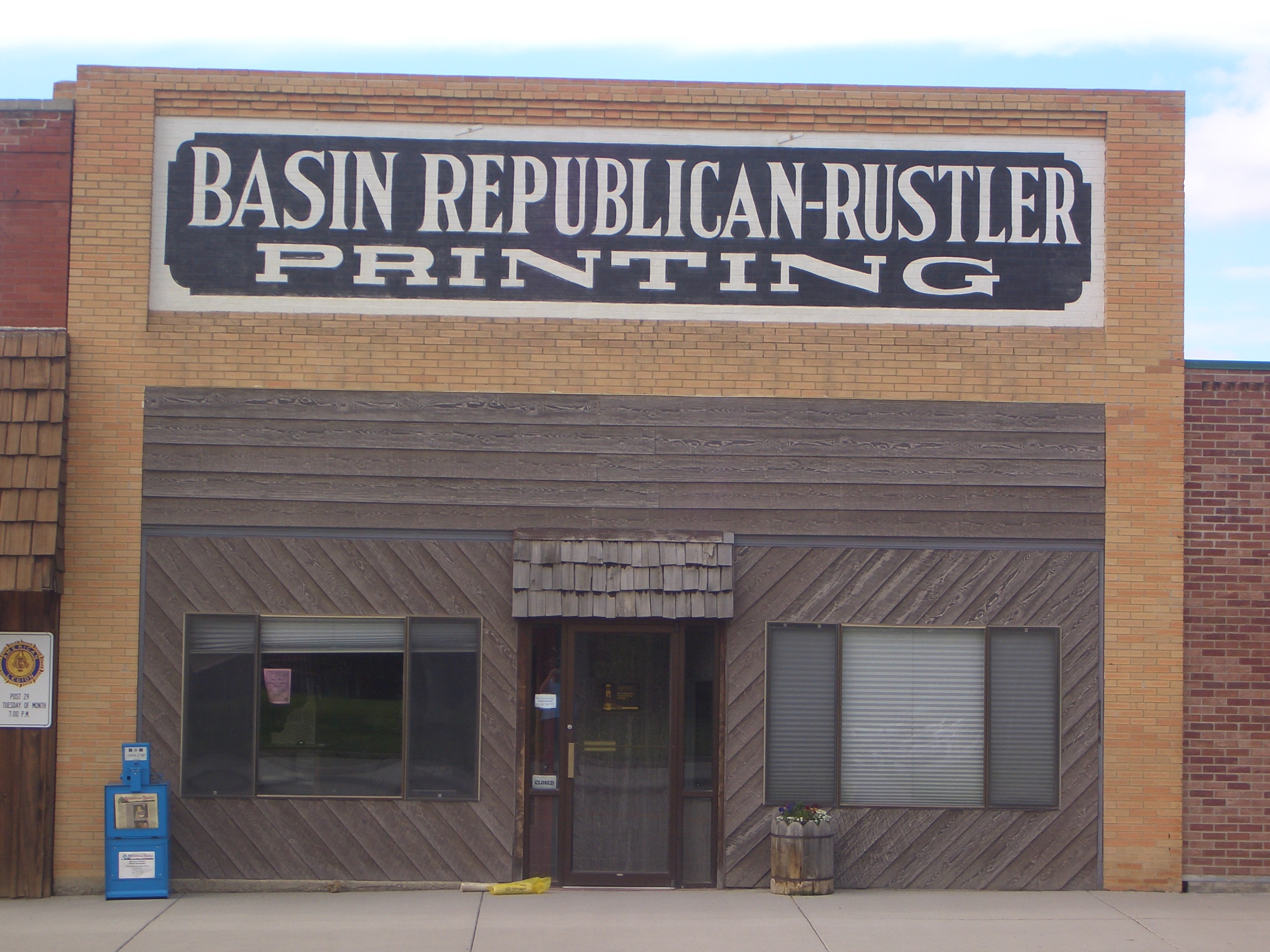
45°03′07″N 108°15′44″W / 45.051944°N 108.262222°WWarren 2 Basin Republican-Rustler Printing Building 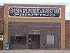
July 19, 1976 409 W. C St.
44°22′51″N 108°02′22″W / 44.380833°N 108.039444°WBasin 3 Bear Creek Ranch Medicine Wheel (48BH48) 
May 4, 1987 Address Restricted[4] Greybull 4 Big Horn Academy Historic District March 26, 1992 25 and 35 E. 1st S.
44°52′56″N 108°28′04″W / 44.882222°N 108.467778°WCowley 5 Black Mountain Archeological District (48BH900/902/1064/106 7/1126/1127/1128/1129) July 2, 1987 Address Restricted[4] Shell 6 Bridger Immigrant Road-Dry Creek Crossing January 17, 1975 26 miles east of Cody on U.S. Route 14
44°27′34″N 108°31′44″W / 44.459444°N 108.528889°WCody 7 Carey Block December 18, 2009 602 Greybull Ave.
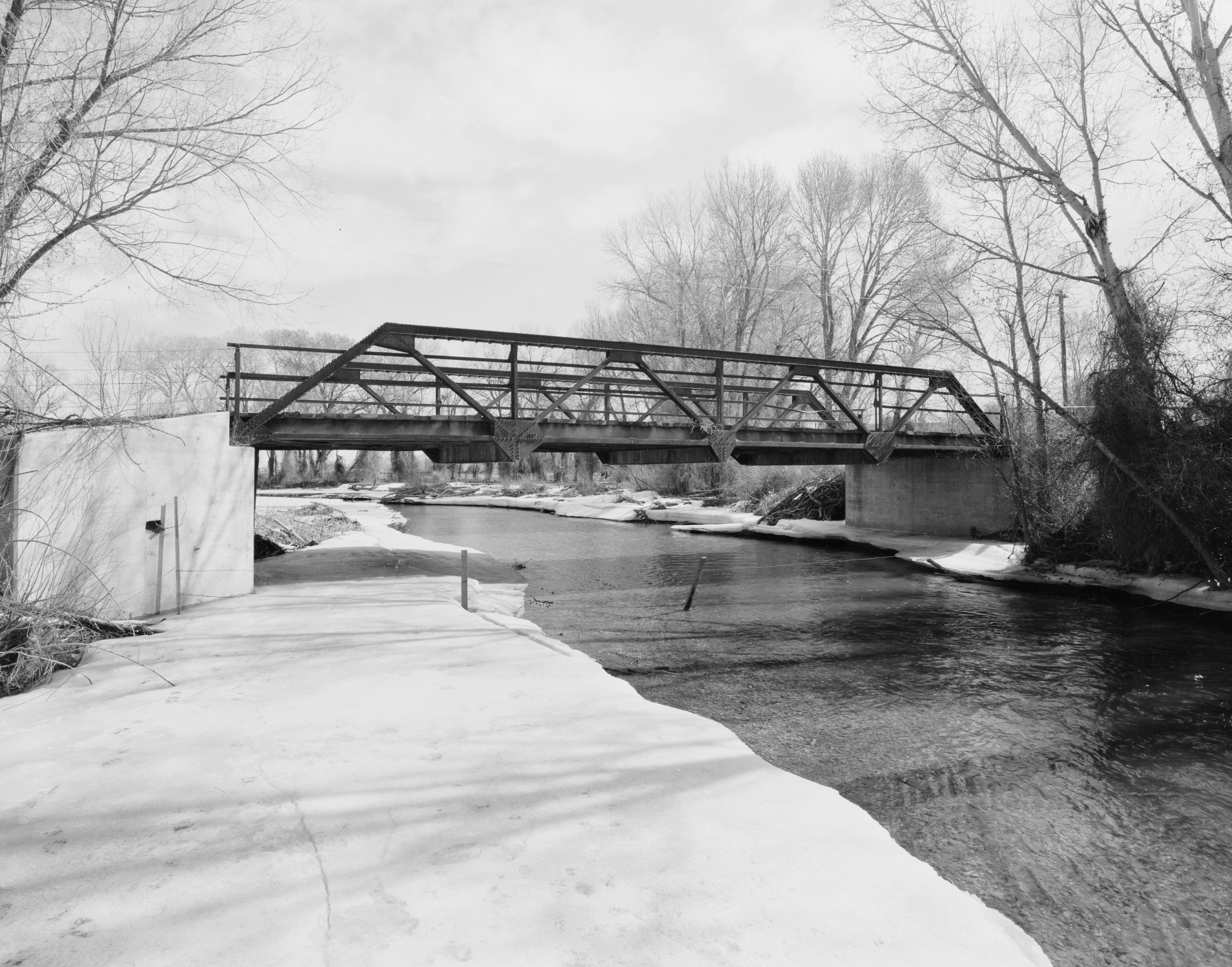
44°29′20″N 108°03′19″W / 44.488906°N 108.055414°WGreybull 8 EJE Bridge over Shell Creek 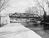
February 22, 1985 County Road CN9-57
44°32′05″N 107°48′06″W / 44.534722°N 107.801667°WShell 9 EJP County Line Bridge February 22, 1985 Road CN9-60
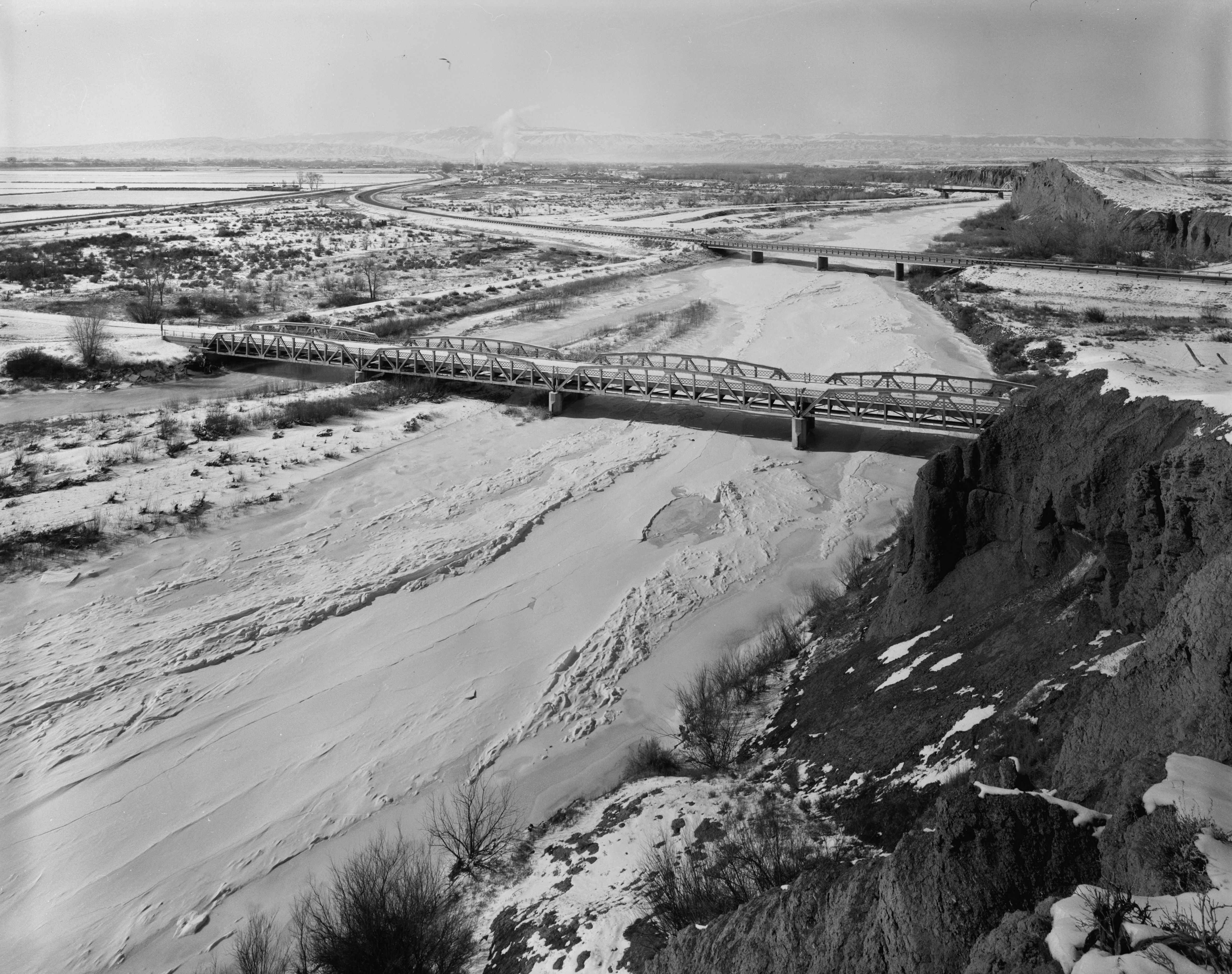
44°09′59″N 107°41′01″W / 44.166389°N 107.683611°WHyattville 10 EJZ Bridge over Shoshone River 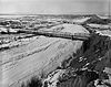
February 22, 1985 County Road CN9-111
44°50′18″N 108°26′03″W / 44.838333°N 108.434167°WLovell 11 Hanson Site December 15, 1978 Address Restricted[4] Shell 12 Hyart Theater 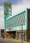
January 8, 2009 251 E. Main St.
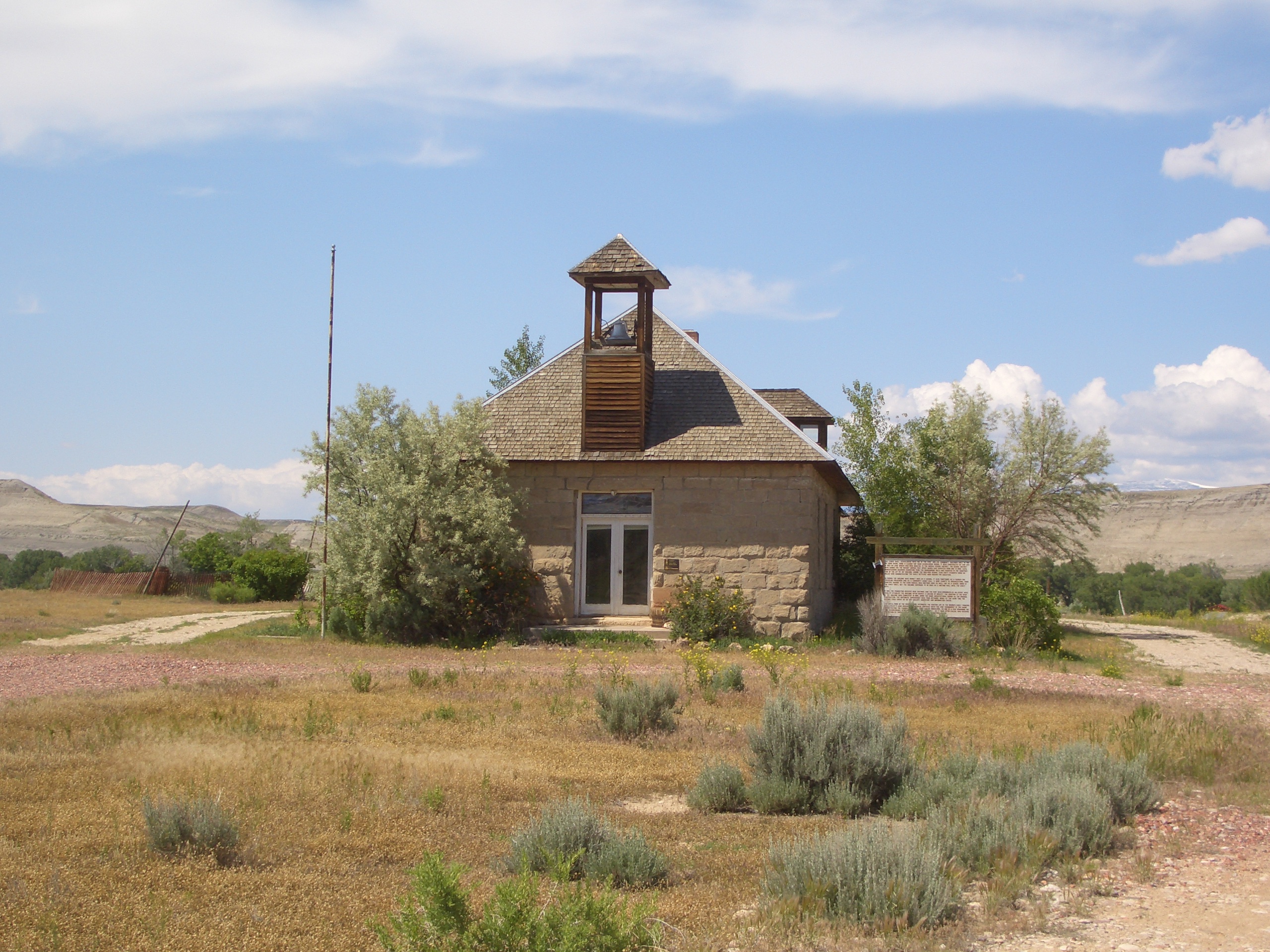
44°50′15″N 108°23′18″W / 44.83758°N 108.38822°WLovell 13 Lower Shell School House 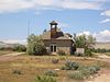
February 7, 1985 U.S. Route 14
44°31′15″N 107°56′03″W / 44.520833°N 107.934167°WGreybull 14 M L Ranch July 15, 1992 Off Alternate U.S. Route 14 near the eastern shore of Bighorn Lake, 13 miles east of Lovell, Bighorn Canyon National Recreation Area
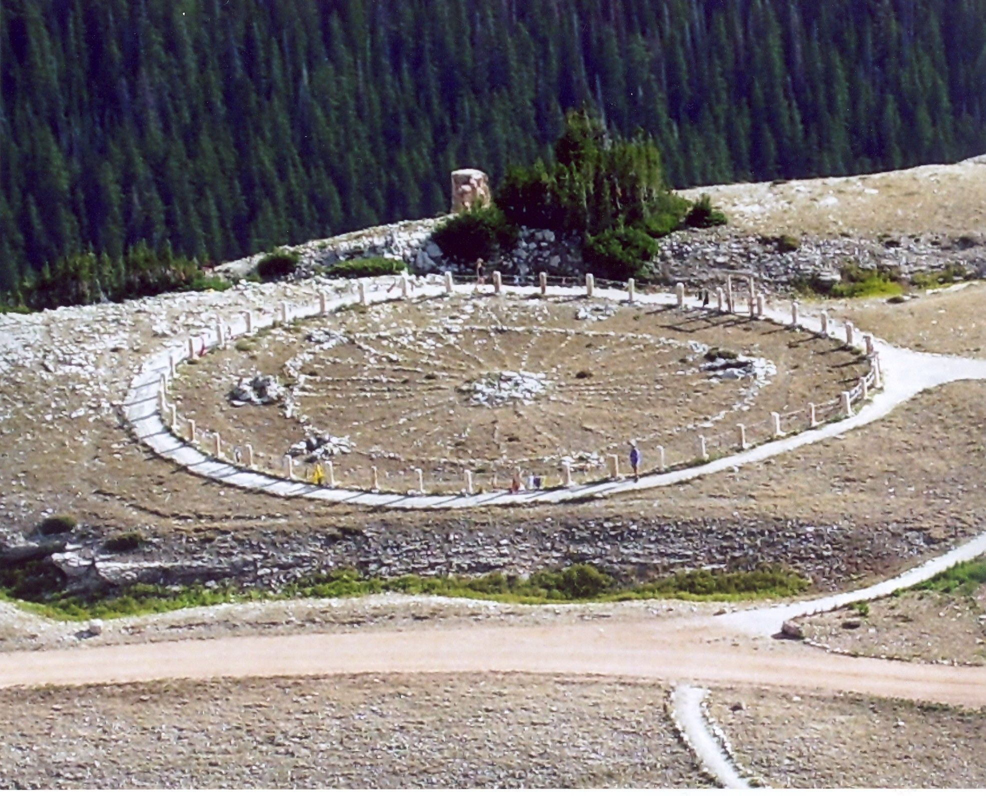
44°49′49″N 108°09′28″W / 44.830278°N 108.157778°WLovell 15 Medicine Lodge Creek Site July 5, 1973 Address Restricted[4] Hyattville 16 Medicine Wheel-Medicine Mountain 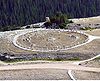
April 16, 1969 Address Restricted Kane 17 Paint Rock Canyon Archeological Landscape District July 12, 1990 Address Restricted[4] Hyattville 18 Rairden Bridge February 22, 1985 South of Big Horn County Road CN9-30
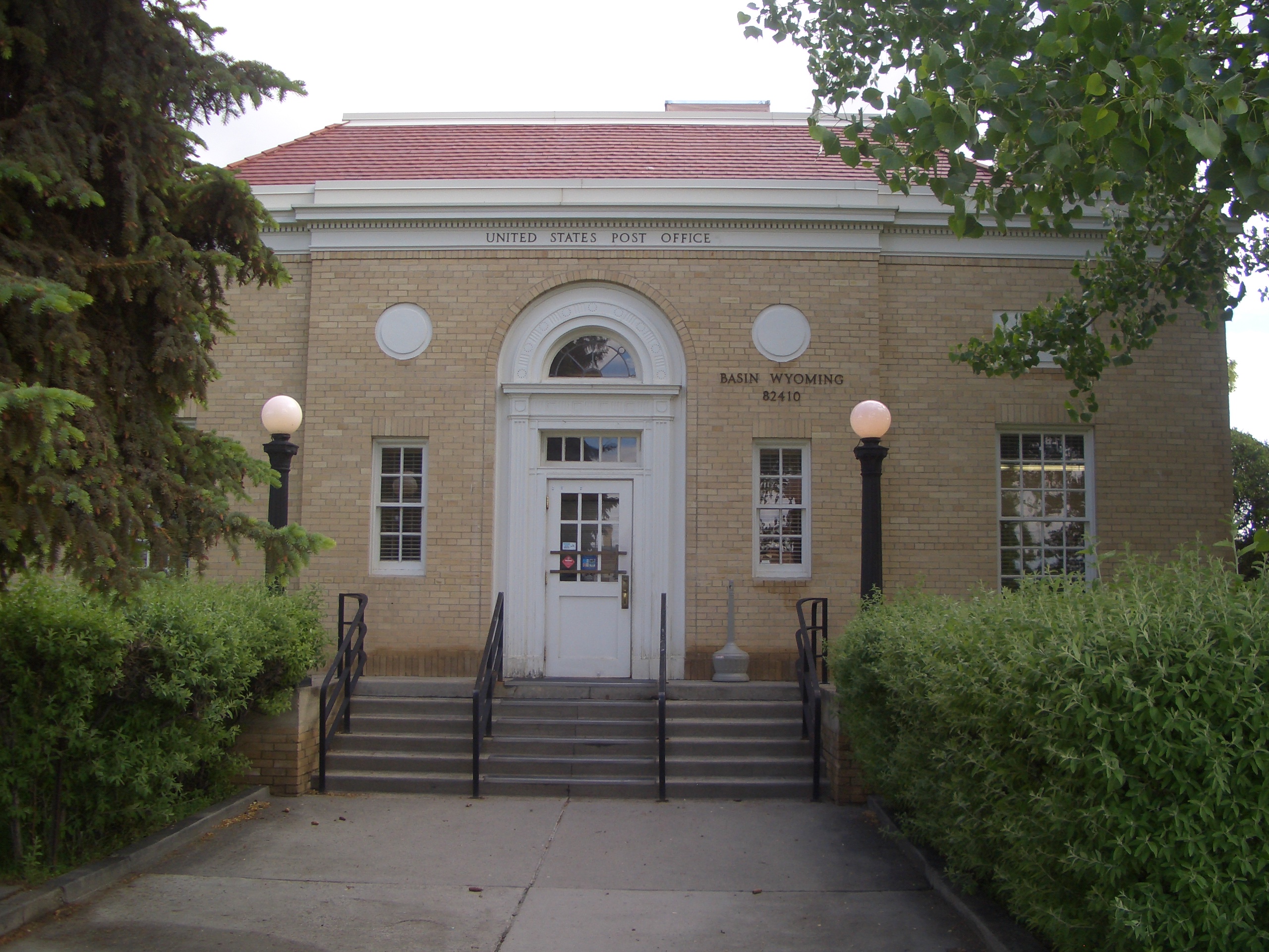
44°11′40″N 107°54′53″W / 44.194444°N 107.914722°WManderson 19 US Post Office-Basin Main 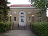
May 19, 1987 402 W. C St.
44°22′53″N 108°02′19″W / 44.381389°N 108.038611°WBasin 20 US Post Office-Greybull Main May 22, 1987 401 Greybull Ave.
44°29′19″N 108°03′08″W / 44.488611°N 108.052222°WGreybull See also
- List of National Historic Landmarks in Wyoming
- National Register of Historic Places listings in Wyoming
References
- ^ The latitude and longitude information provided in this table was derived originally from the National Register Information System, which has been found to be fairly accurate for about 99% of listings. For about 1% of NRIS original coordinates, experience has shown that one or both coordinates are typos or otherwise extremely far off; some corrections may have been made. A more subtle problem causes many locations to be off by up to 150 yards, depending on location in the country: most NRIS coordinates were derived from tracing out latitude and longitudes off of USGS topographical quadrant maps created under the North American Datum of 1927, which differs from the current, highly accurate WGS84 GPS system used by Google maps. Chicago is about right, but NRIS longitudes in Washington are higher by about 4.5 seconds, and are lower by about 2.0 seconds in Maine. Latitudes differ by about 1.0 second in Florida. Some locations in this table may have been corrected to current GPS standards.
- ^ "National Register of Historic Places: Weekly List Actions". National Park Service, United States Department of the Interior. Retrieved on November 10, 2011.
- ^ Numbers represent an ordering by significant words. Various colorings, defined here, differentiate National Historic Landmark sites and National Register of Historic Places Districts from other NRHP buildings, structures, sites or objects.
- ^ a b c d e Some listings on the NRHP are highly sensitive sites and may be subject to looting or vandalism. The NRHP lists this site as "Address Restricted."
U.S. National Register of Historic Places Topics Lists by states Alabama • Alaska • Arizona • Arkansas • California • Colorado • Connecticut • Delaware • Florida • Georgia • Hawaii • Idaho • Illinois • Indiana • Iowa • Kansas • Kentucky • Louisiana • Maine • Maryland • Massachusetts • Michigan • Minnesota • Mississippi • Missouri • Montana • Nebraska • Nevada • New Hampshire • New Jersey • New Mexico • New York • North Carolina • North Dakota • Ohio • Oklahoma • Oregon • Pennsylvania • Rhode Island • South Carolina • South Dakota • Tennessee • Texas • Utah • Vermont • Virginia • Washington • West Virginia • Wisconsin • WyomingLists by territories Lists by associated states Other Municipalities and communities of Big Horn County, Wyoming Towns 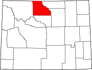
CDPs Unincorporated
communitiesFootnotes ‡This populated place also has portions in an adjacent county or counties
Categories:- National Register of Historic Places in Wyoming by county
- Big Horn County, Wyoming
-


Wikimedia Foundation. 2010.