- National Register of Historic Places listings in Crook County, Wyoming
-
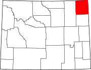
 Location of Crook County in Wyoming
This is a list of the National Register of Historic Places listings in Crook County, Wyoming. It is intended to be a complete list of the properties and districts on the National Register of Historic Places in Crook County, Wyoming, United States. The locations of National Register properties and districts for which the latitude and longitude coordinates are included below, may be seen in a Google map.[1]
There are 13 properties and districts listed on the National Register in the county.
-
- This National Park Service list is complete through NPS recent listings posted November 10, 2011.[2]
Contents: Counties in Wyoming Albany - Big Horn - Campbell - Carbon - Converse - Crook - Fremont - Goshen - Hot Springs - Johnson - Laramie - Lincoln - Natrona - Niobrara - Park - Platte - Sheridan - Sublette - Sweetwater - Teton - Uinta - Washakie - Weston Listings county-wide
[3] Landmark name Image Date listed Location City or town Summary 1 Arch Creek Petroglyphs (48CK41) 
December 4, 1986 Address Restricted[4] Moorcroft 2 DXN Bridge over Missouri River 
February 22, 1985 Crook County Road 18-200
44°58′59″N 104°29′39″W / 44.983056°N 104.494167°WHulett 3 Entrance Road-Devils Tower National Monument 
July 24, 2000 Devils Tower National Monument
44°35′14″N 104°42′52″W / 44.587222°N 104.714444°WDevils Tower 4 Entrance Station-Devils Tower National Monument 
July 24, 2000 Devils Tower National Monument
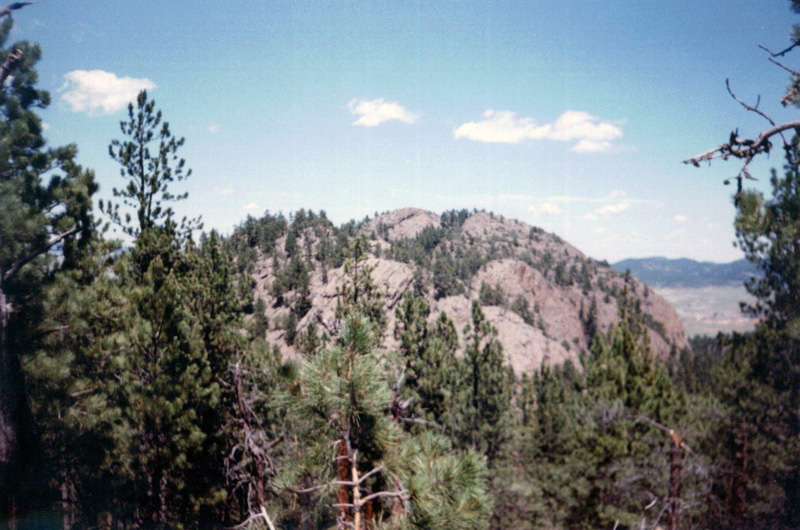
44°35′23″N 104°42′00″W / 44.589722°N 104.7°WDevils Tower 5 Inyan Kara Mountain 
April 24, 1973 About 15 mi (24 km) south of Sundance in Black Hills National Forest
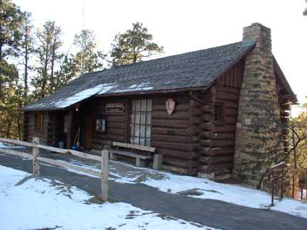
44°12′45″N 104°20′40″W / 44.2125°N 104.344444°WSundance 6 McKean Archeological Site (48CK7) April 1, 1991 Address Restricted[4] Moorcroft 7 Old Headquarters Area Historic District 
July 20, 2000 Devils Tower National Monument
44°35′26″N 104°43′13″W / 44.590556°N 104.720278°WDevils Tower 8 Ranch A March 17, 1997 Off Riflepit Rd., approximately 3 mi (4.8 km) east of Interstate 90/U.S. Route 14, Ranch A National Fish Genetics Laboratory
44°29′27″N 104°06′53″W / 44.490833°N 104.114722°WBeulah 9 Sundance School December 2, 1985 108 N. 4th St.
44°24′22″N 104°22′38″W / 44.406111°N 104.377222°WSundance 10 Sundance State Bank March 23, 1984 301 Main St.
44°24′22″N 104°22′47″W / 44.406111°N 104.379722°WSundance 11 Tower Ladder-Devils Tower National Monument 
July 24, 2000 Devils Tower National Monument
44°35′23″N 104°42′50″W / 44.589722°N 104.713889°WDevils Tower 12 Vore Buffalo Jump 
April 11, 1973 Between Interstate 90 and the old U.S. Route 14, 5 miles west of the South Dakota border
44°32′9″N 104°9′24″W / 44.53583°N 104.15667°W[5]Sundance 13 Wyoming Mercantile April 16, 1991 Wyoming Highway 24
44°38′25″N 104°11′01″W / 44.640278°N 104.183611°WAladdin See also
- List of National Historic Landmarks in Wyoming
- National Register of Historic Places listings in Wyoming
References
- ^ The latitude and longitude information provided in this table was derived originally from the National Register Information System, which has been found to be fairly accurate for about 99% of listings. For about 1% of NRIS original coordinates, experience has shown that one or both coordinates are typos or otherwise extremely far off; some corrections may have been made. A more subtle problem causes many locations to be off by up to 150 yards, depending on location in the country: most NRIS coordinates were derived from tracing out latitude and longitudes off of USGS topographical quadrant maps created under the North American Datum of 1927, which differs from the current, highly accurate WGS84 GPS system used by Google maps. Chicago is about right, but NRIS longitudes in Washington are higher by about 4.5 seconds, and are lower by about 2.0 seconds in Maine. Latitudes differ by about 1.0 second in Florida. Some locations in this table may have been corrected to current GPS standards.
- ^ "National Register of Historic Places: Weekly List Actions". National Park Service, United States Department of the Interior. Retrieved on November 10, 2011.
- ^ Numbers represent an ordering by significant words. Various colorings, defined here, differentiate National Historic Landmark sites and National Register of Historic Places Districts from other NRHP buildings, structures, sites or objects.
- ^ a b Some listings on the NRHP are highly sensitive sites and may be subject to looting or vandalism. The NRHP lists this site as "Address Restricted."
- ^ Location derived from this Wyoming State Historic Preservation Office website; the NRIS lists the site as "Address Restricted"
U.S. National Register of Historic Places Topics Lists by states Alabama • Alaska • Arizona • Arkansas • California • Colorado • Connecticut • Delaware • Florida • Georgia • Hawaii • Idaho • Illinois • Indiana • Iowa • Kansas • Kentucky • Louisiana • Maine • Maryland • Massachusetts • Michigan • Minnesota • Mississippi • Missouri • Montana • Nebraska • Nevada • New Hampshire • New Jersey • New Mexico • New York • North Carolina • North Dakota • Ohio • Oklahoma • Oregon • Pennsylvania • Rhode Island • South Carolina • South Dakota • Tennessee • Texas • Utah • Vermont • Virginia • Washington • West Virginia • Wisconsin • WyomingLists by territories Lists by associated states Other Municipalities and communities of Crook County, Wyoming Towns Hulett | Moorcroft | Pine Haven | Sundance
Unincorporated
communitiesCategories:- National Register of Historic Places in Wyoming by county
- Crook County, Wyoming
-


Wikimedia Foundation. 2010.