- Randolph, Missouri
Infobox Settlement
official_name = Randolph, Missouri
settlement_type = Village
nickname =
motto =
imagesize =
image_caption =
image_
imagesize =
image_caption =
image_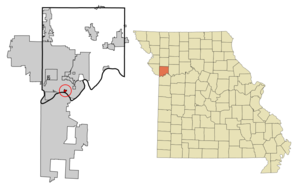
mapsize = 250px
map_caption = Location of Randolph, Missouri
mapsize1 =
map_caption1 =subdivision_type = Country
subdivision_name =United States
subdivision_type1 = State
subdivision_name1 =Missouri
subdivision_type2 = County
subdivision_name2 = Clay
government_footnotes =
government_type =
leader_title =
leader_name =
leader_title1 =
leader_name1 =
established_title =
established_date =unit_pref = Imperial
area_footnotes =area_magnitude =
area_total_km2 = 0.9
area_land_km2 = 0.9
area_water_km2 = 0.0
area_total_sq_mi = 0.3
area_land_sq_mi = 0.3
area_water_sq_mi = 0.0population_as_of = 2000
population_footnotes =
population_total = 47
population_density_km2 = 53.2
population_density_sq_mi = 137.7timezone = Central (CST)
utc_offset = -6
timezone_DST = CDT
utc_offset_DST = -5
elevation_footnotes =
elevation_m = 234
elevation_ft = 768
latd = 39 |latm = 9 |lats = 31 |latNS = N
longd = 94 |longm = 29 |longs = 40 |longEW = Wpostal_code_type =
ZIP code s
postal_code = 64117, 64161
area_code = 816
blank_name = FIPS code
blank_info = 29-60590GR|2
blank1_name = GNIS feature ID
blank1_info = 0755566GR|3
website =
footnotes =Randolph is a village in Clay County,
Missouri ,United States . The population was 47 at the 2000 census.Geography
Randolph is located at coor dms|39|9|31|N|94|29|40|W|city (39.158653, -94.494410)GR|1.
According to the
United States Census Bureau , the village has a total area of 0.3square mile s (0.9km² ), all of it land. Randolph is on the banks of the Missouri River. It is surrounded by Kansas City on all land borders, and the opposite side of the Missouri is also Kansas City. [ANdriot, John L. "Township Atlas of the United States" (McLean, Virginia: Andriot Associates, 1979) p. 366]Demographics
As of the
census GR|2 of 2000, there were 49 people, 20 households, and 14 families residing in the village. Thepopulation density was 137.7 people per square mile (53.4/km²). There were 22 housing units at an average density of 64.5/sq mi (25.0/km²). The racial makeup of the village was 95.74% White, and 4.26% from two or more races.There were 20 households out of which 15.0% had children under the age of 18 living with them, 55.0% were married couples living together, 15.0% had a female householder with no husband present, and 30.0% were non-families. 20.0% of all households were made up of individuals and 5.0% had someone living alone who was 65 years of age or older. The average household size was 2.35 and the average family size was 2.64.
In the village the population was spread out with 14.9% under the age of 18, 6.4% from 18 to 24, 38.3% from 25 to 44, 21.3% from 45 to 64, and 19.1% who were 65 years of age or older. The median age was 39 years. For every 100 females there were 123.8 males. For every 100 females age 18 and over, there were 110.5 males.
The median income for a household in the village was $53,750, and the median income for a family was $53,750. Males had a median income of $31,667 versus $35,000 for females. The
per capita income for the village was $23,067. None of the population and none of the families were below thepoverty line .ources
External links
Wikimedia Foundation. 2010.