- Vandalia, Missouri
Infobox Settlement
official_name = Vandalia, Missouri
settlement_type =City
nickname =
motto =
imagesize = 250px
image_caption =Water tower in Vandalia
image_
image_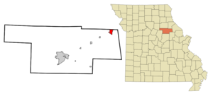
mapsize = 250px
map_caption = Location of Vandalia, Missouri
mapsize1 =
map_caption1 =subdivision_type = Country
subdivision_name =United States
subdivision_type1 = State
subdivision_name1 =Missouri
subdivision_type2 = Counties
subdivision_name2 = Audrain, Ralls
government_footnotes =
government_type =
leader_title =
leader_name =
leader_title1 =
leader_name1 =
established_title =
established_date =unit_pref = Imperial
area_footnotes =area_magnitude =
area_total_km2 = 5.9
area_land_km2 = 5.9
area_water_km2 = 0.0
area_total_sq_mi = 2.3
area_land_sq_mi = 2.3
area_water_sq_mi = 0.0population_as_of = 2000
population_footnotes =
population_total = 2529
population_density_km2 = 431.6
population_density_sq_mi = 1117.8timezone = Central (CST)
utc_offset = -6
timezone_DST = CDT
utc_offset_DST = -5
elevation_footnotes =
elevation_m = 232
elevation_ft = 761
latd = 39 |latm = 18 |lats = 27 |latNS = N
longd = 91 |longm = 29 |longs = 21 |longEW = Wpostal_code_type =
ZIP code
postal_code = 63382
area_code = 573
blank_name = FIPS code
blank_info = 29-75688GR|2
blank1_name = GNIS feature ID
blank1_info = 0728133GR|3
website =
footnotes =Vandalia is a city in Audrain and Ralls Counties in the
U.S. state ofMissouri . The population was 2,529 at the 2000 census.Col. Aaron McPike, who founded Vandalia in 1874, called Vandalia "Queen of the Prairie". Vast rolling prairies had underlying coal and refractory types of clay. Brickplants are major employers in Audrain County today.
The Audrain County portion of Vandalia is part of the Mexico
Micropolitan Statistical Area , while the Ralls County portion is part of the Hannibal Micropolitan Statistical Area.Geography
Vandalia is located at coor dms|39|18|27|N|91|29|21|W|city (39.307388, -91.489105)GR|1.
According to the
United States Census Bureau , the city has a total area of 2.3square mile s (5.9km² ), all land.Vandalia is located in northeast Missouri in Audrain County - 27 miles from the Mississippi River, 30 miles southwest of Hannibal and 100 miles northwest of St. Louis. The Gateway Western railroad line runs through the town.
Demographics
As of the
census GR|2 of 2000, there were 2,529 people, 1,176 households, and 702 families residing in the city. Thepopulation density was 1,117.8 people per square mile (432.1/km²). There were 1,343 housing units at an average density of 593.6/sq mi (229.4/km²). The racial makeup of the city was 86.91% White, 10.76% African American, 0.47% Asian, 0.20% from other races, and 1.66% from two or more races. Hispanic or Latino of any race were 0.79% of the population.There were 1,176 households out of which 25.6% had children under the age of 18 living with them, 44.3% were married couples living together, 12.0% had a female householder with no husband present, and 40.3% were non-families. 37.5% of all households were made up of individuals and 20.2% had someone living alone who was 65 years of age or older. The average household size was 2.15 and the average family size was 2.81.
In the city the population was spread out with 23.7% under the age of 18, 7.0% from 18 to 24, 24.1% from 25 to 44, 23.2% from 45 to 64, and 22.0% who were 65 years of age or older. The median age was 42 years. For every 100 females there were 86.1 males. For every 100 females age 18 and over, there were 84.6 males.
The median income for a household in the city was $25,213, and the median income for a family was $33,819. Males had a median income of $26,356 versus $16,114 for females. The
per capita income for the city was $14,859. About 14.6% of families and 18.0% of the population were below thepoverty line , including 33.7% of those under age 18 and 6.7% of those age 65 or over.References
External links
Wikimedia Foundation. 2010.