- Chamois, Missouri
-
Chamois, Missouri — City — Location of Chamois, Missouri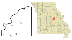
Coordinates: 38°40′32″N 91°46′11″W / 38.67556°N 91.76972°WCoordinates: 38°40′32″N 91°46′11″W / 38.67556°N 91.76972°W Country United States State Missouri County Osage Area - Total 0.4 sq mi (1.0 km2) - Land 0.4 sq mi (0.9 km2) - Water 0.0 sq mi (0.1 km2) Elevation 538 ft (164 m) Population (2000) - Total 456 - Density 1,268.3/sq mi (489.7/km2) Time zone Central (CST) (UTC-6) - Summer (DST) CDT (UTC-5) ZIP code 65024 Area code(s) 573 FIPS code 29-13060[1] GNIS feature ID 0715711[2] Chamois is a city in Osage County, Missouri, United States. The population was 456 at the 2000 census. It is part of the Jefferson City, Missouri Metropolitan Statistical Area. The city was founded in 1856 and is named after Chamonix in France, due to its Alpine scenery. Locally residents pronounce the city's name as 'Sham-OY.'
Contents
Geography
Chamois is located at 38°40′32″N 91°46′11″W / 38.67556°N 91.76972°W (38.675603, -91.769749)[3].
According to the United States Census Bureau, the city has a total area of 0.4 square miles (1.0 km2), of which, 0.4 square miles (1.0 km2) of it is land and 0.04 square miles (0.10 km2) of it (5.26%) is water.
Demographics
As of the census[1] of 2000, there were 456 people, 194 households, and 112 families residing in the city. The population density was 1,268.3 people per square mile (489.1/km²). There were 230 housing units at an average density of 639.7 per square mile (246.7/km²). The racial makeup of the city was 97.81% White, 0.22% Native American, and 1.97% from two or more races. Hispanic or Latino of any race were 0.44% of the population.
There were 194 households out of which 28.4% had children under the age of 18 living with them, 50.0% were married couples living together, 7.2% had a female householder with no husband present, and 41.8% were non-families. 39.2% of all households were made up of individuals and 25.8% had someone living alone who was 65 years of age or older. The average household size was 2.35 and the average family size was 3.16.
In the city the population was spread out with 27.6% under the age of 18, 9.0% from 18 to 24, 22.6% from 25 to 44, 19.1% from 45 to 64, and 21.7% who were 65 years of age or older. The median age was 35 years. For every 100 females there were 83.1 males. For every 100 females age 18 and over, there were 77.4 males.
The median income for a household in the city was $26,563, and the median income for a family was $32,813. Males had a median income of $26,719 versus $20,568 for females. The per capita income for the city was $12,226. About 11.5% of families and 17.9% of the population were below the poverty line, including 20.5% of those under age 18 and 11.8% of those age 65 or over.
References
- ^ a b "American FactFinder". United States Census Bureau. http://factfinder.census.gov. Retrieved 2008-01-31.
- ^ "US Board on Geographic Names". United States Geological Survey. 2007-10-25. http://geonames.usgs.gov. Retrieved 2008-01-31.
- ^ "US Gazetteer files: 2010, 2000, and 1990". United States Census Bureau. 2011-02-12. http://www.census.gov/geo/www/gazetteer/gazette.html. Retrieved 2011-04-23.
External links
- Historic maps of Chamois in the Sanborn Maps of Missouri Collection at the University of Missouri
Municipalities and communities of Osage County, Missouri Cities Belle‡ | Bland‡ | Chamois | Linn | Meta | Westphalia

Villages Townships Benton | Crawford | Jackson | Jefferson | Linn | Washington
Unincorporated
communitiesFootnotes ‡This populated place also has portions in an adjacent county or counties
Categories:- Cities in Osage County, Missouri
- Jefferson City metropolitan area
- Missouri populated places on the Missouri River


Wikimedia Foundation. 2010.