- McCord, Oklahoma
-
McCord, Oklahoma — CDP — Location within the state of Oklahoma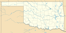
 McCord, Oklahoma
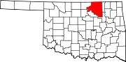
Coordinates: 36°40′56″N 97°2′19″W / 36.68222°N 97.03861°WCoordinates: 36°40′56″N 97°2′19″W / 36.68222°N 97.03861°W Country United States State Oklahoma County Osage Area – Total 4.4 sq mi (11.3 km2) – Land 4.3 sq mi (11.3 km2) – Water 0.0 sq mi (0.0 km2) Elevation 1,070 ft (326 m) Population (2010) – Total 1,440 – Density 393.4/sq mi (151.9/km2) Time zone Central (CST) (UTC-6) – Summer (DST) CDT (UTC-5) FIPS code 40-44925[1] GNIS feature ID 1867470[2] McCord is a census-designated place (CDP) in Osage County, Oklahoma, United States. The population was 1,440 at the 2010 census, a decrease of 15.8 percent from 1,711 at the 2000 census.[3]
Geography
McCord is located at 36°40′56″N 97°02′19″W / 36.682098°N 97.038567°W.[4]
According to the United States Census Bureau, the CDP has a total area of 4.4 square miles (11 km2), of which, 4.3 square miles (11 km2) of it is land and 0.23% is water.
Demographics
As of the census[1] of 2000, there were 1,711 people, 676 households, and 506 families residing in the CDP. The population density was 393.4 people per square mile (151.9/km2). There were 772 housing units at an average density of 177.5/sq mi (68.5/km2). The racial makeup of the CDP was 87.73% White, 0.76% African American, 5.20% Native American, 0.41% Asian, 0.76% from other races, and 5.14% from two or more races. Hispanic or Latino of any race were 2.45% of the population.
There were 676 households out of which 28.6% had children under the age of 18 living with them, 63.5% were married couples living together, 7.1% had a female householder with no husband present, and 25.1% were non-families. 21.2% of all households were made up of individuals and 8.4% had someone living alone who was 65 years of age or older. The average household size was 2.53 and the average family size was 2.94.
In the CDP the population was spread out with 25.0% under the age of 18, 6.7% from 18 to 24, 25.6% from 25 to 44, 28.5% from 45 to 64, and 14.1% who were 65 years of age or older. The median age was 41 years. For every 100 females there were 107.1 males. For every 100 females age 18 and over, there were 99.8 males.
The median income for a household in the CDP was $39,479, and the median income for a family was $45,446. Males had a median income of $36,429 versus $20,927 for females. The per capita income for the CDP was $17,654. About 7.9% of families and 10.9% of the population were below the poverty line, including 13.8% of those under age 18 and 8.1% of those age 65 or over.
References
- ^ a b "American FactFinder". United States Census Bureau. http://factfinder.census.gov. Retrieved 2008-01-31.
- ^ "US Board on Geographic Names". United States Geological Survey. 2007-10-25. http://geonames.usgs.gov. Retrieved 2008-01-31.
- ^ MuniNet Guide: McCord, Oklahoma.[1]
- ^ "US Gazetteer files: 2010, 2000, and 1990". United States Census Bureau. 2011-02-12. http://www.census.gov/geo/www/gazetteer/gazette.html. Retrieved 2011-04-23.
Municipalities and communities of Osage County, Oklahoma Cities Barnsdall | Bartlesville‡ | Hominy | Pawhuska | Ponca City‡ | Sand Springs‡ | Shidler | Tulsa‡
Towns CDP McCord
Unincorporated
communitiesApperson | Bowring | Carter Nine | Gray Horse | Little Chief | Lynn Addition | McCord | Nelagony | Okesa | Pearsonia | Pershing | Tallant | Whippoorwill | Wild Horse | Wolco
Footnotes ‡This populated place also has portions in an adjacent county or counties
Categories:- Populated places in Osage County, Oklahoma
- Census-designated places in Oklahoma


Wikimedia Foundation. 2010.