- National Register of Historic Places listings in Tulare County, California
-
This list includes properties and districts listed on the National Register of Historic Places in Tulare County, California. Click the "Map of all coordinates" link to the right to view a Google map of all properties and districts with latitude and longitude coordinates in the table below.[1]
-
- This National Park Service list is complete through NPS recent listings posted November 10, 2011.[2]
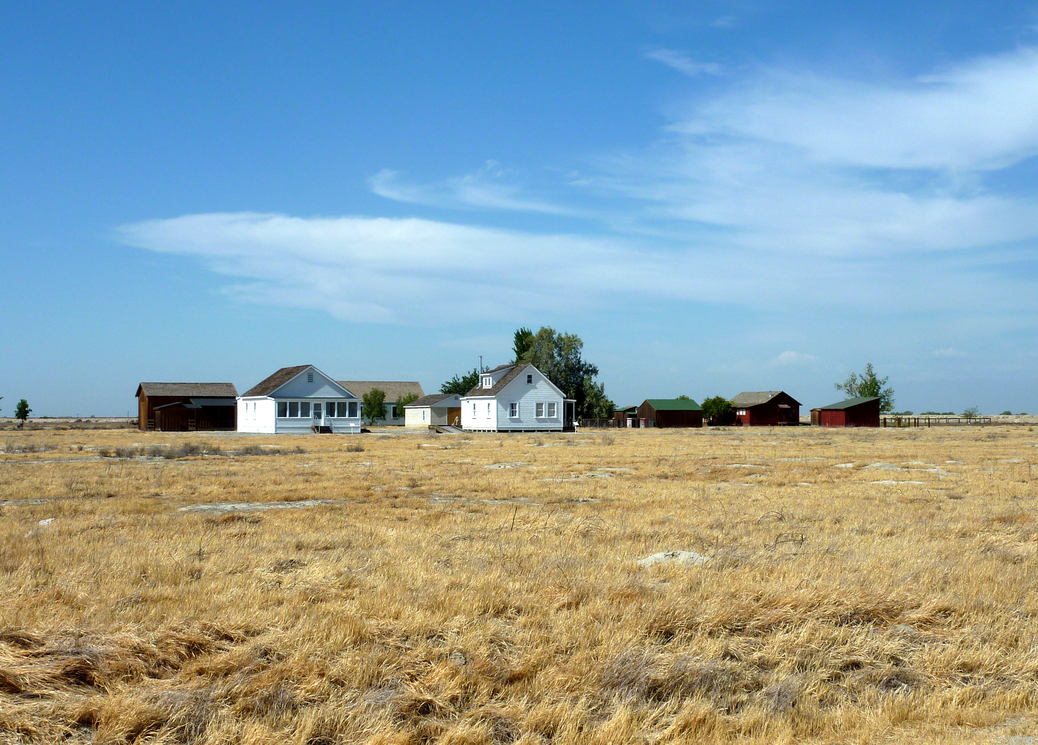
[3] Landmark name [4] Image Date listed Location City or town Summary 1 Allensworth Historic District 
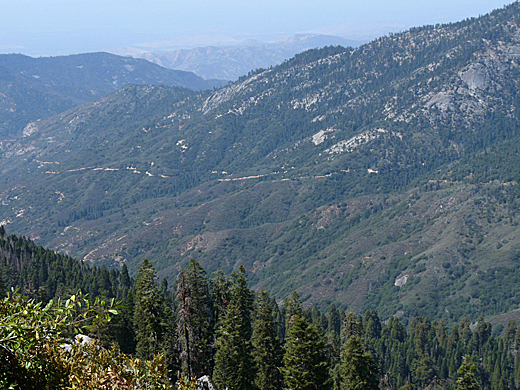
February 23, 1972 Town of Allensworth and its environs along CA 43
35°51′45″N 119°23′12″W / 35.8625°N 119.386667°WAllensworth and vicinity 2 Ash Mountain Entrance Sign 
April 27, 1978 N of Three Rivers in Sequoia National Park
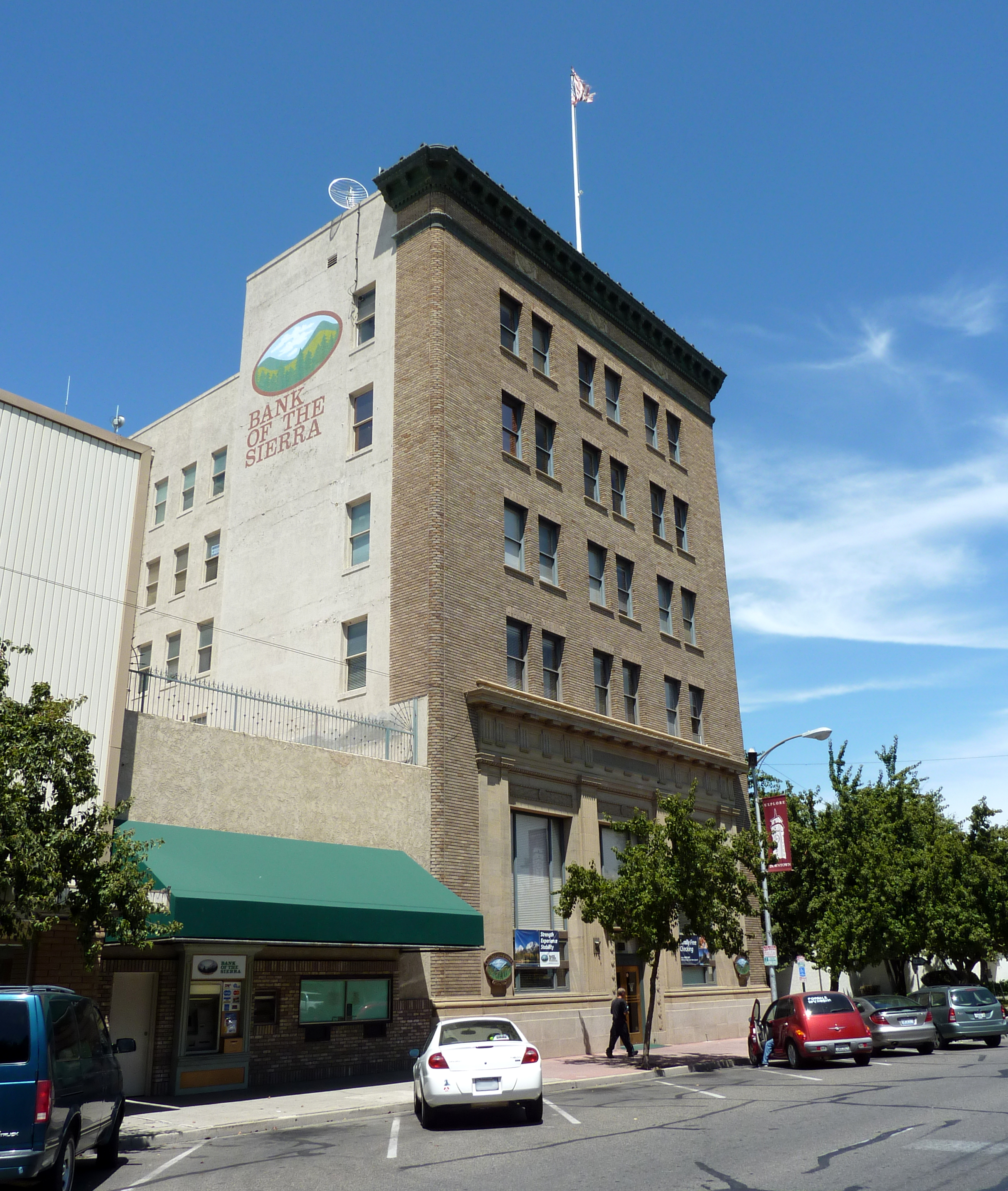
36°29′15″N 118°50′09″W / 36.4875°N 118.835833°WThree Rivers 3 Bank of Italy Building 
April 1, 1982 128 E. Main St.
36°19′49″N 119°17′16″W / 36.330278°N 119.287778°WVisalia 4 Barton-Lackey Cabin 
March 30, 1978 N of Mineral King in Kings Canyon National Park
36°42′46″N 118°34′59″W / 36.712778°N 118.583056°WMineral King 5 Cabin Creek Ranger Residence and Dormitory 
April 27, 1978 SE of Wilsonia on Generals Highway in Sequoia National Park
36°38′56″N 118°48′49″W / 36.648889°N 118.813611°WWilsonia 6 Cattle Cabin 
September 15, 1977 NE of Three Rivers on Sequoia National Park
36°34′18″N 118°45′11″W / 36.571667°N 118.753056°WThree Rivers 7 C. A. Elster Building March 25, 1982 CA 190 and Tule River Dr.
36°07′50″N 118°48′59″W / 36.130556°N 118.816389°WSpringville 8 Exeter Public Library 
December 10, 1990 309 S. E St.
36°17′36″N 119°08′17″W / 36.293333°N 119.138056°WExeter 9 First Congregational Church 
January 5, 1999 165 E. Mill St.
36°04′07″N 119°00′43″W / 36.068611°N 119.011944°WPorterville 10 Generals' Highway Stone Bridges 
September 13, 1978 N of Mineral King in Sequoia National Park
36°36′27″N 118°44′46″W / 36.6075°N 118.746111°WMineral King 11 Giant Forest Lodge Historic District 
May 5, 1978 NE of Three Rivers in Sequoia National Park
36°33′56″N 118°45′58″W / 36.565556°N 118.766111°WThree Rivers 12 Giant Forest Village-Camp Kaweah Historic District 
May 22, 1978 N of Three Rivers in Sequoia National Park
36°33′52″N 118°46′24″W / 36.564444°N 118.773333°WThree Rivers 13 Groenfeldt Site March 30, 1978 Address Restricted Three Rivers 14 Hockett Meadow Ranger Station 
April 27, 1978 S of Silver City in Sequoia National Park
36°22′37″N 118°39′19″W / 36.376944°N 118.655278°WSilver City 15 Hospital Rock 
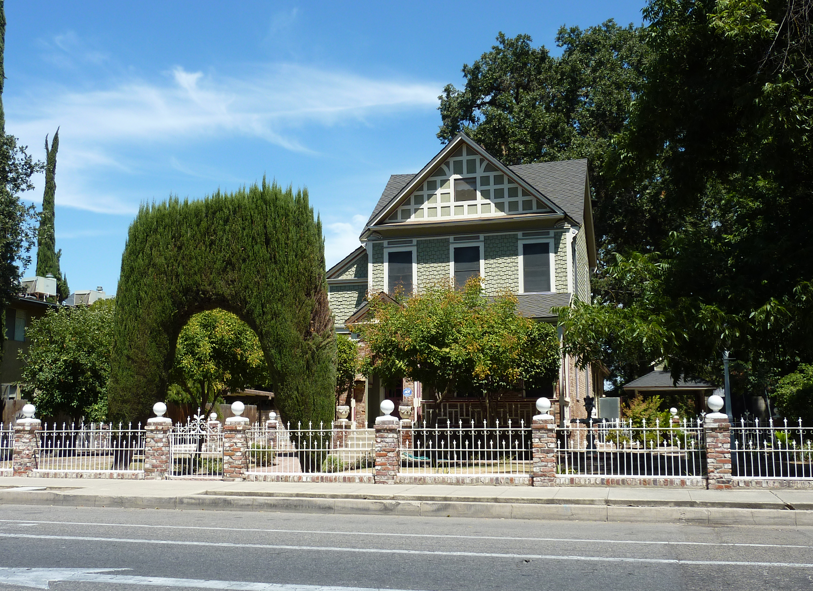
August 29, 1977 Address Restricted Three Rivers 16 Hyde House 
April 26, 1979 500 S. Court St.
36°19′33″N 119°17′28″W / 36.325833°N 119.291111°WVisalia 17 Mineral King Road Cultural Landscape 
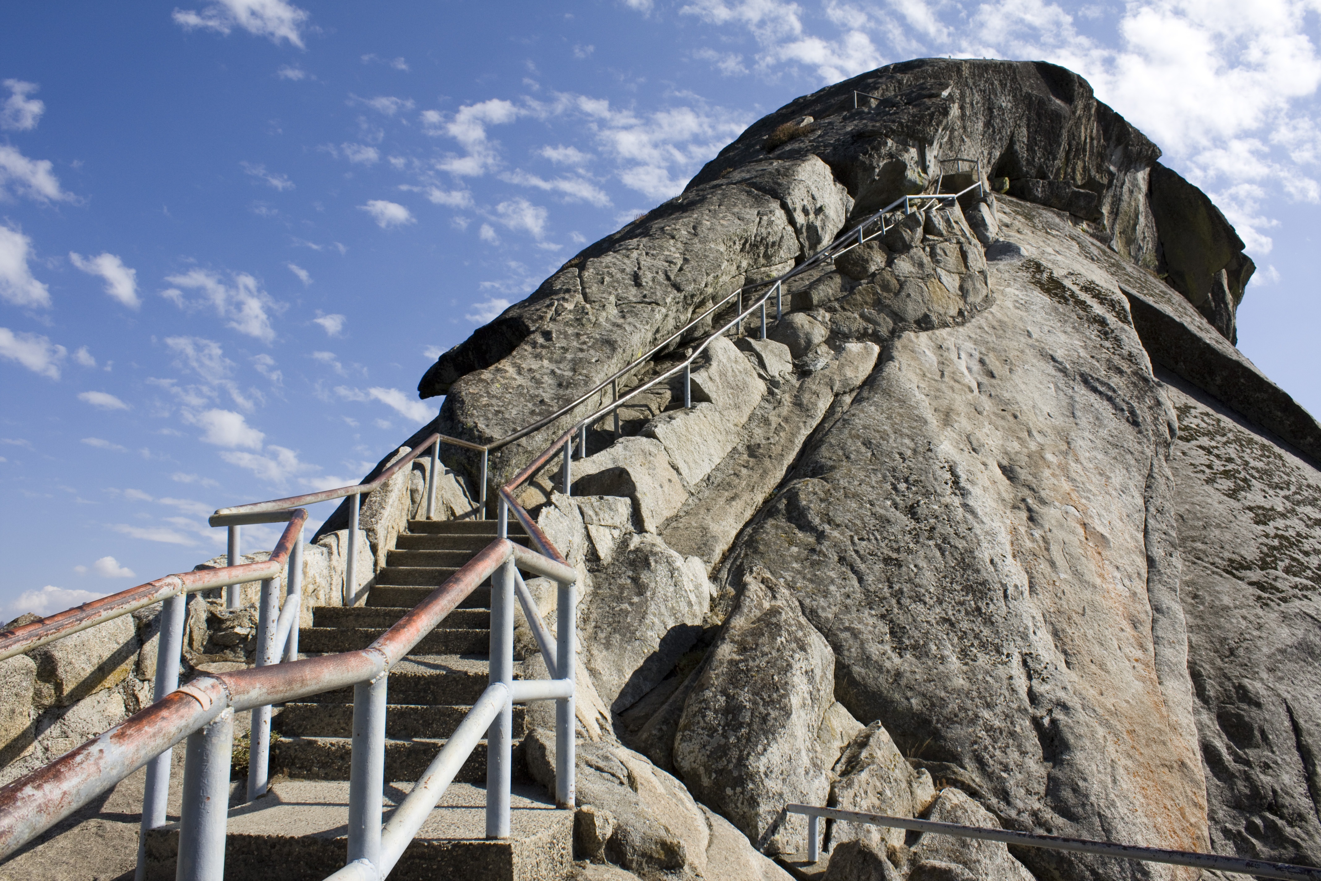
October 24, 2003 Mineral King Rd, Sequoia National Park Mineral King 18 Moro Rock Stairway 
December 29, 1978 N of Three Rivers in Sequoia National Park
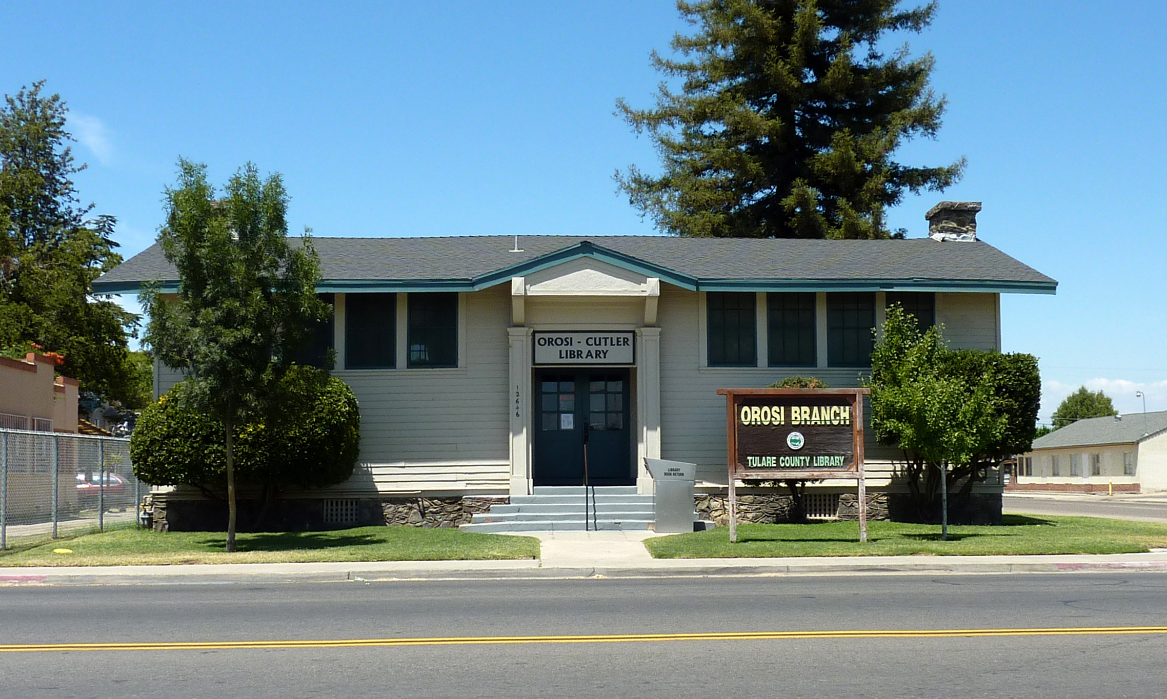
36°32′39″N 118°45′51″W / 36.544167°N 118.764167°WThree Rivers 19 Orosi Branch Library 
August 25, 1983 12662 Ave. 416
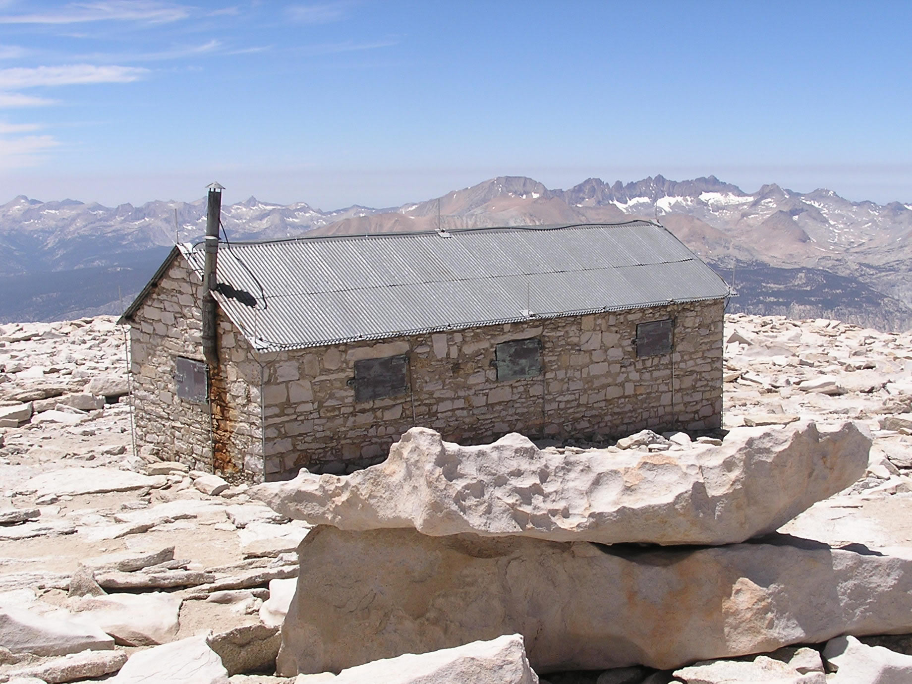
36°32′42″N 119°17′22″W / 36.545°N 119.289444°WOrosi 20 Pear Lake Ski Hut 
May 5, 1978 N of Mineral King on Sequioa National Park
36°36′29″N 118°40′15″W / 36.608056°N 118.670833°WMineral King 21 Pogue Hotel August 5, 1991 32792 Sierra Dr. (CA 198)
36°22′58″N 119°01′25″W / 36.382778°N 119.023611°WLemon Cove 22 Quinn Ranger Station 
April 13, 1977 S on Mineral King on Sequoia National Park
36°19′29″N 118°34′33″W / 36.324722°N 118.575833°WMineral King 23 Redwood Meadow Ranger Station 
April 13, 1978 NE of Three Rivers in Sequoia National Park
36°31′46″N 118°38′07″W / 36.529444°N 118.635278°WThree Rivers 24 Sequoia Field- Visalia-Dinuba School of Aeronautics 
June 9, 2000 Near jct. of Ave. 368 and Road 112, 9 mi (14 km). N of Visalia
36°26′51″N 119°19′15″W / 36.4475°N 119.320833°WVisalia 25 Shorty Lovelace Historic District January 31, 1978 E of Pinehurst on Kings Canyon National Park
36°44′26″N 118°31′03″W / 36.740556°N 118.5175°WPinehurst 26 Smithsonian Institution Shelter 
March 8, 1977 W of Lone Pine in Sequoia National Park
36°34′49″N 118°17′32″W / 36.580278°N 118.292222°WLone Pine 27 Squatter's Cabin 
March 8, 1977 NE of Three Rivers
36°33′31″N 118°45′09″W / 36.558611°N 118.7525°WThree Rivers 28 Tenalu September 4, 1986 Address Restricted Porterville 29 Tharp's Log 
March 8, 1977 NE of Three Rivers
36°33′40″N 118°44′29″W / 36.561111°N 118.741389°WThree Rivers 30 The Pioneer May 5, 1977 27000 S. Mooney Blvd.
36°16′50″N 119°18′43″W / 36.280556°N 119.311944°WVisalia 31 Tulare Union High School Auditorium and Administration Building December 17, 1999 755 E. Tulare Ave.
36°12′32″N 119°20′17″W / 36.208889°N 119.338056°WTulare 32 US Post Office-Porterville Main 
January 11, 1985 65 W. Mill Ave.
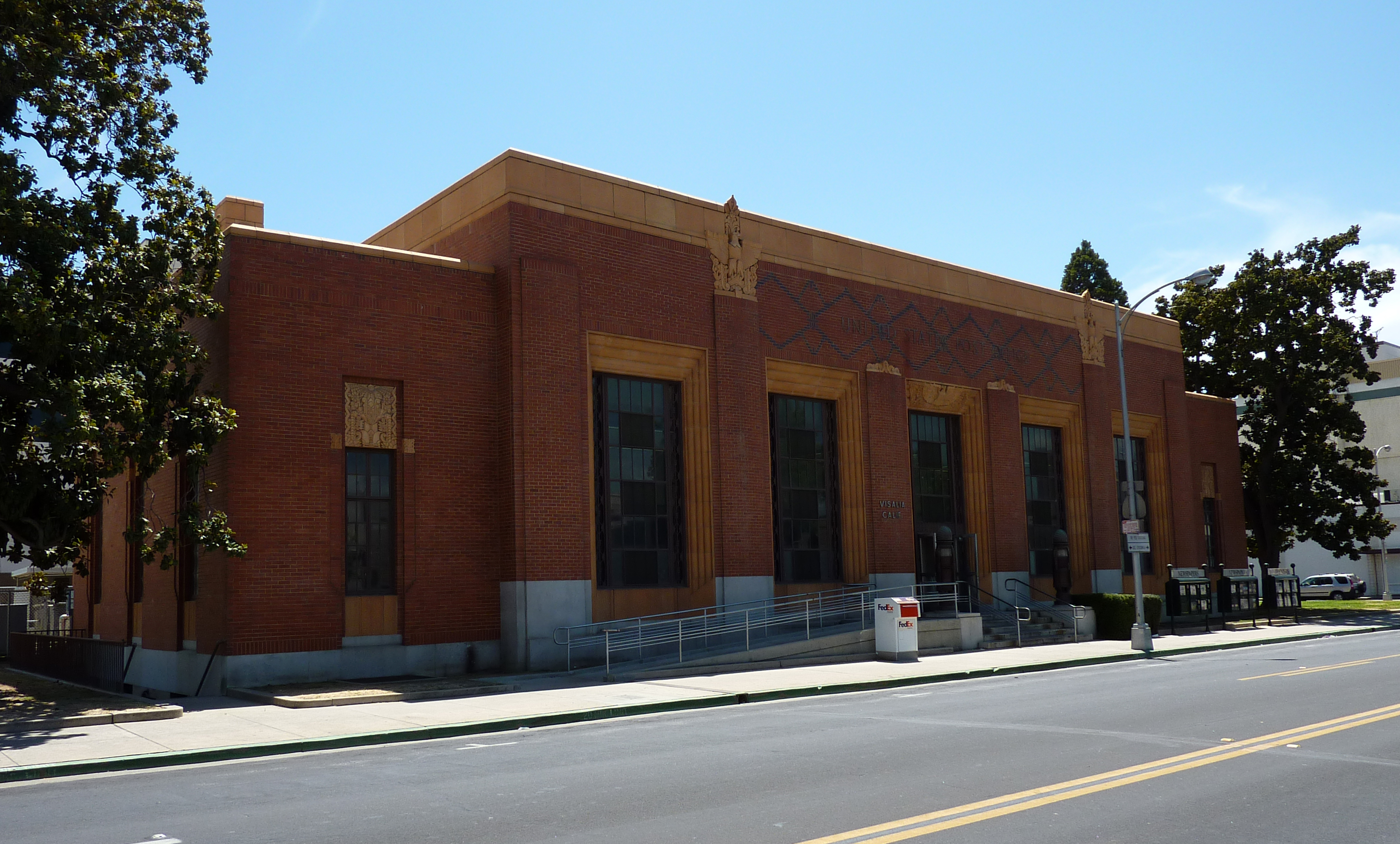
36°04′07″N 119°01′01″W / 36.068611°N 119.016944°WPorterville 33 US Post Office-Visalia Town Center Station 
January 11, 1985 11 W. Acequia St.
36°19′41″N 119°17′27″W / 36.328056°N 119.290833°WVisalia 34 Wilsonia Historic District March 14, 1996 Roughly bounded by Pine Ln., Fern Ln., Hillcrest Rd., Sierra Ln., Kaweah Ln., Goddard Ln. and Park Rd.
36°44′05″N 118°57′22″W / 36.734722°N 118.956111°WWilsonia 35 Zalud House 
March 31, 1987 393 N. Hockett St.
36°04′21″N 119°00′56″W / 36.0725°N 119.015556°WPorterville See also
- National Register of Historic Places listings in California
- List of National Historic Landmarks in California
References
- ^ The latitude and longitude information provided in this table was derived originally from the National Register Information System, which has been found to be fairly accurate for about 99% of listings. For about 1% of NRIS original coordinates, experience has shown that one or both coordinates are typos or otherwise extremely far off; some corrections may have been made. A more subtle problem causes many locations to be off by up to 150 yards, depending on location in the country: most NRIS coordinates were derived from tracing out latitude and longitudes off of USGS topographical quadrant maps created under the North American Datum of 1927, which differs from the current, highly accurate WGS84 GPS system used by Google maps. Chicago is about right, but NRIS longitudes in Washington are higher by about 4.5 seconds, and are lower by about 2.0 seconds in Maine. Latitudes differ by about 1.0 second in Florida. Some locations in this table may have been corrected to current GPS standards.
- ^ "National Register of Historic Places: Weekly List Actions". National Park Service, United States Department of the Interior. Retrieved on November 10, 2011.
- ^ Numbers represent an ordering by significant words. Various colorings, defined here, differentiate National Historic Landmark sites and National Register of Historic Places Districts from other NRHP buildings, structures, sites or objects.
- ^ "National Register Information System". National Register of Historic Places. National Park Service. . http://nrhp.focus.nps.gov/natreg/docs/All_Data.html.
U.S. National Register of Historic Places Topics Lists by states Alabama • Alaska • Arizona • Arkansas • California • Colorado • Connecticut • Delaware • Florida • Georgia • Hawaii • Idaho • Illinois • Indiana • Iowa • Kansas • Kentucky • Louisiana • Maine • Maryland • Massachusetts • Michigan • Minnesota • Mississippi • Missouri • Montana • Nebraska • Nevada • New Hampshire • New Jersey • New Mexico • New York • North Carolina • North Dakota • Ohio • Oklahoma • Oregon • Pennsylvania • Rhode Island • South Carolina • South Dakota • Tennessee • Texas • Utah • Vermont • Virginia • Washington • West Virginia • Wisconsin • WyomingLists by territories Lists by associated states Other Municipalities and communities of Tulare County, California Cities Dinuba | Exeter | Farmersville | Lindsay | Porterville | Tulare | Visalia | Woodlake
CDPs Allensworth | Alpaugh | California Hot Springs | Camp Nelson | Cedar Slope | Cutler | Delft Colony | Ducor | Earlimart | East Orosi | East Porterville | East Tulare Villa | El Rancho | Goshen | Hartland | Idlewild | Ivanhoe | Kennedy Meadows | Lemon Cove | Lindcove | Linnell Camp | London | Matheny | McClenney Tract | Monson | Orosi | Panorama Heights | Patterson Tract | Pierpoint | Pine Flat | Pixley | Plainview | Ponderosa | Poplar-Cotton Center | Posey | Poso Park | Richgrove | Rodriguez Camp | Sequoia Crest | Seville | Silver City | Springville | Strathmore | Sugarloaf Mountain Park | Sugarloaf Saw Mill | Sugarloaf Village | Sultana | Terra Bella | Teviston | Three Rivers | Tipton | Tonyville | Tooleville | Traver | Waukena | West Goshen | Wilsonia | Woodville | Yettem
Unincorporated
communitiesAdvance | Angiola | Badger | Balance Rock | Cairns Corner | Calgro | Johnsondale | Kaweah | Rocky Hill | White River | Yokohl Valley | Zante
Ghost town Fountain Springs
Indian
reservationTule River Reservation
Categories:- Tulare County, California
- History of the San Joaquin Valley Area
- National Register of Historic Places in California by county
- Lists of National Register of Historic Places in California
-


Wikimedia Foundation. 2010.