- Lindsay, California
Infobox Settlement
official_name = Lindsay, California
other_name =
native_name =
nickname =
settlement_type =City
motto =
imagesize =
image_caption =
flag_size =
image_
seal_size =
image_shield =
shield_size =
image_blank_emblem =
blank_emblem_type =
blank_emblem_size =
imagesize =
image_caption =
flag_size =
image_
seal_size =
image_shield =
shield_size =
image_blank_emblem =
blank_emblem_type =
blank_emblem_size =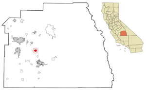
mapsize = 250x200px
map_caption = Location in Tulare County and the state ofCalifornia
mapsize1 =
map_caption1 =
image_dot_
dot_mapsize =
dot_map_caption =
dot_x =
dot_y =
pushpin_
pushpin_label_position =
pushpin_map_caption =
pushpin_mapsize =
subdivision_type = Country
subdivision_name =United States
subdivision_type1 = State
subdivision_name1 =California
subdivision_type2 = County
subdivision_name2 = Tulare
subdivision_type3 =
subdivision_name3 =
subdivision_type4 =
subdivision_name4 =
government_footnotes =
government_type =
leader_title =
leader_name =
leader_title1 =
leader_name1 =
leader_title2 =
leader_name2 =
leader_title3 =
leader_name3 =
leader_title4 =
leader_name4 =
established_title =
established_date =
established_title2 =
established_date2 =
established_title3 =
established_date3 =
area_magnitude =
unit_pref =
area_footnotes =
area_total_km2 = 6.3
area_land_km2 = 6.3
area_water_km2 = 0
area_total_sq_mi = 2.4
area_land_sq_mi = 2.4
area_water_sq_mi = 0
area_water_percent =
area_urban_km2 =
area_urban_sq_mi =
area_metro_km2 =
area_metro_sq_mi =
area_blank1_title =
area_blank1_km2 =
area_blank1_sq_mi =
population_as_of = 2000
population_footnotes =
population_note =
population_total = 10297
population_density_km2 = 1634.4
population_density_sq_mi = 4290.4
population_metro =
population_density_metro_km2 =
population_density_metro_sq_mi =
population_urban =
population_density_urban_km2 =
population_density_urban_sq_mi =
population_blank1_title =
population_blank1 =
population_density_blank1_km2 =
population_density_blank1_sq_mi =
timezone = Pacific (PST)
utc_offset = -8
timezone_DST = PDT
utc_offset_DST = -7
latd = 36 |latm = 12 |lats = 26 |latNS = N
longd = 119 |longm = 5 |longs = 20 |longEW = W
elevation_footnotes =
elevation_m = 118
elevation_ft = 387
postal_code_type =ZIP code
postal_code = 93247
area_code = 559
blank_name = FIPS code
blank_info = 06-41712
blank1_name = GNIS feature ID
blank1_info = 1652744
website =
footnotes =Lindsay is a city in Tulare County,
California ,United States . The population was 10,297 at the 2000 census. Lindsay is located southeast of Visalia and is considered part of theVisalia Metropolitan Area by theUnited States Census Bureau .History
Orton family
When Thomas Orton, an
emigrant fromEngland , landed inBoston harbor in 1635, he had little idea that one of his descendants would be planting the first of many orange trees some seven generations and 245 years laterFact|date=July 2008, in Lindsay, California, convert|3000|mi|km to the west.Julius Orton, a seventh generation descendant of Thomas, was born in
Ohio in 1825. The family moved toMissouri in 1838. Julius enlisted as ateamster in the U.S. Army when the war with Mexico began in 1846, then serve as a guard for a pack train crossing the plains for Placerville, a booming California gold mining town.Finding no
gold , Julius moved to Soquel, alumber town near Santa Cruz, where he worked as a laborer and eventually developed his own herd ofcattle . In 1859, accompanied by his wife and two small daughters, and driving a small herd of cattle, he walked more than convert|200|mi|km from the coast to a homestead along theTule River southwest of Lindsay.Julius Orton became a part of Lindsay history in the 1880s when he took up a second convert|160|acre|km2|sing=on homestead on land adjacent to the property of Lewis and John Keeley, brothers who had homesteaded a few miles southwest of Lindsay in the mid 1870's.
Julius Orton is credited with planting the first orange trees in the Lindsay district on his homestead, giving rise to the motto, "Central California's Citrus Center."
Other pioneers
The Ortons and Keeleys were not the only pioneers in the district. Members of the Yandanche Indian tribe had for centuries come into the valley by way of Lewis Creek canyon to hunt and fish. Captain John Fremont passed by the site of Lindsay twice on exploration trips, following what later became the
Butterfield Overland Mail stagecoach route.John J. Cairns, a Scotsman by birth, came to the Lindsay area in 1881. His first venture was as a sheep rancher, followed by cattle, then as a grower of 22,000 acres (89 km²) of grain in Tulare and northern Kern counties. He also was credited with development of water wells which encouraged the further development of citrus cropping. The Cairns homestead property and citrus orchard, bordered by century-old olive trees, still exists at Cairns Corner west of Lindsay.
Capt. Arthur J. Hutchinson, known as the founder of the city of Lindsay, came to the area in 1889. He was born in Bermuda, where his father was assigned by the British government and served for a time as governor. Capt. Hutchinson was a
Royal Military College graduate and served in India until 1879, when illness forced his retirement. Coming to California for his health, he moved to the Lindsay area, bought 2,000 acres (8 km²) and formed the Lindsay Land Company.When the
Southern Pacific Railroad came through the area in 1889, development of the Lindsay townsite began under the Pacific Development Company.The townsite was laid out by Capt. Hutchinson and the community was named for his wife, Sadie Lindsay Patton Hutchinson.
Stockton Berry migrated to the area about the same time as Capt. Hutchinson and farmed several thousand acres of
grain ,grape s and oranges to the northeast of Lindsay.G.S. Berry introduced a self propelled harvester around 1885. It used the stalks of the wheat for fuel. The chance of fire was great as the sparks could ignite entire fields of grain, before it was harvested.
In addition to farming, Stockton Berry invented the first
tractor drawn grain harvester, revolutionizing the industry. He also developed an efficient method for usingelectric motor s and power for drilling wells and pumping water.Twentieth century
The advent of the 20th century saw an increase of population in the area. Jobs were available in the increased orange and olive plantings. Many others worked in timber and mining operations in the mountains to the east. By 1905, approximately 700 acres (2.8 km²) of oranges had been planted in the district, but only a few were in full bearing.
The increase in population which followed the arrival of the railroad included many persons interested in development of a town site.
The Southern Pacific Depot was located on Sweetbrier. The train was a much-used means of travel for Lindsay residents and relatives. This group of travelers was captured on film in the 1920s.
Excursion train s fromsouthern California arrived every few weeks carrying people interested in settling in the Lindsay area. This influx of people sparked the development of some 75,000 acres (304 km²) of land by 1910, along with packing houses to process the agricultural products.The Lindsay Chamber of Commerce was organized in 1908 with G. B. Moore, a food market owner, as first president. Its first project was to promote the incorporation of the City of Lindsay on February 28, 1910, with some 700 residents within the city limits.
Citizens were eager to develop their community and its economy. In 1911, a bond issue of $130,000 was approved to develop a water system and construct a
sewer system.By 1916, there were 23 blocks of paved streets and the population rose to 3,000. There were four schools, nine churches and numerous
social clubs . There were 115 members in the Tuesday Club (later to become the Lindsay Women's Club), which constructed thearboretum at the southwest corner of Mirage and Hermosa, now occupied by a church.The economy in 1916 was also robust. Stores with a full complement of merchandise lined the downtown streets.
W. A. Morley had the first
Ford dealership in Lindsay. This wonderful old building and garage was at the corner of South Elmwood and Apia.Citrus growers sent 3,186 cars to market, up from the 556 cars in 1910, and 14 large packing houses employed 1,500 workers. The three banks recorded gross resources of $1,320,000.
Irrigation problems
But there was trouble ahead. Foothill area
irrigation wells began to show signs ofsalt . The Lindsay-Strathmore Irrigation District began to import water from wells it owned in theKaweah River Delta. The Tulare Irrigation District and other Delta interests in 1916 filed a lawsuit which was in the courts for 20 years, and which was not compromised until 1936 only after the advent of theCentral Valley Project which bought water to the district in theFriant-Kern Canal . In celebration of the settlement, the members of the California State Supreme Court visited Lindsay for the celebration.Chamber of Commerce
The Chamber of Commerce continued to serve the community through the crisis of the Great Depression and the war years. R.I. Clearman, who served the Chamber for 23 years as secretary/manager, originated the Orange Blossom Festival in 1931 to counteract the "depression blues." During
World War II , the Chamber of Commerce served as headquarters for committees concerned with "home front" activities.The Chamber of Commerce has had many homes during its 90 years of existence. In the 1920s it occupied the Honolulu Street building now the office of Landmark Title Company. It later moved to the Mt. Whitney Hotel and the City Hall on its completion, and later to the old Dr. Tourtillott house on Gale Hill Avenue.
Now the Chamber of Commerce operates from quarters in the new Sierra Vista Plaza on West Honolulu Street, construction which it helped to sponsor. The Chamber of Commerce motto, in its 90th year, is "Look to Lindsay."
Geography
Lindsay is located at coor dms|36|12|26|N|119|5|20|W|city (36.207172, -119.088810)GR|1.
According to the
United States Census Bureau , the city has a total area of 2.4 square miles (6.2 km²), all of it land.Demographics
As of the
census GR|2 of 2000, there were 10,297 people, 2,717 households, and 2,208 families residing in the city. Thepopulation density was 4,264.4 people per square mile (1,649.7/km²). There were 2,865 housing units at an average density of 1,186.5/sq mi (459.0/km²). The racial makeup of the city was 44.83% White, 0.57% African American, 1.51% Native American, 1.06% Asian, 0.15% Pacific Islander, 48.27% from other races, and 3.62% from two or more races. Hispanic or Latino of any race were 77.97% of the population.There were 2,717 households out of which 53.4% had children under the age of 18 living with them, 57.2% were married couples living together, 17.1% had a female householder with no husband present, and 18.7% were non-families. 15.9% of all households were made up of individuals and 8.6% had someone living alone who was 65 years of age or older. The average household size was 3.74 and the average family size was 4.16.
In the city the population was spread out with 38.0% under the age of 18, 11.4% from 18 to 24, 27.3% from 25 to 44, 14.2% from 45 to 64, and 9.1% who were 65 years of age or older. The median age was 25 years. For every 100 females there were 102.6 males. For every 100 females age 18 and over, there were 101.0 males.
The median income for a household in the city was $24,305, and the median income for a family was $24,934. Males had a median income of $23,645 versus $18,992 for females. The
per capita income for the city was $8,230. About 33.3% of families and 39.9% of the population were below thepoverty line , including 49.3% of those under age 18 and 12.3% of those age 65 or over.Politics
In the state legislature Lindsay is located in the 16th Senate District, represented by Democrat
Dean Florez , and in the 34th Assembly District, represented by RepublicanBill Maze . Federally, Lindsay is located inCalifornia's 21st congressional district , which has a Cook PVI of R +13 [cite web | title = Will Gerrymandered Districts Stem the Wave of Voter Unrest? | publisher = Campaign Legal Center Blog | url=http://www.clcblog.org/blog_item-85.html | accessdate = 2008-02-10] and is represented by RepublicanDevin Nunes .External links
* [http://www.lindsay.ca.us/ Lindsay official website]
* [http://www.lindsaynaz.com/ Lindsay Church of the Nazarene]
Wikimedia Foundation. 2010.