- Highgrove, California
Infobox Settlement
official_name = Highgrove, California
settlement_type = CDP
imagesize =
image_caption =
image_
imagesize =
image_caption =
image_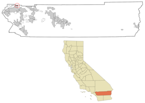
mapsize = 250x200px
map_caption = Location in Riverside County and the state ofCalifornia
mapsize1 =
map_caption1 =
subdivision_type = Country
subdivision_type1 = State
subdivision_type2 = County
subdivision_name =United States
subdivision_name1 =California
subdivision_name2 = Riverside
government_type =
leader_title =
leader_name =
established_date =
area_magnitude =
area_total_km2 = 2.8
area_total_sq_mi = 1.1
area_land_km2 = 2.8
area_land_sq_mi = 1.1
area_water_km2 = 0
area_water_sq_mi = 0
elevation_ft = 951
elevation_m = 290
population_as_of = 2000
population_footnotes =
population_total = 3445
population_metro =
population_density_km2 = 1230.4
population_density_sq_mi = 3131.8
timezone = PST
utc_offset = -8
latd = 34 |latm = 0 |lats = 55 |latNS = N
longd = 117 |longm = 19 |longs = 51 |longEW = W
timezone_DST = PDT
utc_offset_DST = -7
postal_code_type =ZIP code
postal_code = 92507
area_code = 951
blank_name = FIPS code
blank_info = 06-33574
blank1_name = GNIS feature ID
blank1_info = 1652721
footnotes =
website =Highgrove is a
census-designated place (CDP) in Riverside County,California ,United States . The population was 3,445 at the 2000 census.Geography
Highgrove is located at coor dms|34|0|55|N|117|19|51|W|city (34.015253, -117.330926)GR|1.
According to the
United States Census Bureau , the CDP has a total area of 1.1square mile s (2.8km² ), all of it land.Highgrove is located in an unincorporated area of Riverside County between the City of Riverside and the City of Grand Terrace.
Demographics
As of the
census GR|2 of 2000, there were 3,445 people, 1,026 households, and 777 families residing in the CDP. Thepopulation density was 3,133.5 people per square mile (1,209.2/km²). There were 1,090 housing units at an average density of 991.5/sq mi (382.6/km²). The racial makeup of the CDP was 54.02% White, 4.30% Black or African American, 1.13% Native American, 2.38% Asian, 0.49% Pacific Islander, 33.58% from other races, and 4.09% from two or more races. 56.66% of the population were Hispanic or Latino of any race.There were 1,026 households out of which 48.9% had children under the age of 18 living with them, 51.3% were married couples living together, 16.4% had a female householder with no husband present, and 24.2% were non-families. 16.6% of all households were made up of individuals and 4.2% had someone living alone who was 65 years of age or older. The average household size was 3.35 and the average family size was 3.81.
In the CDP the population was spread out with 36.4% under the age of 18, 10.1% from 18 to 24, 31.1% from 25 to 44, 16.1% from 45 to 64, and 6.2% who were 65 years of age or older. The median age was 27 years. For every 100 females there were 105.9 males. For every 100 females age 18 and over, there were 103.7 males.
The median income for a household in the CDP was $30,685, and the median income for a family was $33,929. Males had a median income of $32,199 versus $27,177 for females. The
per capita income for the CDP was $16,422. About 22.4% of families and 27.8% of the population were below thepoverty line , including 38.7% of those under age 18 and 8.2% of those age 65 or over.Politics
In the state legislature Highgrove is located in the 31st Senate District, represented by Republican
Robert Dutton , and in the 63rd and 64th Assembly Districts, represented by RepublicansBill Emmerson andJohn J. Benoit respectively. Federally, Highgrove is located inCalifornia's 44th congressional district , which has a Cook PVI of R +6 [cite web | title = Will Gerrymandered Districts Stem the Wave of Voter Unrest? | publisher = Campaign Legal Center Blog | url=http://www.clcblog.org/blog_item-85.html | accessdate = 2008-02-10] and is represented by RepublicanKen Calvert .External links
Wikimedia Foundation. 2010.