- Coachella, California
-
For the music and arts festival, see Coachella Valley Music and Arts Festival.
City Of Coachella — City — Nickname(s): Coachello, La Coachelita and Cochele. 
Coordinates: 33°40′46″N 116°10′28″W / 33.67944°N 116.17444°WCoordinates: 33°40′46″N 116°10′28″W / 33.67944°N 116.17444°W Country  United States
State  California
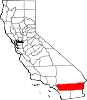
County Riverside Government - Mayor Eduardo Garcia Area[1] - Total 28.950 sq mi (74.981 km2) - Land 28.950 sq mi (74.981 km2) - Water 0 sq mi (0 km2) 0% Elevation -66 ft (-20.74 m) Population (2010) - Total 40,704 - Density 1,406/sq mi (542.9/km2) Time zone PST (UTC-8) - Summer (DST) PDT (UTC-7) ZIP code 92236 Area code(s) 760 FIPS code 06-14260 GNIS feature ID 1652686 Website Coachella.org U.S. Geological Survey Geographic Names Information System: Coachella, California Coachella (ko-CHEL-a, ko-a-CHEL-a)[2] is a city in Riverside County, California; it is the easternmost city in the region collectively known as the Coachella Valley (or the Palm Springs area). It is located 28 miles (45 km) east of Palm Springs, 72 miles (116 km) east of Riverside, and 130 miles (210 km) east of Los Angeles.
Known as the "City of Eternal Sunshine", Coachella is largely a rural, agricultural, family-oriented community in the desert and one of the state's fastest growing cities in the late 20th century. When it first incorporated back in 1946, it had 1,000 residents, but the population was 40,704 at the 2010 census.
The eastern half of the Coachella valley is below sea level, and the area's average elevation is 68 feet (35 m) below sea level. The Salton Sea, a saltwater lake located about 10 miles (16 km) South of Coachella, lies 227 feet (69 m) below sea level.
The city also lends its name to the Coachella grapefruit; the town's stretch of State Route 111 is named Grapefruit Boulevard in its honor. Harrison Street or State Route 86 is declared historic U.S. Route 99, the major thoroughfare that connects with Interstate 10 a few miles north of town.
Contents
Geography
Coachella is located at 33°40′46″N 116°10′28″W / 33.679522°N 116.174488°W.[3]
According to the United States Census Bureau, the city has a total area of 28.95 square miles (75.0 km2), all of it land.
The elevation is 68 feet (21 m) below sea level, as the eastern half of the Coachella valley is below sea level. The saltwater lake, Salton Sea, 10 miles (16 km) south of Coachella, is 228 feet (69 m) below sea level.
History
The city was originally founded as Woodspur in 1876, when the Southern Pacific Railroad built a rail siding on the site. In the 1880s the indigenous Cahuilla tribe sold their land plots to the railroads for new lands east of the current town site, and in the 1890s, a few hundred traqueros took up settlement along the tracks.
The origin of the name Coachella is unclear, but in 1901 the citizens of Woodspur voted on a new name for their community; at their town hall meeting, the homeowners settled on "Coachella". Some locals believe it was a misspelling of Conchilla, a Spanish word for the small white snail shells found in the valley's sandy soil, vestiges of a lake which dried up over 3,000 years ago.
Coachella began as a 2.5-square-mile (6.5 km2) territory gridded out on the mesquite-covered desert floor. Not until the 1950s did Coachella begin to expand into its present range, about 32 square miles (83 km2), an area which contained large year-round agricultural corporate farms and fruit groves, particularly of citrus (lemons, oranges, grapefruit) and date palms.
Coachella became a city in 1946. During the incorporation voting process, the first city council was tentatively elected: Lester C. Cox, T. E. Reyes, John W. Westerfield, Lester True, and Paul S. Atkinson. Also elected on November 26, 1946, were City Clerk Marie L. Johnson and City Treasurer John C. Skene. John Westerfield was appointed mayor at the first meeting.
By the 1980 census, Coachella's population had reached at least 10,000 due to relative slow population growth. Due to a high percentage of Hispanics in the city, Coachella was a scene of Chicano political activism including protests and visits by United Farm Workers leader César Chávez in the 1960s and 1970s.
Education
Coachella is served by the Coachella Valley Unified School District, based in Thermal, California. Its main high school is Coachella Valley High School (with 2900 students) followed by a new high school Desert Mirage High School about 5 miles to the south; its two middle schools are Cahuilla Desert Academy and Bobby Duke. Elementary schools include Cesar Chavez, Palm View, Peter Pendleton, Valle Del Sol, Valley View, Westside and Coral Mountain Academy.
The Coachella Valley Adult School, in operation since 1952, is the third largest adult school in Riverside County. It offers seven levels of English as a Second Language (ESL), and has offered citizenship classes for over 20 years. In the last ten years, over 1,500 people completed citizenship classes at the school and submitted N-400 forms.
Culture
The film director Frank Capra is interred in the Coachella Valley Cemetery. Professional boxing champions Antonio Diaz and Julio Díaz (brothers), are originally from Coachella. The agricultural area surrounding Coachella was where the United Farm Workers union staged strikes and protests, including visits by UFW leader César Chávez. Migrant labor activist Sam Maestas has a home in the rural outskirts of Coachella.
Downtown Coachella is under renovation as the area experiences an economic boom which has brought increasing numbers of people in the city — Pueblo Viejo (the old neighborhood) as locals of Hispanic origin sometimes call it.[citation needed] Despite its image for Mexican immigration, a large percentage are US citizens, born and raised in Coachella. A multi-generational Mexican American subculture has taken root in the town.
Much of its population consists of younger Latino families (an estimated 90 percent of Hispanic origin) and, in the outlying areas, migrant farm workers. The city is officially bilingual in the English and Spanish languages, although city council meetings are nominally spoken and performed in English. Historically, Coachella was predominantly Mexican/Latino (including Central America) and/or Native American, but had other ethnic groups like Arabs, Armenians, Filipinos, Italians, Japanese and recent immigrants from Southeast Asia and the former Yugoslavia.
Three popular fiestas are celebrated each year in town: Cinco de Mayo (May 5), the 16 de Septiembre Fiestas Patrias (Mexico's Independence from Spain) and the 12 de Diciembre (the patron saint of Mexico, Santa Maria de Guadalupe) to celebrate the Virgin Mary.
Near the city limits of Coachella are three casinos on Indian reservations: Fantasy Springs Resort and Casino, Spotlight 29 Casino, and Augustine Casino, which are owned and operated by Native American tribes — the Cabazon Band of Mission Indians, Twentynine Palms Band of Mission Indians, and Augustine Band of Cahuilla Indians, respectively. These small but highly profitable tribes have representative councils to ensure self-reliance as a community. Coachella is also home to a significant Southwest Indian (Apache, Hopi, Navajo and Zuni) population, though not indigenous to the California desert region.
In the 1953 Warner Brothers cartoon Bully For Bugs, Bugs Bunny misses his "left toin at Albuquerque" and pops up in a Mexican bull ring, where he asks for directions to "...the shortest route to the Coachella Valley and the big carrot festival therein?"
Demographics
Historical populations Census Pop. %± 1950 2,755 — 1960 4,854 76.2% 1970 8,353 72.1% 1980 9,129 9.3% 1990 16,896 85.1% 2000 22,724 34.5% 2010 40,704 79.1% 2010
The 2010 United States Census[4] reported that Coachella had a population of 40,704. The population density was 1,406.0 people per square mile (542.9/km²). The racial makeup of Coachella was 19,576 (48.1%) White, 320 (0.8%) African American, 290 (0.7%) Native American, 266 (0.7%) Asian, 34 (0.1%) Pacific Islander, 19,154 (47.1%) from other races, and 1,064 (2.6%) from two or more races. Hispanic or Latino of any race were 39,254 persons (96.4%).
The Census reported that 40,646 people (99.9% of the population) lived in households, 58 (0.1%) lived in non-institutionalized group quarters, and 0 (0%) were institutionalized.
There were 8,998 households, out of which 6,625 (73.6%) had children under the age of 18 living in them, 5,583 (62.0%) were opposite-sex married couples living together, 1,927 (21.4%) had a female householder with no husband present, 820 (9.1%) had a male householder with no wife present. There were 795 (8.8%) unmarried opposite-sex partnerships, and 76 (0.8%) same-sex married couples or partnerships. 464 households (5.2%) were made up of individuals and 151 (1.7%) had someone living alone who was 65 years of age or older. The average household size was 4.52. There were 8,330 families (92.6% of all households); the average family size was 4.57.
The population was spread out with 15,786 people (38.8%) under the age of 18, 4,889 people (12.0%) aged 18 to 24, 11,896 people (29.2%) aged 25 to 44, 6,306 people (15.5%) aged 45 to 64, and 1,827 people (4.5%) who were 65 years of age or older. The median age was 24.5 years. For every 100 females there were 99.3 males. For every 100 females age 18 and over, there were 97.3 males.
There were 9,903 housing units at an average density of 342.1 per square mile (132.1/km²), of which 5,586 (62.1%) were owner-occupied, and 3,412 (37.9%) were occupied by renters. The homeowner vacancy rate was 6.4%; the rental vacancy rate was 5.4%. 25,519 people (62.7% of the population) lived in owner-occupied housing units and 15,127 people (37.2%) lived in rental housing units.
2000
As of the census[5] of 2000, there were 22,724 people, 4,807 households, and 4,480 families residing in the city. The population density was 1,091.4 people per square mile (421.4/km²). There were 5,024 housing units at an average density of 241.3 per square mile (93.2/km²). The racial makeup of the city was 38.8% White, 0.5% Black or African American, 0.8% Native American, 0.3% Asian, < 0.1% Pacific Islander, 56.6% from other races, and 3.0% from two or more races. 97.4% of the population were Hispanic or Latino of any race.
There were 4,807 households,and many more of which 65.9% had children under the age of 18, 66.5% were married couples living together, 19.4% had a female householder with no husband present, and 6.8% were non-families. 5.3% of all households were individuals living alone, and 2.3% had someone living alone who was 65 years of age or older. The average household size was 4.72 and the average family size was 4.80.
In the city the population was spread out with 40.8% under the age of 18, 12.7% from 18 to 24, 28.8% from 25 to 44, 12.8% from 45 to 64, and 5.0% 65 years or older. The median age was 23 years. For every 100 females there were 100.1 males. For every 100 females age 18 and over, there were 99.4 males.
The median income for a household in the city was $28,590, and the median income for a family was $28,320. Males had a median income of $23,044, compared to $15,550 for females. The per capita income for the city was $7,416. About 29.1% of families and 28.9% of the population were below the poverty line, including 35.3% of those under age 18 and 25.7% of those 65 or over.
Politics
Coachella has played a minor yet important role in state and national political causes. The majority of registered voters are in the Democratic Party, a stronghold of Democrats in a largely Republican voting bloc (the Inland Empire) and compared to neighboring cities.
In the state legislature Coachella is located in the 40th Senate District, represented by Democrat Denise Moreno Ducheny, and in the 80th Assembly District, represented by Democrat Manuel Perez. Federally, Coachella is located in California's 45th congressional district, which has a Cook PVI of R +3[6] and is represented by Republican Mary Bono Mack.
Local issues
According to a 2006 state-funded economic survey, Coachella ranks third lowest in average personal income of any California city, and one of ten poorest cities in the state. The city's remote location from urban areas can be responsible for the high poverty rate.
Coachella has dealt with socioeconomic issues which produced a history of above-average crime rates. Coachella received negative local media attention as a city riddled by youth gangs, drug trade activity, massive movement of undocumented immigration and racial separatism. Much of the non-Hispanic population moved away in reaction. However, the 2006 FBI crime statistical release placed Coachella at the lowest crime rates in all of the Coachella Valley and Riverside County.
In 1995, state and federal officials designated Coachella as part of the Coachella Valley Enterprise Zone to boost economic activity and entice businesses to relocate to this rural city which was once home to several fruit shipping plants.
Near Coachella, a new four-lane expressway State Route 86 was built for international trucking from Mexicali, Mexico to Los Angeles or Arizona. Referred to as the "NAFTA highway" (in reference to the North American Free Trade Agreement took effect in 1994), it replaces an older and less safe two-lane road known as the "killer highway" where over 400 auto accident fatalities took place since 1980.
In 2006 mayoral elections, 29-year-old Eduardo Garcia became the city's youngest mayor ever. Garcia was a lifelong Coachella resident and a 1995 graduate of Coachella Valley High School. He attended the College of the Desert in Palm Desert, California.
Also in 2006, the city council passed a resolution (No. 2006-34) opposing the Clear Air Act and Sensenbrenner Bill (H.R. 4437), then pending in the U.S. Senate.
Today, retail and commercial properties appear on Coachella's two main streets: Harrison Street (formerly U.S. Route 99) and Grapefruit Boulevard (State Route 111), along with a new retail development on Avenue 48 and Jackson street. Since 2000, thousands of single-family homes and multi-unit apartment complexes are being built at a fast pace, as the city's population soars, having more than doubled in the last decade.
In 2010, a Coca-Cola bottling facility was added to the city's new light industry facilities, a boon in the rapid-growth community which has a currently troubled economy.[7]
The future of Coachella could be linked one day to tourism as well as agriculture. Coachella expanded recreational and social activities for which residents once had to drive ten or twenty miles (32 km) west. The city has a recreation center, a Boys and Girls Club center, and a boxing club in Bagdouma Park. There are two dance clubs and the Corona Yacht Club located near Spotlight 29 casino; two new golf courses (Desert Lakes and the Vineyards) attract many retirees, RV owners, and local business people.
Events and points of interest
Public safety
The Riverside County Sheriff's Department now serves the city from the nearby Indio Regional Station. (The original Coachella Police Department was disbanded in 1998.) The City also contracts out for fire protection and emergency medical services (EMS) with the Riverside County Fire Department through a cooperative agreement with the California Department of Forestry and Fire Protection (Cal Fire). The County Fire Department currently staffs 2 paramedic engine companies out of Station 79 with plans for another station in the future.
References
- ^ U.S. Census
- ^ http://www.languagehat.com/archives/001249.php which quotes California Place Names: The Origin and Etymology of Current Geographical Names by Gudde and Bright
- ^ "US Gazetteer files: 2010, 2000, and 1990". United States Census Bureau. 2011-02-12. http://www.census.gov/geo/www/gazetteer/gazette.html. Retrieved 2011-04-23.
- ^ All data are derived from the United States Census Bureau reports from the 2010 United States Census, and are accessible on-line here. The data on unmarried partnerships and same-sex married couples are from the Census report DEC_10_SF1_PCT15. All other housing and population data are from Census report DEC_10_DP_DPDP1. Both reports are viewable online or downloadable in a zip file containing a comma-delimited data file. The area data, from which densities are calculated, are available on-line here. Percentage totals may not add to 100% due to rounding. The Census Bureau defines families as a household containing one or more people related to the householder by birth, opposite-sex marriage, or adoption. People living in group quarters are tabulated by the Census Bureau as neither owners nor renters. For further details, see the text files accompanying the data files containing the Census reports mentioned above.
- ^ "American FactFinder". United States Census Bureau. http://factfinder.census.gov. Retrieved 2008-01-31.
- ^ "Will Gerrymandered Districts Stem the Wave of Voter Unrest?". Campaign Legal Center Blog. http://www.clcblog.org/blog_item-85.html. Retrieved 2008-02-10.
- ^ Coca-Cola's Coachella facility to open Wednesday with LEED certification, Desert Sun, April 19, 2010, http://www.mydesert.com/article/20100419/BUSINESS/100419031/1006/news01/Coca-Cola+%27s%20Coachella%20facility%20to%20open%20Wednesday%20with%20LEED%20certification, retrieved 2010-04-22[dead link]
External links
- City of Coachella Official site
- Coachella Chamber Of Commerce Official site
- Coachella Valley Unified School District Official site
Municipalities and communities of Riverside County, California Cities Banning | Beaumont | Blythe | Calimesa | Canyon Lake | Cathedral City | Coachella | Corona | Desert Hot Springs | Eastvale | Hemet | Indian Wells | Indio | Jurupa Valley | La Quinta | Lake Elsinore | Menifee | Moreno Valley | Murrieta | Norco | Palm Desert | Palm Springs | Perris | Rancho Mirage | Riverside | San Jacinto | Temecula | Wildomar
CDPs Aguanga | Anza | Bermuda Dunes | Cabazon | Cherry Valley | Coronita | Crestmore Heights | Desert Center | Desert Edge | Desert Palms | East Hemet | El Cerrito | El Sobrante | French Valley | Garnet | Glen Avon | Good Hope | Green Acres | Highgrove | Home Gardens | Homeland | Idyllwild-Pine Cove | Indio Hills | Lake Mathews | Lake Riverside | Lakeland Village | Lakeview | March ARB | Mead Valley | Meadowbrook | Mecca | Mesa Verde | Mira Loma | Mountain Center | North Shore | Nuevo | Oasis | Pedley | Ripley | Romoland | Rubidoux | Sky Valley | Sunnyslope | Temescal Valley | Thermal | Thousand Palms | Valle Vista | Vista Santa Rosa | Warm Springs | Whitewater | Winchester | Woodcrest
Unincorporated
communitiesAlberhill | Alessandro | Arcilla | Arnold Heights | Belltown | Biskra Palms | Bly | Bonnie Bell | Box Springs | Cactus City | Cahuilla | Cahuilla Hills | Chiriaco Summit | East Blythe | Edgemont | El Cariso | Gilman Hot Springs | La Cresta | Lost Lake | Mortmar | Murrieta Hot Springs | River Bend Lodge | Sun City Palm Desert
Indian
reservationsAgua Caliente Indian Reservation | Cabazon Indian Reservation | Cahuilla Reservation | Colorado River Indian Reservation | Los Coyotes Reservation | Morongo Reservation | Ramona Indian Reservation | Santa Rosa Indian Reservation | Soboba Reservation | Torres-Martinez Indian Reservation
Ghost towns Alamo Bonito | Auld | Bergman | Caleb | Eagle Mountain | Hell | La Placita | Midland | Pinacate | Saahatpa | Terra Cotta
Categories:- Coachella, California
- Populated places in the Colorado Desert
- Coachella Valley
- Populated places in California with Hispanic majority populations
- Cities in Riverside County, California
- Incorporated cities and towns in California


Wikimedia Foundation. 2010.