- Romoland, California
Infobox Settlement
official_name = Romoland, California
settlement_type = CDP
imagesize =
image_caption =
image_
imagesize =
image_caption =
image_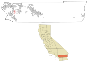
mapsize = 250x200px
map_caption = Location in Riverside County and the state ofCalifornia
mapsize1 =
map_caption1 =
subdivision_type = Country
subdivision_type1 = State
subdivision_type2 = County
subdivision_name =United States
subdivision_name1 =California
subdivision_name2 = Riverside
government_type =
leader_title =
leader_name =
established_date =
area_magnitude =
area_total_km2 = 7.7
area_total_sq_mi = 3
area_land_km2 = 7.7
area_land_sq_mi = 3
area_water_km2 = 0
area_water_sq_mi = 0
elevation_ft = 1444
elevation_m = 440
population_as_of = 2000
population_footnotes =
population_total = 2764
population_metro =
population_density_km2 = 359
population_density_sq_mi = 921.3
timezone = PST
utc_offset = -8
latd = 33 |latm = 44 |lats = 45 |latNS = N
longd = 117 |longm = 10 |longs = 27 |longEW = W
timezone_DST = PDT
utc_offset_DST = -7
postal_code_type =ZIP code
postal_code = 92585
area_code = 951
blank_name = FIPS code
blank_info = 06-62756
blank1_name = GNIS feature ID
blank1_info = 1661327
footnotes =
website =Romoland is a
census-designated place (CDP) in Riverside County,California ,United States . The population was 2,764 at the 2000 census.The city was named by Greek immigrant Romonio Homonicholai, who emigrated from Naxos in 1889 (nearby Homeland is also named for Homonicholai, although, with a slight spelling variation, it was named for his
patronymic , not hisgiven name ). The Homonicholai family planted a vineyard in the town as well as orange groves, and was the first to manufacturesangria in California.The first
blood orange s were cultivated in the United States in Romoland in the 1920s. In an attempt to build a larger market for the oranges, the Romoland Fruit Co. began in 1936 to market its blood oranges as "citrus tomatoes" on the idea that the word "blood" discouraged buyers. However, "citrus tomatoes" proved unsuccessful, and the Romoland Fruit Co. returned to marketing its oranges as "blood oranges" in 1937.In 2006, construction began on a $500 million energy plant in Romoland. The plant will use General Electric’s latest gas turbine technology to generate electricity for Riverside County, one of the fastest growing regions in the nation. The project will provide more than 500 construction jobs over the next three years and about two-dozen jobs when it opens.
On October 1, 2008, a portion of Romoland became part of the City of Menifee.
Geography
Romoland is located at coor dms|33|44|45|N|117|10|27|W|city (33.745783, -117.174228)GR|1.
According to the
United States Census Bureau , the CDP has a total area of 3.0square mile s (7.7km² ), all of it land.According to the
Geographic Names Information System , the town has also had thetoponyms Ethanac and Ethanac Siding in the past.Other possible names that Romoland has been called are: Romonaland, Romola and Romola Farms.
Demographics
As of the
census GR|2 of 2000, there were 2,764 people, 785 households, and 620 families residing in the CDP. Thepopulation density was 926.4 people per square mile (358.1/km²). There were 867 housing units at an average density of 290.6/sq mi (112.3/km²). The racial makeup of the CDP was 54.05% White, 2.50% African American, 1.74% Native American, 0.33% Asian, 0.18% Pacific Islander, 36.65% from other races, and 4.56% from two or more races. Hispanic or Latino of any race were 55.35% of the population.There were 785 households out of which 43.1% had children under the age of 18 living with them, 59.1% were married couples living together, 12.7% had a female householder with no husband present, and 20.9% were non-families. 15.9% of all households were made up of individuals and 7.3% had someone living alone who was 65 years of age or older. The average household size was 3.51 and the average family size was 3.87.
In the CDP the population was spread out with 34.8% under the age of 18, 9.8% from 18 to 24, 27.9% from 25 to 44, 19.0% from 45 to 64, and 8.5% who were 65 years of age or older. The median age was 29 years. For every 100 females there were 103.5 males. For every 100 females age 18 and over, there were 102.0 males.
The median income for a household in the CDP was $33,523, and the median income for a family was $37,574. Males had a median income of $23,850 versus $18,971 for females. The
per capita income for the CDP was $12,932. About 20.5% of families and 25.9% of the population were below thepoverty line , including 30.6% of those under age 18 and 20.6% of those age 65 or over.Politics
In the state legislature Romoland is located in the 37th Senate District, represented by Republican
Jim Battin , and in the 65th Assembly District, represented by RepublicanPaul Cook . Federally, Romoland is located inCalifornia's 49th congressional district , which has a Cook PVI of R +10 [cite web | title = Will Gerrymandered Districts Stem the Wave of Voter Unrest? | publisher = Campaign Legal Center Blog | url=http://www.clcblog.org/blog_item-85.html | accessdate = 2008-02-10] and is represented by RepublicanDarrell Issa .External links
* [http://www.menifee247.com/labels/Romoland.htm Romoland News on Menifee 24/7]
Wikimedia Foundation. 2010.