- El Cerrito, Riverside County, California
----Infobox Settlement |official_name = El Cerrito, California
image_
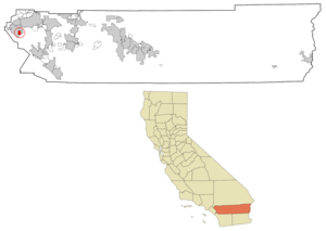
map_caption = Location in Riverside County and the state of
California
subdivision_type = Country
subdivision_type1 = State
subdivision_type2 = Counties
subdivision_name =United States
subdivision_name1 =California
subdivision_name2 = Riverside
leader_title =
leader_name =
area_magnitude =
area_total_km2 = 8.1
area_total_sq_mi = 3.2
area_land_km2 = 7.7
area_land_sq_mi = 3
area_water_km2 = 0.4
area_water_sq_mi = 0.2
elevation_ft =
elevation_m =
population_as_of = 2000
population_footnotes =
population_total = 4590
population_metro =
population_density_km2 = 566.7
population_density_sq_mi = 1434.4
timezone = PST
utc_offset = -8
timezone_DST = PDT
utc_offset_DST = -7
latd =
latm =
lats =
latNS =
longd =
longm =
longs =
longEW =
postal_code_type =ZIP code
postal_code = 91720
area_code = 951
footnotes =El Cerrito is a
census-designated place (CDP) in Riverside County,California , USA. It is an unincorporated area mostly surrounded by the city of Corona.Geography
El Cerrito is located at coor dms|33|50|3|N|117|31|32|W|city (33.834166, -117.525527)GR|1, southeast of downtown Corona and about 15 miles (25 km) southwest of the city of Riverside.
According to the
United States Census Bureau , the CDP has a total area of 3.1square mile s (8.1km² ), of which, 3.0 square miles (7.7 km²) of it is land and 0.2 square miles (0.4 km²) of it (5.11%) is water.Demographics
As of the
census GR|2 of 2000, there were 4,590 people, 1,292 households, and 1,122 families residing in the CDP. Thepopulation density was 1,545.6 people per square mile (596.7/km²). There were 1,331 housing units at an average density of 448.2/sq mi (173.0/km²). The racial makeup of the CDP was 71.02% White, 2.22% Black or African American, 0.92% Native American, 1.24% Asian, 0.46% Pacific Islander, 19.83% from other races, and 4.31% from two or more races. 37.21% of the population were Hispanic or Latino of any race.There were 1,292 households out of which 45.7% had children under the age of 18 living with them, 72.7% were married couples living together, 9.1% had a female householder with no husband present, and 13.1% were non-families. 9.4% of all households were made up of individuals and 2.2% had someone living alone who was 65 years of age or older. The average household size was 3.55 and the average family size was 3.74.
In the CDP the population was spread out with 31.3% under the age of 18, 9.4% from 18 to 24, 28.9% from 25 to 44, 23.5% from 45 to 64, and 7.0% who were 65 years of age or older. The median age was 33 years. For every 100 females there were 108.6 males. For every 100 females age 18 and over, there were 105.7 males.
The median income for a household in the CDP was $61,190, and the median income for a family was $62,981. Males had a median income of $42,552 versus $36,886 for females. The
per capita income for the CDP was $19,466. About 5.2% of families and 8.5% of the population were below thepoverty line , including 11.1% of those under age 18 and 5.0% of those age 65 or over.Politics
In the state legislature El Cerrito is located in the 37th Senate District, represented by Republican
Jim Battin , and in the 66th Assembly District, represented by RepublicanKevin Jeffries . Federally, El Cerrito is located inCalifornia's 44th congressional district , which has a Cook PVI of R +6 [cite web | title = Will Gerrymandered Districts Stem the Wave of Voter Unrest? | publisher = Campaign Legal Center Blog | url=http://www.clcblog.org/blog_item-85.html | accessdate = 2008-02-10] and is represented by RepublicanKen Calvert .External links
Wikimedia Foundation. 2010.