- Redlands, California
-
For other uses of the term "Redlands", see Redlands (disambiguation).
City of Redlands — City — 
SealNickname(s): Jewel of the Inland Empire Location of Redlands in California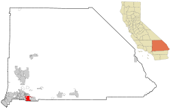
Coordinates: 34°3′17″N 117°10′57″W / 34.05472°N 117.1825°WCoordinates: 34°3′17″N 117°10′57″W / 34.05472°N 117.1825°W Country  United States
State  California
County San Bernardino Incorporated (city) 1888 Government – Mayor Pete Aguilar[1] Area[2] – Total 36.427 sq mi (94.344 km2) – Land 36.126 sq mi (93.565 km2) – Water 0.301 sq mi (0.779 km2) 0.83% Elevation 1,358 ft (414 m) Population (2010) – Total 68,747 – Density 1,887.3/sq mi (728.7/km2) Time zone PST (UTC-8) – Summer (DST) PDT (UTC-7) ZIP Code 92373, 92374 [3] Area code(s) 909 [4] FIPS code 06-59962 GNIS feature ID 0252966 Website http://www.ci.redlands.ca.us/ Redlands (
 /ˈrɛdlɨndz/) is a city in San Bernardino County, California, United States. As of the 2010 census, the city had a population of 68,747, up from 63,591 at the 2000 census. The city is located 10 miles (16 km) east of downtown San Bernardino.[citation needed]
Contents
History
The area now occupied by Redlands was originally part of the territory of the Morongo and Aguas Calientes tribes of Cahuilla people. Explorations such as those of Pedro Fages and Francisco Garcés sought to extend Catholic influence to the indigenous people and the dominion of the Spanish crown into the area in the 1770s. The Serrano (Mountain-dwelling Cahuilla) village of Guachama, located just to the west of present-day Redlands, was visited by Fr. Francisco Dumetz in 1810, and was the reason the site was chosen for a mission outpost. Dumetz reached the village on May 20, the feast day of Saint Bernardino of Siena, and thus named the region the San Bernardino Valley.[5] The Franciscan friars from San Gabriel established the San Bernardino Asistencia in 1819 and embarked on the usual program of training the native tribes to raise crops and encouraging permanent settlements. By 1820, a ditch, known as a zanja, was dug by the natives for the friars from Mill Creek to the Asistencia. In 1822, word of the Mexican triumph in the War of Independence reached the inland area, and lands previously claimed by Spain passed to the custody of the Mexican government.
In 1842, the Lugo family bought the Rancho San Bernardino Mexican land grant and this became the first fixed settler civilization in the area. The area northwest of current Redlands, astride the Santa Ana River, would become known as Lugonia. In 1851, the area received its first Anglo inhabitants in the form of several hundred Mormon pioneers, who purchased the entire Rancho San Bernardino, founded nearby San Bernardino, and established a prosperous farming community watered by the many lakes and streams of the San Bernardino Mountains. The Mormon community left wholesale in 1857, recalled to Utah by Brigham Young during the tensions with the federal government that ultimately led to the brief Utah War. Benjamin Barton purchased 1,000 acres (4 km2) from the Latter-day Saints and planted extensive vineyards and built a winery.[6]
"The first settler on the site of the present Redlands is recorded to have erected a hut at the corner of what is now Cajon St. and Cypress Ave.; he was a sheep herder, and the year, 1865," reported Ira L. Swett in "Tractions of the Orange Empire." Lugonia attracted settlers; in 1869, Barry Roberts, followed a year later by the Craw and Glover families. "The first school teacher in Lugonia, George W. Beattie, arrived in 1874—shortly followed by the town's first negro settler, Israel Beal."[7]
Railroads
In the 1880s, the arrival of the Southern Pacific and Atchison, Topeka and Santa Fe Railroads, connecting Southern California to San Francisco and Salt Lake triggered a land boom, with speculators such as John W. North flooding the area now known as the Inland Empire. North and others saw the area, with its hot, dry climate and ready access to water as an ideal center for citrus production. The city of Redlands was soon established by Frank E. Brown, a civil engineer, and E. G. Judson, a New York stock broker, to provide a center (along with North's nearby settlement at Riverside) for the burgeoning citrus industry. They named their city “Redlands” after the color of the adobe soil.[8] So large had the area grown by 1888 that it was decided to incorporate. "A red-letter day in the Annals of Redlands," pronounced Scipio Craig, editor of The Citrograph newspaper, of the November 26 incorporation.[9][10] The original community of Lugonia was absorbed at this time.
The Redlands Street Railway Company was incorporated on March 22, 1888, acquiring on June 5 a franchise from the San Bernardino County Supervisors dating to December 1887, conveying the right to construct, operate and maintain for a term of 50 years a line of street railways in Redlands, Terracina and vicinity.[11] The initial operations began in June 1889 with a single-track line operating two-mule-team cars, the first street railway company of several to provide service to the community. Electrification and new rails replaced mules in 1899.[12] Most Redlands street railways would pass to the San Bernardino Valley Traction Company in a consolidation on June 3, 1903,[13] and thence to the Pacific Electric in the "Great Merger" of Huntington properties under new ownership by the Southern Pacific Transportation Company on February 8, 1911.[14] Henry E. Huntington, nephew of late Southern Pacific president Collis P. Huntington, had gained control of the four-mile (6 km)-long streetcar line of the Redlands Central Railway Company in 1908.[15]
The Pacific Electric Railway completed an interurban connection between Los Angeles and San Bernardino in 1914, providing a convenient, speedy connection to the fast-growing city of Los Angeles and its new port at San Pedro, bringing greater prosperity to the town and a new role as a vacation destination for wealthy Angelenos. Redlands was the eastern terminus of the "Big Red Car" system. At its peak, PE operated five local routes in Redlands, with streetcars running to Smiley Heights, and on Orange, Olive, and Citrus Avenues.[16] Pacific Electric interurban service to Redlands was abandoned on July 20, 1936, with 2.07 miles (3.33 km) of track into the city lifted,[17] although PE and Southern Pacific (parent company of PE) provided freight service as far as the Sunkist packing plant on San Bernardino Avenue[18] into at least the 1970s. The abandoned Pacific Electric La Quinta trestle over the Santa Ana River stands today, immediately south of San Bernardino International Airport.
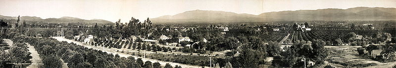

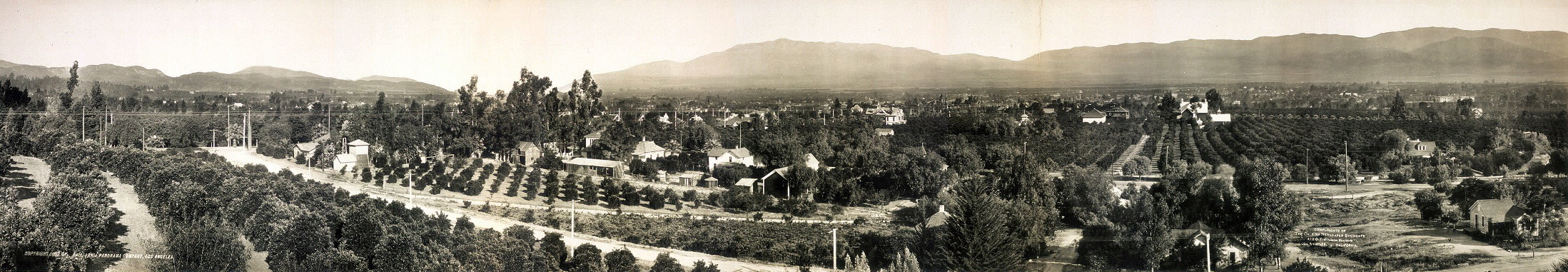
Redlands, California, 1908. Redlands peak period
At the turn of the 20th century, Redlands was the "Palm Springs" of the next century, with roses being planted along many city thoroughfares. Some of these plantings would survive as wild thickets into the 1970s, especially adjacent to orange groves where property management was lax. Washingtonia palms (Washingtonia robusta) were planted along many main avenues. In fact, Redlands was the first city to have center medians with trees or gardens in between roads. So beautifully kept was the area, with the dramatic mountain backdrops, that for several years the Santa Fe Railroad operated excursion trains along the loop that passed through the orange groves of Redlands and Mentone, across the Santa Ana River, and back into San Bernardino via East Highlands, Highlands and Patton, and advertised as the "Kite Route" due to its multi-sided alignment. The trestle over "the Wash" north of Mentone was carried away during a flood in 1938 and never replaced, the line being truncated there. The Southern Pacific branch line from the San Timoteo Canyon to Crafton was abandoned after the downtown packing house business died. A thru-truss bridge over the Zanja (locally pronounced "Zank-ee") exists today, abandoned in place. Burlington Northern Santa Fe, result of the AT&SF-Burlington Northern merger, applied to abandon its San Bernardino-connected branch line east of downtown Redlands in 2007. A move was made by transit activists to have this branch revitalized as part of the Southern California transit districts, but it came to nothing.
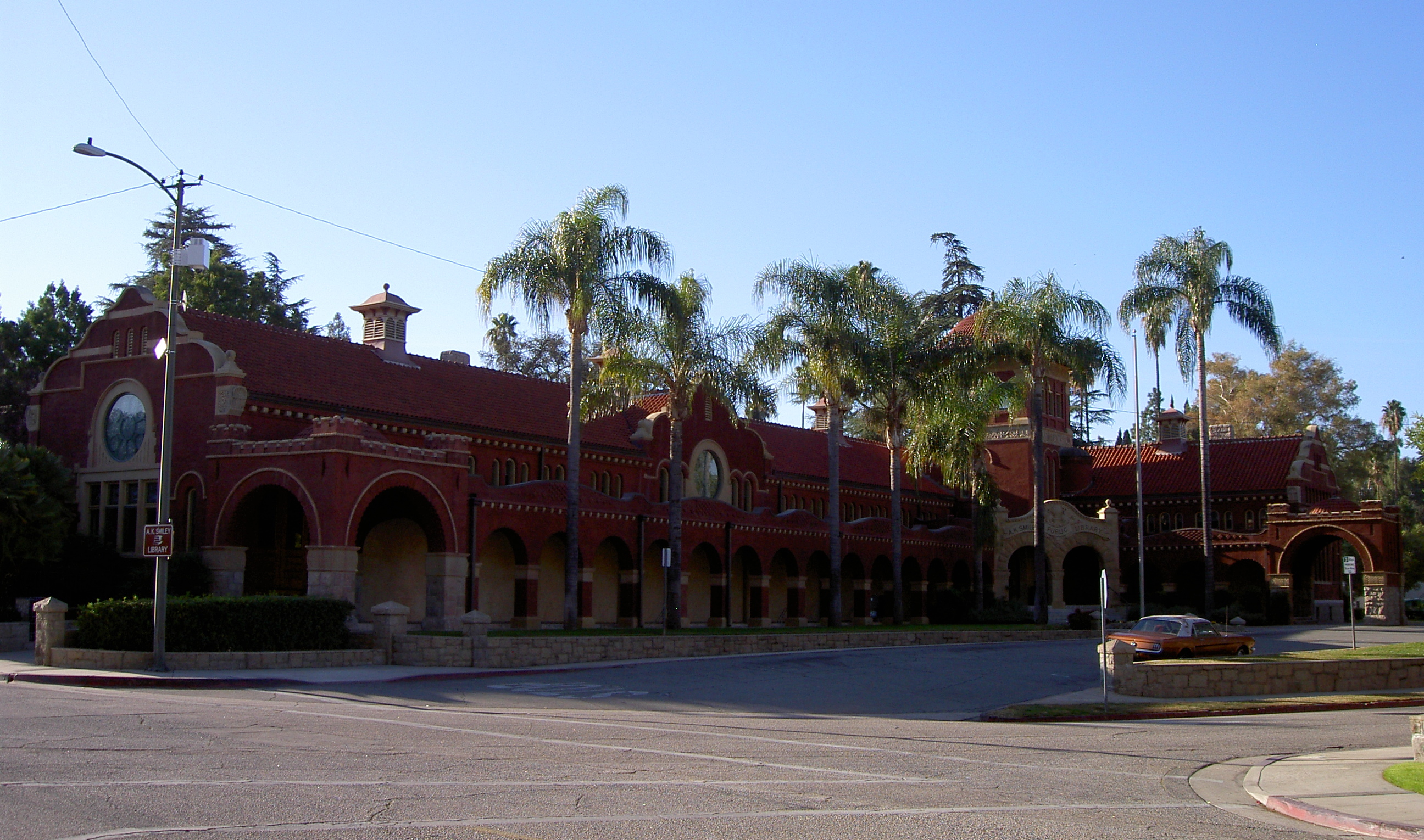
The city has been visited by three U.S. Presidents: William McKinley was the first in 1901, followed by Theodore Roosevelt in 1903 and William Howard Taft in 1909. Local landmarks include the A.K. Smiley Public Library, a Moorish-style library built in 1898, and the Redlands Bowl, built in 1930 and home of the oldest continuously free outdoor concert series in the United States. Located behind the Smiley Library is the Lincoln Shrine, the only memorial honoring the "Great Emancipator", the sixteenth president, west of the Mississippi River. Other famous homes include “America’s Favorite Victorian,” the Morey Mansion,[19] on Terracina Boulevard, and the Kimberly Crest House and Gardens, a home museum featured on the PBS series “America’s Castles.” Named after the family that purchased the house, the owners of Kimberly-Clark (makers of paper goods and Kleenex), it is a beautiful mansion set high on a hill overlooking the whole valley. Redlands is still regarded as the "Jewel of the Inland Empire."[20] In the mid-late 20th Century, Redlands was home to various light manufacturing firms, and became a bedroom community for the military personnel and contractor employees of the aerospace industry that supported missions at Norton Air Force Base as well as the Lockheed Propulsion Company plant in Mentone. The citrus industry declined in the area as more agricultural areas were replaced by subdivisions, and all three citrus packing houses (two in downtown and one on San Bernardino Avenue) had closed by the end of the 1900s.
Geography
According to the United States Census Bureau, the city has a total area of 36.4 square miles (94 km2). 36.1 square miles (93 km2) of it is land and 0.3 square miles (0.78 km2) of it (0.83%) is water.
Demographics
2010
The 2010 United States Census[21] reported that Redlands had a population of 68,747. The population density was 1,887.3 people per square mile (728.7/km²). The racial makeup of Redlands was 47,452 (69.0%) White, 3,564 (5.2%) African American, 625 (0.9%) Native American, 5,216 (7.6%) Asian, 235 (0.3%) Pacific Islander, 8,266 (12.0%) from other races, and 3,389 (4.9%) from two or more races. Hispanic or Latino of any race were 20,810 persons (30.3%).
The Census reported that 66,379 people (96.6% of the population) lived in households, 1,856 (2.7%) lived in non-institutionalized group quarters, and 512 (0.7%) were institutionalized.
There were 24,764 households, out of which 8,598 (34.7%) had children under the age of 18 living in them, 12,374 (50.0%) were opposite-sex married couples living together, 3,397 (13.7%) had a female householder with no husband present, 1,291 (5.2%) had a male householder with no wife present. There were 1,255 (5.1%) unmarried opposite-sex partnerships, and 164 (0.7%) same-sex married couples or partnerships. 6,083 households (24.6%) were made up of individuals and 2,198 (8.9%) had someone living alone who was 65 years of age or older. The average household size was 2.68. There were 17,062 families (68.9% of all households); the average family size was 3.21.
The population was spread out with 16,273 people (23.7%) under the age of 18, 8,185 people (11.9%) aged 18 to 24, 17,381 people (25.3%) aged 25 to 44, 17,930 people (26.1%) aged 45 to 64, and 8,978 people (13.1%) who were 65 years of age or older. The median age was 36.2 years. For every 100 females there were 90.9 males. For every 100 females age 18 and over, there were 87.3 males.
There were 26,634 housing units at an average density of 731.2 per square mile (282.3/km²), of which 15,061 (60.8%) were owner-occupied, and 9,703 (39.2%) were occupied by renters. The homeowner vacancy rate was 2.2%; the rental vacancy rate was 7.9%. 41,102 people (59.8% of the population) lived in owner-occupied housing units and 25,277 people (36.8%) lived in rental housing units.
2000
As of the census[22] of 2000, there were 63,591 people, 23,593 households, and 16,019 families residing in the city. The population density was 1,793.1 inhabitants per square mile (692.2/km²). There were 24,790 housing units at an average density of 699.0 per square mile (269.8/km²). The racial makeup of the city was 73.7% White, 4.3% African American, 0.9% Native American, 5.1% Asian, 0.2% Pacific Islander, 11.3% from other races, and 4.4% from two or more races. Hispanic or Latino of any race were 24.1% of the population. The approximate population is 72,008 (as of March 2008).
There were 23,593 households out of which 33.5% had children under the age of 18 living with them, 50.6% were married couples living together, 13.0% had a female householder with no husband present, and 32.1% were non-families. 26.0% of all households were made up of individuals and 9.2% had someone living alone who was 65 years of age or older. The average household size was 2.6 and the average family size was 3.2.
In the city the population was spread out with 26.2% under the age of 18, 10.7% from 18 to 24, 27.9% from 25 to 44, 22.7% from 45 to 64, and 12.6% who were 65 years of age or older. The median age was 35 years. For every 100 females there were 89.4 males. For every 100 females age 18 and over, there were 85.4 males.
The median income for a household in the city was $58,155, and the median income for a family was $76,254. Males had a median income of $64,408 versus $52,122 for females. The per capita income for the city was $24,237. About 2.7% of families and 1.5% of the population were below the poverty line, including 8.5% of those under age 18 and 5.2% of those age 65 or over.
The 2008 population estimated by the California Department of Finance was 71,807.[23]
Government

Federal
Redlands is located in California's 41st congressional district, which has a Cook PVI of R +9[24] and is represented by Republican Jerry Lewis.
State
In the state legislature Redlands is located in the 31st Senate District, represented by Republican Robert Dutton, and in the 59th, 63rd and 65th Assembly Districts, represented by Republicans Tim Donnelly, Bill Emmerson, and Paul Cook respectively.
Local
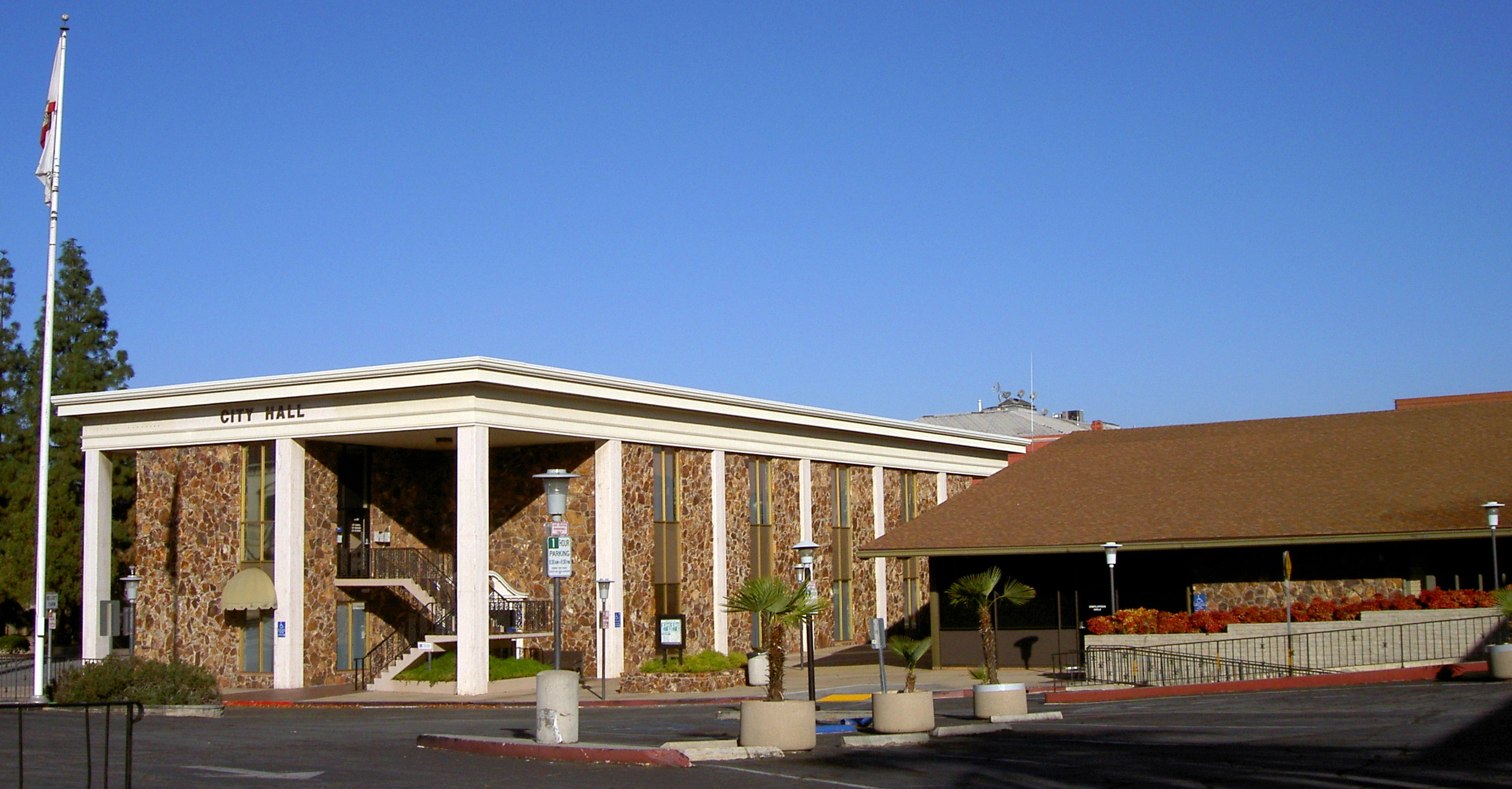
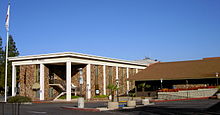 City Hall
The city uses a Mayor and City-Council system, each serving a four year term.
Education
Higher education
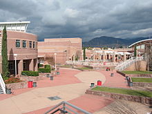
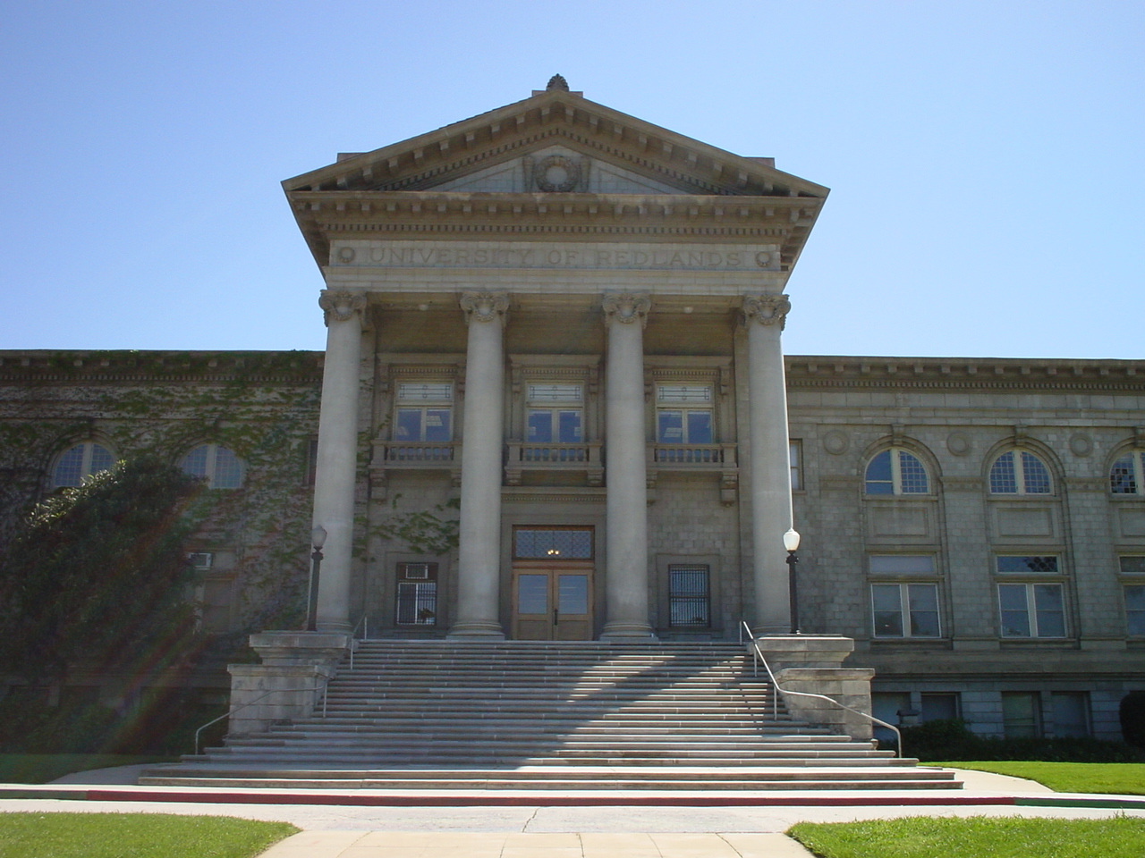
 University of Redlands
- University of Redlands
- ESRI Learning Center[citation needed]
- Community Christian College
Public education
Redlands Unified School District
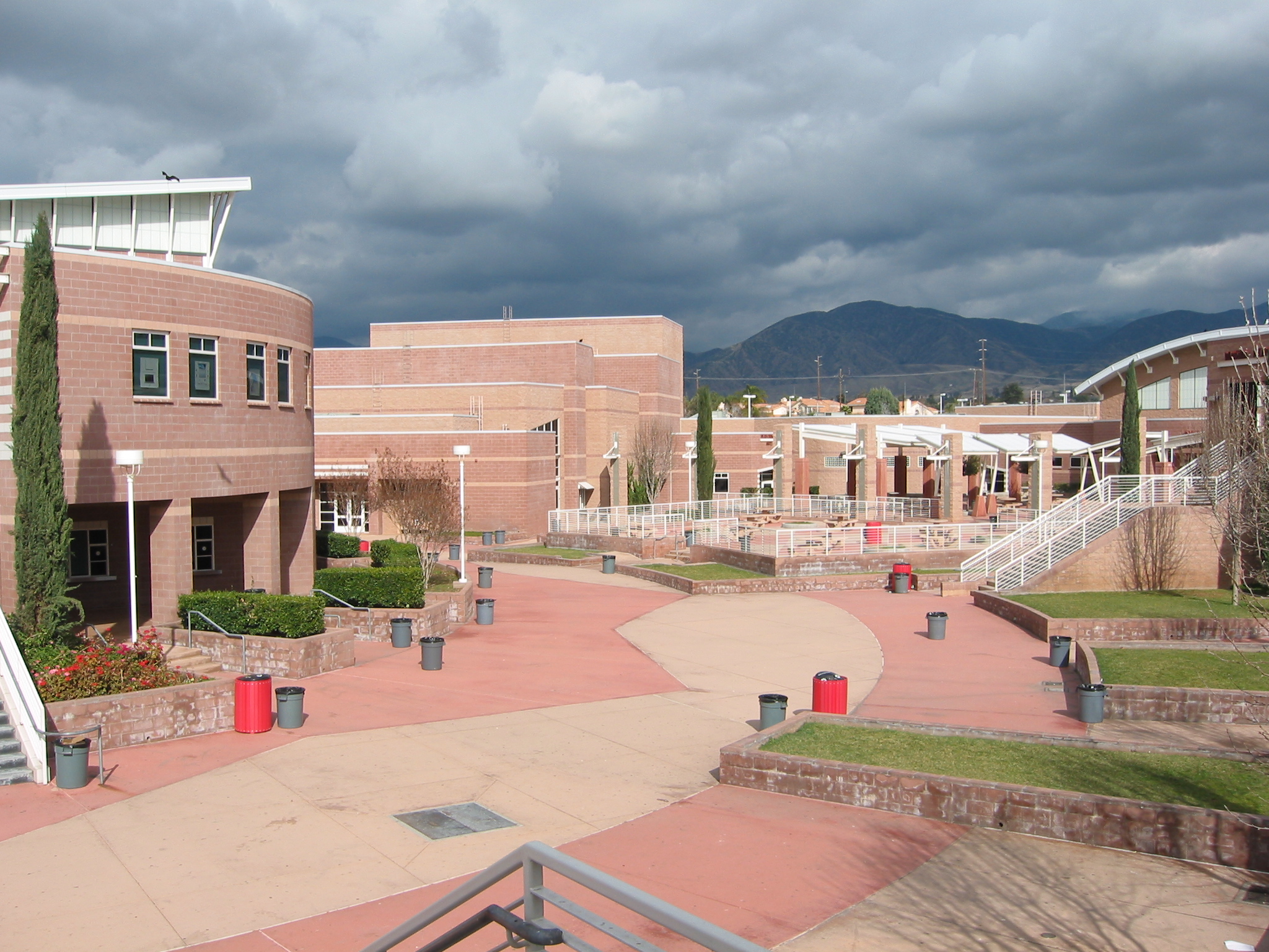
 Redlands East Valley High School
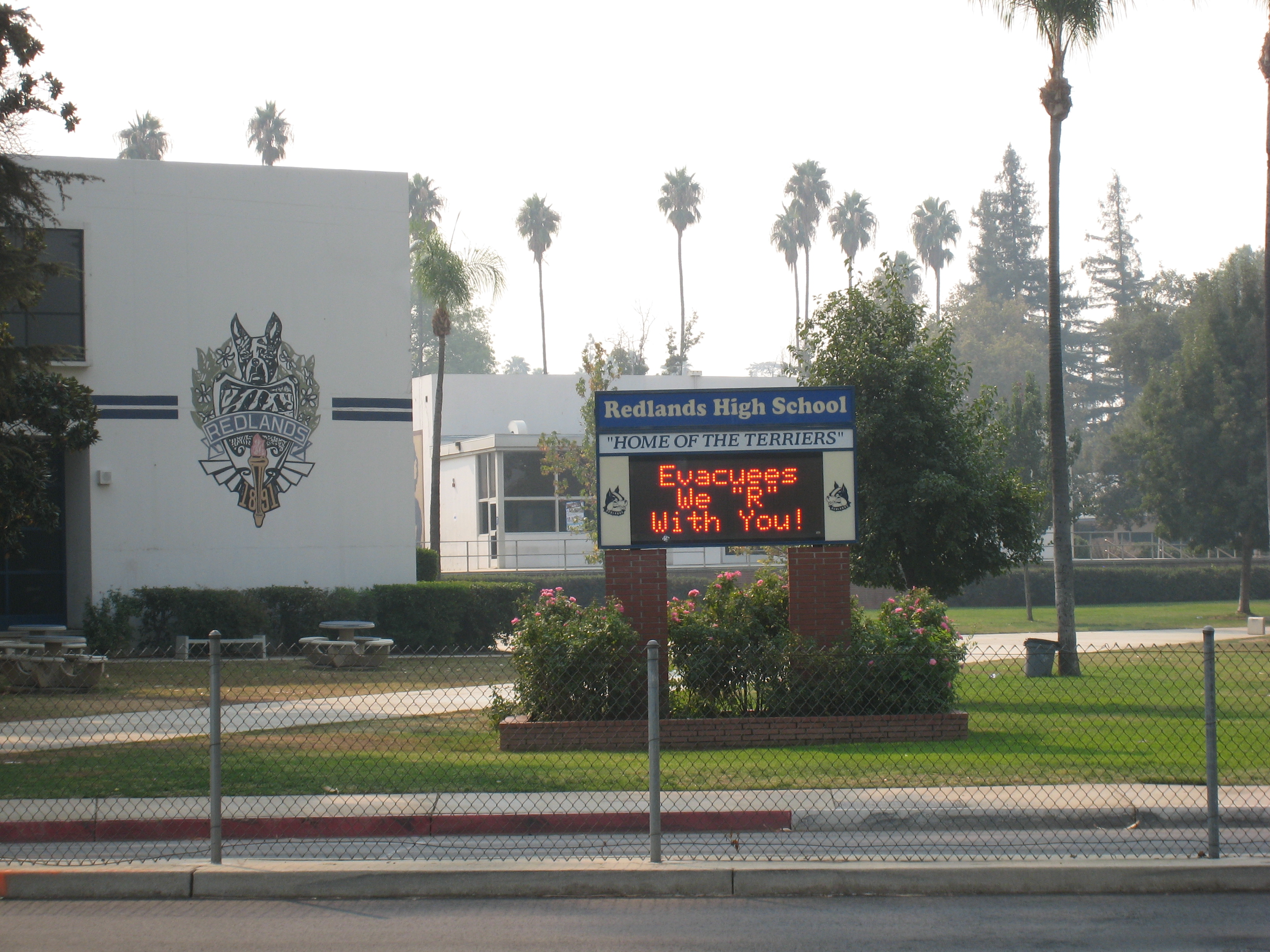
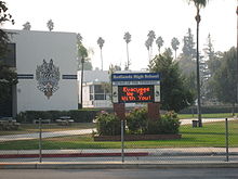 Redlands High School during October 2007 fires. The sign reads, "Evacuees We 'R' With You!"
- Citrus Valley High School
- Redlands East Valley High School
- Redlands High School
- Orangewood High School (Continuation)
- The Grove School (charter)
- Beattie Middle School
- Cope Middle School
- Clement Middle School
- Moore Middle School
- Colton-Redlands-Yucaipa Regional Occupational Program
Private education
- Christ the King Lutheran Church & School[25]
- Arrowhead Christian Academy
- The Packinghouse Christian Academy
- Chartwell School
- Hope Christian School
- Redlands Adventist Academy
- Redlands Christian School
- Valley Preparatory School
- Montessori in Redlands
- Sacred Heart Academy
Transportation
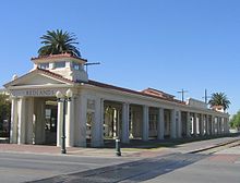 Redlands, California AT&SF train station, designed 1909 by architect Arthur Brown, Jr.
Coming west from Los Angeles and heading east toward Palm Springs, Interstate 10 bisects Redlands. A tempestuous political battle occurred in the 1950s when three routes for the new freeway were considered, one north of town through the Lugonia district, the center route through the city, and a southern alignment through San Timoteo Canyon, parallelling the Southern Pacific railroad tracks. The central route was finalized in 1957 and Redlands Mayor Charles Parker cut the ceremonial ribbon to open the new interstate on August 28, 1962.[26] The new State Route 210 or Foothill Freeway ends at Interstate 10 in Redlands, then heads west toward Pasadena and Los Angeles. The San Bernardino line of the Greater Los Angeles regional transportation system called Metrolink has a stop in nearby San Bernardino. The San Bernardino based Omnitrans bus system which handles the bus service for the area serves Redlands.[20]
A passenger rail connection to San Bernardino is planned to open in the mid to late 2010s.[27]
Airports
- Los Angeles International Airport, 59 miles (95 km) west.
- Redlands Municipal Airport is a general aviation airport located on the Northeastern end of the city.
- LA/Ontario International Airport is about 20 miles (32 km) west.
- San Bernardino International Airport, the former Norton Air Force Base, will provide passenger service to the city in Fall 2009.
Economy
- Esri - a major geographic information systems software company
- Five Ten Footwear – Headquarters.
- La-Z-Boy – Western U.S. Headquarters/Distribution and manufacturing center.
- Salton Inc. – General Contractors-Industrial Buildings and Warehouses. (George Foreman Grills)
- Hydro Tek Systems – A manufacturer of high pressure washers and industrial cleaning equipment[28]
- Gill Batteries – Manufacturer of Aviation Batteries, used in everything from General Aviation aircraft to Airliners[29]
Culture
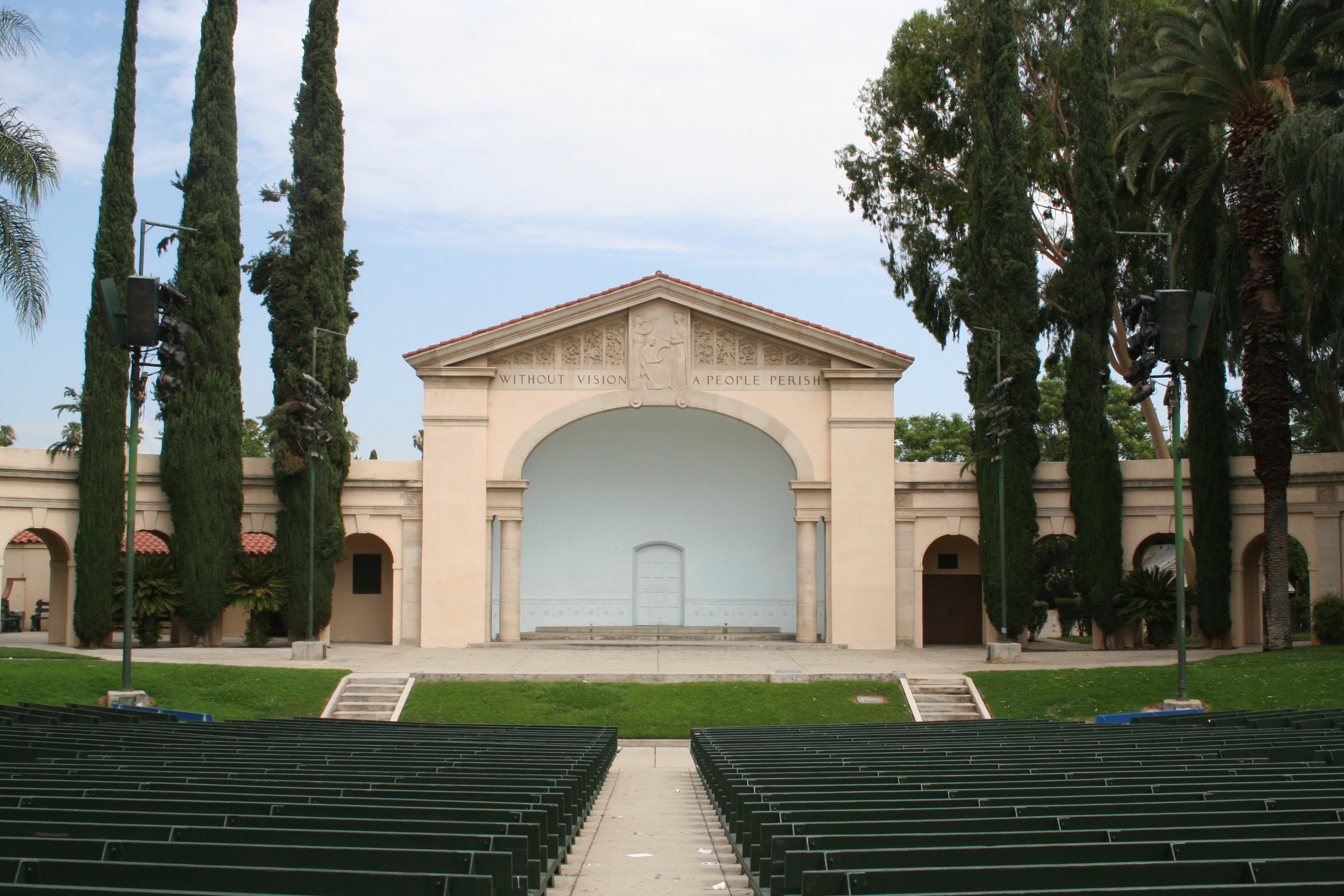
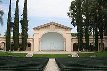 Redlands Bowl
Museums
- Redlands Historical Museum, located inside the A.K. Smiley Library on the grounds of Smiley Park in downtown Redlands. The Museum will refurbish the old 1940 City Hall, now used as the Redlands Police Department as their new Museum Center. The Heritage Center holds various Pictures, Pamphlets, Maps, Yearbooks, Newspapers, manuscripts and books all relating to the rise of Redlands as a navel orange producing mecca to the close knit community is has become today.[30]
- San Bernardino County Museum (SBCM), is a regional museum with exhibits and collections in cultural and natural history. Special exhibits, the Exploration Station live animal discovery center, extensive research collections, and public programs for adults, families, students, and children are all part of the museum experience. The SBCM also runs the San Bernardino de Sena Estancia.[31]
- Redlands Historical Glass Museum holds displays of American Glassware dating from the early 19th century to contemporary times. Displays include, glass from Heisey, Cambridge, Fenton Art Glass Company, Fostoria, and Sandwich factories as well as those that produced depression-era glassware. Items on display include candlesticks, compotes, milk glass, stems, bowls, historical plates, salts, kerosene lamps-and even several items from the estate of Liberace.[32]
Historic structures
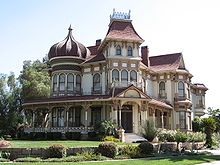
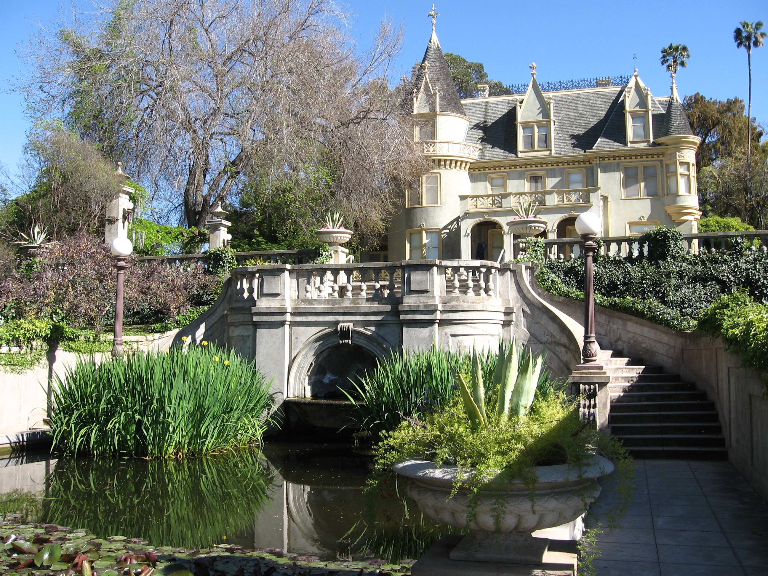
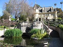 Kimberly Crest House and Gardens
- Kimberly Crest House and Gardens, built in 1897 this French château-style home is preserved by the Kimberly-Shirk Association that was formed for that purpose. This three-story chateau is over 7,000 square feet (650 m2) and was originally built for Mrs. Cornelia A. Hill. In 1905 J. Alfred Kimberly (co-founder of Kimberly-Clark) purchased this home for his family. His daughter, Mary Kimberly Shirk, lived in the home until her death in 1979. Before she passed the majority of the grounds were sold to the City of Redlands to become a botanical park, now known as Prospect Park. After her death, the home was left to "the people of Redlands" and the monies from the sale of the park were used to create the Kimberly-Shirk Association that cares for the home and provides tours within.[33]
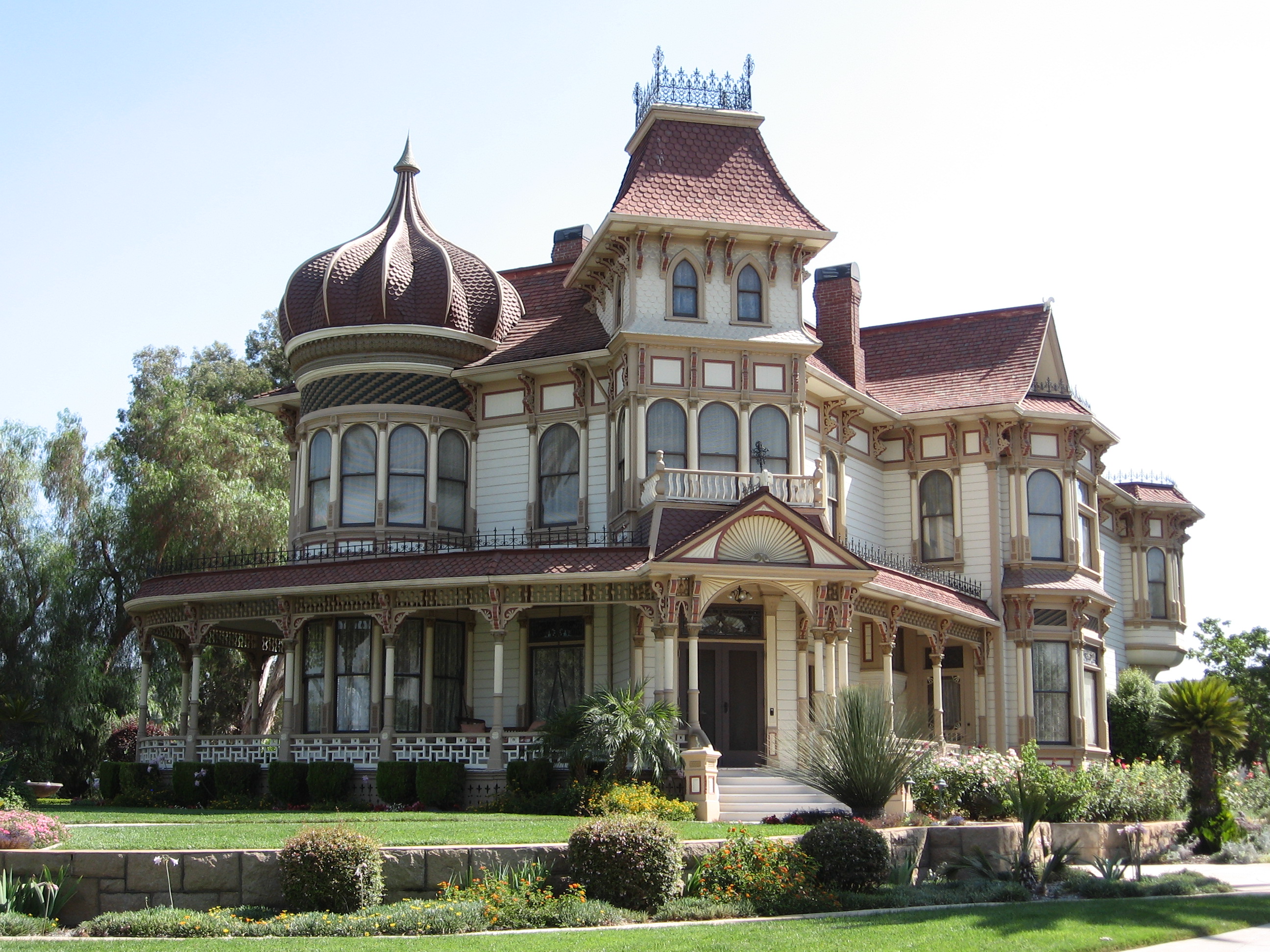
 Edwards Mansion
- Edwards Mansion, built in 1890 by one of the founders of Redlands, Citrus grower James S. Edwards, this structure was originally used not as a family home but as a boarding house. Mr. Edwards used standard plans and built the house on a small rise on Cajon St. from where the young orange groves he planted could be seen in every direction. Eventually the Edwards family moved into the structure and occupied it continually until 1958 when Mrs. Edwards died. Almost a decade later, Plymouth Village acquired the home and used it for their business offices until it was acquired by the Edwards Mansion complex in 1973 for the large sum of one dollar. The structure was moved to its current location off of the 10 freeway and restored to serve its current purpose as a popular wedding location.[34]
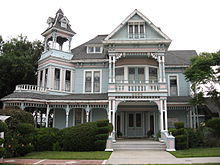
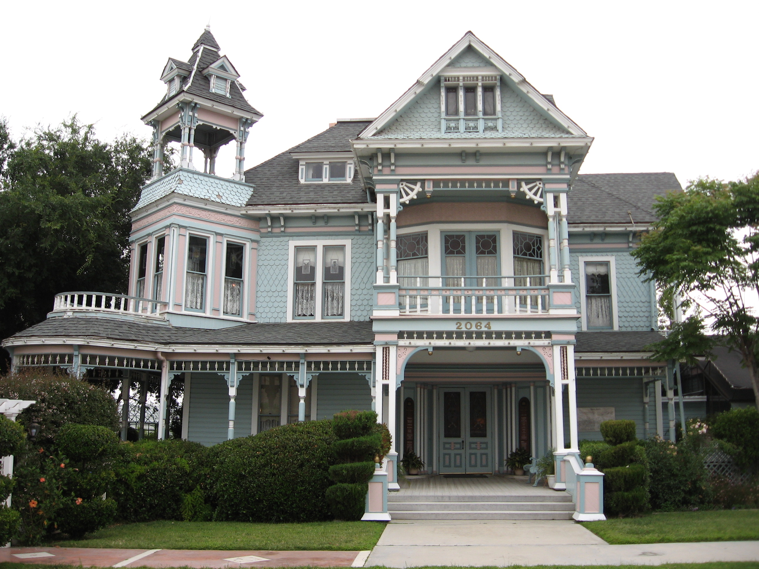
 Morey Mansion Inn at 190 Terracina Blvd
- Morey Mansion, built in 1890 with the proceeds from the sale of Sarah Morey's citrus nursery there is no known architect to this beautiful structure. David and Sarah Morey moved to Redlands in 1882 where David did carpentry work on many of the local structures and the Big Bear dam. Sarah started a citrus nursery using seeds from local growers that became one of the foremost citrus nurseries in the area. She eventually sold it and used 1/2 the proceeds to build their family home. After the Morey family sold the house it was alternatively a bed and breakfast and private residence and now serves both functions. Located on the bluffs overlooking San Timoteo Canyon it is known for its commanding view.[35]
- The Barton School House, built in 1877, is the oldest building in Redlands. The historic elementary school closed down in the 1960s and has since deteriorated on Nevada Street. In early 2008, construction had become huge in the area surrounding it and in late 2008, the land the property sat on was purchased for construction. Instead of destroying the building, the company paid to move it to Orange Street at The Grove School's farm campus. The building has been moved but it is in 3 pieces and will be renovated and remodeled over the next 3 years. It will become the school's lunch area as well as theater. It is now owned and operated by The Grove School, but the company that moved it will pay to reattach the 3 pieces, with The Grove School planning to pay for the remodeling.
City parks
The city of Redlands owns and operates 14 public parks totaling more than 143 acres (0.58 km2):
- Brookside Park: a 9.2-acre (37,000 m2) neighborhood park with picnic and playground facilities. (Brookside Avenue between Terracina Boulevard and Bellevue Avenue)
- Caroline Park: a 16.8-acre (68,000 m2) nature park with trails and open space planted with native California plants and a water conservation garden. It houses a large variety of animals. Especially active near sundown. (Sunset Drive and Mariposa Drive)
- Community Park: an 18.2-acre (74,000 m2) park with lighted baseball fields, tennis courts, picnic and playground facilities. (San Bernardino Avenue and Church Street)
- Crafton Park: a 7.5-acre (30,000 m2)-neighborhood park with lighted soccer field, picnic and playground facilities. (Wabash Avenue and Independence Avenue)
- Ed Hales Park: a .7-acre (2,800 m2) downtown park with picnic facilities. (State Street and Fifth Street)
- Jennie Davis Park: a 5.2-acre (21,000 m2) neighborhood park with picnic and playground facilities. (Redlands Boulevard and New York Street)
- Ford Park: a 27-acre (110,000 m2) park with two ponds for fishing, lighted tennis courts, picnic and playground facilities. (Redlands Boulevard and Ford Street)
- Franklin Park: a .6-acre (2,400 m2) natural open space area. (Garden Street and Franklin Avenue)
- Prospect Park: an 11.4-acre (46,000 m2) natural park with trails and picnic facilities. The park contains the Avice Meeker Sewall Theater, an outdoor amphitheater with seating for 407. (Cajon Street and Highland Avenue)
- San Timoteo Canyon Nature Preserve: a 40-acre (160,000 m2) natural preserve facility. (San Timoteo Canyon Road and Alessandro Road)
- Simonds Parkway: a .9-acre (3,600 m2) neighborhood park. (Garden Street and Rossmont Drive)
 A.K. Smiley Public Library
 Lincoln Shrine
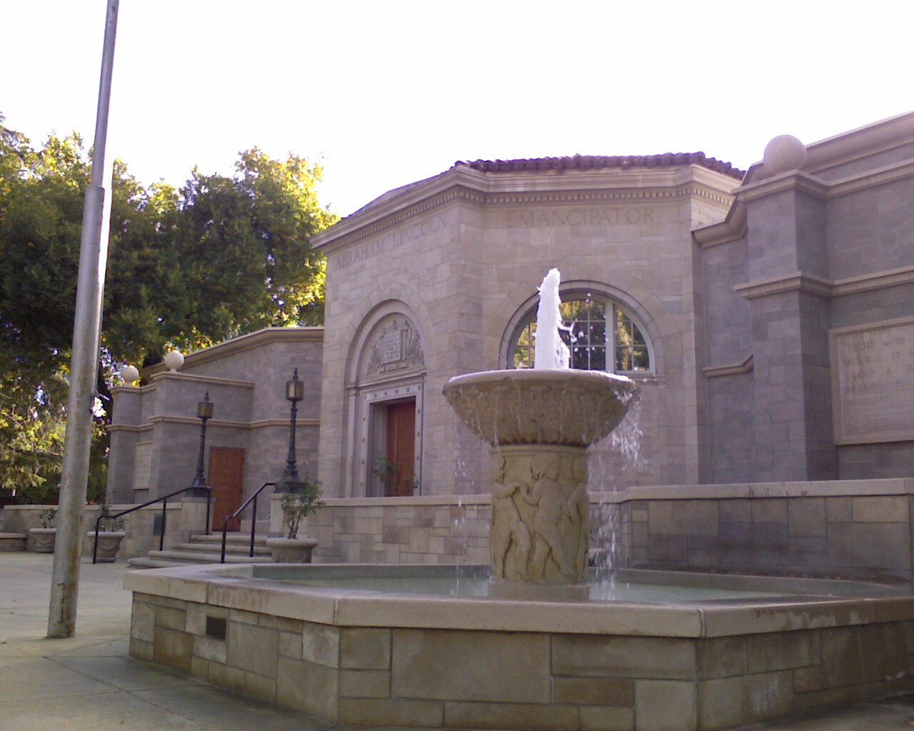
- Smiley Park: a 9.2-acre (37,000 m2) park at the Redlands Civic Center. This park is home to A.K. Smiley Public Library, a facility listed on the National Register of Historic Places; the Lincoln Memorial Shrine, built in 1932, containing the largest collection of Abraham Lincoln memorabilia west of the Mississippi River; and the Redlands Bowl, an outdoor amphitheater with seating for approximately 4,000 where summer concerts are performed each Tuesday and Friday evening during July and August. (Eureka Street and Vine Street). The Lincoln Shrine is host to the annual Boy Scout Pilgrimage to the Lincoln Shrine.[36]
- Sylvan Park: a 23.3-acre (94,000 m2) park with softball field, group and individual picnic areas and playground facilities. (Colton Avenue and University Street)
- Texonia Park: a 10.7-acre (43,000 m2) neighborhood park with lighted softball field, basketball courts, picnic and playground facilities. (Texas Street and Lugonia Avenue)
- Redlands Sports Park: The 120-acre (0.49 km2) facility includes soccer fields, softball fields, group picnic facilities, playground and recreations elements. (Wabash Avenue and San Bernardino Avenue) by Redlands Municipal Airport
Local attractions
- Citrus Plaza: a large open-air shopping center.
- Pharaoh's Adventure Park: 20 acre theme park which re-opened in late 2010. The park incorporates Egyptian themes, and includes a Go-Cart raceway, miniature golf, bumper cars, an amphitheater, and a water park. The park has been used in television filming, including a 2006 episode of C.S.I. Las Vegas featuring a rollercoaster accident.
- Hangar 24 Craft Brewery: A microbrewery located near Redlands Municipal Airport.[37] Hangar 24's signature beer, Orange Wheat, is made with locally grown oranges.[38]
Novels
- Jardien's Dream, a young adult novel published in October 2009, takes place in Redlands.[39]
Religion
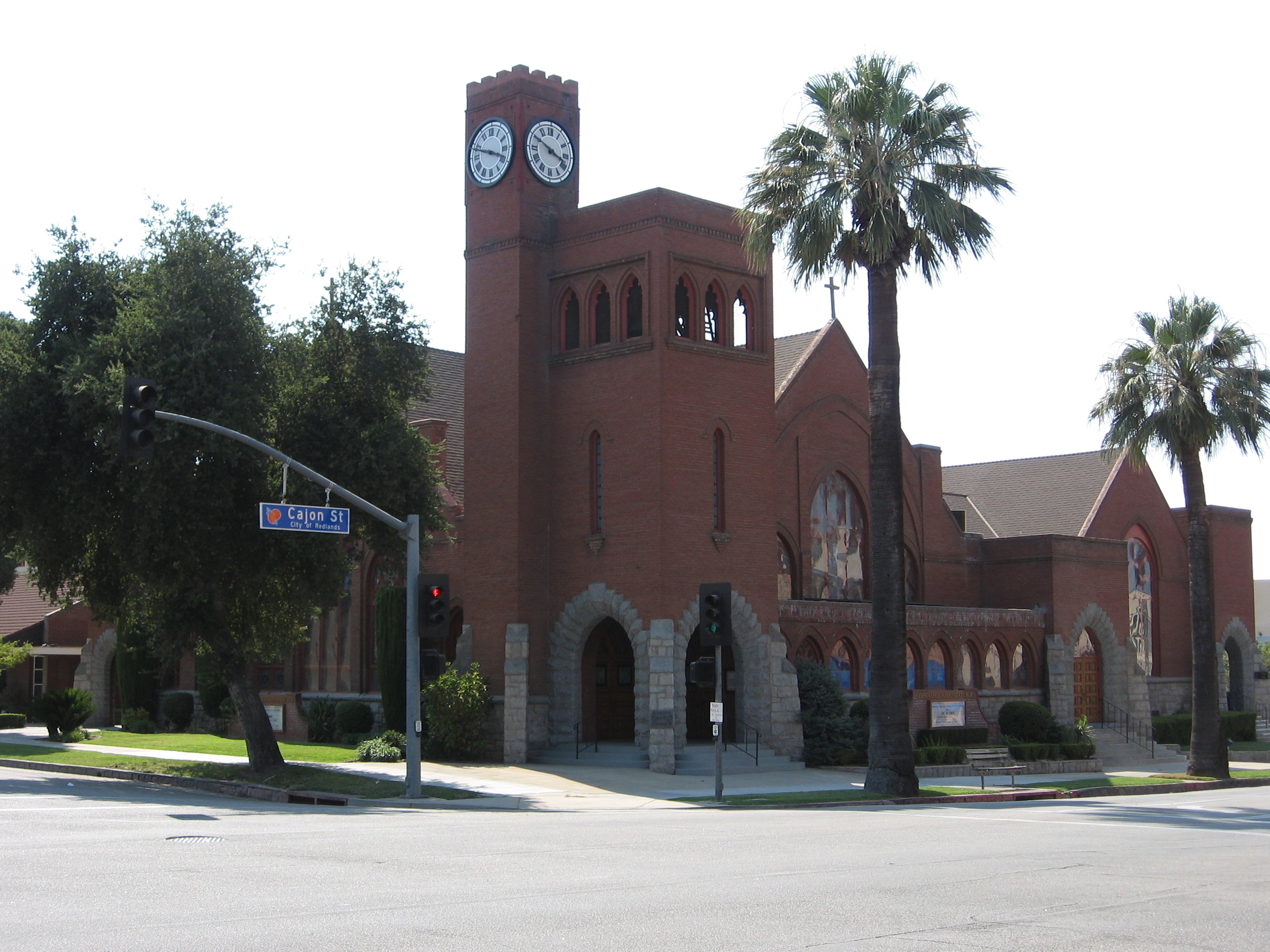
 First Congregational Church
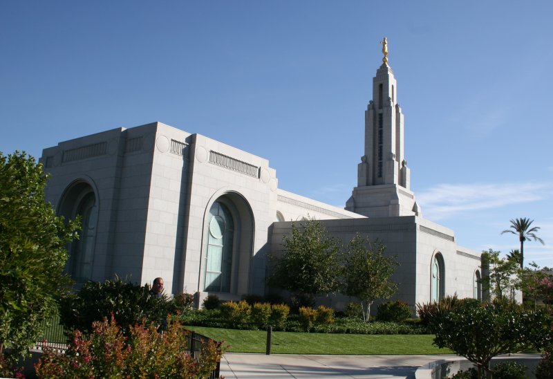
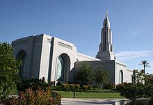 Redlands Temple of the LDS Church
A variety of religions have a presence in Redlands, including a number of Christian faiths and Judaism. There is a Redlands Area Interfaith Council.[40]
The Redlands California Temple is the 116th operating temple of The Church of Jesus Christ of Latter-day Saints and one of four LDS temples in Southern California.
Notable natives and residents
- Ashley Argota, actress
- Joan Baez, folksinger, attended Redlands High School
- Brian Billick, former head coach of the Baltimore Ravens
- Harry Blackstone, Jr., professional magician
- Hugh "Lumpy" Brannum, actor, Mr. Green Jeans on Captain Kangaroo
- Barney Childs, composer
- Ryan Christenson, MLB player for the Oakland Athletics, Arizona Diamondbacks, Milwaukee Brewers, and the Texas Rangers
- Jack Dangermond, founder of ESRI
- Landon Donovan, professional soccer player for the Los Angeles Galaxy and the US National Team
- James Fallows, journalist for The Atlantic Monthly
- Davey Faragher, musician with Elvis Costello
- Tommy Hanson, professional baseball player for the Atlanta Braves.
- Johnny Hickman, musician, guitarist for Cracker
- Taylor Horn, singer-songwriter and actress
- Brion James, actor
- Patrick Johnson, professional football player for the Baltimore Ravens
- John Jorgenson, guitar virtuoso with the Desert Rose Band, the Hellecasters, the John Jorgenson Quintet, and six-year member of Elton John's tour band – attended Moore Junior High, and Redlands High Schools
- Jerry Lewis, congressman, ranking member of the House Appropriations Committee
- David Lowery, musician/lead singer for Camper Van Beethoven and Cracker
- Greta Morris, former United States Ambassador to the Republic of the Marshall Islands
- Benji Schwimmer, winner of the second season of So You Think You Can Dance
- Lacey Schwimmer, one of the professional dancers on "Dancing with the Stars"
- Mark R. Shepherd, Democratic Party activist and politician
- Dave Stockton, professional golfer
- Tim Tackett, martial artist
- Mark Teahen, professional baseball player for the Chicago White Sox
- Joan Tewkesbury, American film director
- Josh Whitesell, professional baseball player for the Arizona Diamondbacks
Sister cities
Redlands has two sister cities, as designated by Sister Cities International:
 Hino, Japan
 San Miguel de Allende, Mexico
See also
- Redlands Bicycle Classic
- Greater San Bernardino Area
- Inland Empire Metropolitan Area
References
- ^ "Redlands- City Mayor". http://www.ci.redlands.ca.us/clerk/aguilar.htm. Retrieved February 25, 2010.
- ^ U.S. Census
- ^ "USPS – ZIP Code Lookup – Find a ZIP+ 4 Code By City Results". http://zip4.usps.com/zip4/zcl_1_results.jsp?visited=1&pagenumber=0&state=ca&city=Rancho%20Cucamonga. Retrieved February 20, 2007.
- ^ "Number Administration System – NPA and City/Town Search Results". http://www.nanpa.com/nas/public/npa_city_query_step2.do?method=displayData&cityToNpaModel.stateAbbr=CA&cityToNpaModel.city=Rancho%20Cucamonga. Retrieved February 20, 2007.
- ^ Robinson, W.W. (1962). The Story of San Bernardino County. San Bernardino, California: Title Insurance and Trust Company.
- ^ Hinckley, Edith B. (1951). On the Banks of the Zanja: The Story of Redlands. Claremont, California: The Saunders Press. p. 42.
- ^ Swett, Ira L., "Tractions of the Orange Empire", Interurbans Special Number Forty-One, Interurbans Magazine, Los Angeles, California, August 1967, Chapter 7, Redlands The Beautiful, page 61.
- ^ "About the City of Redlands". Redlands.edu. http://www.redlands.edu/x91.xml. Retrieved February 22, 2011.
- ^ Craig, Scipio, "HURRAH! For the City of Redlands ! ! – Incorporation Carried by a Rousing Majority", The Citrograph, Redlands, California, Extra, November 27, 1888, Volume 3, Number -, front page.
- ^ Swett, Ira L., "Tractions of the Orange Empire", Interurbans Special Number Forty-One, Interurbans Magazine, Los Angeles, California, August 1967, Chapter 7, Redlands The Beautiful, pages 60–61.
- ^ Swett, Ira L., "Tractions of the Orange Empire", Interurbans Special Number Forty-One, Interurbans Magazine, Los Angeles, California, August 1967, Chapter 7, The Horse Cars of Redlands, page 34.
- ^ Swett, Ira L., "Tractions of the Orange Empire", Interurbans Special Number Forty-One, Interurbans Magazine, Los Angeles, California, August 1967, Chapter 7, Official Corporate (PE) Histories – The Redlands Street Railway Company, page 35.
- ^ Swett, Ira L., "Tractions of the Orange Empire", Interurbans Special Number Forty-One, Interurbans Magazine, Los Angeles, California, August 1967, Chapter 7, The Redlands Street Railway Company, page 54.
- ^ Swett, Ira L., "Tractions of the Orange Empire", Interurbans Special Number Forty-One, Interurbans Magazine, Los Angeles, California, August 1967, Chapter 21, Pacific Electric Waxes and Wanes, page 235.
- ^ Crump, Spencer, "Ride the Big Red Cars – The Pacific Electric Story", Trans-Anglo Books, a division of Interurban Press, Glendale, California, 1983, Seventh Edition – Summer 1988, Library of Congress card number 77-72017, ISBN 0-87046-047-1, page 65.
- ^ Crump, Spencer, "Ride the Big Red Cars – The Pacific Electric Story", Trans-Anglo Books, a division of Interurban Press, Glendale, California, 1983, Seventh Edition – Summer 1988, Library of Congress card number 77-72017, ISBN 0-87046-047-1, page 95.
- ^ http://www.erha.org/pensb.htm
- ^ Swett, Ira L., "Tractions of the Orange Empire", Interurbans Special Number Forty-One, Interurbans Magazine, Los Angeles, California, August 1967, Chapter 7, The Redlands Interurban Line, page 85.
- ^ Morey Mansion
- ^ a b "ESRI: Redlands Brochure (2007) –". http://www.esri.com/library/brochures/pdfs/redlands_guide.pdf. Retrieved January 5, 2007.
- ^ All data are derived from the United States Census Bureau reports from the 2010 United States Census, and are accessible on-line here. The data on unmarried partnerships and same-sex married couples are from the Census report DEC_10_SF1_PCT15. All other housing and population data are from Census report DEC_10_DP_DPDP1. Both reports are viewable online or downloadable in a zip file containing a comma-delimited data file. The area data, from which densities are calculated, are available on-line here. Percentage totals may not add to 100% due to rounding. The Census Bureau defines families as a household containing one or more people related to the householder by birth, opposite-sex marriage, or adoption. People living in group quarters are tabulated by the Census Bureau as neither owners nor renters. For further details, see the text files accompanying the data files containing the Census reports mentioned above.
- ^ "American FactFinder". United States Census Bureau. http://factfinder.census.gov. Retrieved 2008-01-31.
- ^ "State of California, Department of Finance, E-1 Population Estimates for Cities, Counties and the State with Annual Percent Change — January 1, 2007 and 2008. Sacramento, California, May 2008". Dof.ca.gov. http://www.dof.ca.gov/research/demographic/reports/estimates/e-1_2006-07/. Retrieved February 22, 2011.
- ^ "Will Gerrymandered Districts Stem the Wave of Voter Unrest?". Campaign Legal Center Blog. http://www.clcblog.org/blog_item-85.html. Retrieved February 10, 2008.
- ^ "Christ the King REDLANDS Pre-K". Ctkredlands.org. http://ctkredlands.org. Retrieved February 22, 2011.
- ^ Moore, Frank Ensor (1995). Redlands Astride the Freeway: The Development of Good Automobile Roads. Redlands, California: Moore Historical Foundation. ISBN 0–914167–07–3.
- ^ "Imperfect Rail Solution". The Press-Enterprise. 16 May 2011. Archived from the original on 4 November 2011. http://www.webcitation.org/62yydEzrq. Retrieved 5 November 2011.
- ^ "Hydro Tek Systems". Hydrotek.us. http://www.hydrotek.us/. Retrieved February 22, 2011.
- ^ "Gill Batteries". Gill Batteries. http://www.gillbatteries.com/. Retrieved February 22, 2011.
- ^ "Redlands Historical Museum". Redlands Historical Museum. http://www.redlandshistoricalmuseum.org/. Retrieved February 22, 2011.
- ^ "San Bernardino County Museum". Co.san-bernardino.ca.us. http://www.co.san-bernardino.ca.us/museum/. Retrieved February 22, 2011.
- ^ "Redlands Historical Glass Museum". Historicalglassmuseum.com. August 2, 2005. http://historicalglassmuseum.com/. Retrieved February 22, 2011.
- ^ "Kimberly Crest Website". http://www.kimberlycrest.org/aboutus.htm.
- ^ "Edwards Mansion Website". http://www.edwardsmansion.com/history.html.
- ^ "Morey Mansion Website". http://www.moreymansion.com/history.htm.
- ^ LINCOLN MEMORIAL SHRINE – Boy Scout Pilgrimage[dead link]
- ^ "Hangar 24 Craft Brewery". Hangar24brewery.com. http://hangar24brewery.com/index.htm. Retrieved February 22, 2011.
- ^ "Hangar 24 Craft Brewery". Hangar24brewery.com. http://hangar24brewery.com/co_orangewheat.htm. Retrieved February 22, 2011.
- ^ "Jardien's Dream". Jardiensdream.blogspot.com. http://jardiensdream.blogspot.com/. Retrieved February 22, 2011.
- ^ See Redlands Detailed Profile, Redlands Worship, and Religious Diversity News.
External links
Inland Empire Counties Major cities Cities and towns
100k-200kCities and towns
25k-100kApple Valley • Cathedral City • Chino • Chino Hills • Colton • Eastvale • Hemet • Hesperia • Highland • Indio •
Jurupa Valley • Lake Elsinore • Menifee • Montclair • Palm Desert • Palm Springs • Perris • Redlands • Rialto • Rubidoux • San Jacinto • Upland • Valle Vista • Wildomar • YucaipaCities and towns
10k-25kAdelanto • Banning • Barstow • Beaumont • Big Bear Lake • Bloomington • Blythe • Cabazon • Canyon Lake • Coachella • Crestline • Desert Hot Springs • Glen Avon • Grand Terrace • La Quinta • Loma Linda • Mira Loma • Norco • Pedley • Rancho Mirage • Twentynine Palms • Yucca ValleyCities and towns
under 10kBig Bear City • Calimesa • Devore • El Cerrito • Oak Glen • Highgrove • Home Gardens • Indian Wells • Joshua Tree • Lake Arrowhead • Mentone • Muscoy • Needles • Romoland • San Antonio Heights • Sunnyslope • Wrightwood • WoodcrestRegions Coachella Valley • Cucamonga Valley • High Desert • Morongo Basin • San Bernardino Valley • San Jacinto Valley • Victor ValleyGreater Los Angeles Area Central city Counties Satellite cities Cities
>200kCities and towns
100k–200kBurbank • Compton • Corona • Costa Mesa • Downey • East Los Angeles • El Monte • Fontana • Fullerton • Garden Grove • Inglewood • Lancaster • Mission Viejo • Moreno Valley • Murrieta • Norwalk • Ontario • Orange • Palmdale • Pasadena • Pomona • Rancho Cucamonga • Santa Clarita • Simi Valley • South Gate • Temecula • Thousand Oaks • Torrance • Ventura • Victorville • West CovinaArea regions Antelope Valley • Conejo Valley • Downtown Los Angeles • East Los Angeles • Gateway Cities • Greater Hollywood • Harbor Area • Inland Empire • Palos Verdes Hills • Pomona Valley • San Bernardino Valley • San Fernando Valley • San Gabriel Valley • Santa Ana Valley • Santa Clarita Valley • South Bay • South Los Angeles • Westside Los AngelesLandforms Los Angeles Basin • Baldwin Hills (range) • Calico Mountains • Catalina Island • Channel Islands • Coachella Valley • High Desert—Mojave Desert • Low Desert—Colorado Desert • San Fernando Valley • San Bernardino Mountains • San Gabriel Mountains • Santa Ana Mountains • Santa Monica Mountains • Santa Susana Mountains • Verdugo MountainsBodies of water Los Angeles River • Aliso Creek • Arroyo Seco • Ballona Creek • Bell Creek • Big Bear Lake • Coyote Creek • Lake Arrowhead • Lake Perris • Lake Piru • Malibu Creek • Pacific Ocean • Pyramid Lake • Rio Hondo • San Gabriel River • San Juan Creek • San Pedro Bay • Santa Ana River • Santa Clara River • Santa Margarita River • Santa Monica BayCategories:- Redlands, California
- Cities in San Bernardino County, California
- Populated places on the Santa Ana River
- Populated places established in 1851
- Cities in Southern California
- Incorporated cities and towns in California


Wikimedia Foundation. 2010.