- Devore, California
-
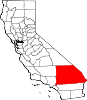
Devore — Neighborhood — Location within the state of California
 Devore
Coordinates: 34°14′6″N 117°24′29″W / 34.235°N 117.40806°WCoordinates: 34°14′6″N 117°24′29″W / 34.235°N 117.40806°W Country United States State California County San Bernardino County City San Bernardino Time zone Pacific (PST) (UTC-8) – Summer (DST) PDT (UTC-7) ZIP codes 92407 Area code(s) 909 FIPS code GNIS feature ID Devore is a neighborhood in the city of San Bernardino, California. It is located near the northern junction of Interstate 15 and Interstate 215. The area is just outside the boundaries of the San Bernardino National Forest; nearby cities/town centers include Universitytown, Fontana, and Rialto. San Manuel Amphitheater, the largest amphitheater in North America, is located in Devore, San Bernardino. Devore is in the 92407 ZIP Code and is within the 909 area code.
External links
City of San Bernardino Topics Neighborhoods Tourism Arrowhead Springs Resort • Arrowhead Credit Union Park • Carousel Mall • California Theatre • Fiscalini Field • Inland CenterHigher education (non-profit) Municipalities and communities of San Bernardino County, California Cities and towns Adelanto | Apple Valley | Barstow | Big Bear Lake | Chino | Chino Hills | Colton | Fontana | Grand Terrace | Hesperia | Highland | Loma Linda | Montclair | Needles | Ontario | Rancho Cucamonga | Redlands | Rialto | San Bernardino | Twentynine Palms | Upland | Victorville | Yucaipa | Yucca Valley
CDPs Baker | Big Bear City | Big River | Bloomington | Bluewater | Crestline | Fort Irwin | Homestead Valley | Joshua Tree | Lake Arrowhead | Lenwood | Lucerne Valley | Lytle Creek | Mentone | Morongo Valley | Mountain View Acres | Muscoy | Oak Glen | Oak Hills | Phelan | Piñon Hills | Running Springs | San Antonio Heights | Searles Valley | Silver Lakes | Spring Valley Lake | Wrightwood
Unincorporated
communitiesAmboy | Angelus Oaks | Argus | Arrowbear Lake | Baldy Mesa | Bell Mountain | Blue Jay | Bryn Mawr | Cadiz | Cedar Glen | Cedarpines Park | Cima | Crafton | Crest Park | Daggett | Declezville | Del Rosa | Devore | Earp | El Mirage | Essex | Fawnskin | Fenner | Forest Falls | Goffs | Green Valley Lake | Guasti | Halloran Springs | Havasu Lake | Helendale | Hinkley | Hodge | Ivanpah | Johnson Valley | Landers | Ludlow | Mojave Heights | Mount Baldy | Mountain Pass | Nebo Center | Newberry Springs | Nipton | Oro Grande | Patton | Parker Dam | Parker Junction | Pioneer Point | Pioneertown | Red Mountain | Rimforest | Skyforest | Sugarloaf | Sunfair | Sunfair Heights | Trona | Twentynine Palms Base | Twin Peaks | Vidal | Vidal Junction | Yermo | Zzyzx
Indian
reservationsGhost towns Categories:- Settlements in San Bernardino County, California
- Unincorporated communities in California
- Communities on U.S. Route 66
- Neighborhoods in San Bernardino, California
- San Bernardino County, California geography stubs


Wikimedia Foundation. 2010.