- Interstate 15 in California
-
This article is about the section of Interstate 15 in California. For the entire length of the highway, see Interstate 15.
Interstate 15

Route information Defined by S&HC § 315 Maintained by Caltrans Length: 287.26 mi[1] (462.30 km) Existed: 1957 – present Major junctions South end: 
 I-8 / SR 15 in San Diego
 SR 78 in Escondido
 I-215 in Murrieta
 I-10 in Ontario
 SR 210 in Ontario
I-215 in San Bernardino
 US 395 near Hesperia
 SR 18 in Victorville

 SR 58 / I-40 in Barstow
North end:  I-15 at Nevada state line
Highway system Main route of the Interstate Highway System
Main • Auxiliary • BusinessState highways in California(list • pre-1964)
History • Unconstructed • Deleted • Freeway • Scenic←  SR 14
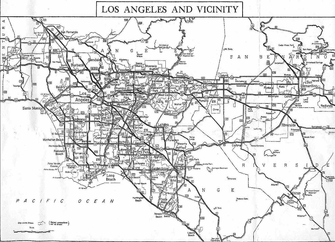
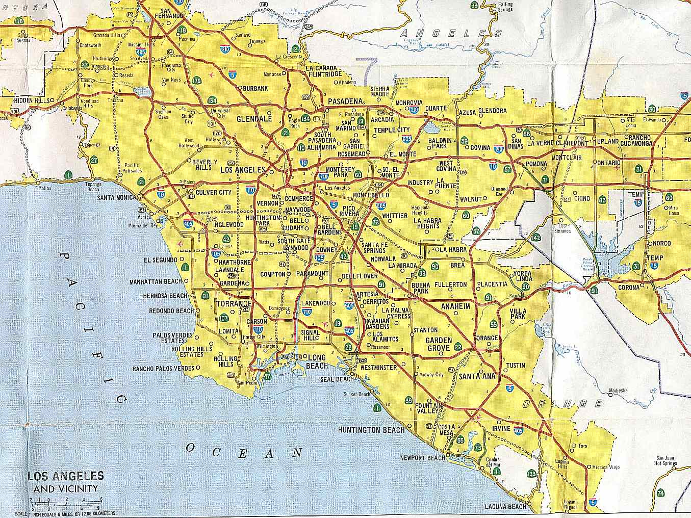
SR 14SR 15 →In the U.S. state of California, Interstate 15 (I-15) is a major north–south route through the San Bernardino, Riverside, and San Diego Counties, and it has a length of 287.26 miles (462.30 km) in the state. It is a major thoroughfare for traffic between Southern California and Las Vegas, Nevada, as well as points beyond. It is also the main route for traffic between San Diego and the Inland Empire.
Contents
Route description
Interstate 15 is part of the California Freeway and Expressway System,[2] and it is eligible for designation as a state highway within the State Scenic Highway System;[3] however the state transportation authority, Caltrans, has not done so.[4] There are various local names for the highway. I-15 between SR 163 and Pomerado Road/Miramar Road is known as the Semper Fi Highway in recognition of the nearby Marine Corps Air Station Miramar.[5] North of the Escondido city limits it is known as the Avocado Highway, whose designation ends upon entering Temecula. There are other local names as noted below.
Heading northward, I-15 currently begins at Interstate 8, at the same place that its continuation, State Route 15, begins its southward journey. I-15 goes through Mission Valley and intersects with State Route 52, before merging with State Route 163. After traversing the Marine Corps Air Station Miramar, I-15 comes into Rancho Penasquitos, where it intersects with the end of State Route 56. Northward, the route crosses Lake Hodges inside the upper San Diego city limits. There are high-occupancy toll lanes in the center of I-15 from State Route 163 to Centre City Parkway, north of Via Rancho Parkway, in Escondido.[6]
I-15 continues north into Escondido, where it interchanges with State Route 78. North of Escondido, I-15 goes through hilly terrain and farmland, intersecting State Route 76 (SR 79), before it crosses the county line into Riverside County. In Riverside County, SR 79 runs concurrently with I-15 for a four-mile (6 km) portion in Temecula, before it splits away running north to Hemet. Then, I-15 intersects with the southern end of Interstate 215, which continues the designation of the Escondido Freeway. Interstate 15 continues north as the Temecula Valley Freeway.[7]
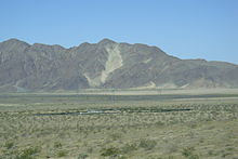
 West of Baker, the freeway jogs north to pass Cave Mountain.
In Murrieta, I-15 splits from its first and only spur route in California, Interstate 215, which runs through the two largest cities in the Inland Empire, San Bernardino and Riverside. I-15 runs along the eastern edge of the Santa Ana Mountains, passing the town of Lake Elsinore. It continues through the suburban areas in the western Inland Empire, passing Corona and Ontario, California. The highway is then rejoined by I-215, before heading northwards and upward through the Cajon Pass, an important mountain pass that is the primary route between Southern California and points eastwards and northeastwards.
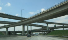 Intersection of I-10 and I-15.
The portion of I-15 that is located between its northern and southern junctions with I-215 is also used by many local residents as the major north–south route for the western portions of the San Bernardino-Riverside-Ontario metropolitan area. (I-215 serves a similar function in the eastern portion of the metropolitan area. These two highways are the only continuous north–south freeways in the area.)
North of Limonite Avenue (south of SR 60), I-15 is known as the Ontario Freeway. I-15 intersects State Route 60, Interstate 10, and State Route 210 in rapid succession as it goes through Mira Loma, Ontario, and Rancho Cucamonga. As it nears Devore, I-15 merges with Interstate 215, where it is called the Barstow Freeway or the Mojave Freeway.
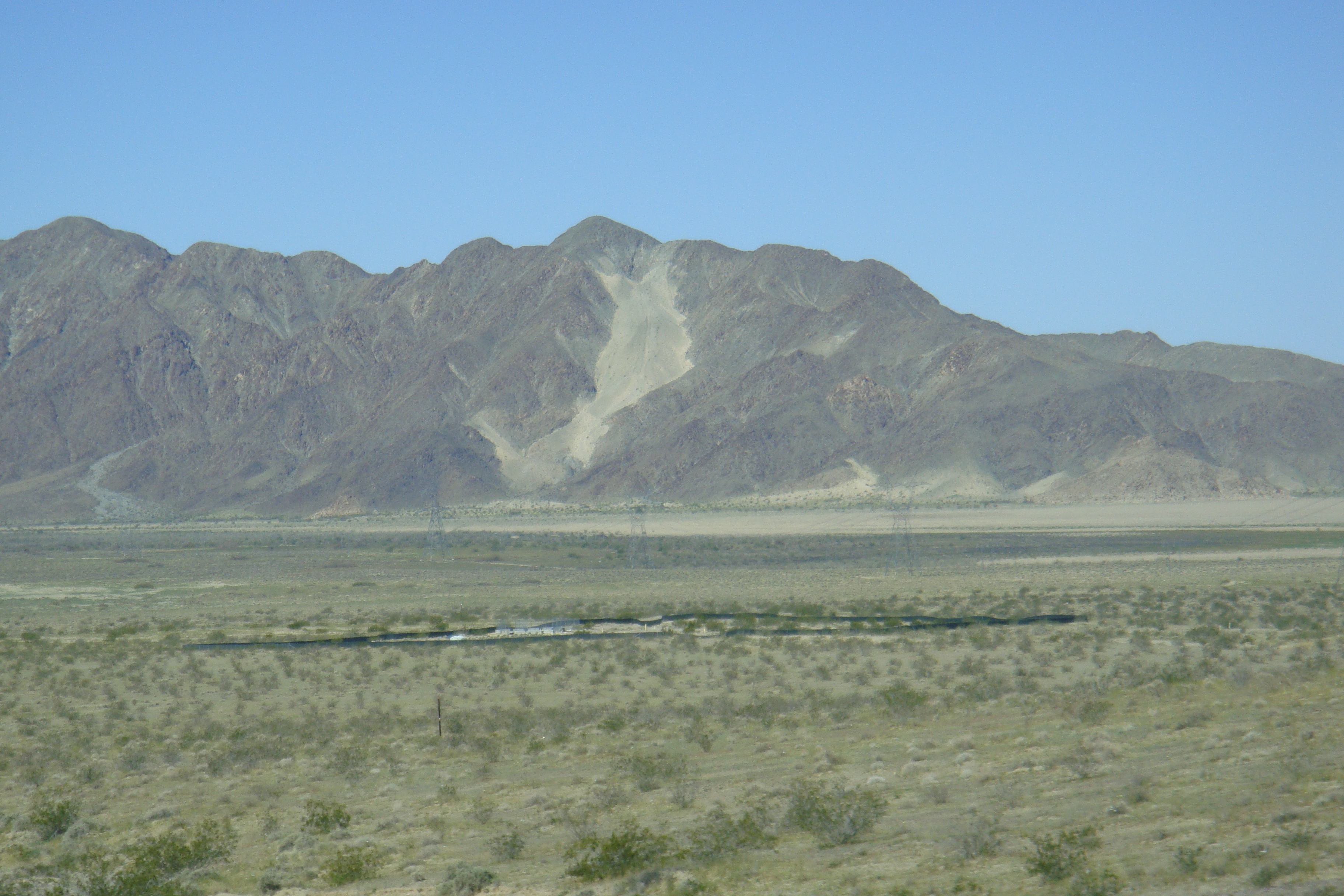
 Exit to Zzyzx.
North of the Cajon Pass, I-15 traverses the Mojave Desert towns of Hesperia and Victorville. I-15 passes through desert for 30 miles (48 km) before reaching Barstow, then continues past Zzyzx Road, before reaching the town of Baker. The sign for Zzyzx Road — alphabetically the last place name in the world — is a landmark of sorts on the drive between Los Angeles and Las Vegas. I-15 enters Nevada near the casino town of Primm, formerly known as Stateline, Nevada.
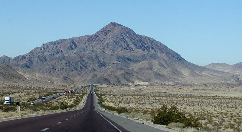
 Westbound coming down into Shadow Valley. Halloran Summit is on the skyline, about 8 miles (13 km) away.
I-15 continues thereafter to Las Vegas, Salt Lake City, and on into Idaho and Montana, before ending at the Canadian border, where Alberta Highway 4 continues the ribbon of asphalt into Canada. Because it joins with the western end of I-70 in Southwestern Utah, I-15 also forms part of a major east–west corridor connecting Southern California with Denver, St. Louis, and points east.
The Mojave Freeway is fairly busy on weekdays, since it connects the rapidly growing exurbs of the Victor Valley with the Los Angeles area. On weekends and holidays, however, it can sometimes be jammed with Californians driving to Las Vegas for short vacations.[8]
Construction is currently underway to rehabilitate the pavement on I-15 and to add truck lanes to separate autos from truck traffic.[citation needed]
History
I-15 replaced US 395 between San Diego and Temecula. The highway replaced US 66 between San Bernardino and Barstow. The route north of Barstow replaced US 91.
I-15 was initially planned to run from I-10 in San Bernardino along the current I-215 alignment then up through the Cajon Pass and on to Las Vegas, with a distance of 186.24 miles (299.72 km) within the state. California successfully argued the addition south to San Diego, suggesting that the freeway would connect the major military bases former March AFB and former NAS (now MCAS) Miramar. US 395 was then signed TEMP-15 and the "old" I-15 between Devore and San Bernardino became I-215.
On January 24, 1957, the State Highway Commission defined the Escondido Freeway as what are now Routes 15 and 215 from Route 805 to Route 91. This entire segment was previously U.S. Route-395 when it was named. Since then, the definition was extended on Route 15 south to Route 8 by Assembly Concurrent Resolution 34, Chapter 67 in 1979.[9] Meanwhile, the segment of Route 15 from the San Diego County Line to the I-15/I-215 interchange was named the Temecula Valley Freeway in 1990.[10]
The original definition for the Corona Freeway, as named by the State Highway Commission on July 23, 1958, stated that it was "Routes 71, 91, and 15 from Route 10 West of Pomona to Route 215".[11]
This legal definition has been amended twice: First in 1990, the California Assembly passed Concurrent Resolution 125, Chapter 78, renaming I-15 between the San Diego County Line (which is further south from Interstate 215) and Bundy Canyon Road near Lake Elsinore as the Temecula Valley Freeway.[12]
Then in 1993, the California Assembly passed legislation officially designating State Route 71 as a part of the Chino Valley Freeway.[13] However, the name "Corona Freeway" is, confusingly, sometimes still applied to this portion of State Route 71; despite the change, guide signs on
eastbound and SR 57 southbound at the Kellogg Interchange in Pomona still refer to SR 71 as the "Corona Freeway".State Route 31
In 1933, Interstate 15 was defined as Legislative Route 193, running from pre-1964 Legislative Route 43 (present State Route 91) in Corona to pre-1964 Legislative Route 9 (now State Route 66, and was extended north to pre-1964 Legislative Route 31 (present I-15 and I-215) in 1935.[14] The piece south of U.S. Route 60 (Mission Boulevard), running along North Main Street, Hamner Avenue and Milliken Avenue, was state-maintained by 1955, but was not assigned a signed number.[15] This was still the only existing piece in 1963, and had a planned freeway replacement to the east.[16]
In the 1964 renumbering, the route was assigned as State Route 31. It was added to the Interstate Highway System in February 1972 as a realignment of Interstate 15 (the former alignment became Interstate 15E).[17] Legislative changes were made in 1974, eliminating SR 31 (along with State Route 71 south of Corona) in favor of I-15.[18] However, SR 31 continued to be signed — as temporary Interstate 15 - until present I-15 was finished. (A 1986 map shows state maintenance continuing north past SR 60 to Jurupa Street, where it turned east to I-15.[19])
Future
California State Route 15 from Interstate 5 to Interstate 8 in San Diego will be re-designated as part of I-15 once this segment is completely upgraded to Interstate standards.
Most of Interstate 15 is undergoing major improvements from Devore to the Nevada State Line, beginning in 2002 and costing $349 million. This project will improve traffic flow on the heavily traveled highway for those going to and from Las Vegas. Most of the construction was completed by Winter 2009.[20] Projects include adding truck lanes on hills (39 miles or 63 kilometres at various locations), repaving 76 miles (122 km) of I-15 at various locations, adding exit numbers, renovating and rehabilitating the rest area between Baker and the Nevada State Line (Valley Wells Rest Area), reconstructing bridges in Baker, and moving the agriculture inspection station from Yermo to the Nevada State Line and including a truck weigh station.
As of March 2008, construction is underway to add a northbound truck descending lane and to repave lanes between Bailey Rd. and Yates Well Rd.
There is also construction ongoing (circa spring 2008) to expand traffic lanes in northern San Diego County, including the northward extension (beyond SR 56) of the existing high-occupancy toll lanes which already exist between SR 56 and SR 163. It appears that this extension will move the northern terminus of the HOV lanes to a location at or near the interchange with SR 78.
Exit list
- Note: Except where prefixed with a letter, postmiles were measured in 1964, based on the alignment as it existed at that time, and do not necessarily reflect current mileage. The numbers reset at county lines; the start and end postmiles in each county are given in the county column.
County Location Postmile
[21][22][23]Exit
[24]Destinations Notes San Diego
SD R6.13-R54.26San Diego R6.13 SR 15 south (Escondido Freeway) – San DiegoContinuation beyond I-8 6B Camino del Rio South R6.13 6B I-8 – El Centro, BeachesR6.82 7 Friars Road – Qualcomm Stadium Signed as exits 7A (east) and 7B (west) northbound R8.37 8 Aero Drive R9.24 9 Balboa Avenue, Tierrasanta Boulevard Former SR 274 west R10.00 10 Clairemont Mesa Boulevard Southbound exit is part of exit 11 R10.58 11  SR 52
SR 52M12.12 12  SR 163 south (Cabrillo Freeway)
Northbound exit is via exit 11; former US 395 south M13.33 13 Miramar Way Serves Marine Corps Air Station Miramar M14.29 14 Miramar Road, Pomerado Road M15.00 15 Carroll Canyon Road M15.92 16 Mira Mesa Boulevard M17.31 17 Mercy Road, Scripps Poway Parkway M18.18 18  CR S4 (Poway Road) / Rancho Peñasquitos Boulevard
M19.47 19  SR 56 west (Ted Williams Freeway) / Ted Williams Parkway
M20.57 21 Carmel Mountain Road M21.92 22 Camino del Norte M22.94 23 Bernardo Center Drive M23.69 24 Rancho Bernardo Road M26.03 26  CR S5 (Pomerado Road) / West Bernardo Drive
Escondido M26.97 27 Via Rancho Parkway M27.65 28 Centre City Parkway (I-15 Bus. north) Northbound exit and southbound entrance; former US 395 north R28.77 29 Felicita Road R30.09 30 9th Avenue, Auto Park Way R30.63 31 Valley Parkway – Downtown Escondido R31.52 32 SR 78 – Oceanside, RamonaR32.86 33 El Norte Parkway R33.92 34 Centre City Parkway (I-15 Bus. south) Southbound exit and northbound entrance; former US 395 south R36.64 37  CR S12 (Deer Springs Road) / Mountain Meadow Road
R40.84 41 Gopher Canyon Road, Old Castle Road R43.28 43 Old Highway 395 Former US 395 R46.49 46  SR 76 – Pala, Oceanside
R50.59 51  CR S13 (Mission Boulevard) – Fallbrook
R54.07 54 Rainbow Valley Boulevard Riverside
RIV R0.00-52.28Temecula 3.44 58  SR 79 south – Temecula, Indio
South end of SR 79 overlap, former SR 71 south 4.98 59 Rancho California Road, Old Town Front Street 6.62 61 SR 79 north (Winchester Road)North end of SR 79 overlap Murrieta 8.74 63 I-215 north (Escondido Freeway) – Riverside, San BernardinoSouthbound exit is via exit 64; former I-15E north / US 395 north 9.47 64 Murrieta Hot Springs Road 10.59 65 California Oaks Road 13.64 68 Clinton Keith Road 15.07 69 Baxter Road 16.30 71 Bundy Canyon Road Lake Elsinore 19.16 73 Diamond Drive, Railroad Canyon Road 20.95 75 Main Street (I-15 Bus. north) 22.28 77  SR 74 (Central Avenue)
23.85 78 Nichols Road 26.69 81 Lake Street (I-15 Bus. south) 30.40 85 Indian Truck Trail 33.39 88 Temescal Canyon Road Former SR 71 35.64 90 Weirick Road 36.81 91 Cajalco Road 37.82 92 El Cerrito Road Corona 38.69 93 Ontario Avenue Former SR 71 40.35 95 Magnolia Avenue 41.50 96  SR 91 (Riverside Freeway) – Riverside, Beach Cities
Signed as exits 96A (east) and 96B (west) southbound; former US 91 Norco 42.88 97 Hidden Valley Parkway 43.64 98 Second Street (I-15 Bus. north) 45.60 100 Sixth Street (I-15 Bus. south) 102 Schleisman Road Proposed interchange[citation needed] 48.26 103 Limonite Avenue 105 Cantu-Galleano Ranch Road 51.47 106  SR 60 (Pomona Freeway) – Los Angeles, Riverside
Signed as exits 106A (east) and 106B (west) northbound San Bernardino
SBD 0.00-186.24Ontario 1.02 108 Jurupa Street Former SR 31 south 2.39 109 I-10 (San Bernardino Freeway, I-10 Bus.) – Los Angeles, San Bernardino, IndioSigned as exits 109A (west) and 109B (east) southbound Rancho Cucamonga 3.05 110 4th Street 5.31 112  SR 66 (Foothill Boulevard)
Former US 66 6.78 113 Baseline Road 8.35 115 SR 210 – Pasadena, San Bernardino, RedlandsSigned as exits 115A (east) and 115B (west) northbound and exits 115A (west) and 115B (east) southbound 115 Highland Avenue Closed[citation needed] Fontana 9.61 116 Summit Avenue 117 Duncan Canyon Road Proposed interchange[citation needed] 12.84 119 Sierra Avenue San Bernardino 15.65 122 Glen Helen Parkway 16.37
R13.78123 I-215 south (Barstow Freeway) – San Bernardino, RiversideLeft exit southbound; former I-15E south / US 66 west / US 91 south / US 395 south R14.96 124 Kenwood Avenue Former US 66 east R20.01 129 Cleghorn Road Former US 66 west R21.37 131  SR 138 – Palmdale, Silverwood Lake
R28.62 138 Oak Hill Road 31.81 141 US 395 north – Adelanto, BishopNorthbound exit and southbound entrance 32.32 141 Joshua Street to US 395 northSouthbound exit and northbound entrance Hesperia 34.00 143 Main Street – Hesperia, Phelan Victorville 37.59 147 Bear Valley Road – Lucerne Valley 40.51 150 SR 18 west (Palmdale Road, I-15 Bus. north)South end of SR 18 overlap; former US 66 east / US 91 north 41.43 151A Roy Rogers Drive 42.03 151B Mojave Drive 43.49 153A SR 18 east (D Street, I-15 Bus. south) – Victorville, Apple ValleyNorth end of SR 18 overlap; former US 66 / US 91 43.62 153B E Street 44.40 154 Stoddard Wells Road 47.39 157 Stoddard Wells Road – Bell Mountain 51.83 161 Dale Evans Parkway – Apple Valley 55.96 165 Wild Wash Road 60.16 169 Hodge Road Barstow 65.84 175 Outlet Center Drive 68.77 178 Lenwood Road 70.10 179 SR 58 west – Bakersfield71.62 181 L Street, West Main Street (I-15 Bus. north) 73.54 183  SR 247 south (Barstow Road)
74.42 184A I-40 east (Needles Freeway) – NeedlesSouthbound exit is via exit 184 74.95 184B East Main Street (I-15 Bus. south) Signed as exit 184 southbound; former US 66 76.88 186 Old Highway 58 Former SR 58 west / US 91 south / US 466 west 79.59 189 Fort Irwin Road Serves Fort Irwin R81.84 191 Ghost Town Road Serves the ghost town of Calico Yermo R84.64 194 Calico Road – Yermo R86.38 196 Yermo Road – Yermo R88.49 198 Minneola Road R96.41 206 Harvard Road R103.63 213 Field Road R111.59 221 Afton Road R120.42 230 Basin Road R124.23 233 Rasor Road Zzyzx R130.18 239 Zzyzx Road – Zzyzx Baker R135.80 245 Baker Boulevard (I-15 Bus. north) – Baker Northbound exit and southbound entrance; former US 91 north / US 466 east R136.57 246  SR 127 north / Kelbaker Road – Death Valley
R138.45 248 Baker Boulevard (I-15 Bus. south) – Baker Southbound exit and northbound entrance; former US 91 south / US 466 west Halloran Springs 149.60 259 Halloran Springs Road 155.57 265 Halloran Summit Road Cima 162.73 272 Cima Road 171.47 281 Bailey Road 176.45 286 Nipton Road 181.39 291 Yates Well Road 186.24 Nevada state line 1.000 mi = 1.609 km; 1.000 km = 0.621 mi
Concurrency terminus • Closed/Former • Incomplete access • UnopenedReferences
- ^ Route Log- Main Routes of the Eisenhower National System of Interstate and Defense Highways - Table 1
- ^ CA Codes (shc:250-257)
- ^ CA Codes (shc:260-284)
- ^ California Department of Transportation, Officially Designated Scenic Highways, accessed 2009-09-14
- ^ "California Highways, Routes 9 through 16". CaHighways.org. 2007-08-30. http://www.cahighways.org/009-016.html#015. Retrieved 2007-08-30.
- ^ Interstate 15 Express Lanes
- ^ Thomas Brothers (2000). California Road Atlas and Driver's Guide (Map). p. V, 99, 106.
- ^ The highway was featured on the television program Dangerous Drives (Speed Channel), which illustrated the difficulties of patroling the highway due to excessive speed and congestion. The 45-minute episode "Dangerous Drives - Highway Patrol" originally aired in january 2010.
- ^ (PDF) 2007 Named Freeways, Highways, Structures and Other Appurtenances in California. Caltrans. p. 60. http://www.dot.ca.gov/hq/tsip/hseb/products/Named_Freeways.pdf. Retrieved 2007-03-28.
- ^ Ib. at 63
- ^ (PDF) 2007 Named Freeways, Highways, Structures and Other Appurtenances in California. Caltrans. p. 69. http://www.dot.ca.gov/hq/tsip/hseb/products/Named_Freeways.pdf. Retrieved 2007-03-28.
- ^ Ib. at 63
- ^ Ib. at 67
- ^ California Highways: LRN 193
- ^ 1955 Gousha Los Angeles district map
- ^ 1963 Caltrans Los Angeles and vicinity map
- ^ California Highways: Interstate Highway Types and the History of California's Interstates
- ^ California Highways: Former State Route 31
- ^ 1986 Caltrans Los Angeles and vicinity map
- ^ http://www.dot.ca.gov/dist8/projects/15/I-15%20Brstw%20-STLN.revsd%206-2004%20copy.pdf dot.ca.gov
- ^ California Department of Transportation, State Truck Route List (XLS file), accessed February 2008
- ^ California Department of Transportation, Log of Bridges on State Highways, July 2007
- ^ California Department of Transportation, All Traffic Volumes on CSHS, 2005 and 2006
- ^ California Department of Transportation, California Numbered Exit Uniform System, Interstate 15 Freeway Interchanges, Retrieved on 2009-02-05.
 Interstate 15
Previous state:
TerminusCalifornia Next state:
NevadaInterstate Highways in California Signed Unsigned Business Loops Former Freeways in Greater Los Angeles Radial Hollywood (US 101/SR 170) • Golden State (I-5) • Antelope Valley (SR 14) • Glendale (SR 2) • Pasadena/Arroyo Seco Pkwy (SR 110) • San Bernardino (I-10) • Pomona (SR 60) • Santa Ana (I-5/US 101) • Laguna (SR 133) • Corona del Mar (SR 73) • Long Beach (I-710) • Seaside (SR 47) • Terminal Island (SR 103) • Harbor (I-110/SR 110) • Marina (SR 90) • Santa Monica (I-10)Circumferential Inland Empire Chino Valley (SR 71) • Foothill (SR 210) • Moreno Valley (SR 60) • Riverside (SR 91) • San Bernardino (I-10/I-215) • I-10 • I-15 • I-215 • SR 259 • SR 330Toll Categories:- Interstate Highways in California
- Juan Bautista de Anza National Historic Trail
- Interstate 15
- Ivanpah Valley
- Southern California freeways
- Roads in San Diego County, California
- Roads in Riverside County, California
- Roads in San Bernardino County, California


Wikimedia Foundation. 2010.