- California State Route 127
-
State Route 127
Death Valley Road 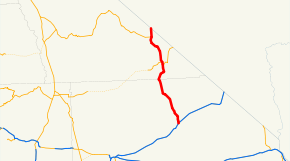
Route information Defined by S&HC § 427 Maintained by Caltrans Length: 91.033 mi[1] (146.503 km) Major junctions South end:  I-15 at Baker
 SR 178 at Shoshone
 SR 190 at Death Valley Junction
North end:  SR 373 at Nevada state line
Highway system State highways in California(list • pre-1964)
History • Unconstructed • Deleted • Freeway • Scenic←  SR 126
SR 128  →
→State Route 127 (SR 127) is a California state highway that connects Interstate 15 to Nevada State Route 373, passing through Death Valley National Park. The entire length of the highway closely follows the central portion of the former Tonopah and Tidewater Railroad and loosely follows the Amargosa River.
Contents
Route description
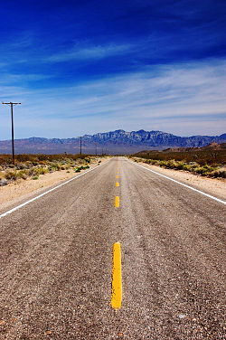 Looking South East at the down Kelbaker Road/SR127 Providence Mountainsin the Mojave National Preserve
SR 127 is part of the California Freeway and Expressway System[2] and is eligible for the State Scenic Highway System.[3] However, it has not been designated by Caltrans as a scenic highway.[4]
The highway begins at I-15 in the community of Baker, the last town travelers from the Greater Los Angeles area or the Las Vegas metropolitan area see before making their trek across Death Valley. SR 127 travels through the town of Baker as Death Valley Road before turning slightly northwest and traveling along the edge of Silver Lake, a dry lake. The road parallels Salt Creek[disambiguation needed
 ] and Silurian Lake as it crosses the Valjean Valley. SR 127 soon runs along the southeastern edge of Death Valley National Park and cuts through the mountains as it is entering Inyo County.[5]
After passing by the turnoff for Tecopa Hot Springs, SR 127 runs concurrently with SR 178 through the community of Shoshone. SR 127 continues along the eastern edge of Death Valley National Park, passing by Eagle Mountain[disambiguation needed
] and the Amargosa River before intersecting SR 190 at Death Valley Junction. The road ends at the California-Nevada border, where Nevada State Route 373 begins.[6] It is the "Lost Highway" featured in David Lynch's film Lost Highway.Major intersections
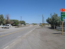 In Baker, looking in Death Valley direction
- Note: Except where prefixed with a letter, postmiles were measured in 1964, based on the alignment as it existed at that time, and do not necessarily reflect current mileage. The numbers reset at county lines; the start and end postmiles in each county are given in the county column.
County Location Postmile
[1][7][8]Destinations Notes San Bernardino
SBD L0.00-41.47Baker L0.00 Kelbaker Road Continuation beyond I-15 L0.00 I-15 (Mojave Freeway) – Las Vegas, BarstowInterchange 0.00 Baker Boulevard (I-15 Bus.) – Las Vegas, Barstow Former US 91 / US 466 Inyo
INY 0.00-49.426.51 Old Spanish Trail Highway – Tecopa, Hot Springs Shoshone 14.75 SR 178 east – Pahrump, Las VegasSouth end of SR 178 overlap 16.25 SR 178 west – BadwaterNorth end of SR 178 overlap Death Valley Junction 42.15 SR 190 – Death Valley National Park49.42 SR 373 – Lathrop WellsContinuation beyond the Nevada state line 1.000 mi = 1.609 km; 1.000 km = 0.621 mi
Concurrency terminus • Closed/Former • Incomplete access • UnopenedReferences
- ^ a b California Department of Transportation, State Truck Route List (XLS file), accessed February 2008
- ^ CA Codes (shc:250-257)
- ^ CA Codes (shc:260-284)
- ^ California Department of Transportation, Officially Designated Scenic Highways, accessed 2010-03-26
- ^ Thomas Brothers (2008). San Bernardino County Road Atlas (Map).
- ^ Thomas Brothers (2009). California Road Atlas (Map).
- ^ California Department of Transportation, Log of Bridges on State Highways, July 2007
- ^ California Department of Transportation, All Traffic Volumes on CSHS, 2005 and 2006
External links
Categories:- State highways in California
- Roads in San Bernardino County, California
- Roads in Inyo County, California
- Scenic highways in California
- Death Valley National Park
- Mojave Desert


Wikimedia Foundation. 2010.