- Tecopa, California
Infobox Settlement
official_name = Tecopa, California
settlement_type = CDP
imagesize =
image_caption =
image_
imagesize =
image_caption =
image_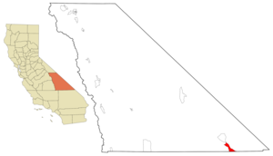
mapsize = 250x200px
map_caption = Location in Inyo County and the state ofCalifornia
mapsize1 =
map_caption1 =
subdivision_type = Country
subdivision_type1 = State
subdivision_type2 = County
subdivision_name =United States
subdivision_name1 =California
subdivision_name2 = Inyo
government_type =
leader_title =
leader_name =
established_date =
area_magnitude =
area_total_km2 = 48.3
area_total_sq_mi = 18.7
area_land_km2 = 48.1
area_land_sq_mi = 18.6
area_water_km2 = 0.2
area_water_sq_mi = 0.1
elevation_ft = 1339
elevation_m = 408
population_as_of = 2000
population_footnotes =
population_total = 99
population_metro =
population_density_km2 = 2
population_density_sq_mi = 5.3
timezone = Pacific (PST)
utc_offset = -8
latd = 35 |latm = 50 |lats = 37 |latNS = N
longd = 116 |longm = 12 |longs = 43 |longEW = W
timezone_DST = PDT
utc_offset_DST = -7
postal_code_type =ZIP code
postal_code = 92389
area_code = 760
blank_name = FIPS code
blank_info = 06-78050
blank1_name = GNIS feature ID
blank1_info = 0250293
footnotes =
website =Tecopa is a
census-designated place in theMojave Desert , in Inyo County,California ,United States . The population was 99 at the 2000 census.One of Tecopa's popular features is its natural
hot spring s. Adjacent to the campground are gender-segregated, no-clothing-mandatory, indoor hot pools for soaking. Access is included in camping fees.Geography
According to the
United States Census Bureau , the CDP has a total area of 18.6square mile s (48.3km² ), of which, 18.6 square miles (48.1 km²) of it is land and 0.1 square miles (0.2 km²) of it (0.38%) is water.Demographics
As of the
census GR|2 of 2000, there were 99 people, 60 households, and 22 families residing in the CDP. Thepopulation density was 5.3 people per square mile (2.1/km²). There were 133 housing units at an average density of 7.2/sq mi (2.8/km²). The racial makeup of the CDP was 88.89% White, 1.01% Black or African American, 7.07% Native American, and 3.03% from two or more races. 4.04% of the population were Hispanic or Latino of any race.There were 60 households out of which 10.0% had children under the age of 18 living with them, 28.3% were married couples living together, 6.7% had a female householder with no husband present, and 63.3% were non-families. 55.0% of all households were made up of individuals and 30.0% had someone living alone who was 65 years of age or older. The average household size was 1.65 and the average family size was 2.50.
In the CDP the population was spread out with 10.1% under the age of 18, 4.0% from 18 to 24, 14.1% from 25 to 44, 28.3% from 45 to 64, and 43.4% who were 65 years of age or older. The median age was 63 years. For every 100 females there were 80.0 males. For every 100 females age 18 and over, there were 78.0 males.
The median income for a household in the CDP was $12,344, and the median income for a family was $16,250. Males had a median income of $0 versus $31,250 for females. The
per capita income for the CDP was $10,395. There were 30.8% of families and 38.6% of the population living below thepoverty line , including 100.0% of under eighteens and 27.0% of those over 64.Politics
In the state legislature Tecopa is located in the 18th Senate District, represented by Republican
Roy Ashburn , and in the 18th Assembly District, represented by RepublicanBill Maze . Federally, Tecopa is located inCalifornia's 25th congressional district , which has a Cook PVI of R +7 [cite web | title = Will Gerrymandered Districts Stem the Wave of Voter Unrest? | publisher = Campaign Legal Center Blog | url=http://www.clcblog.org/blog_item-85.html | accessdate = 2007-10-20] and is represented by Republican Buck McKeon.References
External links
Wikimedia Foundation. 2010.