- California State Route 480
Infobox road
state=CA
type=SR
route=480
alternate_name=Embarcadero Freeway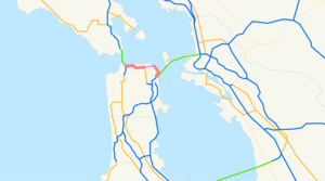
direction_a=West
terminus_a=jct|state=CA|US|101 in San Francisco
direction_b=East
terminus_b=jct|state=CA|I|80 in San FranciscoState Route 480 was a proposed
state highway inSan Francisco, California ,United States , consisting of the elevated double-decker Embarcadero Freeway (also known as the Embarcadero Skyway), the partly-elevatedDoyle Drive approach to theGolden Gate Bridge , and an unbuilt section in between. The Embarcadero Freeway was demolished after the 1989Loma Prieta earthquake , and Doyle Drive is now part of U.S. Route 101. SR 480 was Interstate 480, an auxiliary route of theInterstate Highway System , from 1955 to 1965. [cite web|url=http://www.cahighways.org/466-740.html#480|title=Former State Route 480|publisher=California Highways] [cite web|url=http://www.kurumi.com/roads/3di/i480.html#480ca|title=Interstate 480|publisher=kurumi.com]History
Legislative Route 224 was defined in 1947 to connect U.S. Route 101 (pre-1964 Legislative Route 2) at the intersection of Lombard Street and
Van Ness Avenue with U.S. Route 40 and U.S. Route 50 (pre-1964 Legislative Route 68) at the west end of theSan Francisco – Oakland Bay Bridge (near theTransbay Terminal ). [ [http://cahighways.org/chrphas4.html California Highways: Chronology of California Highways 1947-1962] ] Its alignment was roughly along Lombard Street and the Embarcadero. [ [http://cahighways.org/maps/1963sf.jpg1963 San Francisco inset map] ]Legislative Route 224, as well as Route 2 (US 101) from Route 224 west to the junction with State Route 1 near the
Golden Gate Bridge , was added to theInterstate Highway System onSeptember 15 ,1955 . This included the 1936Doyle Drive , an early freeway built to access theGolden Gate Bridge . [ [http://www.doyledrive.com/ South Access to the Golden Gate Bridge - Doyle Drive] ] After some discussion, the number Interstate 480 was assigned onNovember 10 ,1958 . (Interstate 280, as originally planned, ran south from the west end of I-480 along SR 1, through theMacArthur Tunnel andGolden Gate Park , to join its present alignment in Daly City.) [http://cahighways.org/itypes.html California Highways: Interstate Highway Types and the History of California's Interstates] ]The first section of the Embarcadero Freeway, from the Bay Bridge approach (Interstate 80) north to Broadway, opened in 1959. [http://www.kurumi.com/roads/3di/i480.html#480ca kurumi: I-480 (cancelled) California] ] As a consequence of the freeway revolt, the
San Francisco Board of Supervisors passed Resolution 45-59 in January1959 , opposing certain freeways including the remainder of I-480. [http://cahighways.org/371-480.html#480 California Highways: Former State Route 480] ]In the 1964 renumbering, Route 480 was designated for the full route of I-480, including the US 101 concurrency. The route was deleted from the Interstate Highway System in January
1968 , with Interstate 280 being rerouted north of Daly City at the same time. The short piece of former I-480 from the junction with new I-280 (previously State Route 87) south to the Bay Bridge approach became part of I-280 (to allow I-280 to meet I-80). These changes were made to the state highway system in 1968; Route 480 was only truncated slightly, with the 5.47 miles [http://www.dot.ca.gov/hq/structur/strmaint/brlog2.htm January 1, 2006 California Log of Bridges on State Highways] ] (8.80 km) from I-280 to SR 1 remaining, though downgraded to State Route 480.The freeway was featured in a few
film s, including "Magnum Force ", "Freebie and the Bean ", "Bullitt ", "Serial", "Superman IV ", "Time After Time", and "Koyaanisqatsi ", as well as several TV shows such as "Full House " (in several overhead screen shots) and "The Streets of San Francisco ". In a shot at the start of Zodiac, the freeway was digitally added behind a shot of the Ferry Building.Demise
The Board of Supervisors voted on November 5, 1985 to tear down the Embarcadero Freeway. The proposal was put to the voters in 1987, and soundly defeated. The October 17, 1989 Loma Prieta earthquake damaged the structure, and
Caltrans planned to retrofit and retain the two-decker freeway. Many accounts since then have suggested that the earthquake resulted in the demolition of the freeway, but the record shows that the city convulsed over the issue, with many supporting a rebuild. Then MayorArt Agnos proposed instead demolishing the freeway in favor of a boulevard with an underpass at the Ferry Building to allow for a large plaza.Opposition to demolishing the freeway mounted again, with over 20,000 signatures gathered to again create a ballot measure. The strongest opposition came from Chinatown and the city's downtown. Agnos continued to negotiate with federal and state officials to win enough funding to make the demolition practical, and the opposition quieted. Demolition began on February 27, 1991. [ [http://www.fhwa.dot.gov/byday/fhbd0227.htm FHWA By Day - February 27] ] That year Agnos was defeated for re-election as Chinatown switched its support away from him.
On June 16, 2006, the
Port of San Francisco unveiled a monument to Mayor Agnos honoring his vision and courage, noting "This pedestrian pier commemorates the achievement of Mayor Agnos in leaving our city better and stronger than he found it." Legislative changes that year deleted Route 480 from the state highway system; the northwest section was transferred to U.S. Route 101. The only piece of the Embarcadero Freeway to remain was the beginning of the ramp from the Bay Bridge to Fremont Street, including a shortramp stub that formerly carried traffic to the freeway (Interstate 280 there after 1968). This part was rebuilt as a part of the Bay Bridge retrofit project. (I-280 was never finished to that interchange, though its legislative definition still takes it there. [ [http://cahighways.org/273-280.html#280 California Highways: Interstate 280] ] )Prior to the earthquake, the Embarcadero Freeway carried approximately 70,000 vehicles daily in the vicinity of the Ferry Building. Another 40,000 vehicles/day used associated ramps at Main and Beale Sts.
In 2003, Caltrans began work on a retrofitting project to replace the western approach to the Bay Bridge. This retrofitting is part of a larger, $6 billion project to upgrade the ageing Bay Bridge to modern earthquake standards - which includes replacing the entire eastern span. While the entire project is scheduled to be complete in 2013, the west approach should be replaced by 2009. In late 2005, Caltrans began the demolition of the original west approach after traffic was routed onto a temporary bypass structure. As a result of this retrofitting project, all old parts of the approach will be replaced, removing the final remains of the Embarcadero Freeway. [ [http://www.baybridgeinfo.org Bay Bridge Seismic Safety Project] ]
Exit list
The following is an exit list of the former Embarcadero Freeway prior to the
Loma Prieta earthquake and subsequent demolition.The entire route is in San Francisco.
References
External links
*
San Francisco Chronicle [http://sfgate.com/cgi-bin/object/article?m=/c/pictures/2004/10/17/mn_embarcadero_ferrybldg_joh.jpg&f=/c/a/2004/10/17/MNCITY1.DTL photo of the freeway from 1987]

Wikimedia Foundation. 2010.