- California State Route 180
Infobox road
state=CA
type=SR
route=180
alternate_name=Sequoia-Kings Canyon Freeway, Kings Canyon Road
section=480
maint=Caltrans 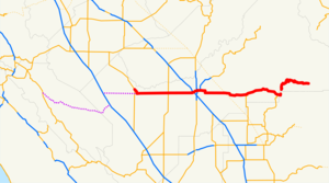
length_mi=112.31
length_ref= [http://www.dot.ca.gov/hq/structur/strmaint/brlog2.htm January 1, 2006 California Log of Bridges on State Highways] ]
length_round=2
length_notes=(via old route in Fresno)
established=1934 [http://cahighways.org/177-184.html#180 California Highways: State Route 180] ]
direction_a=West
terminus_a=jct|state=CA|SR|33 in Mendota
junction=jct|state=CA|SR|99 in Fresno
jct|state=CA|SR|63 near Orange Cove
direction_b=East
terminus_b=Kings Canyon
previous_type=SR
previous_route=178
next_type=SR
next_route=182
commons=categoryState Route 180 is a
state highway inCalifornia ,United States , which runs through the heart of theSan Joaquin Valley from Mendota through Fresno toKings Canyon National Park . A short piece near the eastern end, through theGrant Grove section of Kings Canyon National Park, is not state-maintained. The part east of unbuilt State Route 65 near Minkler is eligible for the State Scenic Highway System; the road east of Dunlap is the Kings Canyon Scenic Byway, aForest Service Byway .Route description
The western terminus of SR 180 is at State Route 33 in Mendota. An unconstructed portion of SR 180 is defined from SR 33 west across Interstate 5 to State Route 25; there are current plans to build the route to I-5 to provide better access to communities along the route. [ [http://www.dot.ca.gov/dist6/factsheets/docs/sr180westsideexp.pdf State Route 180 Westside Expressway Route Adoption Study] (
PDF )Dead link|date=June 2008] Panoche Road, Little Panoche Road, Shields Avenue, Fairfax Avenue and Belmont Avenue provides a locally-maintained route along the proposed corridor from SR 25 to SR 33, and is signed as County Route J1. Until 1984, the route extended as far west as U.S. Route 101 near Gilroy, using present-day Route 25.In Fresno, SR 180 is the Sequoia-Kings Canyon Freeway, named for its destinations to the east in the Sierra Nevada -
Sequoia National Park andKings Canyon National Park . It has full interchanges with three otherfreeway s - State Route 99, State Route 41 and State Route 168. The SR 180 freeway presently runs from Hughes-West Diagonal west of SR 99 to Clovis Avenue east of SR 168; those local streets are temporarily designated SR 180 south to the old surface alignment. The freeway is officially State Route 180S (supplemental) until the rest of it is completed, rejoining the old route on both ends. [ [http://www.dot.ca.gov/hq/traffops/trucks/trucksize/truckmap/101980.htm Truck Networks on California State Highways - Routes 101 to 980] , last updatedJune 20 ,2005 Dead link|date=June 2008] [ [http://www.dot.ca.gov/hq/traffops/trucks/trucksize/truckmap/truckmap-d06.pdf Truck Networks on California State Highways - District 6 map] (PDF ), last revisedJune 20 ,2005 ("NOTE: 180s currently runs from Hughes/West Diagonal to Chestnut Ave., PM 55.3 to 60.9. 180s will soon replace the segment of 180 that runs through downtown Fresno.")] The majority of SR 180, from SR 25 to theGrant Grove section ofKings Canyon National Park , is part of theCalifornia Freeway and Expressway System , but only the piece in Fresno has actually been constructed to freeway standards.Major intersections and exit list
:"Note: Except where prefixed with a letter,
postmile s were measured in 1964, based on the alignment as it existed at that time, and do not necessarily reflect current mileage. The start and end postmiles in each county are given in the county column."References
External links
* [http://www.westcoastroads.com/california/ca-180.html California @ WestCoastRoads.com - State Route 180]
* [http://www.dot.ca.gov/hq/roadinfo/sr180 Caltrans: Route 180 highway conditions]
* [http://www.cahighways.org/177-184.html#180 California Highways: Route 180]

Wikimedia Foundation. 2010.