- California State Route 25
Infobox road
state=CA
type=SR
route=25
section=325
maint=Caltrans 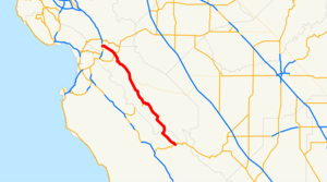
length_mi=74
length_ref= [ [http://www.dot.ca.gov/hq/structur/strmaint/brlog2.htm January 1, 2006 California Log of Bridges on State Highways] ]
length_round=0
direction_a=South
terminus_a=jct|state=CA|SR|198 near Priest Valley
junction=jct|state=CA|SR|146 near Pinnacles jct|state=CA|SR|156 near Hollister
direction_b=North
terminus_b=jct|state=CA|US|101 near Gilroy
previous_type=SR
previous_route=24
next_type=SR
next_route=26
commons=categoryState Route 25 is a
state highway in theU.S. state ofCalifornia between Gilroy and State Route 198. This route is part of theCalifornia Freeway and Expressway System [http://www.leginfo.ca.gov/cgi-bin/displaycode?section=shc&group=00001-01000&file=250-257 CA Codes (shc:250-257)] ] and is eligible for the State Scenic Highway System [http://www.leginfo.ca.gov/cgi-bin/displaycode?section=shc&group=00001-01000&file=260-284 CA Codes (shc:260-284)] ] .Route description
SR 25 (also known as "Bolsa Road" and the "Airline Highway") begins in Priest Valley at State Route 198 in Monterey County. It heads northwest, crossing into San Benito County and passing through the community of Bitterwater. SR 25 provides access to the
Pinnacles National Monument east entrance, running parallel to theSan Andreas Fault [http://pubs.usgs.gov/gip/earthq3/where.html The San Andreas Fault - III. Where Is It?] ] . Running parallel to theDiablo Range , SR 25 passes through the communities of Pacines, Tres Pinos, and the city of Hollister, where it intersects with State Route 156. SR 25 continues northwest, where it ends at U.S. Route 101 in Gilroy to the north.Cite map | publisher=Rand McNally | title=The Road Atlas | year=2009 | page=14 | section=SB4-SD5 ]History
Major intersections
:"Note: Except where prefixed with a letter,
postmile s were measured in 1964, based on the alignment as it existed at that time, and do not necessarily reflect current mileage. The numbers reset at county lines; the start and end postmiles in each county are given in the county column."References
External links
* [http://www.dot.ca.gov/hq/roadinfo/sr25 Caltrans: Route 25 highway conditions]
* [http://www.cahighways.org/025-032.html#025 California Highways: SR 25]
* [http://www.dot.ca.gov/dist05/planning/tcrs/25/index.pdf "Final Transportation Concept Report for State Route 25 in Caltrans Districts 4 and 5"]

Wikimedia Foundation. 2010.