- Interstate 380 (California)
Infobox road
state=CA
type=I
route=380
section=608
maint=Caltrans 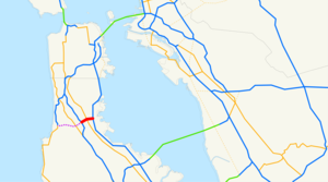
length_mi=1.50
length_round=2
length_ref=cite web|url=http://www.fhwa.dot.gov/reports/routefinder/table2.cfm|title=Route Log and Finder List - Interstate System: Table 2|publisher=FHWA|accessdate=2007-10-04]
established=1964
direction_a=West
terminus_a=jct|state=CA|I|280 in San Bruno
direction_b=East
terminus_b=jct|state=CA|US|101 in South San Francisco
previous_type=SR
previous_route=371
next_type=US
next_route=395Interstate 380 (I-380) is a short 3.3-mile (5.3 km) spur
interstate highway connecting Interstate 280 inSan Bruno, California to U.S. Route 101 near theSan Francisco International Airport (SFO). The highway primarily consists of only three intersections: I-280, El Camino Real (State Route 82), and U.S. 101. However, I-380 never connects to Interstate 80, its parent interstate.I-380 is signed as the Quentin L. Kopp Freeway after a prominent State Senator from
San Mateo County ,California . The road was previously named the Portola Freeway to honor eighteenth century Spanish explorerGaspar de Portolà , whose 1769-70 expedition discoveredSan Francisco Bay from Sweeney Ridge (between San Bruno and Pacifica).This route is part of the
California Freeway and Expressway System [http://www.leginfo.ca.gov/cgi-bin/displaycode?section=shc&group=00001-01000&file=250-257 CA Codes (shc:250-257)] ] .Route description
I-380 begins at a junction with I-280 in San Bruno. This junction is really only partially built, allowing room to build a proposed freeway extension west towards State Route 1 ("see below"). I-380 then travels east through the City of San Bruno, intersecting with State Route 82, El Camino Real, before reaching US 101.
At its terminus at US 101, the mainline lanes of I-380 continue as North Access Road. Meanwhile, the ramps to and from southbound US 101 provide connections to
collector/distributor road s leading directly toSan Francisco International Airport , allowing traffic between the Interstate and the airport to avoid merging with the main lanes of US 101.Original plans
There were plans to extend I-380 all the way to State Route 1 (Cabrillo Highway), but due to the route passing over the
San Andreas Fault and community opposition, the project has yet to come to fruition. The westbound lanes of I-380 branch off to the right at I-280, leaving a very wide, paved space which would carry the freeway extension under I-280 towards SR 1. This space is currently often used as storage space for equipment used in highway maintenance. A pair of unused bridges crossing over the I-280 South to I-380 East offramp remain as evidence.Despite the opposition, Chapter 2, Article 3, Section 608 of the California Streets and Highways Code still legally defines Route 380 as traveling from "Route 1 near Pacifica to Route 280 in San Bruno", [http://law.justia.com/california/codes/shc/300-635.html] and the exit numbers assigned at I-280 go to five instead of one or zero. [http://www.dot.ca.gov/hq/traffops/signtech/calnexus/reports/threeeightywest.htm]
Although recent California Highway Log still propose alternative plans to extend by more peculiar shape, slightly southwest of the I-280/I-380 interchange might make the extension project slightly longer perhaps making the I-380 a bent V-shape. This project is very controversial, and unlikely to come true.
Exit list
:"Note: Except where prefixed with a letter,
postmile s were measured in 1964, based on the alignment as it existed at that time, and do not necessarily reflect current mileage."The entire route is in San Mateo County.References
External links
* [http://www.cahighways.org/371-480.html#380 Interstate 380 @ California Highways]
* [http://www.westcoastroads.com/california/i-380_ca.html Interstate 380 @ WestCoastRoads.com]

Wikimedia Foundation. 2010.