- Interstate 780
-
Interstate 780
Route information Defined by S&HC § 623 Maintained by Caltrans Length: 6.759 mi[1] (10.878 km) History: State highway in 1935; Interstate in 1955; renumbered I-780 in 1973-76 Major junctions West end:  I-80 in Vallejo
East end:  I-680 in Benicia
Highway system Auxiliary route of the Interstate Highway System
Main • Auxiliary • BusinessState highways in California(list • pre-1964)
History • Unconstructed • Deleted • Freeway • Scenic←  I-710
I-710I-805  →
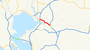
→Interstate 780 (I-780) is an Interstate Highway in the San Francisco Bay Area of the U.S. state of California. It serves to connect Interstate 80 in Vallejo with Interstate 680 just north of the Benicia-Martinez Bridge in Benicia. Originally, this segment was part of I-680 before that Interstate was extended and rerouted to Cordelia. The city-maintained Curtola Parkway continues west from I-80 to State Route 29 in Vallejo.
Contents
Route description
The Interstate 780 state-maintained freeway begins at Lemon Street and Curtola Parkway, quickly crossing underneath I-80 at a cloverleaf interchange. The freeway passes through parts of unincorporated Solano County, then heads southeast along the Benicia State Recreation Area (a marsh). It then bypasses downtown Benicia through the hills to the north. I-780 ends at I-680 at the north end of the Benicia-Martinez Bridge, with I-680 heading south through the East Bay to San Jose.[2]
History
By 1914, a paved county road connected Vallejo and Benicia north of the Carquinez Strait,[3] following the present Maine Street, Benicia Road, Columbus Parkway, and K Street.[4] Although state highways were designated to Benicia in 1910 (Route 7, now I-680) and Vallejo in 1931 (Route 74, now SR 29), this connection was not added until 1935, when Route 74 (an unsigned designation) was extended east from Vallejo to Benicia and north along former Route 7 to Cordelia.[5] (A short spur connecting Vallejo to the Carquinez Bridge was added to Route 74 in 1937.[6]) Route 74 initially entered Benicia on K Street and left on East Fifth Street, making several turns in between.[4][7] Two realignments were built in the 1940s, reducing the number of turns to one, at the corner of L and East Second Streets.[8][9]
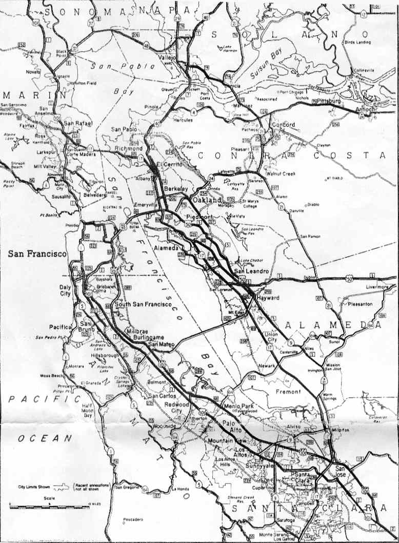
On September 15, 1955, the Bureau of Public Roads approved the Interstate Highway System spurs and connections in urban areas. Among these was a loop around the San Francisco Bay, soon numbered I-280 and I-680. The east half (I-680) incorporated a number of existing legislative routes, including Routes 69, 108, 107, 75, and 74, crossing the Carquinez Strait on the proposed Benicia-Martinez Bridge and ending at I-80 near downtown Vallejo.[10][11] The first piece of this freeway north of the Carquinez Strait was at the I-80 cloverleaf interchange, built in the late 1950s when I-80 was upgraded through Vallejo. This was an extremely short roadway, beginning at Lemon Street, crossing under I-80 and Laurel Street, and ending at Reis Avenue and Cedar Street.[12][13] In about 1960, it was extended east to the old highway (Columbus Parkway) between the cities, and was completed to the new bridge in about 1962, the year the bridge opened.[12]
In the 1964 renumbering, the legislative designation of the completed Vallejo-Benicia freeway was changed from Route 74 to Route 680, reflecting its Interstate designation. The short piece of non-freeway in Vallejo, extending west from I-80 to SR 29, became State Route 141.[14] This route followed Benicia Road and Maine Street, the same alignment the state highway had always taken; it initially connected with I-780 via Lemon Street,[15] but later followed Benicia Road from I-80 north of I-780. In 1975, a proposed (and never constructed) extension west and north to SR 37 east of the Napa River was added to Route 141.[16][17] The route was to be the Waterfront Freeway, scaled down to a boulevard in 1974.[18][19]
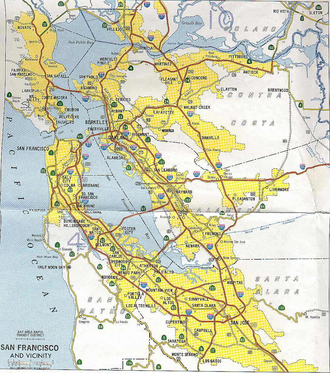
The Federal Highway Administration approved a relocation of I-680 onto the State Route 21 freeway between Benicia and Cordelia in July 1973. To keep the route to Vallejo in the Interstate system, it was renumbered I-780;[11] the corresponding legislative changes were made in 1976.[20] As part of the project to construct a new northbound Benicia-Martinez Bridge, the I-680/I-780 interchange was rebuilt;[when?] the new span opened in August 2007.[21] Route 141 was deleted from the state highway system in 1988,[22] soon after the city of Vallejo constructed Curtola Parkway (partially replacing Maryland Street) just to the south, directly connecting I-780 with a surface road to SR 29.[8]
Exit list
- Note: Except where prefixed with a letter, postmiles were measured in 1964, based on the alignment of Route 680 as it existed at that time, and do not necessarily reflect current mileage.
The entire route is in Solano County.
Location Postmile
[1][12][23]Exit
[24]Destinations Notes Vallejo 7.44 Curtola Parkway – Vallejo Continuation beyond Lemon Street 7.44 Lemon Street At-grade intersection 7.19 1 I-80 – Sacramento, San FranciscoSigned as exits 1A (west) and 1B (east) 7.07 1C Laurel Street, Cedar Street 6.00 1D Glen Cove Road Benicia 4.77 3A Columbus Parkway Serves Benicia State Recreation Area 4.00 3B Military West 2.96 4 Southampton Road 2.02 5 East Second Street – Central Benicia 1.58 6 East Fifth Street 0.68 7 I-680 – Fairfield, Sacramento, Martinez, San JoseEastbound exit and westbound entrance; signed as exits 7A (north) and 7B (south) 1.000 mi = 1.609 km; 1.000 km = 0.621 mi References
- ^ a b California Department of Transportation, State Truck Route List (XLS file), accessed February 2008
- ^ Google Maps street maps and USGS topographic maps, accessed February 2008 via ACME Mapper
- ^ Oakland Tribune, May 15, 1914: "Vallejo to Benicia, paved road"
- ^ a b Official Automobile Blue Book, Volume Eight, 1917, pp. 146, 180
- ^ "An act...relating to State highways.", 1935 chapter 274, p. 959, 281: "Route 74 is from a point on Route 8 near the Napa Y to Cordelia via Vallejo and Benicia."
- ^ "An act to amend section 374 of the Streets and Highways Code, relating to State Highway Route 74.", 1937 chapter 219, p. 515: "Route 74 is from a point on Route 8 near the Napa Y to Cordelia via Vallejo and Benicia, including a connection from Vallejo to Route 7 near the Carquinez Bridge."
- ^ United States Geological Survey, Carquinez Strait (scale 1:62500), 1940
- ^ a b National Bridge Inventory database, 2006: the bridges on East Second Street north of Benicia are dated 1942 and 1944; the pedestrian bridge over Curtola Parkway is dated 1987
- ^ United States Geological Survey, Benicia (scale 1:24000), 1950
- ^ Bureau of Public Roads, General Location of National System of Interstate Highways, 1955: San Francisco
- ^ a b California Department of Transportation, State Highway Routes: Selected Information, 1994 with 1995 revisions, pp. 342, 348
- ^ a b c California Department of Transportation, Log of Bridges on State Highways, July 2007
- ^ United States Geological Survey, Benicia (scale 1:24000), 1959
- ^ "An act...relating to routes on the state highway system.", 1963 chapter 385, p. 1182, 1189: "Route 141 is from Route 80 to Route 29 in Vallejo." "Route 680 is from Route 280 in San Jose to Route 80 in Vallejo passing near Warm Springs, Mission San Jose, Scotts Corners and Sunol, and via Walnut Creek and Benicia."
- ^ Division of Highways, San Francisco and Vicinity, 1963
- ^ California Department of Transportation, San Francisco and Vicinity, 1986
- ^ "An act...relating to state bridges and highways...", 1975 chapter 1078, p. 2638: "Route 141 is the westerly extension of Route 680 from Route 80 to Route 37."
- ^ Vallejo Times Herald, No Freeway for Waterfront Blvd, April 25, 1974
- ^ Vallejo Times Herald, Vallejo Approves Measure to Speed Waterfront Boulevard Construction, August 20, 1974
- ^ "An act to amend...the Streets and Highways Code, relating to state highways.", 1976 chapter 1354, p. 6178: "Route 780 is from Route 680 at Benicia to Route 80 in Vallejo."
- ^ Metropolitan Transportation Commission, Rep. George Miller to Keynote Celebrations for Completion of New Benicia-Martinez Bridge, August 23, 2007
- ^ "An act to add and repeal Sections...of the Government Code, to amend Sections...of, the Streets and Highways Code...", 1988 chapter 106, p. 443
- ^ California Department of Transportation, All Traffic Volumes on CSHS, 2005 and 2006
- ^ California Department of Transportation, California Numbered Exit Uniform System, I-780 Eastbound and I-780 Westbound, accessed February 2008
External links
Auxiliary routes of Interstate 80 California: 180 (former) • 280 • 380 • 480 (former) • 580 • 680 • 780 • 880 • 880 (former) • 980 — Nevada: 580 (unsigned) — Wyoming: 180 — Nebraska: 180 • 280 (former) • 480 • 580 (former) • 680 — Iowa: 280 • 380 • 480 • 680 — Illinois: 180 • 280 — Ohio: 280 • 480 • 680 — Pennsylvania: 180 • 180 (former) • 280 (former) • 380 • 480 (former) • 680 (former) — New Jersey: 280 • 680 (former)
San Francisco Bay Area Freeways Italics denote former routes. Interstates and U.S. Routes I-80 (James Lick / Eastshore / San Francisco Skyway) · US 101 (South Valley / Bayshore / Redwood Highway / Central) · I-238 · I-280 (Junipero Serra / Southern / Sinclair) · I-380 (Kopp) · CA 480 (Embarcadero) · I-580 (MacArthur) · I-680 (Sinclair) · I-780 · I-880 (Nimitz Freeway) · I-980 (Grove-Shafter)
California State Routes CA 1 (Cabrillo Highway) · CA 4 (John Muir Parkway) · CA 12 (Burbank Freeway) · CA 13 (Warren Freeway) · CA 17 (Santa Cruz Highway) · CA 24 (Grove-Shafter Freeway) · CA 29 (Vallejo-Napa Freeway) · CA 37 (Sears Point Freeway/Marine World Parkway) · CA 84 (Dumbarton Bridge) · CA 85 (West Valley Freeway) · CA 87 (Guadalupe Freeway) · CA 92 (San Mateo-Hayward Bridge/Younger Freeway) · CA 160 (Antioch Bridge) · CA 237 (South Bay Freeway) · CA 242 (Concord Freeway)Named interchanges Bridges Golden Gate Bridge · San Francisco – Oakland Bay Bridge · San Mateo – Hayward Bridge · Dumbarton Bridge · Richmond – San Rafael Bridge · Carquinez Bridge · Benicia–Martinez Bridge · Antioch BridgeSee also Interstate Highways in California Signed Unsigned Business Loops Former Categories:- Interstate Highways in California
- San Francisco Bay Area freeways
- Three-digit Interstate Highways
- Interstate 80
- Roads in Solano County, California


Wikimedia Foundation. 2010.