- Interstate 680 (Ohio)
-
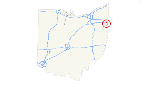
Interstate 680
Route information Maintained by ODOT Length: 16.43 mi[1] (26.44 km) Major junctions South end: 
 I-76 / Ohio Tpk. in North Lima
 US 224 in Boardman

 US 62 / SR 7 in Youngstown
 SR 711 in Youngstown
North end: 
 I-80 / SR 11 near Mineral Ridge
Highway system Auxiliary route of the Interstate Highway System
Main • Auxiliary • BusinessOhio highways
Interstates • U.S. Routes • State Routes←  SR 678
SR 681  →
→Interstate 680 (I-680) in the State of Ohio is the primary Interstate Highway passing through Youngstown, Ohio. Its northern terminus is at Interstate 80 and its southern terminus is at Interstate 76, the Ohio Turnpike.
Contents
Route Description
History
Exit list
The entire route of I-680 is in Mahoning County, Ohio.
Location Mile[2] # Destinations Notes Austintown Township 0.00 I-80 west – ClevelandNorthbound exit and southbound entrance 0.07 1 SR 11 south – CanfieldNorthbound exit and southbound entrance Youngstown 2.06 2 To I-80 east / Meridian Road3.02 3A SR 711 east to I-80 east / M.L. King Boulevard (US 422) – New York, Girard3.74 3B Belle Vista Avenue, Connecticut Avenue Signed as exit 3C northbound 4.29 4B Salt Springs Road Northbound exit and southbound entrance 4.40 4A 
 SR 193 to US 422
5.08 5 Mahoning Avenue, Glenwood Avenue 6.03 6 To US 62 west / SR 7 south / Market Street – Downtown YoungstownSouthbound exit and northbound entrance; signed as exits 6A (US 62/SR 7) and 6B (Downtown) 6.28 6 US 62 east / SR 7 north – HubbardSigned as exit 6B southbound 7.05 7 To US 62 west / SR 7 south / South Avenue – Downtown Youngstown8.18 8 Indianola Avenue, Shirley Road 9.23 9  SR 170 – Struthers
Signed as exits 9A (west) and 9B (east) southbound Boardman Township 11.81 11 US 224 – Canfield, PolandSigned as exits 11A (west) and 11B (east) southbound 14.37 14  SR 164 / Western Reserve Road
Beaver Township 16.43 I-76 east / Ohio Tpk. east – PittsburghSouthbound exit and northbound entrance References
External links
Auxiliary routes of Interstate 80 California: 180 (former) • 280 • 380 • 480 (former) • 580 • 680 • 780 • 880 • 880 (former) • 980 — Nevada: 580 (unsigned) — Wyoming: 180 — Nebraska: 180 • 280 (former) • 480 • 580 (former) • 680 — Iowa: 280 • 380 • 480 • 680 — Illinois: 180 • 280 — Ohio: 280 • 480 • 680 — Pennsylvania: 180 • 180 (former) • 280 (former) • 380 • 480 (former) • 680 (former) — New Jersey: 280 • 680 (former) Categories:
- Three-digit Interstate Highways
- Interstate Highways in Ohio
- Interstate 80
- U.S. Interstate Highway stubs


Wikimedia Foundation. 2010.