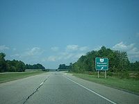
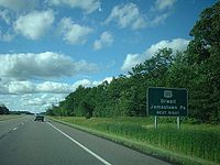
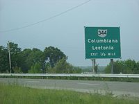
- Ohio State Route 11
-
State Route 11 Lake to River Highway[1] 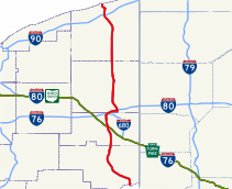
Route information Maintained by ODOT Length: 99.60 mi[2] (160.29 km) Existed: 1969 – present Major junctions South end:  US 30 at East Liverpool
 SR 7 in East Liverpool

 I-80/I-680 near Youngstown

 I-80/SR 711 near Girard
 SR 82 near Niles
 I-90 near Ashtabula
North end:  in Ashtabula
Location Counties: Columbiana, Mahoning, Trumbull, Ashtabula Highway system Ohio highways
Interstates • U.S. Routes • State Routes←  SR 10
SR 10SR 12  →
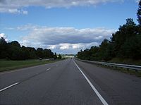
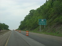
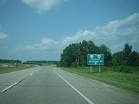
→State Route 11 is a north–south freeway in the eastern portion of the U.S. state of Ohio. Its southern terminus is on U.S. Route 30 in East Liverpool at the West Virginia state line on the Jennings Randolph Bridge over the Ohio River; its northern terminus is at State Route 531 in Ashtabula. The route is concurrent with U.S. Route 30 through East Liverpool and with Interstate 80 near Youngstown. Construction began on State Route 11 in 1968. The first section of the route to be completed, from Canfield to the route's western interchange with Interstate 80, opened in 1969. The entire current route was complete in 1972.
There is a rest area that is unusual in Ashtabula County just north of US 322 on the southbound side of SR 11. Even though SR 11 is a freeway, northbound traffic must cross over (at-grade) the southbound lanes to access the rest area.[3] This is an oddity for a state route that is otherwise up mostly to Interstate Highway standards. It is a holdover from when SR 11 in this area was an expressway. The rest area was closed the summer of 2010 for renovations/upgrades.[citation needed]
Contents
History
- 1969 – Original route certified; Canfield to Austintown completed.[4]
- 1970 – From 5 miles (8.0 km) north of East Liverpool (State Route 7 exit north) to West Point (U.S. Route 30 exit west) completed; Austintown to Interstate 80 west completed.[4]
- 1971 – East Liverpool to 5 miles (8.0 km) north of East Liverpool completed; West Point to State Route 165 completed.[4]
- 1972 – Entire route completed.[4]
- 1976 – State Route 82 to State Route 5 upgrades from 4-lane divided highway to freeway complete.[4]
- 1980 – State Route 5 to State Route 307 upgrades from 4-lane divided highway to freeway complete.[4]
Before 1935
- 1924 – Originally routed from the Indiana state line near New Westville to the West Virginia state line near Gallipolis roughly along the current alignments of U.S. Route 35 from Indiana to Rio Grande, State Route 588 from Rio Grande to Gallipolis, and State Route 7 from Gallipolis to West Virginia[5]
- 1935 – Entire route certified as U.S. Route 35.[4]
Exit list
County Location Mile[2] Exit Destinations Notes Hancock Chester  US 30 east – Pittsburgh
SR 11 begins at the state line; south end of US 30 overlap Ohio River 0.00 Jennings Randolph Bridge Columbiana East Liverpool 0.17  SR 39 east – Midland
South end of SR 39 overlap 1.18 Downtown East Liverpool 1.76 
 SR 7 south / SR 39 west
North end of SR 39 overlap; south end of SR 7 overlap St. Clair Township 4.77  SR 170 north – Calcutta, East Palestine
Madison Township 7.41 
 SR 7 north / SR 267 south – Rogers
North end of SR 7 overlap 11.05 11 
 US 30 west to SR 45 – Lisbon
North end of US 30 overlap Elkrun Township 15.38 15  SR 154 – Lisbon, Rogers
Fairfield Township 23.78 23 
 SR 344 to SR 164 – Leetonia, Columbiana
Mahoning Beaver Township 27.14 27  SR 46 – Columbiana
Canfield Township 34.06 34 
 US 224 to US 62 – Canfield, Poland
Austintown 39.32 39 Mahoning Avenue – Austintown, Youngstown 41.21 41 
 I-80 west / I-680 east – Cleveland, Youngstown
South end of I-80 overlap Trumbull Weathersfield Township 43.08 226 Salt Springs Road Girard 44.29 227  US 422 – Girard, Youngstown
Liberty Township 45.50 228 
 I-80 east / SR 711 – New York, Youngstown
North end of I-80 overlap 48.32 48 Tibbetts-Wick Road –Niles Vienna Township 51.68 51  SR 82 – Warren, Sharon Pa.
54.70 54 King Graves Road – Youngstown-Warren Regional Airport Fowler Township 57.42 57  SR 305 – Cortland, Hartford
Johnston Township 61.47 61  SR 5 – Cortland, Greenville Pa.
Greene Township /
Gustavus Township67.98 68  SR 87 – Kinsman, Jamestown Pa.
Ashtabula Colebrook Township 73.05 73  US 322 – Orwell, Jamestown Pa.
New Lyme Township 77.96 78  US 6 – Andover
Dorset Township 84.56 84  SR 307 – Jefferson, Dorset
Denmark Township 87.97 87  SR 167 – Jefferson
Plymouth Township 92.62 92  SR 46 south (State Road) – Jefferson
94.02 94A  I-90 east Erie Pa.
Exit 228 on Interstate 90. 94.29 94B  I-90 west Cleveland
Exit 228 on Interstate 90. 95.18 95 Seven Hills Road Ashtabula Township 96.51 96  SR 84 (South Ridge Road) – Ashtabula
97.43 97  US 20 (North Ridge Road) – Ashtabula
Ashtabula 98.77 98 East 21st Street 99.60  SR 531 – Ashtabula, North Kingsville
Freeway ends at grade-level intersection 1.000 mi = 1.609 km; 1.000 km = 0.621 mi
Concurrency terminus • Closed/Former • Incomplete access • UnopenedReferences
- ^ Ohio Revised Code 5533.28
- ^ a b Mileages retrieved from Technical Services Straight Line Diagrams unless otherwise noted.
- ^ "Aerial image". USGS via Microsoft Research Maps. http://msrmaps.com/image.aspx?T=1&S=10&Z=17&X=2619&Y=23006&W=2.
- ^ a b c d e f g Route 11 (The Unofficial Ohio State Highways Web Site) by John Simpson
- ^ Explanation of the Ohio State Highway System (The Unofficial Ohio State Highways Web Site) by John Simpson
External links
Categories:- State highways in Ohio
- Freeways in the United States
- Transportation in Columbiana County, Ohio
- Transportation in Mahoning County, Ohio
- Transportation in Trumbull County, Ohio
- Transportation in Ashtabula County, Ohio
Wikimedia Foundation. 2010.


