- Rancho Mirage, California
Infobox Settlement
official_name = Rancho Mirage, California
settlement_type =City
imagesize =
image_caption =
image_
imagesize =
image_caption =
image_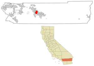
mapsize = 250x200px
map_caption = Location in Riverside County and the state ofCalifornia
mapsize1 =
map_caption1 =
subdivision_type = Country
subdivision_type1 = State
subdivision_type2 = County
subdivision_name =United States
subdivision_name1 =California
subdivision_name2 = Riverside
government_type =
leader_title =
leader_name =
established_date =
area_magnitude =
area_total_km2 = 64
area_total_sq_mi = 24.7
area_land_km2 = 63
area_land_sq_mi = 24.3
area_water_km2 = 1
area_water_sq_mi = 0.4
elevation_ft = 272
elevation_m = 83
population_as_of = 2000
population_footnotes =
population_total = 13249
population_metro =
population_density_km2 = 207
population_density_sq_mi = 536.4
timezone = PST
utc_offset = -8
latd = 33 |latm = 46 |lats = 9 |latNS = N
longd = 116 |longm = 25 |longs = 16 |longEW = W
timezone_DST = PDT
utc_offset_DST = -7
postal_code_type =ZIP code
postal_code = 92270
area_code = 760
blank_name = FIPS code
blank_info = 06-59500
blank1_name = GNIS feature ID
blank1_info = 1661281
footnotes =
website =Rancho Mirage is a city in Riverside County,
California ,United States . The population was 13,249 at the 2000 census, but the seasonal (part-time) population can exceed 20,000. In between Cathedral City and Palm Desert, it is one of the eight cities of theCoachella Valley (Palm Springs area). Rancho Mirage was incorporated in1973 from a merger of Mirage Cove with five unincorporated areas known as the "Cove communities" (Desert, Magnesia, Palmas, Tamarisk and Thunderbird), but had 3,000 permanent residents at the time.Although the first modern settlements date back to the 1920s and 1930s, Rancho Mirage got its claim to fame after World War II. The Annenberg Estate or "Sunnylands" in the area had long been popular with the wealthy and powerful, including
Frank Sinatra ,Bob Hope ,Fred Astaire ,Ginger Rogers ,Mary Martin ,Harry Caray andLloyd Campbell and the Campbells. Several US presidents have vacationed here, andGerald Ford was a frequent visitor who later bought a house. TheBetty Ford Center is located in theEisenhower Medical Center of the town. President Gerald Ford was living in the town at the time of his death.Rancho Mirage boasts of 12
golf course s, also known ascountry club s. The city's first golf resort was theThunderbird Guest Ranch , opened in 1946 for entertainers and business clientele. Other golf resorts are the Tamarisk, Mission Hills, the Springs, Sunrise, KSL Resorts' Rancho Las Palmas hotel (opened in 1979 to replace the Desert Air golf and private airport from 1954-1978), Rancho Mirage, Morningside, Mission Hills North Course,Westin Hotels Mission Hills resort, and Tuscania bySunrise Company opened in 2006.The Agua Caliente Mission Band of
Cahuilla Indians of Palm Springs runs theAgua Caliente Casino on the intersection of Bob Hope Drive and Ramon Road off the I-10 freeway, opened in 2002. The thriving casino is a popular destination for locals, tourists, and gaming enthusiasts, and the tribal board announced in 2006 that Agua Caliente Casino will include a 12-story hotel, two golf courses, tennis courts, a shopping mall, and a convention center-sports arena facility, but will break ground after a federal environmental report. Fact|date=February 2007Rancho Mirage has expanded its economic profile from once regulated to seasonal, resort-based and low-paying, to include more light industry and commerce by the I-10 freeway and
Union Pacific Railroad , high-end retail centers like the River shopping complex, opened in 2005 and built around an artificial lake that resembles a castle's moat.Geography
According to the
United States Census Bureau , the city has a total area of 24.7square mile s (64.0km² ), of which, 24.3 square miles (63.0 km²) of it is land and 0.4 square miles (1.0 km²) of it (1.58%) is water, including the 10-storyDesert Island hotel-golf resort built on an island surrounded by an artificial lake.Demographics
As of the
census GR|2 of 2000, there were 13,249 people, 6,813 households, and 4,074 families residing in the city. Thepopulation density was 544.9 people per square mile (210.4/km²). There were 11,816 housing units at an average density of 486.0/sq mi (187.7/km²). The racial makeup of the city was 92.69% White, 0.89% African American, 0.20% Native American, 1.25% Asian, 0.11% Pacific Islander, 3.62% from other races, and 1.25% from two or more races. Hispanic or Latino of any race were 9.44% of the population.There were 6,813 households out of which 10.5% had children under the age of 18 living with them, 52.9% were married couples living together, 5.2% had a female householder with no husband present, and 40.2% were non-families. 32.3% of all households were made up of individuals and 19.8% had someone living alone who was 65 years of age or older. The average household size was 1.92 and the average family size was 2.36.
In the city the population was spread out with 10.3% under the age of 18, 2.7% from 18 to 24, 14.0% from 25 to 44, 30.0% from 45 to 64, and 43.0% who were 65 years of age or older. The median age was 61 years. For every 100 females there were 91.8 males. For every 100 females age 18 and over, there were 91.1 males. Rancho Mirage owes its legacy to being a retirement haven for
senior citizens since the 1950's. In 2003, the Rancho Mirage was named the best resort town in the world by the London Imperial Traveler Magazine. Contemplation of building a new airport 30 minutes away (theDesert Cities Regional Airport in Coachella) from Rancho Mirage is still in debate.The median
income for a household in the city was $59,826 and the median income for a family was $78,384. Males had a median income of $50,027 versus $36,529 for females. Theper capita income for the city was $58,603. About 4.4% of families and 5.9% of the population were below thepoverty line , including 9.4% of those under age 18 and 3.2% of those age 65 or over.Politics
In the state legislature Rancho Mirage is located in the 37th Senate District, represented by Republican
Jim Battin , and in the 64th Assembly District, represented by RepublicanJohn J. Benoit . Federally, Rancho Mirage is located inCalifornia's 45th congressional district , which has a Cook PVI of R +3 [cite web | title = Will Gerrymandered Districts Stem the Wave of Voter Unrest? | publisher = Campaign Legal Center Blog | url=http://www.clcblog.org/blog_item-85.html | accessdate = 2008-02-10] and is represented by RepublicanMary Bono Mack .Education
The city includes one elementary school (Rancho Mirage Elementary) that is part of the
Palm Springs Unified School District , and the District is building a new high school, with an expected completion date of the 2009-10 school year.References
External links
* [http://www.ci.rancho-mirage.ca.us/ Rancho Mirage homepage]
* [http://www.thedesertsun.com/ The Desert Sun, Coachella Valley Newspaper]
* [http://www.palmspringsusa.com/ Palm Springs Desert Resort Communities Convention & Visitors Authority]
Wikimedia Foundation. 2010.