- Morongo Basin
-
Morongo Basin — Region of the Inland Empire — Twentynine Palms
County San Bernardino The Morongo Basin is located centrally in the southern portion of the state of California in the United States. The Morongo basin is part of the Inland Empire metropolitan statistical area, the 13th largest in the United States. Joshua Tree National Park lies within the basin. The basin stretches approximately from Interstate 10 in the south to the Interstate 40 in the north. Lying within the Mojave Desert, the Morongo Basin is directly east of the city of San Bernardino, California.
Contents
Geography
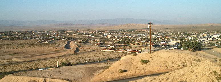
 Joshua Tree National Park lies within the Morongo Basin.
The Morongo Basin is located in the High Desert region of Southern California. The area's elevation can range from 1,950 feet (590 m) in Twentynine Palms, to 3,000 feet (910 m) in Yucca Valley.[citation needed] The terrain in the area is hilly, desert-type land. The Yucca plant (which Yucca Valley is named for) and the Joshua Tree (which Joshua Tree, California is named after) are the most dominant plants in the region. The basin is also home to jackrabbits and coyotes.
Cities and Communities
Over 15,000
Under 15,000
- Morongo Valley
- Landers
- Pioneertown
- Joshua Tree
- Twentynine Palms
- Wonder Valley
Climate
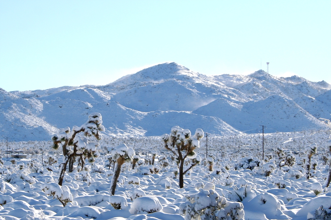
 Yucca Valley after the December 2008 winter storm
The climate is arid desert. Hot, dry summers; cool winters with cold mornings and occasional snow and rain showers. Snow falls in areas above 1,500 feet (460 m) in elevation.
Twenty Nine Palms: Monthly Normal High and Low Temperatures[1] Month Jan Feb Mar Apr May Jun Jul Aug Sep Oct Nov Dec Year Avg high °F 64 69 75 83 91 101 106 104 97 86 72 54 Avg low °F 36 39 43 49 57 65 71 80 64 52 41 35 Local attractions
Joshua Tree National Park attracts most of the tourism to the Morongo Basin. The Desert Christ Park sculpture garden is located in Yucca Valley and attracts visitors from all over the nation.[2]
Education
The Morongo Basin is home to the Morongo Unified School District, which serves all of the cities and communities in the area. Copper Mountain College is the only community college serving the Morongo Basin area, located in Joshua Tree.
References
- ^ Weather.com "Average Weather for Twentynine Palms, CA - Temperature and Precipitation". The Weather Channel. http://www.weather.com/outlook/travel/vacationplanner/wxclimatology/monthly/graph/92277?from=tenDay_bottomnav_vacation&refer= Weather.com. Retrieved 2009-12-06.
- ^ Sachs, Andrea (2004-01-18). "California's Holy Land". Washington Post: pp. P05. http://www.washingtonpost.com/ac2/wp-dyn?pagename=article&node=&contentId=A23359-2004Jan16¬Found=true. Retrieved 2009-12-06.
Categories:- Inland Empire (California)
- Geography of Riverside County, California

Wikimedia Foundation. 2010.