- Montclair, California
-
For the neighborhood in Oakland, California, see Montclair, Oakland, California. For other uses, see Montclair.
City of Montclair — City — Location of Montclair in California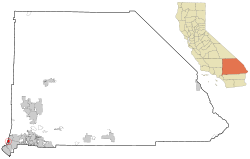
Coordinates: 34°4′15″N 117°41′51″W / 34.07083°N 117.6975°WCoordinates: 34°4′15″N 117°41′51″W / 34.07083°N 117.6975°W Country  United States
State  California
County San Bernardino Incorporated (city) 1956-04-25[1] Government - Mayor Paul M. Eaton[2] - City Manager Edward C. Starr[3] Area[4] - Total 5.517 sq mi (14.289 km2) - Land 5.517 sq mi (14.289 km2) - Water 0 sq mi (0 km2) 0% Elevation 1,066(the city is up and down hill) ft (326 m) Population (2010)[5] - Total 36,664 - Density 6,645.6/sq mi (2,565.9/km2) Time zone PST (UTC-8) - Summer (DST) PDT (UTC-7) ZIP Code 91763[6] Area code(s) 909[7] FIPS code 06-48788 GNIS feature ID 0252320 Website http://www.ci.montclair.ca.us/ Montclair is a city in San Bernardino County, California, United States. The population was 36,664 at the 2010 United States Census.
The current mayor is Paul M. Eaton.
Contents
Description
Montclair is bordered by Pomona to the West, Claremont and Upland to the North, Ontario to the East and Chino to the South and is in San Bernardino County. Montclair is in the Pomona Valley and part of the Inland Empire. The San Bernardino Freeway (10 Fwy.) runs through the northern part of the city.
Geography
Montclair is located at 34°4′15″N 117°41′51″W / 34.07083°N 117.6975°W (34.070960, -117.697531).[8]
According to the United States Census Bureau, the city has a total area of 5.5 square miles (14 km2), all land.
- Montclair is a suburb of Los Angeles ,40 miles (64 km) from downtown L.A.
- San Bernardino 28 miles (45 km)
- Riverside 20 miles (32 km)
Demographics
2010
The 2010 United States Census[9] reported that Montclair had a population of 36,664. The population density was 6,645.4 people per square mile (2,565.8/km²). The racial makeup of Montclair was 19,337 (52.7%) White, 1,908 (5.2%) African American, 434 (1.2%) Native American, 3,425 (9.3%) Asian, 74 (0.2%) Pacific Islander, 9,882 (27.0%) from other races, and 1,604 (4.4%) from two or more races. Hispanic or Latino of any race were 25,744 persons (70.2%).
The Census reported that 36,268 people (98.9% of the population) lived in households, 215 (0.6%) lived in non-institutionalized group quarters, and 181 (0.5%) were institutionalized.
There were 9,523 households, out of which 4,954 (52.0%) had children under the age of 18 living in them, 5,094 (53.5%) were opposite-sex married couples living together, 1,781 (18.7%) had a female householder with no husband present, 901 (9.5%) had a male householder with no wife present. There were 690 (7.2%) unmarried opposite-sex partnerships, and 77 (0.8%) same-sex married couples or partnerships. 1,240 households (13.0%) were made up of individuals and 524 (5.5%) had someone living alone who was 65 years of age or older. The average household size was 3.81. There were 7,776 families (81.7% of all households); the average family size was 4.09.
The population was spread out with 10,756 people (29.3%) under the age of 18, 4,300 people (11.7%) aged 18 to 24, 10,694 people (29.2%) aged 25 to 44, 7,831 people (21.4%) aged 45 to 64, and 3,083 people (8.4%) who were 65 years of age or older. The median age was 30.7 years. For every 100 females there were 99.1 males. For every 100 females age 18 and over, there were 96.8 males.
There were 9,911 housing units at an average density of 1,796.4 per square mile (693.6/km²), of which 5,683 (59.7%) were owner-occupied, and 3,840 (40.3%) were occupied by renters. The homeowner vacancy rate was 2.0%; the rental vacancy rate was 4.6%. 21,076 people (57.5% of the population) lived in owner-occupied housing units and 15,192 people (41.4%) lived in rental housing units.
2000
According to the census[10] of 2000, there were 33,049 people, 8,800 households, and 7,048 families residing in the city. The population density was 6,482.4 inhabitants per square mile (2,502.0/km²). There were 9,066 housing units at an average density of 1,778.3 per square mile (686.4/km²). The racial makeup of the city was 33.8% White, 6.4% African American, 1.0% Native American, 5.1% Asian, 0.3% Pacific Islander, 34.6% from other races, and 4.8% from two or more races. Hispanic or Latino of any race were 73.0% of the population.
There were 8,800 households out of which 47.5% had children under the age of 18 living with them, 46.3% were married couples living together, 26.3% had a female householder with no husband present, and 19.9% were non-families. 15.0% of all households were made up of individuals and 6.3% had someone living alone who was 65 years of age or older. The average household size was 3.7 and the average family size was 4.0.
In the city the population was spread out with 33.1% under the age of 18, 10.7% from 18 to 24, 30.4% from 25 to 44, 17.4% from 45 to 64, and 8.3% who were 65 years of age or older. The median age was 29 years. For every 100 females there were 99.6 males. For every 100 females age 18 and over, there were 96.2 males.
The median income for a household in the city was $30,797, and the median income for a family was $32,815. Males had a median income of $30,902 versus $27,014 for females. The per capita income for the city was $13,556. About 34.2% of families and 27.4% of individuals were below the poverty line.
Politics
In the state legislature Montclair is located in the 32nd Senate District, represented by Democrat Gloria Negrete McLeod, and in the 61st Assembly District, represented by Democrat Norma Torres. Federally, Montclair is located in California's 26th congressional district, which has a Cook PVI of R +4[11] and is represented by Republican David Dreier.
History
The earliest known inhabitants of the area were from the Serrano tribe of Native Americans. The Serrano established their village along a creek named Arroyo de los Alisos, now named San Antonio Creek, which flowed along a route that is now Mills Avenue, the western border of the city.
In 1897, a "Township of Marquette" was founded within the borders of the modern city of Montclair. In 1900, a 1,000 acres (4.0 km2) tract of land was surveyed and named "Monte Vista". A small settlement to the south of Monte Vista was established in 1907 and named "Narod". Throughout the first half of the 20th century, the settlement was largely devoted to citrus orchards. The Monte Vista tract experienced growth in residential development after the Second World War, and the tract was incorporated as the city of Monte Vista on April 25, 1956. Due to conflict with the Post Office, which refused to open an office in Monte Vista due to a name conflict with a community in Northern California, the city was renamed Montclair on April 8, 1958.
References
- ^ "Incorporation Dates of California Cities". http://www.cacities.org/resource_files/20457.IncorpDateLO.doc. Retrieved 2007-01-18.
- ^ "City of Montclair, CA - City Elected Officials". http://www.ci.montclair.ca.us/depts/council/city_elected_officials.asp. Retrieved 2007-01-18.
- ^ "City of Montclair, CA - City Manager". http://www.ci.montclair.ca.us/depts/city_manager/default.asp. Retrieved 2007-01-18.
- ^ U.S. Census
- ^ "Montclair city, California - Fact Sheet - American FactFinder". http://factfinder.census.gov/servlet/ACSSAFFFacts?_event=Search&geo_id=&_geoContext=&_street=&_county=&_cityTown=Montclair%20city&_state=04000US06&_zip=&_lang=en&_sse=on&pctxt=fph&pgsl=010. Retrieved 2007-01-18.
- ^ "USPS - ZIP Code Lookup - Find a ZIP+ 4 Code By City Results". http://zip4.usps.com/zip4/zcl_1_results.jsp?visited=1&pagenumber=0&state=ca&city=Montclair. Retrieved 2007-01-18.
- ^ "Number Administration System - NPA and City/Town Search Results". http://www.nanpa.com/nas/public/npa_city_query_step2.do?method=displayData&cityToNpaModel.stateAbbr=CA&cityToNpaModel.city=Montclair. Retrieved 2007-01-18.
- ^ "US Gazetteer files: 2010, 2000, and 1990". United States Census Bureau. 2011-02-12. http://www.census.gov/geo/www/gazetteer/gazette.html. Retrieved 2011-04-23.
- ^ All data are derived from the United States Census Bureau reports from the 2010 United States Census, and are accessible on-line here. The data on unmarried partnerships and same-sex married couples are from the Census report DEC_10_SF1_PCT15. All other housing and population data are from Census report DEC_10_DP_DPDP1. Both reports are viewable online or downloadable in a zip file containing a comma-delimited data file. The area data, from which densities are calculated, are available on-line here. Percentage totals may not add to 100% due to rounding. The Census Bureau defines families as a household containing one or more people related to the householder by birth, opposite-sex marriage, or adoption. People living in group quarters are tabulated by the Census Bureau as neither owners nor renters. For further details, see the text files accompanying the data files containing the Census reports mentioned above.
- ^ "American FactFinder". United States Census Bureau. http://factfinder.census.gov. Retrieved 2008-01-31.
- ^ "Will Gerrymandered Districts Stem the Wave of Voter Unrest?". Campaign Legal Center Blog. http://www.clcblog.org/blog_item-85.html. Retrieved 2008-02-10.
External links
Inland Empire Counties Major cities Cities and towns
100k-200kCities and towns
25k-100kApple Valley • Cathedral City • Chino • Chino Hills • Colton • Eastvale • Hemet • Hesperia • Highland • Indio •
Jurupa Valley • Lake Elsinore • Menifee • Montclair • Palm Desert • Palm Springs • Perris • Redlands • Rialto • Rubidoux • San Jacinto • Upland • Valle Vista • Wildomar • YucaipaCities and towns
10k-25kAdelanto • Banning • Barstow • Beaumont • Big Bear Lake • Bloomington • Blythe • Cabazon • Canyon Lake • Coachella • Crestline • Desert Hot Springs • Glen Avon • Grand Terrace • La Quinta • Loma Linda • Mira Loma • Norco • Pedley • Rancho Mirage • Twentynine Palms • Yucca ValleyCities and towns
under 10kBig Bear City • Calimesa • Devore • El Cerrito • Oak Glen • Highgrove • Home Gardens • Indian Wells • Joshua Tree • Lake Arrowhead • Mentone • Muscoy • Needles • Romoland • San Antonio Heights • Sunnyslope • Wrightwood • WoodcrestRegions Coachella Valley • Cucamonga Valley • High Desert • Morongo Basin • San Bernardino Valley • San Jacinto Valley • Victor ValleyGreater Los Angeles Area Central city Counties Satellite cities Cities
>200kCities and towns
100k–200kBurbank • Compton • Corona • Costa Mesa • Downey • East Los Angeles • El Monte • Fontana • Fullerton • Garden Grove • Inglewood • Lancaster • Mission Viejo • Moreno Valley • Murrieta • Norwalk • Ontario • Orange • Palmdale • Pasadena • Pomona • Rancho Cucamonga • Santa Clarita • Simi Valley • South Gate • Temecula • Thousand Oaks • Torrance • Ventura • Victorville • West CovinaArea regions Antelope Valley • Conejo Valley • Downtown Los Angeles • East Los Angeles • Gateway Cities • Greater Hollywood • Harbor Area • Inland Empire • Palos Verdes Hills • Pomona Valley • San Bernardino Valley • San Fernando Valley • San Gabriel Valley • Santa Ana Valley • Santa Clarita Valley • South Bay • South Los Angeles • Westside Los AngelesLandforms Los Angeles Basin • Baldwin Hills (range) • Calico Mountains • Catalina Island • Channel Islands • Coachella Valley • High Desert—Mojave Desert • Low Desert—Colorado Desert • San Fernando Valley • San Bernardino Mountains • San Gabriel Mountains • Santa Ana Mountains • Santa Monica Mountains • Santa Susana Mountains • Verdugo MountainsBodies of water Los Angeles River • Aliso Creek • Arroyo Seco • Ballona Creek • Bell Creek • Big Bear Lake • Coyote Creek • Lake Arrowhead • Lake Perris • Lake Piru • Malibu Creek • Pacific Ocean • Pyramid Lake • Rio Hondo • San Gabriel River • San Juan Creek • San Pedro Bay • Santa Ana River • Santa Clara River • Santa Margarita River • Santa Monica BayCategories:- Cities in San Bernardino County, California
- Populated places in California with Hispanic majority populations
- Incorporated cities and towns in California


Wikimedia Foundation. 2010.