- Del Rosa, San Bernardino, California
-
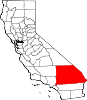
Del Rosa, San Bernardino, California — Neighborhood community — Location of Del Rosa in California

Coordinates: 34°08′48″N 117°14′37″W / 34.14667°N 117.24361°WCoordinates: 34°08′48″N 117°14′37″W / 34.14667°N 117.24361°W Country United States State California City San Bernardino Elevation[1] 1,291 ft (393 m) Time zone PST (UTC-8) – Summer (DST) PDT (UTC-7) [2] Del Rosa is a neighborhood community in the city of San Bernardino, California. [3]
Geography
Del Rosa is located 2 miles (3.2 km) east of downtown San Bernardino in San Bernardino County, California.[4] The coordinates are 34.853N, -117.13W, and the elevation is 1,321 feet, and it is in the Pacific Time Zone (UTC-8, UTC-7 in the summer).
Climate
Del Rosa has a Continental Mediterranean climate, found only in the San Bernardino Foothills, which are rare in the United States. It experiences chilly winters and hot summers.
References
- ^ U.S. Geological Survey Geographic Names Information System: Del Rosa, California. Retrieved on 2008-07-10.
- ^ "Del Rosa CA". ZIP Code Lookup. http://www.zipinfo.com/cgi-local/zipsrch.exe?cnty=cnty&ac=ac&zip=Del+Rosa&Go=Go. Retrieved 2008-07-10.
- ^ http://california.hometownlocator.com/ca/san-bernardino/del-rosa.cfm All about Del Rosa on california hometownlocator
- ^ http://www.mapquest.com/maps?city=Del+Rosa&state=CA Map of Del Rosa
City of San Bernardino Topics Neighborhoods Tourism Arrowhead Springs Resort • Arrowhead Credit Union Park • Carousel Mall • California Theatre • Fiscalini Field • Inland CenterHigher education (non-profit) Municipalities and communities of San Bernardino County, California Cities and towns Adelanto | Apple Valley | Barstow | Big Bear Lake | Chino | Chino Hills | Colton | Fontana | Grand Terrace | Hesperia | Highland | Loma Linda | Montclair | Needles | Ontario | Rancho Cucamonga | Redlands | Rialto | San Bernardino | Twentynine Palms | Upland | Victorville | Yucaipa | Yucca Valley
CDPs Baker | Big Bear City | Big River | Bloomington | Bluewater | Crestline | Fort Irwin | Homestead Valley | Joshua Tree | Lake Arrowhead | Lenwood | Lucerne Valley | Lytle Creek | Mentone | Morongo Valley | Mountain View Acres | Muscoy | Oak Glen | Oak Hills | Phelan | Piñon Hills | Running Springs | San Antonio Heights | Searles Valley | Silver Lakes | Spring Valley Lake | Wrightwood
Unincorporated
communitiesAmboy | Angelus Oaks | Argus | Arrowbear Lake | Baldy Mesa | Bell Mountain | Blue Jay | Bryn Mawr | Cadiz | Cedar Glen | Cedarpines Park | Cima | Crafton | Crest Park | Daggett | Declezville | Del Rosa | Devore | Earp | El Mirage | Essex | Fawnskin | Fenner | Forest Falls | Goffs | Green Valley Lake | Guasti | Halloran Springs | Havasu Lake | Helendale | Hinkley | Hodge | Ivanpah | Johnson Valley | Landers | Ludlow | Mojave Heights | Mount Baldy | Mountain Pass | Nebo Center | Newberry Springs | Nipton | Oro Grande | Patton | Parker Dam | Parker Junction | Pioneer Point | Pioneertown | Red Mountain | Rimforest | Skyforest | Sugarloaf | Sunfair | Sunfair Heights | Trona | Twentynine Palms Base | Twin Peaks | Vidal | Vidal Junction | Yermo | Zzyzx
Indian
reservationsGhost towns Categories:- Neighborhoods in San Bernardino, California
- San Bernardino County, California geography stubs


Wikimedia Foundation. 2010.