- Murrieta Hot Springs, California
-
Murrieta Hot Springs, California — District of Murrieta — Location in Riverside County and the state of California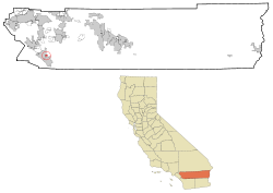
Coordinates: 33°33′46″N 117°9′20″W / 33.56278°N 117.15556°WCoordinates: 33°33′46″N 117°9′20″W / 33.56278°N 117.15556°W Country United States State California County Riverside Area – Total 1.3 sq mi (3.3 km2) – Land 1.3 sq mi (3.3 km2) – Water 0 sq mi (0 km2) Elevation 1,194 ft (364 m) Population (2000) – Total 2,948 – Density 2,267.7/sq mi (893.3/km2) Time zone PST (UTC-8) – Summer (DST) PDT (UTC-7) ZIP codes 92562-92564 Area code(s) 951 FIPS code 06-50090 GNIS feature ID 1661080 Murrieta Hot Springs is a former census-designated place (CDP) in Riverside County, California, United States. The population was 2,948 at the 2000 census. It was annexed by the city of Murrieta on July 1, 2002.[1]
French Valley Airport (FAA designator: F70), near Murrieta Hot Springs, has a 4,600-foot (1,400 m) runway.
Contents
Geography
Murrieta Hot Springs is located at 33°33′46″N 117°9′20″W / 33.56278°N 117.15556°W (33.562880, -117.155610)[2].
According to the United States Census Bureau, the CDP has a total area of 1.3 square miles (3.3 km²), of which, 1.3 square miles (3.3 km²) of it is land and 0.78% is water.
Demographics
As of the census[3] of 2000, there were 2,948 people, 1,340 households, and 769 families residing in the CDP. The population density was 2,306.6 people per square mile (889.2/km²). There were 1,457 housing units at an average density of 1,140.0 per square mile (439.5/km²). The racial makeup of the CDP was 91.86% White, 1.56% African American, 0.64% Native American, 1.93% Asian, 0.03% Pacific Islander, 1.70% from other races, and 2.27% from two or more races. Hispanic or Latino of any race were 8.11% of the population.
There were 1,340 households out of which 8.4% had children under the age of 18 living with them, 49.8% were married couples living together, 6.3% had a female householder with no husband present, and 42.6% were non-families. 38.5% of all households were made up of individuals and 28.2% had someone living alone who was 65 years of age or older. The average household size was 1.85 and the average family size was 2.37.
In the CDP the population was spread out with 8.1% under the age of 18, 16.0% from 18 to 24, 13.0% from 25 to 44, 19.4% from 45 to 64, and 43.6% who were 65 years of age or older. The median age was 61 years. For every 100 females there were 82.4 males. For every 100 females age 18 and over, there were 81.2 males.
The median income for a household in the CDP was $27,311, and the median income for a family was $35,102. Males had a median income of $39,081 versus $28,594 for females. The per capita income for the CDP was $19,991. About 5.2% of families and 6.3% of the population were below the poverty line, including none of those under age 18 and 6.5% of those age 65 or over.
Politics
In the state legislature Murrieta Hot Springs is located in the 36th Senate District, represented by Republican Dennis Hollingsworth, and in the 66th Assembly District, represented by Republican Kevin Jeffries. Federally, Murrieta Hot Springs is located in California's 49th congressional district, which has a Cook PVI of R +10[4] and is represented by Republican Darrell Issa.
References
- ^ http://www3.murrieta.org/agendas/council/MG27382/AS27385/AS27396/AI27507/DO27619/1.PDF
- ^ "US Gazetteer files: 2010, 2000, and 1990". United States Census Bureau. 2011-02-12. http://www.census.gov/geo/www/gazetteer/gazette.html. Retrieved 2011-04-23.
- ^ "American FactFinder". United States Census Bureau. http://factfinder.census.gov. Retrieved 2008-01-31.
- ^ "Will Gerrymandered Districts Stem the Wave of Voter Unrest?". Campaign Legal Center Blog. http://www.clcblog.org/blog_item-85.html. Retrieved 2008-02-10.
Categories:- Former census-designated places in California
- Populated places in Riverside County, California

Wikimedia Foundation. 2010.