- Alamo, California
Infobox Settlement
official_name = Alamo, California
settlement_type = CDP
imagesize =
image_caption =
image_
imagesize =
image_caption =
image_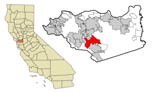
mapsize = 250x200px
map_caption = Location in Contra Costa County and the state ofCalifornia
mapsize1 =
map_caption1 =
subdivision_type = Country
subdivision_type1 = State
subdivision_type2 = County
subdivision_name =United States
subdivision_name1 =California
subdivision_name2 = Contra Costa
government_type =
leader_title = Mayor
leader_name =
leader_title1 = Senate
leader_name1 =Tom Torlakson (D)
leader_title2 = Assembly
leader_name2 = Guy Houston (R)
leader_title3 = U. S. Congress
leader_name3 =Ellen Tauscher (D)
established_date =
area_magnitude =
area_total_km2 = 53.3
area_total_sq_mi = 20.6
area_land_km2 = 53.3
area_land_sq_mi = 20.6
area_water_km2 = 0
area_water_sq_mi = 0
elevation_ft = 259
elevation_m = 79
population_as_of = 2000
population_footnotes =
population_total = 15626
population_metro =
population_density_km2 = 293.2
population_density_sq_mi = 758.5
timezone = PST
utc_offset = -8
latd = 37 |latm = 51 |lats = 32 |latNS = N
longd = 122 |longm = 1 |longs = 58 |longEW = W
timezone_DST = PDT
utc_offset_DST = -7
postal_code_type =ZIP code
postal_code = 94507
area_code = 925
blank_name = FIPS code
blank_info = 06-00618
blank1_name = GNIS feature ID
blank1_info = 1657900
footnotes =
website =Alamo is an
unincorporated community andcensus-designated place (CDP) in Contra Costa County,California , in theUnited States . It is located in the East Bay region of theSan Francisco Bay Area . As of the 2000 census, the population was 15,626.Alamo was named by the Spanish in 1850 for the
poplar tree s that linedSan Ramon Creek .As an unincorporated community, Alamo does not have a government of its own. Police services are provided by the Contra Costa County Office of the Sheriff. Fire and EMS services are provided by the
San Ramon Valley Fire Protection District .In August, 2007, a group of citizens launched a new initiative to incorporate the community, the latest in a series of attempts that go back to the early 1960s or before. [http://www.alamoinc.org/] Previous failed Alamo incorporation efforts always included parts of other nearby unincorporated areas: Alamo-Danville (1964) [http://www.museumsrv.org/srvm_History_HomeRuleII.html] and Alamo-Danville-San Ramon (1976). [http://www.museumsrv.org/srvm_History_HomeRuleII.html] [http://www.museumsrv.org/srvm_history_HomeRuleIII.html]
In 1985, Alamo almost had a chance to vote on its own incorporation, but Contra Costa County turned down the effort. Alamo has never had an opportunity to vote on incorporation by itself. [http://www.yourmonthlypaper.com/pdfs/AT/2007/AT2007.Oct.full.pdf]
History
People have lived in this area for over 5,000 years. The
Tatcan Indians , aBay Miwok tribe closely connected to the Saclans of Walnut Creek, lived in Alamo in the eighteenth century.After
Mission San José was founded in 1797, its grazing area stretched throughout theSan Ramon Valley . A Mexican land grant, called the San Ramon Rancho, was deeded toMariano Castro and his uncle Bartolo Pacheco in 1833. It covered today's Danville and Alamo. Castro owned the northern half, which included Alamo.In 1843 much of the Alamo, Las Trampas and Tice Valley areas were granted to brothers Inocencio and Jose Romero. It was called Rancho El Sobrante de San Ramon. Because of missing title papers, the brothers lost their ranch in American courts in 1857.
Pioneers Mary Ann and John Jones traveled through Alamo in 1847. she provided the earliest English description of the area in her diary. Her husband stopped the wagon saying, "Mary, look! Did you ever see anything so beautiful?" She wrote later:
"On every side, the valley and surrounding hills were covered with thick, velvety clover, and with wild oats standing waist high waving and rippling in the summer breeze, like the bosom of a lake."
Fact|date=April 2008The Jones family returned to Alamo in 1851, after California had become a state. John became the first postmaster in 1852 and she applied her considerable energies to schooling children and beginning a Cumberland
Presbyterian church. Other early Alamo founders included David Glass, George Engelmeyer, Silas and Susanna Stone, Captain Wall, Joshua Bollinger, and James Foster.The area was named Alamo, which means "poplar" or "
cottonwood " in Spanish. Because of its location and fine weather, Alamo grew quickly. An early road from the redwoods near Moraga ran throughTice Valley to Alamo, since Americans preferredredwood for building materials instead of Mexicanadobe brick .The Hemme, Bollinger, Jones and Stone ranches began by grazing cattle and raising wheat and other grains. In 1891 the Hemme train station was placed near today's Hemme Avenue; later it was re-named the Alamo station.
Eventually orchards and vineyards spread across the area. Almonds, walnuts, pears, grapes and other fruit thrived in the mild climate. In 1873, Alamo pioneer Myron Hall grafted Persian cuttings to native
walnut trees and helped start the prosperous walnut industry in Contra Costa County. This "mother tree" was tended for over 100 years.The Alamo post office is the oldest continuously operated one in the valley. It was always an important community gathering place. According to longtime postmistress Bertha Linhares, when the mail was expected the men
sat in the post office-store in the winter … the women went into our sitting room and visited with my mother … We always heard all the news and troubles of the Alamo residents.
Fact|date=April 2008Her father, brother and sister were also postmasters from 1905 to 1960.
On September 5th, 2008, a 4.0 earthquake occurred in the area of Round Hill North.
Alamo in modern times
During
World War II , an Alamo air watch tower was built by the community. Volunteers watched forJapan ese war planes round the clock from 1942 to 1945. San Ramon Valley's population totaled 2,126 at that time.The Alamo Improvement Association (AIA) began in 1953. For 50 years its purpose has been to advance and improve the welfare of properties in Alamo and to preserve the established character of Alamo as an agricultural and semi-rural residential area.
After the war, hundreds and then thousands of new people arrived. Round Hill Country Club opened in 1960 on land that had belonged to the Mott sisters and Grover Squire. In 1964, Interstate 680 was completed through San Ramon Valley, which encouraged even more growth.
Rapid valley growth fueled controversies. In the mid-'60s, one controversy focused on the philosophy of a new, visionary superintendent of the San Ramon Unified School District, Richard L. Foster. Also, debates about the pace of development led to several votes on cityhood, spearheaded by residents who wanted more local control. An Alamo-Danville incorporation election in 1964 lost 2,086 to 1,958 with "loss of identity for Alamo" a main concern.
Today Alamo is an enclave of green with many one-half acre lot homes between Walnut Creek and Danville. Its population in 2000 was 15,625. It is governed by the County Board of Supervisors, with the AIA and several active county service areas advising on police, landscape and park issues.
St. Louis Cardinals managerTony La Russa resides in Alamo.Olympic gold medalist
Kristi Yamaguchi resides in Alamo.Geography
Alamo is located in Contra Costa County. Adjoining towns and cities are Walnut Creek to the north, Danville, Dublin, and San Ramon to the south, and Diablo plus Blackhawk to the southeast.
Interstate 680 serves as the main means of transport out of the town.
According to the
United States Census Bureau , the CDP has a total area of 20.6 square miles (53.3 km²), all of it land.Parks
Andrew H. Young Park is located at the corner of Danville Blvd. & Jackson Way. This park is named in memory of Alamo resident Andrew H. Young who was instrumental in preserving the charm of Alamo.
Livorna Park is at the corner of Livorna Road & Miranda Avenue. It features a large open-air gazebo, a sand volleyball court, a multi-use sports court, playground structures, large play areas, drinking fountain, restrooms and off-street parking.
Alamo School Sports Field located at 100 Wilson Road offers soccer and baseball fields, batting cages, and a picnic and
barbecue area.Hap Magee Ranch Park is on the Alamo-Danville Border on La Gonda Way. This park has several historic structures. There are picnic facilities, children's water play area, a large meadow with a spectacular heritage oak, dog parks and off-street parking. The park sits near the intersection of the Iron Horse Trail and the Las Trampas to Mt. Diablo Regional Trail.
Las Trampas Regional Wilderness is a convert|5342|acre|km2|sing=on|adj=on park [ [http://www.ebparks.org/parks/las_trampas Las Trampas Regional Wilderness | East Bay Regional Parks ] ] located to the immediate southwest of the town. The wilderness contains numerous plant and animal communities, including forested hillsides and riparian woods. The park is also host to several secluded waterfalls, many of which are difficult to reach.
chools
*
Rancho Romero Elementary School
*Alamo School
*Stone Valley Middle School Demographics
As of the
census GR|2 of 2000, there were 15,626 people, 5,406 households, and 4,573 families residing in the CDP. Thepopulation density was 759.5 people per square mile (293.3/km²). There were 5,497 housing units at an average density of 267.2/sq mi (103.2/km²). The racial makeup of the CDP was 90.36% White, 0.47% Black or African American, 0.22% Native American, 6.10% Asian, 0.12% Pacific Islander, 0.64% from other races, and 2.21% from two or more races. 3.94% of the population were Hispanic or Latino of any race.There were 5,406 households out of which 40.1% had children under the age of 18 living with them, 78.1% were married couples living together, 4.4% had a female householder with no husband present, and 15.4% were non-families. 11.5% of all households were made up of individuals and 5.2% had someone living alone who was 65 years of age or older. The average household size was 2.87 and the average family size was 3.10.
In the CDP the population was spread out with 27.6% under the age of 18, 3.9% from 18 to 24, 21.9% from 25 to 44, 34.4% from 45 to 64, and 12.2% who were 65 years of age or older. The median age was 43 years. For every 100 females there were 98.5 males. For every 100 females age 18 and over, there were 94.3 males.
The median income for a household in the CDP was $137,105, and the median income for a family was $147,643. Males had a median income of $100,000 versus $59,205 for females. The
per capita income for the CDP was $65,705. About 2.6% of families and 3.8% of the population were below thepoverty line , including 5.2% of those under age 18 and 5.3% of those age 65 or over.ESRI lists more recent statistics (2006). The racial makeup of Alamo is listed as 87.7% White, 0.6% Black, 0.2% American Indian, 7.7% Asian or Pacific Islander, 0.8% Other. 3.0% were two or more races, with 5.4% being of Hispanic origin.
The Median Household Income was listed as $169,918 and the average home value was listed as $1,163,436.
Source [http://www.esri.com/software/bao/index.html ESRI Business Analyst Online]
Population history of Alamo CDP from the
U.S. Census Bureau *1960 – 1,791
*1970 – 14,059 (Z)
*1980 – 8,505
*1990 – 12,277
*2000 – 15,186(Z): Area reported as Alamo-Danville during the 1970 census. "(The separate communities of Alamo and Danville were not returned separately by the census.)"
Source: [http://www.census.gov U.S. Census Bureau] .
External links
* [http://www.alamore.org Alamo Community Web Site]
References
Wikimedia Foundation. 2010.