- Moss Beach, California
-
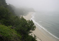
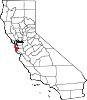
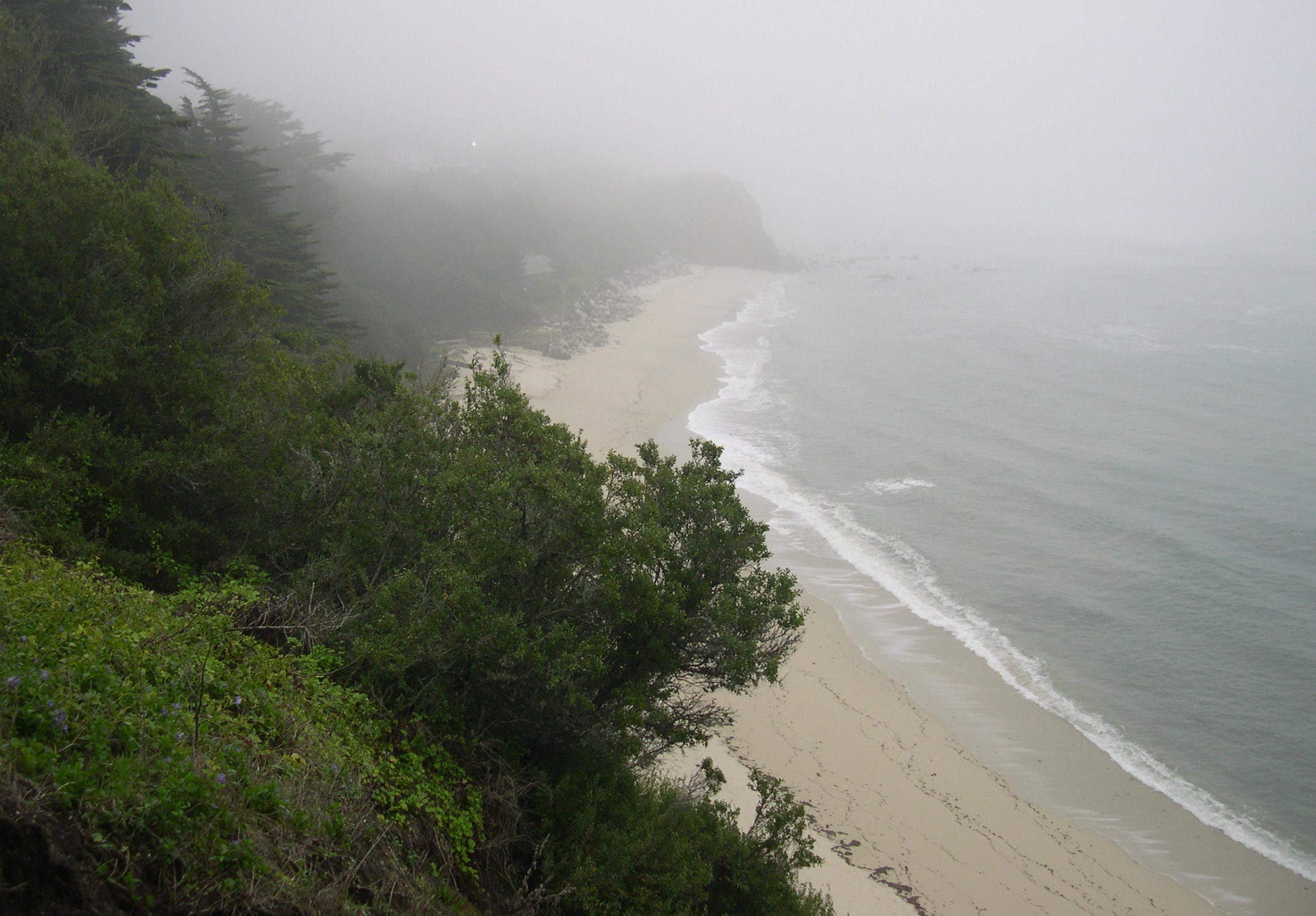
Moss Beach — census-designated place — Moss Beach shoreline, April 2007. Part of the Franciscan formation is visible near the beach Location in San Mateo County and the state of California
Coordinates: 37°31′31″N 122°30′46″W / 37.52528°N 122.51278°WCoordinates: 37°31′31″N 122°30′46″W / 37.52528°N 122.51278°W Country  United States
State  California
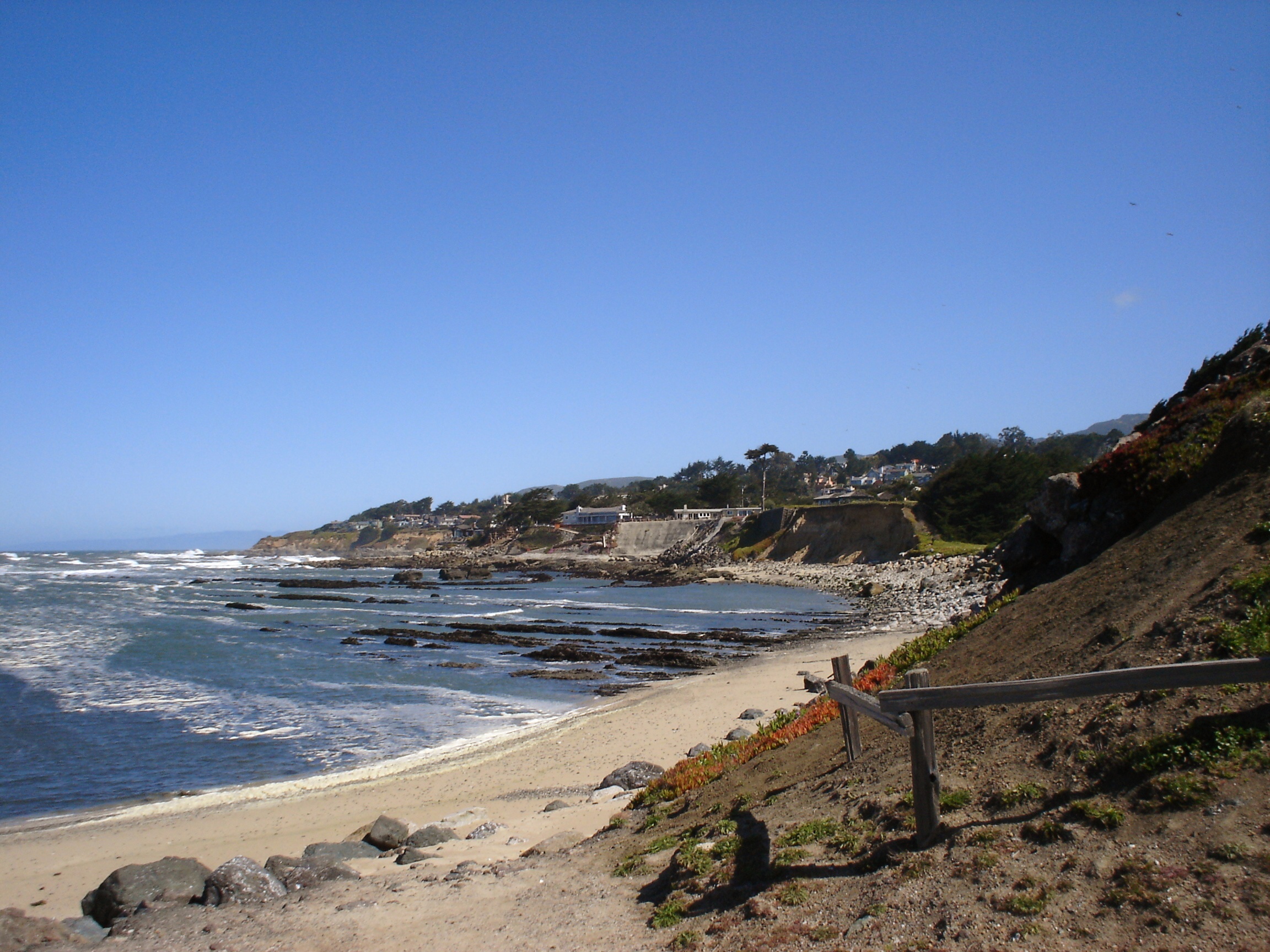
County San Mateo Area[1] - Total 2.254 sq mi (5.837 km2) - Land 2.254 sq mi (5.837 km2) - Water 0 sq mi (0 km2) 0% Elevation 62 ft (19 m) Population (2010) - Total 3,103 - Density 1,376.7/sq mi (531.6/km2) Time zone PST (UTC-8) - Summer (DST) PDT (UTC-7) ZIP code 94038 Area code(s) 650 FIPS code 06-49446 GNIS feature ID 1659183 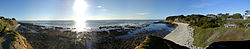 A panorama of Moss Beach
Moss Beach is a coastal census-designated place in San Mateo County, California, with a year 2010 census population of 3,103. Located in Moss Beach are the Fitzgerald Marine Reserve, a marine sanctuary; the Half Moon Bay Airport, the historic Moss Beach Distillery and the Seal Cove Inn, a destination lodging property. Moss Beach is naturally a foggy, drippy microclimate that gives one a sense of isolation from nearby cosmopolitan regions, and assures that summer temperatures are generally mild.
Contents
Geography
Moss Beach is situated at 37°31'31" North latitude, 122°30'46" West (37.525240, -122.512811)[2], approximately 20 miles (32 km) south of San Francisco and 50 miles (80 km) north of Santa Cruz, California. Nearby towns include Montara to the north, El Granada, Princeton-by-the-Sea, and Half Moon Bay to the south. According to the United States Census Bureau, the CDP has a total area of 2.3 square miles (6.0 km2), all land.
Demographics
2010
The 2010 United States Census[3] reported that Moss Beach had a population of 3,103. The population density was 1,377.0 people per square mile (531.6/km²). The racial makeup of Moss Beach was 2,280 (73.5%) White, 25 (0.8%) African American, 43 (1.4%) Native American, 118 (3.8%) Asian, 9 (0.3%) Pacific Islander, 494 (15.9%) from other races, and 134 (4.3%) from two or more races. Hispanic or Latino of any race were 903 persons (29.1%).
The Census reported that 2,983 people (96.1% of the population) lived in households, 12 (0.4%) lived in non-institutionalized group quarters, and 108 (3.5%) were institutionalized.
There were 1,062 households, out of which 359 (33.8%) had children under the age of 18 living in them, 607 (57.2%) were opposite-sex married couples living together, 85 (8.0%) had a female householder with no husband present, 41 (3.9%) had a male householder with no wife present. There were 49 (4.6%) unmarried opposite-sex partnerships, and 14 (1.3%) same-sex married couples or partnerships. 251 households (23.6%) were made up of individuals and 68 (6.4%) had someone living alone who was 65 years of age or older. The average household size was 2.81. There were 733 families (69.0% of all households); the average family size was 3.35.
The population was spread out with 710 people (22.9%) under the age of 18, 234 people (7.5%) aged 18 to 24, 699 people (22.5%) aged 25 to 44, 1,097 people (35.4%) aged 45 to 64, and 363 people (11.7%) who were 65 years of age or older. The median age was 43.2 years. For every 100 females there were 99.9 males. For every 100 females age 18 and over, there were 97.6 males.
There were 1,154 housing units at an average density of 512.1 per square mile (197.7/km²), of which 868 (81.7%) were owner-occupied, and 194 (18.3%) were occupied by renters. The homeowner vacancy rate was 1.2%; the rental vacancy rate was 6.3%. 2,448 people (78.9% of the population) lived in owner-occupied housing units and 535 people (17.2%) lived in rental housing units.
2000
As of the 2000 census[4] there were 1953 people, 740 households, and 526 families residing in the Census Designated Place (CDP). The population density was 1,092.5 people per square mile (421.3/km²). There were 771 housing units at an average density of 431.3 per square mile (166.3/km²). The racial makeup in 2010 was 62.9% non-Hispanic White, 0.7% non-Hispanic African American, 0.2% Native American, 3.8% Asian, 0.3% Pacific Islander, 0.3% from other races, and 2.6% from two or more races. 29.1% of the population were Hispanic.
There are 740 households, of which 36.1% have children under the age of 18, 58.9% are married couples , 7.4% had a female householder with no husband present, and 28.9% were non-families. 18.4% of all households were made up of individuals and 2.6% had someone living alone who was 65 years of age or older. The average household size was 2.64 and average family size is 2.98.
The median household income is $91,992, and the median family income is $99,307. Males had a median income of $81,619 versus $41,411 for females. The per capita income is $41,283. 4.3% of the population and 3.2% of families were below the poverty line. 2.2% of those under the age of 18 and 2.7% of those over 64 are below the poverty line.
Politics
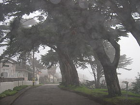 Typical Moss Beach Streetscape
In the state legislature Moss Beach is located in the 8th Senate District, represented by Democrat Leland Yee, and in the 19th Assembly District, represented by Democrat Gene Mullin. Federally, Moss Beach is located in California's 12th congressional district, which has a Cook PVI of D +22[5] and is currently held by Jackie Speier.
Noteworthy features
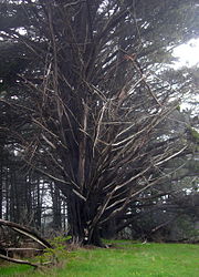
Due to the marine air currents off of the Pacific Ocean, Moss Beach experiences above average fog levels, but also superior ambient air quality. Note the everpresent fog in the photo above (the circular blotches are not a special effect, but a result of the droplets formed on the camera lens cover). Situated along the coast of Moss Beach is the Fitzgerald Marine Reserve, a California designated area of Special Biological Significance. The reserve boasts a scenic blufftop trail through ancient cypress groves overlooking the Pacific Ocean, historically interesting tidepools and a variety of significant marine animals and pelagic birds. The unique outcroppings along the beach are part of the Franciscan formation, a favorite of local geologists.[6]
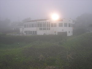 Moss Beach Distillery photographed standing at cliffedge
An occurrence of the rare plant Hickman's potentilla, Potentilla hickmanii was observed by E.C. Suttliffe in 1933[7] in the vicinity of the mouth of San Vicente Creek within Moss Beach. This colony was not further documented for decades, but another colony was discovered[8] toward the end of the 20th century north of Moss Beach. The plant was listed as an endangered species by the United States government in 1998, and had previously been listed as California endangered in 1973.
Off State Route 1, one finds the famous restaurant Moss Beach Distillery, an architecturally and historically noteworthy building located upon a cliff with ocean views. This present day restaurant has its roots in bootleg liquor during Prohibition. This building is an official California Point of Historical Interest [1] and includes its own ghost (the Blue Lady) which has been featured in a number of ghost hunting programs including Unsolved Mysteries.Sci-Fi's Ghost Hunters recently found their paranormal claims to be fraudulent by revealing that owners of the distillery have created various hoaxes simulating paranormal activity. Noted travel author Karen Brown operates the Seal Cove Inn adjacent to the reserve.
References
- ^ U.S. Census
- ^ "US Gazetteer files: 2010, 2000, and 1990". United States Census Bureau. 2011-02-12. http://www.census.gov/geo/www/gazetteer/gazette.html. Retrieved 2011-04-23.
- ^ All data are derived from the United States Census Bureau reports from the 2010 United States Census, and are accessible on-line here. The data on unmarried partnerships and same-sex married couples are from the Census report DEC_10_SF1_PCT15. All other housing and population data are from Census report DEC_10_DP_DPDP1. Both reports are viewable online or downloadable in a zip file containing a comma-delimited data file. The area data, from which densities are calculated, are available on-line here. Percentage totals may not add to 100% due to rounding. The Census Bureau defines families as a household containing one or more people related to the householder by birth, opposite-sex marriage, or adoption. People living in group quarters are tabulated by the Census Bureau as neither owners nor renters. For further details, see the text files accompanying the data files containing the Census reports mentioned above.
- ^ "American FactFinder". United States Census Bureau. http://factfinder.census.gov. Retrieved 2008-01-31.
- ^ "Will Gerrymandered Districts Stem the Wave of Voter Unrest?". Campaign Legal Center Blog. http://www.clcblog.org/blog_item-85.html. Retrieved 2008-02-10.
- ^ College of San Mateo Geology Department
- ^ U.S. Federal Register: August 2, 1995 Volume 60, Number 148, Pages 39326-39337
- ^ Fremontia 21(1):25-29 (1993) and 24(1):3-11 (1996)
External links
- Coastsider, Coastal San Mateo County news site
- Moss Beach Distillery homepage
- Fitzgerald Marine Reserve
Municipalities and communities of San Mateo County, California County seat: Redwood City Cities and towns Atherton | Belmont | Brisbane | Burlingame | Colma | Daly City | East Palo Alto | Foster City | Half Moon Bay | Hillsborough | Menlo Park | Millbrae | Pacifica | Portola Valley | Redwood City | San Bruno | San Carlos | San Mateo | South San Francisco | Woodside
CDPs Broadmoor | El Granada | Emerald Lake Hills | Highlands-Baywood Park | Ladera | La Honda | Loma Mar | Montara | Moss Beach | North Fair Oaks | Pescadero | West Menlo Park
Unincorporated
communitiesGhost towns Categories:- Populated coastal places in California
- Census-designated places in San Mateo County, California


![[1]](http://www.hauntedbay.com/images/features/MBDsign500x490.jpg)
Wikimedia Foundation. 2010.