- East Richmond Heights, California
Infobox Settlement
official_name = East Richmond Heights, California
settlement_type = CDP
imagesize =
image_caption =
image_
imagesize =
image_caption =
image_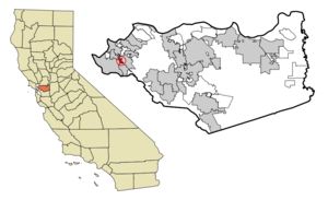
mapsize = 250x200px
map_caption = Location in Contra Costa County and the state ofCalifornia
mapsize1 =
map_caption1 =
subdivision_type = Country
subdivision_type1 = State
subdivision_type2 = County
subdivision_name =United States
subdivision_name1 =California
subdivision_name2 = Contra Costa
government_type =
leader_title = N/A
leader_name =
leader_title1 = Senate
leader_name1 =Tom Torlakson (D)
leader_title2 = Assembly
leader_name2 =Loni Hancock (D)
leader_title3 = U. S. Congress
leader_name3 = George Miller (D)
established_date =
area_magnitude =
area_total_km2 = 1.5
area_total_sq_mi = 0.6
area_land_km2 = 1.5
area_land_sq_mi = 0.6
area_water_km2 = 0
area_water_sq_mi = 0
elevation_ft = 387
elevation_m = 118
population_as_of = 2000
population_footnotes =
population_total = 3357
population_metro =
population_density_km2 = 2238
population_density_sq_mi = 5595
timezone = PST
utc_offset = -8
latd = 37 |latm = 56 |lats = 39 |latNS = N
longd = 122 |longm = 18 |longs = 50 |longEW = W
timezone_DST = PDT
utc_offset_DST = -7
postal_code_type =ZIP code
postal_code = 94805
area_code = 510
blank_name = FIPS code
blank_info = 06-21061
blank1_name = GNIS feature ID
blank1_info = 1867019
footnotes =
website =East Richmond Heights is an unincorporated community (or
census-designated place ) in western Contra Costa County,California ,United States . The community is sometimes referred to as Richmond View, especially in the context of real estate advertisements. Its population was 3,357 at the 2000 census.Geography
Situated at the north end of the
Berkeley Hills , East Richmond Heights overlooks the northern part of theSan Francisco Bay . This small residential community is bordered by El Cerrito to the south, Richmond to the west, andWildcat Canyon Regional Park to the north and east.Arlington Boulevard, a major north-south thoroughfare traversing the Berkeley and El Cerrito portions of the
Berkeley Hills , runs through the center of the community and terminates at its north end. Interstate 80 is located about one-half mile to the west, and provides access to the community via its Solano and McBryde Avenue exits.According to the
United States Census Bureau , the community has a total area of 0.6square mile s (1.5km² ), all of it land.Geographic Location
Centre = East Richmond Heights
North = El Sobrante
Northeast =
East = Wildcat Canyon Regional Park
Southeast =
South = El Cerrito
Southwest =
West = Richmond
Northwest = San PabloGovernment and municipal services
Police services for the community are provided by the of the Contra Costa County Sheriff's Office Bay Station [http://www.cocosheriff.org/patrol/station_houses/bay/bay.htm] . Traffic services are handled by the California Highway Patrol. The county contracts with the nearby city of Richmond to provide fire, refuse collection, and curbside recycling services [http://www.co.contra-costa.ca.us/depart/cd/recycle/options/v6078.htm] for the community.
Mail delivered to addresses within the community are addressed to the city of Richmond. Nonetheless, these addresses are not located within the city of Richmond.
Education
East Richmond Heights is home to two schools: Adams Middle School and Mira Vista Elementary School. Both are part of the
West Contra Costa Unified School District .Demographics
As of the
census GR|2 of 2000, there were 3,357 people, 1,377 households, and 885 families residing in the CDP. Thepopulation density was 5,930.4 people per square mile (2,273.9/km²). There were 1,406 housing units at an average density of 2,483.8/sq mi (952.4/km²). The racial makeup of the CDP was 64.13% White, 13.94% Black or African American, 0.66% Native American, 10.72% Asian, 0.54% Pacific Islander, 3.90% from other races, and 6.11% from two or more races. 10.66% of the aforementioned population groups are also Hispanic or Latino of any race.There were 1,377 households out of which 23.6% had children under the age of 18 living with them, 48.7% were married couples living together, 11.4% had a female householder with no husband present, and 35.7% were non-families. 26.9% of all households were made up of individuals and 10.1% had someone living alone who was 65 years of age or older. The average household size was 2.43 and the average family size was 2.94.
In the CDP the population was spread out with 19.0% under the age of 18, 5.6% from 18 to 24, 29.8% from 25 to 44, 31.0% from 45 to 64, and 14.5% who were 65 years of age or older. The median age was 42 years. For every 100 females there were 94.5 males. For every 100 females age 18 and over, there were 91.2 males.
The median income for a household in the CDP was $57,500, and the median income for a family was $60,588. Males had a median income of $46,771 versus $43,190 for females. The
per capita income for the CDP was $27,873. About 1.3% of families and 5.3% of the population were below thepoverty line , including 6.4% of those under age 18 and 3.9% of those age 65 or over.The percentages of languages spoke by residents in East Richmond Heights are 87.80% English, 8.59% Spanish, 1.54% Vietnamese, 1.37 Cantonese, 0.68% Japanese. [http://www.mla.org/map_data_results&state_id=6&county_id=&mode=place&zip=&place_id=21061&cty_id=&ll=&a=&ea=&order=r East Richmond Heights entry] , MLA Data Center, retrieved October 21, 2007]
Notes
External links
Wikimedia Foundation. 2010.