- Quetzaltenango
Infobox Settlement
official_name = Quetzaltenango
other_name =
native_name = Xelajú
nickname = Xela
motto = "La ciudad de la Estrella"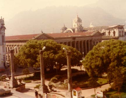
imagesize =250px
image_caption = Buildings flanking the Central Park Square in Quetzaltenango
flag_size =
image_
seal_size =
image_shield =
shield_size =
image_blank_emblem =
blank_emblem_type =
blank_emblem_size =
mapsize =
map_caption =
mapsize1 =
map_caption1 =
image_dot_
dot_mapsize =
dot_map_caption =
dot_x = |dot_y =
pushpin_
pushpin_label_position =bottom
pushpin_map_caption =Location in Guatemala
subdivision_type = Country
subdivision_name =
subdivision_type1 = Department
subdivision_name1 = Quetzaltenango
subdivision_type2 =
subdivision_name2 =
subdivision_type3 =
subdivision_name3 =
subdivision_type4 =
subdivision_name4 =
government_footnotes =
government_type =
leader_title =Mayor
leader_name = Mito Barrientos,Grand National Alliance
established_title = Foundation
established_date =May 7 ,1524
leader_title1 =
leader_name1 =
leader_title2 =
leader_name2 =
leader_title3 =
leader_name3 =
leader_title4 =
leader_name4 =
established_title =
established_date =
established_title2 =
established_date2 =
established_title3 =
established_date3 =
area_magnitude =
unit_pref =Imperial
area_footnotes =
area_total_km2 = 120
area_land_km2 =
area_water_km2 =
area_total_sq_mi =
area_land_sq_mi =
area_water_sq_mi =
area_water_percent =
area_urban_km2 =
area_urban_sq_mi =
area_metro_km2 =
area_metro_sq_mi =
area_blank1_title =
area_blank1_km2 =
area_blank1_sq_mi =
population_as_of =
population_footnotes =
population_note =
population_total =
population_density_km2 =
population_density_sq_mi =
population_metro =
population_density_metro_km2 =
population_density_metro_sq_mi =
population_urban =
population_density_urban_km2 =
population_density_urban_sq_mi =
population_blank1_title =Ethnicities
population_blank1 =K'iche' , Mam, Ladino
population_blank2_title =Religions
population_blank2 =Roman Catholicism ,Evangelicalism , Maya
population_density_blank1_km2 =
population_density_blank1_sq_mi =
timezone =
utc_offset =
timezone_DST =
utc_offset_DST =
latd=14 |latm=50 |lats=45 |latNS=N
longd=91|longm=31 |longs=08 |longEW=W
elevation_footnotes =
elevation_m = 2333
elevation_ft =
postal_code_type =
postal_code =
area_code =
blank_name =
blank_info =
blank1_name =
blank1_info =
website =
[http://www.xelaenlinea.com/ City Official Site] (Needs verification)
footnotes =Quetzaltenango is the second most populous city of
Guatemala , afterGuatemala City . It is both the capital ofQuetzaltenango Department and the municipal seat of Quetzaltenangomunicipality .It has an estimated
population of 300,000. The population is about 50% indigenous orAmerindian , 47%Mestizo orladino , and 3% European. Quetzaltenango is located in a mountain valley at an altitude of 2,333 meters (7,655 ft) above sea level.History
In
Pre-Columbian times Quetzaltenango was a city of the MamMaya people called Xelajú, although by the time of theSpanish Conquest it had become part of theK'iche' Kingdom of Q'umarkaj . The name may be derived from "Xe laju' noj" meaning "under ten mountains". The city was said to have already been over 300 years old when the Spanish first arrived. With the help of his allies,Conquistador Pedro de Alvarado defeated and killed the Maya rulerTecún Umán here. When Alvarado conquered the city for Spain in the 1520s, he called it by theNahuatl name used by his Central Mexican Indian allies, "Quetzaltenango", generally considered to mean "the place of the quetzal bird" (although see note on etymology below). Quetzaltenango became the city's official name in colonial times. However, many people (especially, but not only, the indigenous population) continue to call the city "Xelajú" (pronounced shay-lah-WHO) or more commonly Xela for short, and some proudly, but unofficially, consider it the "capital of the Mayas".From 1838 to 1840 Quetzaltenango was capital of the state of Los Altos, one of the states or provinces of the
Federal Republic of Central America . As the union broke up, the army of Guatemala underRafael Carrera conquered Quetzaltenango making it again part of Guatemala.In the 19th century,
coffee was introduced as a major crop in the area and the economy of Xela prospered. Much fineBelle Époque architecture can still be found in the city.In 1930 the only electric railway in Guatemala, the Ferrocarril de los Altos, was inaugurated, which was later destroyed by mudslides and finally demolished in 1933. It had been built by
AEG andKrupp and it consisted of 14 waggons. The track connected Quetzaltenango with San felipeRetalhuleu . The people of Quetzaltenango are still very proud of their railway. A railway museum has been established in the city centre.Recently, the city has become a popular destination for foreign students studying the
Spanish language orMayan language .Climate
There are two main seasons in Quetzaltenango: the rainy season, which generally runs from May through mid-November, and the dry season, which runs from December until May. During the rainy season, rain falls consistently, usually in the afternoons. During the dry season, the city frequently will not receive a single drop of rain for months on end. From December through February, the days are quite warm, but the temperature drops dramatically during the nights.
Sports
Quetzaltenango is home to the
Club Xelajú MC soccer team. The team competes atEstadio Mario Camposeco which has a capacity of 13,500 and is the most successful non-capital team in theLiga Nacional de Guatemala .Fact|date=July 2007It is also home to a rugby team in the newly formed Guatemalan rugby union and has enjoyed moderate success in the competition.Etymology
The original
Nahuatl name was quetzaltenānco, "quetzal-tenān-co", of which a likely etymology is:
* ["erected"] - ["wall"] - ["place"] roughly translated as "place where there are erected walls"or
* ["Quetzal bird"] - ["fortification"] - ["in the"] roughly translated as "In the Quetzal fortress"(Note that while "quetzalli" also means "feather of the quetzal bird" it also means "something erected", and it became associated with quetzal feathers because those were the kind of feathers that Mesoamerican rulers used in their "erect" head-dresses.)
Transportation
*The city boasts a system of micro-buses for quick and cheap movement within the city. A micro-bus is essentially a large van stuffed with seats. Micro-buses are numbered based on the route they take through the city (i.e. "ruta 7").
*There is no efficient urban mass transport system in the city. The sole public mean of transport within the city is the bus or system of micro-buses.
*Transportation to other cities in the country is provided by bus.
*Quetzaltenango Airport is currently undergoing ampliation.Transportes Aereos Guatemaltecos offers charter flights toGuatemala City .ons and daughters of the city
*
Jacobo Arbenz Guzmán ,President of Guatemala , born in Xelajú in 1913.
* ComandanteRolando Morán , one of the guerrilla leaders inGuatemalan Civil War , born there in 1929.
*Carlos Navarrete Cáceres (b. 1931), anthropologist and writer
*Juan Arturo Gutierrez , founder of international fast-food chainPollo Campero
*Paco Pérez , Author ofLuna de Xelajú
*Manuel Estrada Cabrera ,Dictator Consular representations
*Consulate of
Spain [http://www.lexureditorial.com/boe/0710/18083.htm]
*Consulate ofEl Salvador [http://www.comunidades.gob.sv/comunidades/comunidades.nsf/pages/CenANoti9-06-181203]
*Consulate ofItaly [http://www.embajada-consulado.com/consulados-de-italia_en_guatemala.html]
*Consulate ofMexico [http://www.sre.gob.mx/acerca/directorio/consulados/quetzaltenango.htm]References
In popular culture
In the ninth episode of the eighth season of The Simpsons, "El Viaje Misterioso de Nuestro Jomer (
The Mysterious Voyage of Our Homer )", Homer eats an "Insanity Pepper" and goes on a mysterious voyage, which features surreal animation to depict the elaborate hallucination. Following this he questions his relationship with Marge and goes on a journey to find his soulmate. The episode was written by Ken Keeler, directed by Jim Reardon and features Johnny Cash in a guest spot as the "Space Coyote".At the cook-off, Homer demonstrates an extraordinary ability to withstand hot foods, until he falls victim to Chief Wiggum's chili which is spiked with "The Merciless Peppers of Quetzaltenango - Grown deep in the jungle primeval by the inmates of a Guatemalan insane asylum."ee also
*
* [http://wikitravel.org/en/Quetzaltenango] Wikitravel article
* [http://www.languageselnahal.com] El Nahual: 100% Non-profit language center located in Xela
* [http://www.xelapages.com] Xela Pages: Information about Xela - Spanish School, Hotels, Volunteering...etc
* [Manos De Colores: Educacion para desarollo social http://www.languageselnahual.com]
*Luna de Xelajú
* [http://www.bomberosxela.org/ 5ª. Compañía Bomberos Voluntarios]
*Club Xelajú MC , pro football team
*History of Guatemala
*History of Central America
*Tromsø ,Norway , Quetzaltenango'sTwin City
*Livermore, California , also Quetzaltenango'sTwin City
*Quetzaltenango Map [http://larutamayaonline.com/map.html]

Wikimedia Foundation. 2010.