- Olema, California
-
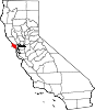
Olema — Unincorporated community — 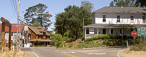 Location in California
 Olema
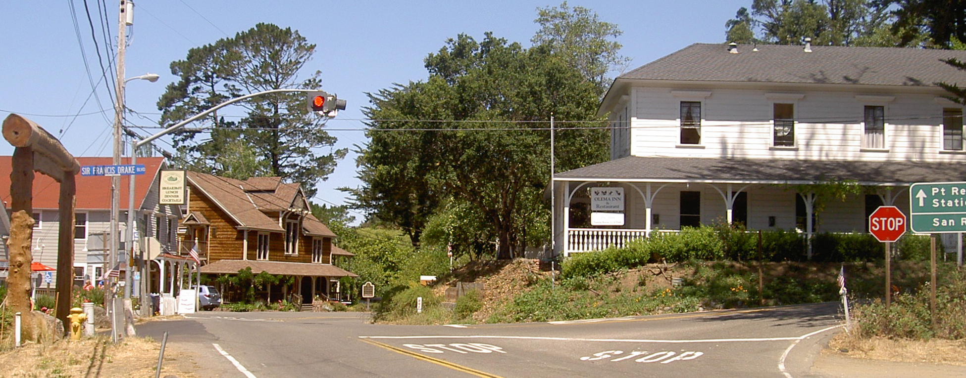
OlemaCoordinates: 38°02′27″N 122°47′17″W / 38.04083°N 122.78806°WCoordinates: 38°02′27″N 122°47′17″W / 38.04083°N 122.78806°W Country United States State California County Marin County Elevation[1] 69 ft (21 m) ZIP code 94950 Area code(s) 415 FIPS code 06-53630 GNIS feature ID 1659297 Olema is an unincorporated community in Marin County, California.[1] It is located on Olema Creek 2.25 miles (3.6 km) south-southeast of Point Reyes Station,[2] at an elevation of 69 feet (21 m).[1]
Olema is along State Route 1 and on the eastern edge of the Point Reyes Peninsula in the western part of Marin County. "Olema" is Miwok for coyote.[2]
Olema was once thought to be the epicenter of the 1906 San Francisco earthquake due to the huge fault rifts still visible via a nearby hiking path. There are historical references to this in and around the town, including at shops and restaurants. However, more recent evidence suggests that a location near Daly City is more likely the epicenter.[3]
Olema also was the title subject of the late-1960s country-rock song, "Hippie from Olema", The Youngbloods' rejoinder to Merle Haggard's "Okie from Muskogee".
The Olema post office opened in 1859, closed in 1860, and re-opened in 1864.[2]
Attractions
Olema has a few shops, two restaurants, a lodge, and several bed and breakfasts. Nearby is a large campground and also a large retreat for the Vedanta Society (a branch of Hinduism). Also, the Bear Valley Visitor Center, a quarter-mile from town on Bear Valley Road, provides a standard starting point for a visit to the Point Reyes National Seashore. Inside the center are exhibits and books for sale. Outside are picnic tables, a Morgan horse ranch, and Kule Loklo, a reconstructed Miwok village.[4]
Politics
In the state legislature Olema is located in the 3rd Senate District and in the 6th Assembly District. Federally, Olema is in California's 6th congressional district.
 Towns of rural western Marin County. Olema is in yellow.
References
- ^ a b c U.S. Geological Survey Geographic Names Information System: Olema, California
- ^ a b c Durham, David L. (1998). California's Geographic Names: A Gazetteer of Historic and Modern Names of the State. Quill Driver Books. p. 675. ISBN 9781884995149.
- ^ 1906 San Francisco earthquake
- ^ History of Olema
West Marin Villages Bolinas • Dillon Beach • Dogtown • Inverness • Inverness Park • Lagunitas • Marshall • Millerton • Muir Beach • Nicasio • Olema • Pt. Reyes Station • Stinson Beach • TomalesGeography Audubon Canyon • Bolinas Lagoon • Bolinas Ridge • Bonita Channel • Centissima Reef • Copper Mine Gulch • Drakes Bay • Drakes Estero • Gull Rock • Pirates Cove • Point Reyes • Kent Island • Nicasio Creek • Nicasio Reservoir • Olema Valley • Rancho Punta de los Reyes Sobrante • Rodeo Lagoon • Rodeo Cove • Tennessee Cove • Tomales Bay • Sears RockParks and transportation Municipalities and communities of Marin County, California Cities and towns Belvedere | Corte Madera | Fairfax | Larkspur | Mill Valley | Novato | Ross | San Anselmo | San Rafael | Sausalito | Tiburon
CDPs Alto | Black Point-Green Point | Bolinas | Dillon Beach | Inverness | Kentfield | Lagunitas-Forest Knolls | Lucas Valley-Marinwood | Marin City | Muir Beach | Nicasio | Point Reyes Station | San Geronimo | Santa Venetia | Sleepy Hollow | Stinson Beach | Strawberry | Tamalpais-Homestead Valley | Tomales | Woodacre
Unincorporated
communitiesAlmonte | Bel Marin Keys | Belvedere Island | Bivalve | Black Point | Blakes Landing | Burdell | California Park | Cerro | Chapman | Cypress Grove | Dewitt | Dogtown | El Campo | Fallon | Five Brooks | Forest Knolls | Gallinas | Greenbrae | Hamlet | Harbor Point | Homestead Valley | Ignacio | Inverness Park | Jewell | Kent Woodlands | Lagunitas | Lairds Landing | Las Gallinas | Los Ranchitos | Lucas Valley | Manzanita | Marconi | Marinwood | Marshall | McDonald | McNears Beach | Meadowsweet | Millerton | Murray Park | Nicks Cove | Ocean Roar | Old Town | Olema | Paradise Cay | Reed | Reynolds | Sacramento Landing | Saint Vincent | San Antonio | San Quentin | Seahaven | Shafter | Strawberry Manor | Tamalpais Valley | Tamalpais Valley Junction | Tocaloma | Vincent Landing | Waldo
Ghost towns Categories:- West Marin
- Populated places in Marin County, California
- Unincorporated communities in California


Wikimedia Foundation. 2010.