- Marshall, California
-
- For the place formerly with this name in El Dorado County, see Lotus, California.
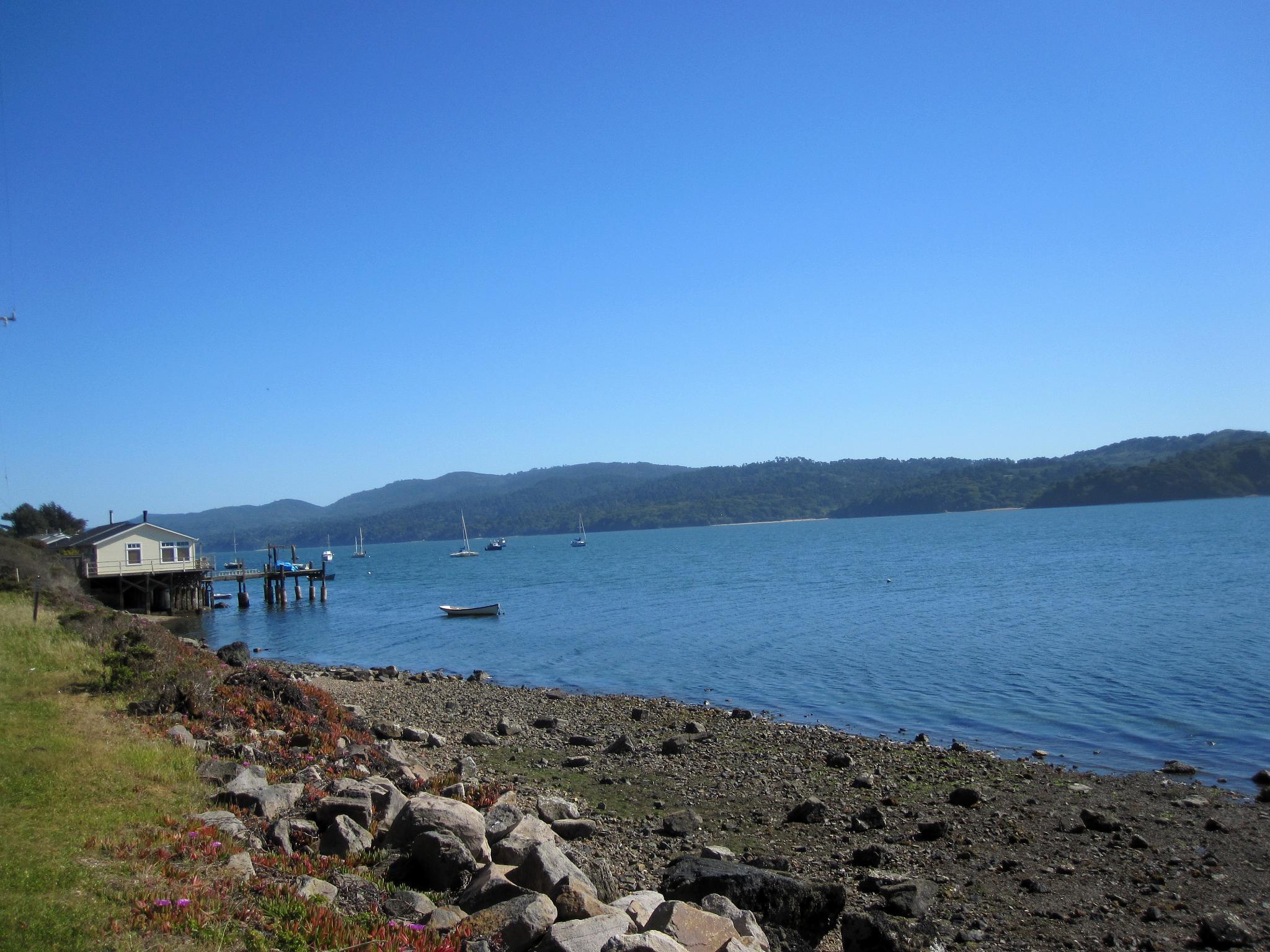
Marshall — Unincorporated community — Marshall shoreline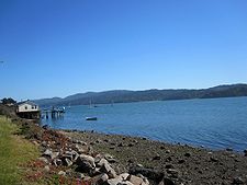 Towns of rural western Marin County. Marshall is in red.
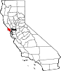
 Location within the state of California
 Marshall
Coordinates: 38°9′38″N 122°53′39″W / 38.16056°N 122.89417°WCoordinates: 38°9′38″N 122°53′39″W / 38.16056°N 122.89417°W Country United States State California County Marin Region West Marin Government – County Board District 4
Steve Kinsey– State Senate Mark Leno (D) – Assembly Jared Huffman (D) – U. S. Congress Lynn Woolsey (D) Elevation[1] 23 ft (7 m) Population – Total 400 Time zone PST (UTC-8) – Summer (DST) PDT (UTC-7) ZIP code 94940 Area code(s) 415 FIPS code 06-46058 GNIS feature ID 228136 Marshall is an unincorporated community in Marin County, California.[1] It is located on the northeast shore of Tomales Bay 6 miles (9.7 km) south of Tomales,[2] at an elevation of 23 feet (7 m).[1]
Marshall is located on the east shore of Tomales Bay. It has a population of about 400,[3] although it has long claimed a population of 50 and touted this as the sum of the elevation (15 feet or 4.5 m above sea level) and the speed limit of 35 miles per hour (56 km/h).[4] It is located approximately 15 miles (24 km) south east of Bodega Bay, on State Route 1. Its ZIP code is 94940.
The town is named after four brothers called Marshall, who set up a dairying industry there in the 1850s. Starting in the 1870s, Marshall was a stop on the North Pacific Coast Railroad connecting Cazadero to the Sausalito ferry.
There is still some dairying in the area, but nowadays the town's major commerce is in oysters and clams, for which it is a center. It also acts as a center for tourists visiting Tomales Bay and the neighbouring Point Reyes Peninsula.
References
- ^ a b c U.S. Geological Survey Geographic Names Information System: Marshall
- ^ Durham, David L. (1998). California's Geographic Names: A Gazetteer of Historic and Modern Names of the State. Quill Driver Books. p. 660. ISBN 9781884995149.
- ^ http://factfinder.census.gov/servlet/SAFFPopulation?_event=ChangeGeoContext&geo_id=86000US94940&_geoContext=&_street=&_county=&_cityTown=&_state=04000US06&_zip=94940&_lang=en&_sse=on&ActiveGeoDiv=&_useEV=&pctxt=fph&pgsl=010&_submenuId=population_0&ds_name=null&_ci_nbr=null&qr_name=null®=null%3Anull&_keyword=&_industry= factfinder.census.gov
- ^ http://www.inn-california.com/sanfrancisco/Marin/Tomales/marshall.html inn.california.com
External links
- Information and photographs about Marshall on the Beach California website
- Information about Marshall on the West Marin Chamber of Commerce website
West Marin Villages Bolinas • Dillon Beach • Dogtown • Inverness • Inverness Park • Lagunitas • Marshall • Millerton • Muir Beach • Nicasio • Olema • Pt. Reyes Station • Stinson Beach • TomalesGeography Audubon Canyon • Bolinas Lagoon • Bolinas Ridge • Bonita Channel • Centissima Reef • Copper Mine Gulch • Drakes Bay • Drakes Estero • Gull Rock • Pirates Cove • Point Reyes • Kent Island • Nicasio Creek • Nicasio Reservoir • Olema Valley • Rancho Punta de los Reyes Sobrante • Rodeo Lagoon • Rodeo Cove • Tennessee Cove • Tomales Bay • Sears RockParks and transportation Municipalities and communities of Marin County, California Cities and towns Belvedere | Corte Madera | Fairfax | Larkspur | Mill Valley | Novato | Ross | San Anselmo | San Rafael | Sausalito | Tiburon
CDPs Alto | Black Point-Green Point | Bolinas | Dillon Beach | Inverness | Kentfield | Lagunitas-Forest Knolls | Lucas Valley-Marinwood | Marin City | Muir Beach | Nicasio | Point Reyes Station | San Geronimo | Santa Venetia | Sleepy Hollow | Stinson Beach | Strawberry | Tamalpais-Homestead Valley | Tomales | Woodacre
Unincorporated
communitiesAlmonte | Bel Marin Keys | Belvedere Island | Bivalve | Black Point | Blakes Landing | Burdell | California Park | Cerro | Chapman | Cypress Grove | Dewitt | Dogtown | El Campo | Fallon | Five Brooks | Forest Knolls | Gallinas | Greenbrae | Hamlet | Harbor Point | Homestead Valley | Ignacio | Inverness Park | Jewell | Kent Woodlands | Lagunitas | Lairds Landing | Las Gallinas | Los Ranchitos | Lucas Valley | Manzanita | Marconi | Marinwood | Marshall | McDonald | McNears Beach | Meadowsweet | Millerton | Murray Park | Nicks Cove | Ocean Roar | Old Town | Olema | Paradise Cay | Reed | Reynolds | Sacramento Landing | Saint Vincent | San Antonio | San Quentin | Seahaven | Shafter | Strawberry Manor | Tamalpais Valley | Tamalpais Valley Junction | Tocaloma | Vincent Landing | Waldo
Ghost towns Categories:- West Marin
- Populated coastal places in California
- Populated places in Marin County, California
- Unincorporated communities in California
- Marin County, California geography stubs


Wikimedia Foundation. 2010.