California State Route 246
- California State Route 246
Infobox road
state=CA
type=SR
route=246
section=546
maint=Caltrans
length_mi=26
length_round=0
length_ref= [ [http://www.dot.ca.gov/hq/structur/strmaint/brlog2.htm January 1, 2006 California Log of Bridges on State Highways] ]
direction_a=West
terminus_a=Lompoc west limit
direction_b=East
terminus_b=jct|state=CA|SR|154 at Santa Ynez
previous_type=SR
previous_route=245
next_type=SR
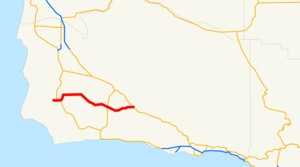
next_route=247State Route 246 is a convert|26|mi|km|sing=on route that runs from Lompoc to Santa Ynez and cuts through the Santa Barbara Wine Country.
Route description
Most of the road is two lanes wide, with the exception of the route through the cities of Lompoc and Buellton. This is the primary route from U.S. Route 101 to Solvang, one of the Santa Ynez Valley's biggest tourist attractions. It follows the Santa Ynez River for most of its length. The portion of the route through Lompoc is called "Ocean Avenue" and is co-signed with State Route 1. SR 246 was defined all the way to Surf, but in 1984, it was truncated to SR 1 (known as "H Street" in Lompoc.) SR 246 then leads northeast out of Lompoc along a relatively flat two-lane road until reaching Buellton, where it widens upon its intersection with US 101. It narrows once again to two lanes through Solvang and Santa Ynez before reaching its eastern terminus at the junction with State Route 154. This is the main alternate route from Northern Santa Barbara County to the South Coast, and it is a pleasant drive for those who want to avoid the heavy truck traffic on US 101.
In 1933, this was part of State Route 150, and in 1963, it was part of State Route 154.
References
Wikimedia Foundation.
2010.
Look at other dictionaries:
California State Route 1 — For other uses, see CA1 (disambiguation). State Route 1 Route information … Wikipedia
California State Route 150 — Infobox road state=CA type=SR route=150 section=450 maint=Caltrans length mi=36 length round=0 length ref= [ [http://www.dot.ca.gov/hq/structur/strmaint/brlog2.htm January 1, 2006 California Log of Bridges on State Highways] ] direction a=West… … Wikipedia
California State Route 299 — Karte … Deutsch Wikipedia
California State Route 120 — State Route 120 Route information … Wikipedia
California State Route 247 — State Route 247 Old Woman Springs Road, Barstow Road … Wikipedia
California State Route 245 — Infobox road state=CA type=SR route=245 section=545 maint=Caltrans length mi=42 length round=0 length ref= [ [http://www.dot.ca.gov/hq/structur/strmaint/brlog2.htm January 1, 2006 California Log of Bridges on State Highways] ] established=1972… … Wikipedia
Maryland Route 246 — Great Mills Road, Cedar Point Road … Wikipedia
California Freeway and Expressway System — The California Freeway and Expressway System is a system of existing or planned freeways and expressways in the U.S. state of California. It is defined by the Streets and Highways Code.List of roads in the system*State Route 1 (part) *State Route … Wikipedia
California's 1st congressional district — This page is about California s 1st congressional district. You may be looking for California State Route 1. Infobox U.S. congressional district state = California district number = 1 representative = Mike Thompson party = Democratic english area … Wikipedia
List of highways numbered 246 — The following highways are numbered 246: Canada Nova Scotia Route 246 Japan Japan National Route 246 United States … Wikipedia
