- Ocotillo, California
-
Ocotillo — census-designated place — Location in Imperial County and the state of California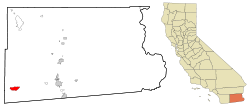
Coordinates: 32°44′19″N 115°59′39″W / 32.73861°N 115.99417°WCoordinates: 32°44′19″N 115°59′39″W / 32.73861°N 115.99417°W Country  United States
State  California
County Imperial Area[1] – Total 8.857 sq mi (22.941 km2) – Land 8.857 sq mi (22.941 km2) – Water 0 sq mi (0 km2) 0% Elevation 377 ft (115 m) Population (2010) – Total 266 – Density 30/sq mi (11.6/km2) Time zone Pacific (PST) (UTC-8) – Summer (DST) PDT (UTC-7) ZIP code 92259 Area code(s) 760 FIPS code 06-53378 GNIS feature ID 1656587 U.S. Geological Survey Geographic Names Information System: Ocotillo, California Ocotillo is a census-designated place (CDP) in Imperial County, California. Ocotillo is located 26 miles (42 km) west of El Centro,[2] The population was 266 at the 2010 census, down from 296 at the 2000 census. It is part of the El Centro, California Metropolitan Statistical Area.
Ocotillo was devastated by floods from Hurricane Kathleen in 1976; 3 people died.
Contents
Geography
Ocotillo is located at 32°44′19″N 115°59′39″W / 32.73861°N 115.99417°W.[3]
According to the United States Census Bureau, the CDP has a total area of 8.9 square miles (23 km2), all of it land. According to the United States Census Bureau there are two places to get a drink in town—the Old Highway Cafe and the Lazy Lizard Saloon.[citation needed]
The mountains nearby grew a little taller as a result of a series of minor earthquakes on 15 June 2010 which seems to be a result of 7.2 Richter Scale earthquake in Baja California (Mexico) back in April 2010.
History
Ocotillo was originally a retirement community.[2] The post office was opened in 1957.[2]
Demographics
2010
The 2010 United States Census[4] reported that Ocotillo had a population of 266. The population density was 30.0 people per square mile (11.6/km²). The racial makeup of Ocotillo was 242 (91.0%) White, 1 (0.4%) African American, 1 (0.4%) Native American, 2 (0.8%) Asian, 0 (0.0%) Pacific Islander, 17 (6.4%) from other races, and 3 (1.1%) from two or more races. Hispanic or Latino of any race were 61 persons (22.9%).
The Census reported that 266 people (100% of the population) lived in households, 0 (0%) lived in non-institutionalized group quarters, and 0 (0%) were institutionalized.
There were 138 households, out of which 24 (17.4%) had children under the age of 18 living in them, 50 (36.2%) were opposite-sex married couples living together, 13 (9.4%) had a female householder with no husband present, 5 (3.6%) had a male householder with no wife present. There were 3 (2.2%) unmarried opposite-sex partnerships, and 2 (1.4%) same-sex married couples or partnerships. 60 households (43.5%) were made up of individuals and 25 (18.1%) had someone living alone who was 65 years of age or older. The average household size was 1.93. There were 68 families (49.3% of all households); the average family size was 2.60.
The population was spread out with 44 people (16.5%) under the age of 18, 9 people (3.4%) aged 18 to 24, 33 people (12.4%) aged 25 to 44, 109 people (41.0%) aged 45 to 64, and 71 people (26.7%) who were 65 years of age or older. The median age was 56.1 years. For every 100 females there were 111.1 males. For every 100 females age 18 and over, there were 113.5 males.
There were 323 housing units at an average density of 36.5 per square mile (14.1/km²), of which 98 (71.0%) were owner-occupied, and 40 (29.0%) were occupied by renters. The homeowner vacancy rate was 2.8%; the rental vacancy rate was 14.9%. 189 people (71.1% of the population) lived in owner-occupied housing units and 77 people (28.9%) lived in rental housing units.
2000
As of the census[5] of 2000, there were 296 people, 145 households, and 79 families residing in the CDP. The population density was 33.3 people per square mile (12.9/km²). There were 253 housing units at an average density of 28.5 per square mile (11.0/km²). The racial makeup of the CDP was 87.8% White, 0.7% Black or African American, 1.7% Native American, 0.3% Asian, 0.3% Pacific Islander, 4.4% from other races, and 4.7% from two or more races. 19.9% of the population were Hispanic or Latino of any race.
There were 145 households out of which 22.8% had children under the age of 18 living with them, 44.8% were married couples living together, 8.3% had a female householder with no husband present, and 45.5% were non-families. 42.1% of all households were made up of individuals and 22.1% had someone living alone who was 65 years of age or older. The average household size was 2.0 and the average family size was 2.8.
In the CDP the population was spread out with 21.6% under the age of 18, 3.7% from 18 to 24, 18.9% from 25 to 44, 32.1% from 45 to 64, and 23.6% who were 65 years of age or older. The median age was 48 years. For every 100 females there were 112.9 males. For every 100 females age 18 and over, there were 100.0 males.
The median income for a household in the CDP was $23,438, and the median income for a family was $43,125. Males had a median income of $24,196 versus $55,556 for females. The per capita income for the CDP was $14,849. None of the families and 16.6% of the population were living below the poverty line, including no under eighteens and 26.2% of those over 64.
Politics
In the state legislature Ocotillo is located in the 40th Senate District, represented by Democrat Juan Vargas, and in the 80th Assembly District, represented by Republican Bonnie Garcia. Federally, Ocotillo is located in California's 51st congressional district, which has a Cook PVI of D +7[6] and is represented by Democrat Bob Filner.
See also
- San Diego–Imperial, California
- El Centro Metropolitan Area
References
- ^ U.S. Census
- ^ a b c Durham, David L. (1998). California's Geographic Names: A Gazetteer of Historic and Modern Names of the State. Quill Driver Books. p. 1450. ISBN 9781884995149.
- ^ U.S. Geological Survey Geographic Names Information System: Ocotillo, California
- ^ All data are derived from the United States Census Bureau reports from the 2010 United States Census, and are accessible on-line here. The data on unmarried partnerships and same-sex married couples are from the Census report DEC_10_SF1_PCT15. All other housing and population data are from Census report DEC_10_DP_DPDP1. Both reports are viewable online or downloadable in a zip file containing a comma-delimited data file. The area data, from which densities are calculated, are available on-line here. Percentage totals may not add to 100% due to rounding. The Census Bureau defines families as a household containing one or more people related to the householder by birth, opposite-sex marriage, or adoption. People living in group quarters are tabulated by the Census Bureau as neither owners nor renters. For further details, see the text files accompanying the data files containing the Census reports mentioned above.
- ^ "American FactFinder". United States Census Bureau. http://factfinder.census.gov. Retrieved 2008-01-31.
- ^ "Will Gerrymandered Districts Stem the Wave of Voter Unrest?". Campaign Legal Center Blog. http://www.clcblog.org/blog_item-85.html. Retrieved 2007-10-20.
Municipalities and communities of Imperial County, California Cities Brawley | Calexico | Calipatria | El Centro | Holtville | Imperial | Westmorland
CDPs Bombay Beach | Desert Shores | Heber | Niland | Ocotillo | Palo Verde | Salton City | Salton Sea Beach | Seeley | Winterhaven
Unincorporated
communitiesAcolita | Alamorio | Amos | Andrade | Anza | Araz Junction | Bard | Bertram | Bonds Corner | Boulder Park | Cactus | Citrus View | Clyde | Coolidge Springs | Coyote Wells | Curlew | Date City | Dixieland | Dunes | Edgar | Elmore Desert Ranch | Estelle | Felicity | Fondo | Frink | Fuller | Glamis | Gordons Well | Hovley | Imperial Gables | Iris | Kane Spring | Meloland | Mesquite | Moss | Mount Signal | Mundo | Munyon | Obregon | Ogilby | Orita | Paymaster Landing | Perrys Corner | Picacho | Plaster City | Pope | Rico | Rockwood | Ross Corner | Ruthven | Sandia | Slab City | Tortuga | Truckhaven | Verdant | Watermans Corner | Wiest | Wilsie | Wister
Indian
reservationsFort Yuma Indian Reservation | Torres-Martinez Indian Reservation
Ghost towns Araz | Barnes | Bernice | Bradtmoore | Butlers | Colorado | Concepcíon | Eastside | Gleason | Hazelwood | Highline | Indian Wells | Keystone | Laguna | Laparra | Lano | Mayflower | Mobile | No Mirage | Paringa | Picacho Basin | Potholes | Sackett's Wells | Sellew | Shamrock | Silsbee | Squeaky Springs
Categories:- Populated places in the Colorado Desert
- Census-designated places in Imperial County, California


Wikimedia Foundation. 2010.