- Niland, California
-
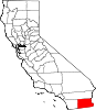
Niland — census-designated place — Location in Imperial County and the state of California
Coordinates: 33°14′24″N 115°31′08″W / 33.24°N 115.51889°WCoordinates: 33°14′24″N 115°31′08″W / 33.24°N 115.51889°W Country  United States
State  California
County Imperial Area[1] – Total 0.402 sq mi (1.040 km2) – Land 0.402 sq mi (1.040 km2) – Water 0 sq mi (0 km2) 0% Elevation -141 ft (-43 m) Population (2010) – Total 1,006 – Density 2,502.5/sq mi (967.3/km2) Time zone Pacific (PST) (UTC-8) – Summer (DST) PDT (UTC-7) ZIP code 92257 Area code(s) 760 FIPS code 06-51392 GNIS feature ID 1652758 Niland (formerly, Imperial Junction,[2] Old Beach,[2] and Hobgood[3]) is a census-designated place (CDP) in Imperial County, California. The town is located 8 miles (13 km) north of Calipatria,[3] 2 miles (3.2 km) southeast of Salton Sea. The population was 1,006 at the 2010 census, down from 1,143 at the 2000 census. It is part of the 'El Centro, California Metropolitan Statistical Area'.
Contents
History
The Old Beach post office operated from 1905 to 1907.[3] The Imperial Junction post office opened in 1910, changed its name to Hobgood in 1913, and to Niland in 1914.[3] The name Hobgood honors pioneer Richard H. Hobgood.[3] The name Niland was coined by the Imperial Farm Lands Association from "Nile Land" a commendatory name for the supposed fertility of the place.[3]
Demographics
2010
The 2010 United States Census[4] reported that Niland had a population of 1,006. The population density was 2,504.8 people per square mile (967.1/km²). The racial makeup of Niland was 539 (53.6%) White, 36 (3.6%) African American, 20 (2.0%) Native American, 36 (3.6%) Asian, 0 (0.0%) Pacific Islander, 315 (31.3%) from other races, and 60 (6.0%) from two or more races. Hispanic or Latino of any race were 618 persons (61.4%).
The Census reported that 1,006 people (100% of the population) lived in households, 0 (0%) lived in non-institutionalized group quarters, and 0 (0%) were institutionalized.
There were 367 households, out of which 131 (35.7%) had children under the age of 18 living in them, 143 (39.0%) were opposite-sex married couples living together, 83 (22.6%) had a female householder with no husband present, 30 (8.2%) had a male householder with no wife present. There were 25 (6.8%) unmarried opposite-sex partnerships, and 5 (1.4%) same-sex married couples or partnerships. 99 households (27.0%) were made up of individuals and 49 (13.4%) had someone living alone who was 65 years of age or older. The average household size was 2.74. There were 256 families (69.8% of all households); the average family size was 3.27.
The population dispersal was 248 people (24.7%) under the age of 18, 99 people (9.8%) aged 18 to 24, 215 people (21.4%) aged 25 to 44, 284 people (28.2%) aged 45 to 64, and 160 people (15.9%) who were 65 years of age or older. The median age was 39.6 years. For every 100 females there were 96.9 males. For every 100 females age 18 and over, there were 94.4 males.
There were 489 housing units at an average density of 1,217.5 per square mile (470.1/km²), of which 189 (51.5%) were owner-occupied, and 178 (48.5%) were occupied by renters. The homeowner vacancy rate was 7.4%; the rental vacancy rate was 23.3%. 497 people (49.4% of the population) lived in owner-occupied housing units and 509 people (50.6%) lived in rental housing units.
2000
As of the census[5] of 2000, there were 1,143 people, 422 households, and 281 families residing in the CDP. The population density was 2,813.3 people per square mile (1,076.4/km²). There were 530 housing units at an average density of 1,304.5 per square mile (499.1/km²). The racial makeup of the CDP was 54.8% White, 3.2% Black or African American, 2.0% Native American, 4.6% Asian, 28.1% from other races, and 7.4% from two or more races. 55.3% of the population were Hispanic or Latino of any race.
There were 422 households out of which 33.6% had children under the age of 18 living with them, 39.3% were married couples living together, 18.2% had a female householder with no husband present, and 33.4% were non-families. 29.1% of all households were made up of individuals and 14.7% had someone living alone who was 65 years of age or older. The average household size was 2.7 and the average family size was 3.3.
In the CDP the population was spread out with 30.0% under the age of 18, 8.0% from 18 to 24, 24.0% from 25 to 44, 22.4% from 45 to 64, and 15.6% who were 65 years of age or older. The median age was 36 years. For every 100 females there were 100.2 males. For every 100 females age 18 and over, there were 105.7 males.
The median income for a household in the CDP was $25,592, and the median income for a family was $27,500. Males had a median income of $36,786 versus $26,250 for females. The per capita income for the CDP was $11,297. About 15.1% of families and 21.4% of the population were below the poverty line, including 19.8% of those under age 18 and 12.4% of those age 65 or over.
Politics
In the state legislature Niland is located in the 40th Senate District, represented by Democrat Juan Vargas, and in the 80th Assembly District, represented by Democrat Manuel Perez. Federally, Niland is located in California's 51st congressional district, which has a Cook PVI of D +7[6] and is represented by Democrat Bob Filner.
See also
- San Diego–Imperial, California
- Slab City, a camp near Niland in the Colorado Desert in southeastern California, used by recreational vehicle owners and squatters from across North America
- El Centro Metropolitan Area
References
- ^ U.S. Census
- ^ a b U.S. Geological Survey Geographic Names Information System: Niland, California
- ^ a b c d e f Durham, David L. (1998). California's Geographic Names: A Gazetteer of Historic and Modern Names of the State. Quill Driver Books. p. 1449. ISBN 9781884995149.
- ^ All data are derived from the United States Census Bureau reports from the 2010 United States Census, and are accessible on-line here. The data on unmarried partnerships and same-sex married couples are from the Census report DEC_10_SF1_PCT15. All other housing and population data are from Census report DEC_10_DP_DPDP1. Both reports are viewable online or downloadable in a zip file containing a comma-delimited data file. The area data, from which densities are calculated, are available on-line here. Percentage totals may not add to 100% due to rounding. The Census Bureau defines families as a household containing one or more people related to the householder by birth, opposite-sex marriage, or adoption. People living in group quarters are tabulated by the Census Bureau as neither owners nor renters. For further details, see the text files accompanying the data files containing the Census reports mentioned above.
- ^ "American FactFinder". United States Census Bureau. http://factfinder.census.gov. Retrieved 2008-01-31.
- ^ "Will Gerrymandered Districts Stem the Wave of Voter Unrest?". Campaign Legal Center Blog. http://www.clcblog.org/blog_item-85.html. Retrieved 2007-10-20.
External links
- The 2006 documentary film Plagues and Pleasures on the Salton Sea (narrated by John Waters) documented the lives of the inhabitants of Niland, as well as the ecological issues associated with the Sea - www.saltonseadoc.com.
Municipalities and communities of Imperial County, California Cities Brawley | Calexico | Calipatria | El Centro | Holtville | Imperial | Westmorland
CDPs Bombay Beach | Desert Shores | Heber | Niland | Ocotillo | Palo Verde | Salton City | Salton Sea Beach | Seeley | Winterhaven
Unincorporated
communitiesAcolita | Alamorio | Amos | Andrade | Anza | Araz Junction | Bard | Bertram | Bonds Corner | Boulder Park | Cactus | Citrus View | Clyde | Coolidge Springs | Coyote Wells | Curlew | Date City | Dixieland | Dunes | Edgar | Elmore Desert Ranch | Estelle | Felicity | Fondo | Frink | Fuller | Glamis | Gordons Well | Hovley | Imperial Gables | Iris | Kane Spring | Meloland | Mesquite | Moss | Mount Signal | Mundo | Munyon | Obregon | Ogilby | Orita | Paymaster Landing | Perrys Corner | Picacho | Plaster City | Pope | Rico | Rockwood | Ross Corner | Ruthven | Sandia | Slab City | Tortuga | Truckhaven | Verdant | Watermans Corner | Wiest | Wilsie | Wister
Indian
reservationsFort Yuma Indian Reservation | Torres-Martinez Indian Reservation
Ghost towns Araz | Barnes | Bernice | Bradtmoore | Butlers | Colorado | Concepcíon | Eastside | Gleason | Hazelwood | Highline | Indian Wells | Keystone | Laguna | Laparra | Lano | Mayflower | Mobile | No Mirage | Paringa | Picacho Basin | Potholes | Sackett's Wells | Sellew | Shamrock | Silsbee | Squeaky Springs
Categories:- Populated places in the Colorado Desert
- Census-designated places in Imperial County, California
- Populated places in California with Hispanic majority populations
- Imperial Valley


Wikimedia Foundation. 2010.