- Holtville, California
Infobox Settlement
official_name = Holtville, California
settlement_type =City
imagesize =
image_caption =
image_
imagesize =
image_caption =
image_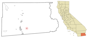
mapsize = 250x200px
map_caption = Location in Imperial County and the state ofCalifornia
mapsize1 =
map_caption1 =
subdivision_type = Country
subdivision_type1 = State
subdivision_type2 = County
subdivision_name =United States
subdivision_name1 =California
subdivision_name2 = Imperial
government_type =
leader_title =
leader_name =
established_date =
area_magnitude =
area_total_km2 = 3
area_total_sq_mi = 1.1
area_land_km2 = 3
area_land_sq_mi = 1.1
area_water_km2 = 0
area_water_sq_mi = 0
elevation_ft = -10
elevation_m = -3
population_as_of = 2000
population_footnotes =
population_total = 5612
population_metro =
population_density_km2 = 1870.7
population_density_sq_mi = 5101.8
timezone = Pacific (PST)
utc_offset = -8
latd = 32 |latm = 48 |lats = 43 |latNS = N
longd = 115 |longm = 22 |longs = 46 |longEW = W
timezone_DST = PDT
utc_offset_DST = -7
postal_code_type =ZIP code
postal_code = 92250
area_code = 760
blank_name = FIPS code
blank_info = 06-34246
blank1_name = GNIS feature ID
blank1_info = 1660761
footnotes =
website =Holtville is a city in Imperial County,
California ,United States . The population was 5,612 at the 2000 census. It is part of the 'El Centro, California Metropolitan Statistical Area '. City officials believed the population doubled in the last 6 years by 2007.Holtville was famous in the 20th century with having the "Imperial Valley Carrot Festival" but was confused with the "Coachella Valley" from
Bugs Bunny animated shorts in the 1940s when he reads the map seeking a Carrot Festival.Geography
Holtville is located at coor dms|32|48|43|N|115|22|46|W|city (32.811885, -115.379512)GR|1.
According to the
United States Census Bureau , the city has a total area of 1.1square mile s (3.0km² ), all of it land.Demographics
As of the
census GR|2 of 2000, there were 5,612 people, 1,564 households, and 1,340 families residing in the city. Thepopulation density was 4,920.8 people per square mile (1,900.7/km²). There were 1,617 housing units at an average density of 1,417.8/sq mi (547.7/km²). The racial makeup of the city was 54.37% White, 0.62% Black or African American, 0.84% Native American, 0.84% Asian, 0.07% Pacific Islander, 39.15% from other races, and 4.12% from two or more races. 73.84% of the population were Hispanic or Latino of any race.There were 1,564 households out of which 52.1% had children under the age of 18 living with them, 64.9% were married couples living together, 16.5% had a female householder with no husband present, and 14.3% were non-families. 12.3% of all households were made up of individuals and 5.8% had someone living alone who was 65 years of age or older. The average household size was 3.51 and the average family size was 3.80.
In the city the population was spread out with 35.2% under the age of 18, 8.9% from 18 to 24, 26.5% from 25 to 44, 18.3% from 45 to 64, and 11.1% who were 65 years of age or older. The median age was 30 years. For every 100 females there were 94.1 males. For every 100 females age 18 and over, there were 89.4 males.
The median income for a household in the city was $36,318, and the median income for a family was $39,347. Males had a median income of $31,328 versus $26,477 for females. The
per capita income for the city was $12,505. About 15.7% of families and 18.2% of the population were below thepoverty line , including 23.2% of those under age 18 and 11.8% of those age 65 or over.Politics
In the state legislature Holtville is located in the 40th Senate District, represented by Democrat
Denise Moreno Ducheny , and in the 80th Assembly District, represented by RepublicanBonnie Garcia . Federally, Holtville is located inCalifornia's 51st congressional district , which has a Cook PVI of D +7 [cite web | title = Will Gerrymandered Districts Stem the Wave of Voter Unrest? | publisher = Campaign Legal Center Blog | url=http://www.clcblog.org/blog_item-85.html | accessdate = 2007-10-20] and is represented by DemocratBob Filner .General information
The city was founded by Swiss-German settlers in the 1880s often through the
U.S.-Mexican border fromMexico . The construction of railroads in the 1890s, theAll-American Canal in the late 1940s, U.S. Route 80 in the 1920s later converted to Interstate 8 in the 1970s and theNorth American Free Trade Agreement (NAFTA) economic boom in the 1990s brought more people to Holtville and the Imperial Valley.The City of Holtville, which was originally called "Holton", was founded in 1903 by W.F. Holt, and incorporated on June 20, 1908. The name was changed to Holtville due to a request by the Postal Service because the name Holton sounded too much like Colton the regional headquarters of the
Southern Pacific Railroad at the time.The city lies on the northeast bank of the
Alamo River formed by the floods of 1905-07 when theColorado River break made the river's course turn west and filled the low-lying depression of water now theSalton Sea .The old U.S. Route 80 once ran along Fifth Street through the center of town. A small obelisk in Holt Park, just north of Fifth Street, gives the distances to various points to the north, east and west. U.S. Route 80 has been decommissioned and made as
County Route S80 in California. The portion in and near Holtville is now part of State Route 115.Much of the east-west automobile traffic has been diverted to Interstate 8, about 2.5 miles to the south. Holtville is easily accessible through the Orchard Road interchange. The newly constructed State Route 7 connects Holtville with the factories and industrial areas of
Mexicali, Baja California ,Mexico .The city was once joined by railroad to El Centro, but this line, and another railroad line going to the north, have been abandoned. The closure of the railroad station brought on economic decline to the town in the late 20th century.
The city's major civic event is the annual Carrot Festival, held in January or February. It usually features a parade, a carnival and other activities over a 12-day period. Holtville was famous in the mid 20th century with having the "Imperial Valley" "Carrot Festival" but was confused with the "Coachella Valley" name from
Bugs Bunny animated shorts in the 1940s when he reads the map seeking a "Carrot Festival".A weekly newspaper, "The Holtville Tribune", is distributed by mail and newsstand in the Holtville area. Its circulation is about 3,750. The daily newspaper, the "Imperial Valley Press" in El Centro, has circulation at over 20,000.
References
External links
* [http://www.holtville.ca.gov/ City of Holtville website]
* [http://www.holtvillechamber.com/ Holtville Chamber of Commerce]
* [http://www.efgh.com/holtville/index.html Map of Holtville and vicinity]
Wikimedia Foundation. 2010.