- Calexico, California
-
City of Calexico — City — Location of Calexico, California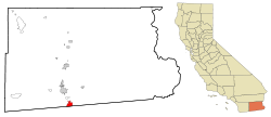
Coordinates: 32°40′44″N 115°29′56″W / 32.67889°N 115.49889°WCoordinates: 32°40′44″N 115°29′56″W / 32.67889°N 115.49889°W Country  United States
State  California
County Imperial Government – Mayor John Moreno Area[1] – Total 8.391 sq mi (21.733 km2) – Land 8.391 sq mi (21.733 km2) – Water 0 sq mi (0 km2) 0% Elevation 7 ft (2 m) Population (2010) – Total 38,572 – Density 4,596.8/sq mi (1,774.8/km2) Time zone PST (UTC-8) – Summer (DST) PDT (UTC-7) ZIP codes 92231-92232 Area code(s) 760 FIPS code 06-09710 GNIS feature ID 1652680 Website http://www.calexico.ca.gov Calexico is a city in Imperial County, California. The population was 38,572 at the 2010 census, up from 27,109 at the 2000 census. Calexico is about 122 miles (196 km) east of San Diego and 62 miles (100 km) west of Yuma, Arizona. The name “Calexico” is a portmanteau of California and Mexico, which like that of its adjacent sister city of Mexicali, emphasizes its importance as a border city.
Major events every year are the Mariachi festival on March 25 followed by the SDSU "Perspective of the Latino Race" art exhibition on April 3.
Contents
Geography
Calexico is located at 32°40′44″N 115°29′56″W / 32.67889°N 115.49889°W.[2]
According to the United States Census Bureau, at the 2010 census, the city had a total area of 6.2 square miles (16 km2), all land. Calexico is located 230 miles (370 km) southeast of Los Angeles, 125 miles (201 km) east of San Diego, 260 miles (420 km) west of Phoenix, and adjacent to Mexicali, Baja California, Mexico.
Calexico's location provides easy overnight trucking access to all those transportation hubs plus the ports of Long Beach, California, and Ensenada, Baja California, Mexico.
Calexico's strategic location is seen by many[who?] as the prime link between the interior of Mexico and the major markets along the west coast of the U.S. and Canada.
Calexico is served by State Routes 98, 7 and 111, with direct connection to Interstate 8 (5 miles north) and State Route 86. There are eighteen regular and irregular common carriers for intrastate and interstate truck service to Calexico.
Rail service is provided by Union Pacific Railroad, and connects with the main line to Portland, Oregon; Rock Island, Illinois; Tucumcari, New Mexico; St. Louis, Missouri; and New Orleans, Louisiana.
Within city limits is Calexico International Airport, the U.S. Customs and Border Protection check-point for private passenger and air-cargo flights entering the U.S. from Mexico. Private charter services are also available there.
General aviation facilities and scheduled passenger and air-cargo service to Los Angeles International Airport, Phoenix Sky Harbor International Airport, and other points are available at Imperial County Airport (Boley Field), located 17 miles (27 km) north.
History
Calexico began as a tent city of the Imperial Land Company and has grown into a large, thriving city on the U.S.-Mexico border. Calexico was founded in 1899 and incorporated in 1908. The Imperial Land Company converted bone-dry desert land into a fertile setting for year-round agriculture that provides an economic base. The originally proposed names were Santo Tomas or Thomasville.
Today, Calexico is said to hold the highest percentage of Latino residents of any city in the U.S. (about 90%).[citation needed]
Although it gained a reputation for a while as a typical U.S.-Mexico bordertown with all the tawdry aspects usually associated with such places, the modern city of Calexico is a far cry from what it was back in those early days. Hundreds of acres are now being devoted to industrial parks, and commercial and retail incentives are being offered to encourage industrial development.
Since Calexico represents the mixing of two cultures and areas and because of its proximity to the Mexican border, the name Calexico was coined from a combination of the words California and Mexico. Mexicali is a similarly named city directly across the international border from Calexico.
The first post office in Calexico opened in 1902.[3]
2010 Earthquake
Main article: 2010 Baja California earthquakeOn April 4, 2010 the El Mayor earthquake caused moderate to heavy damage throughout Calexico and across the border in Mexicali. Measuring 7.2 on the Richter scale, the quake was centered about 40 miles south of the U.S.-Mexico border near Mexicali.[4] A state of emergency was declared and officials cordoned off First and Second streets between Paulin and Heber Avenues. Glass and debris littered the streets of downtown Calexico and two buildings partially collapsed. The Calexico water treatment plant sustained severe damage.[5]
Government
The City of Calexico operates under a City Council/City Manager form of government. The City Council consists of five Council Members, elected to overlapping four-year term. The Mayor and Mayor Pro-Tem are chosen from among the five council members and rotate on an annual basis.
The Mayor presides at council meetings, where all official policies and laws of the City are enacted. The members of the Calexico City Council set policy and appoint commissions and committees that study the present and future needs of Calexico.
The other two elected officials in the City of Calexico are the City Clerk and City Treasurer. Each of them is elected directly by the voters and serves a four year term.
The Calexico branch of the Imperial County Superior Court system was officially renamed on Saturday, December 19, 1992 in honor of Legaspi family members Henry, Victor and Luis Legaspi as the Legaspi Municipal Court Complex.[6]
Demographics
2010
The 2010 United States Census[7] reported that Calexico had a population of 38,572. The population density was 4,596.7 people per square mile (1,774.8/km²). The racial makeup of Calexico was 23,150 (60.0%) White, 134 (0.3%) African American, 204 (0.5%) Native American, 504 (1.3%) Asian, 21 (0.1%) Pacific Islander, 12,920 (33.5%) from other races, and 1,639 (4.2%) from two or more races. Hispanic or Latino of any race were 37,354 persons (96.8%).
The Census reported that 38,472 people (99.7% of the population) lived in households, 100 (0.3%) lived in non-institutionalized group quarters, and 0 (0%) were institutionalized.
There were 10,116 households, out of which 5,759 (56.9%) had children under the age of 18 living in them, 5,767 (57.0%) were opposite-sex married couples living together, 2,319 (22.9%) had a female householder with no husband present, 595 (5.9%) had a male householder with no wife present. There were 316 (3.1%) unmarried opposite-sex partnerships, and 61 (0.6%) same-sex married couples or partnerships. 1,200 households (11.9%) were made up of individuals and 675 (6.7%) had someone living alone who was 65 years of age or older. The average household size was 3.80. There were 8,681 families (85.8% of all households); the average family size was 4.09.
The population was spread out with 12,011 people (31.1%) under the age of 18, 4,262 people (11.0%) aged 18 to 24, 9,332 people (24.2%) aged 25 to 44, 8,559 people (22.2%) aged 45 to 64, and 4,408 people (11.4%) who were 65 years of age or older. The median age was 31.8 years. For every 100 females there were 89.6 males. For every 100 females age 18 and over, there were 84.2 males.
There were 10,651 housing units at an average density of 1,269.3 per square mile (490.1/km²), of which 5,430 (53.7%) were owner-occupied, and 4,686 (46.3%) were occupied by renters. The homeowner vacancy rate was 2.6%; the rental vacancy rate was 3.1%. 22,155 people (57.4% of the population) lived in owner-occupied housing units and 16,317 people (42.3%) lived in rental housing units.
2000
As of the census[8] of 2000, there were 27,109 people, 6,814 households, and 5,982 families residing in the city. The population density was 4,353.4 people per square mile (1,680.1/km²). There were 6,983 housing units at an average density of 1,121.4 per square mile (432.8/km²).
The racial makeup of the city was 4.6% White, 0.5% Black or African American, 0.7% Native American, 1.8% Asian, <0.1% Pacific Islander, 47.0% from other races, and 3.5& from two or more races. With 95.3% of the population Hispanic or Latino (of any race), Calexico has one of the highest Hispanic/Latino percentages of any California city.
There were 6,814 households out of which 53.4% had children under the age of 18 living with them, 61.2% were married couples living together, 22.0% had a female householder with no husband present, and 12.2% were non-families. 10.4% of all households were made up of individuals and 6.9% had someone living alone who was 65 years of age or older. The average household size was 4.0 and the average family size was 4.2.
In the city the population was spread out with 34.9% under the age of 18, 9.9% from 18 to 24, 27.1% from 25 to 44, 17.6% from 45 to 64, and 10.4% who were 65 years of age or older. The median age was 29 years. For every 100 females there were 87.2 males. For every 100 females age 18 and over, there were 80.6 males. The rate of teen pregnancy in the city is ranked third in the nation with 17.3% of females between the ages of 14 and 18 being pregnant.
The median income for a household in the city was $28,929, and the median income for a family was $30,277. Males had a median income of $27,712 versus $18,857 for females. The per capita income for the city was $9,981. About 22.6% of families and 25.7% of the population were below the poverty line, including 30.8% of those under age 18 and 16.2% of those age 65 or over. The poverty rate in Calexico as a border city is above-average in the US, while in contrast Mexicali is considered prosperous by Mexican standards.
Politics
In the state legislature Calexico is located in the 40th Senate District, represented by Democrat Juan Vargas, and in the 80th Assembly District, represented by Democrat Manuel Perez. Federally, Calexico is located in California's 51st congressional district, which has a Cook PVI of D +7[9] and is represented by Democrat Bob Filner.
The current mayor is Luis Castro, and Mayor Pro Term Daniel Romero with council members: Maritza Hurtado, Bill Hodge, and John Moreno.
Education
Colleges and universities
Post-secondary education is available at the San Diego State University Imperial Valley Campus of San Diego State University, and at Imperial Valley College. In addition, there are more than 20 local agencies and programs providing vocational training which can be tailored to the specific needs of potential employers.
Public schools
The Calexico Unified School District serves city residents.
Elementary
[K-6] Kennedy Gardens Elementary - Home of the Eagles
Allen and Helen Mains Elementary - Home of the Trojans
Rockwood Elementary - Home of the Rockets
Blanche Charles Elementary - Home of the Dolphins
Jefferson Elementary - Home Of the Tigers
Dool Elementary - Home of the Cougars
Cesar Chavez Elementary - Home of the Lobos
Junior high schools
[7-8]
Willam Moreno Jr. High - Home of the Aztecs
Enrique Camarena Junior High School - Home of the Firebirds
[9]
De Anza 9th Grade Academy - Home of the Bullpups
Secondary schools
[10-12]
Calexico High School - Home of the Bulldogs
Aurora High School - Home of the Eagles
Adult education schools
Robert F. Morales Adult Education Center
Independent Studies Office
Private schools
Calexico Mission School, a Seventh-day Adventist Academy operated by the Southeastern California Conference in Riverside, CA provides private religious education in Calexico from K-12.
Our Lady of Guadalupe Academy (Home to the Bees), and Vincent Memorial Catholic High School (Home to the Scots), Roman Catholic schools operated by the Roman Catholic Diocese of San Diego, are also in Calexico.
Notable people
- Anita Álvarez de Williams - anthropologist and photographer
- Dan Navarro - singer/songwriter
- Enrique Castillo - actor
- Enrique Camarena -DEA Agent
- Mariano-Florentino Cuéllar - President Obama's Advisor on Immigration policy during the campaign and the transition, an attorney and professor of law at Stanford University.[10]
- Emilio Delgado - actor
- Bob Huff - California senator
- Takashi Kijima - photographer
- Ruben Niebla - baseball player
- Allen Strange - composer
- Eugenio Elorduy Walther - Governor of Baja California
- Bob Wilson - US Congressman
- Isaac Acuña - soccer player (Club America)
Louis A. Fuentes - 101st Mayor, Appointed by Governor Arnold Schwarzenegger to the Imperial County Board of Supervisors for District 1 Calexico. Chairman of the Board 2010
In popular culture
- Curtis Hanson's Losin' It was filmed in Calexico.
- The band Calexico is named after the town.
- A narcotics officer in Michael Connelly's The Black Ice is named after the town.
References
- ^ U.S. Census
- ^ U.S. Geological Survey Geographic Names Information System: Calexico, California
- ^ Durham, David L. (1998). California's Geographic Names: A Gazetteer of Historic and Modern Names of the State. Quill Driver Books. p. 1401. ISBN 9781884995149.
- ^ [1]
- ^ Imperial Valley Press blog
- ^ “Calexico Chronicle” Vol. 90, No. 21, December 24, 1992.
- ^ All data are derived from the United States Census Bureau reports from the 2010 United States Census, and are accessible on-line here. The data on unmarried partnerships and same-sex married couples are from the Census report DEC_10_SF1_PCT15. All other housing and population data are from Census report DEC_10_DP_DPDP1. Both reports are viewable online or downloadable in a zip file containing a comma-delimited data file. The area data, from which densities are calculated, are available on-line here. Percentage totals may not add to 100% due to rounding. The Census Bureau defines families as a household containing one or more people related to the householder by birth, opposite-sex marriage, or adoption. People living in group quarters are tabulated by the Census Bureau as neither owners nor renters. For further details, see the text files accompanying the data files containing the Census reports mentioned above.
- ^ "American FactFinder". United States Census Bureau. http://factfinder.census.gov. Retrieved 2008-01-31.
- ^ "Will Gerrymandered Districts Stem the Wave of Voter Unrest?". Campaign Legal Center Blog. http://www.clcblog.org/blog_item-85.html. Retrieved 2007-10-20.
- ^ Hendricks, Tyche (November 22, 2008). "Stanford professor leads Obama immigration team". The San Francisco Chronicle. http://www.sfgate.com/cgi-bin/article.cgi?f=/c/a/2008/11/21/BA2I149R42.DTL.
External links
- City of Calexico website
- Calexico Chamber of Commerce
- Calexico Unified School District
- Camarena Memorial Library website
- Discover the Best of Calexico
Southern Border Region Counties 
Global City
1.2 millionMajor Cities
100k-200kCities and towns
25k-100kEl Cajon • El Centro • Encinitas • Calexico • Fallbrook • Imperial Beach • La Mesa • La Presa • National City • Poway • San Marcos • Santee • Spring Valley • VistaCities and towns
under 25kAlpine • Bombay Beach • Bonita • Bostonia • Brawley • Casa de Oro-Mount Helix • Calipatria • Coronado • Desert Shores • Heber • Holtville • Imperial • Lakeside • Lemon Grove • Niland • Ocotillo • Palo Verde • Ramona • Rancho San Diego • Salton City • Salton Sea Beach • Seeley • Solana Beach • Westmorland • Winter Gardens • WinterhavenBodies of water Alamo River • Colorado River • Mission Bay • New River • Salton Sea • San Diego Bay • San Diego River • San Luis Rey River • Santa Margarita River • Sweetwater River • Tijuana RiverLandforms Regions North County • Borrego • South Bay • East County • San Diego • Imperial Valley • Southern Border RegionMunicipalities and communities of Imperial County, California Cities Brawley | Calexico | Calipatria | El Centro | Holtville | Imperial | Westmorland
CDPs Bombay Beach | Desert Shores | Heber | Niland | Ocotillo | Palo Verde | Salton City | Salton Sea Beach | Seeley | Winterhaven
Unincorporated
communitiesAcolita | Alamorio | Amos | Andrade | Anza | Araz Junction | Bard | Bertram | Bonds Corner | Boulder Park | Cactus | Citrus View | Clyde | Coolidge Springs | Coyote Wells | Curlew | Date City | Dixieland | Dunes | Edgar | Elmore Desert Ranch | Estelle | Felicity | Fondo | Frink | Fuller | Glamis | Gordons Well | Hovley | Imperial Gables | Iris | Kane Spring | Meloland | Mesquite | Moss | Mount Signal | Mundo | Munyon | Obregon | Ogilby | Orita | Paymaster Landing | Perrys Corner | Picacho | Plaster City | Pope | Rico | Rockwood | Ross Corner | Ruthven | Sandia | Slab City | Tortuga | Truckhaven | Verdant | Watermans Corner | Wiest | Wilsie | Wister
Indian
reservationsFort Yuma Indian Reservation | Torres-Martinez Indian Reservation
Ghost towns Araz | Barnes | Bernice | Bradtmoore | Butlers | Colorado | Concepcíon | Eastside | Gleason | Hazelwood | Highline | Indian Wells | Keystone | Laguna | Laparra | Lano | Mayflower | Mobile | No Mirage | Paringa | Picacho Basin | Potholes | Sackett's Wells | Sellew | Shamrock | Silsbee | Squeaky Springs
Categories:- Incorporated cities and towns in California
- Communities in the Lower Colorado River Valley
- Populated places in the Colorado Desert
- Cities in Imperial County, California
- Populated places in California with Hispanic majority populations


Wikimedia Foundation. 2010.