- Lemon Grove, California
Infobox Settlement
official_name = City of Lemon Grove
other_name =
native_name =
nickname =
motto = Best Climate on Earth
imagesize = 200px
image_caption = Lemon Grove Trolley Station
flag_size =
image_
seal_size =
image_shield =
shield_size =
image_blank_emblem =
blank_emblem_size =
flag_size =
image_
seal_size =
image_shield =
shield_size =
image_blank_emblem =
blank_emblem_size =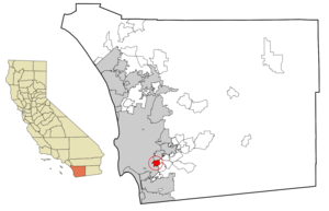
mapsize = 250x200px
map_caption =
mapsize1 =
map_caption1 =
pushpin_
pushpin_label_position =
subdivision_type = Country
subdivision_name =United States
subdivision_type1 = State
subdivision_name1 =California
subdivision_type2 = County
subdivision_name2 = San Diego
government_type =Council-Manager
leader_title =Mayor
leader_name = Teresa Sessom
leader_title1 =City Manager
leader_name1 = Graham Mitchell
leader_title2 =
leader_name2 =
leader_title3 =
leader_name3 =
leader_title4 =
leader_name4 =
established_title =
established_date =
established_title2 =
established_date2 =
established_title3 = Incorporated
established_date3 =July 1 ,1977
area_magnitude =
area_footnotes =
area_total_km2 = 9.8
area_land_km2 = 9.8
area_water_km2 = 0.0
area_total_sq_mi = 3.8
area_land_sq_mi = 3.8
area_water_sq_mi = 0.0
area_water_percent =
area_urban_km2 =
area_urban_sq_mi =
area_metro_km2 =
area_metro_sq_mi =
population_as_of = 2005 - 2007 incl. Tijuana
population_footnotes = [Source: U.S. Census Bureau, 2005 Population Estimates, Census 2000, 1990 Census] [http://world-gazetteer.com/wg.php?x=&men=gpro&lng=en&dat=32&geo=-223&srt=pnan&col=aohdq&pt=a&va=&geo=-1049427 World Gazetteer – San Diego-Tijuana] ]
population_note =
settlement_type =City
population_total = 24,124
population_density_km2 = 2531.8
population_density_sq_mi = 6557.3
population_metro = Incl. Tijuana: 4922723
population_density_metro_km2 =
population_density_metro_sq_mi =
population_urban =
population_density_urban_km2 =
population_density_urban_sq_mi =
timezone = PST
utc_offset = -8
timezone_DST = PDT
utc_offset_DST = -7
latd = 32 |latm = 44 |lats = 29 |latNS = N
longd = 117 |longm = 01 |longs = 54 |longEW = W
elevation_m = 136
elevation_ft = 440
postal_code_type =ZIP code
postal_code = 91945
area_code = 619
website = http://www.ci.lemon-grove.ca.us/
blank_name = FIPS code
blank_info = 06-41124
blank1_name = GNIS feature ID
blank1_info = 1660902
footnotes =Lemon Grove is a city in San Diego County,
California ,United States . The population was 24,918 as of the 2000 census.History
The community was settled in 1869 by its first known permanent resident, sheep rancher Robert Allison. From the 1860s to 1900 the area was known for sheep and poultry ranching and vegetable crops. In the early 1900s, the community acquired its name when large citrus groves were planted and lemon and orange growing and shipping became the area's major industry. By
World War II , most of the citrus groves had disappeared andsuburbanization had begun. By 1960, most of the easily developable land was gone. Lemon Grove wasincorporated as a general law city in 1977. ["General law" means under the provisions established by the legislature, as opposed to a charter city which would have more options. [http://igs.berkeley.edu/library/localweb.html UCB Institute for Governmental Studies] ]The Lemon Grove Mummy
In 1966, two teenagers ventured to caves near Chihuahua, Mexico in search of a mummy to keep for their own. After spending more than a month exploring caves, the teens finally found two mummies which they packed up and smuggled across the border.
Having no idea what to do with their discoveries and not wanting their parents to know, the teens asked a friend if they could store a box in her garage in Lemon Grove, California.
For 14 years, the mummies of the girl and the infant remained in the Lemon Grove garage, until the mother of the friend began to clean out her garage. The mother discovered the mummies and as a result believed a murder had taken place. When the mummies where tracked back to the two males, they wanted to donate the mummies to a museum. The San Diego Museum of Man officials contacted Mexican authorities and asked for permission to keep the mummies as exhibits and an addition to the permanent collection. Permission was granted, and the mummies were placed on exhibit. [ [http://www.history.com/media.do?id=mysteries_lemongrovemummy_broadband&action=clip Video Gallery - Famous Speeches - The History Channel ] ]
Geography
Lemon Grove is located at coor dms|32|44|0|N|117|2|1|W|city (32.733451, -117.033702)GR|1.
According to the
United States Census Bureau , the city has a total area of 9.8 km² (3.8 mi²), all land.Demographics
As of the
census GR|2 of 2000, there were 24,918 people, 8,488 households, and 5,958 families residing in the city. Thepopulation density was 2,531.8/km² (6,557.3/mi²). There were 8,722 housing units at an average density of 886.2/km² (2,295.2/mi²). The racial makeup of the city was 59.63% White, 12.08% African American, 1.10% Native American, 5.75% Asian, 0.84% Pacific Islander, 13.50% from other races, and 7.10% from two or more races. Hispanic or Latino of any race were 28.52% of the population.There were 8,488 households out of which 36.4% had children under the age of 18 living with them, 49.0% were married couples living together, 15.6% had a female householder with no husband present, and 29.8% were non-families. 22.4% of all households were made up of individuals and 8.9% had someone living alone who was 65 years of age or older. The average household size was 2.87 and the average family size was 3.36.
In the city the population was spread out with 27.6% under the age of 18, 9.0% from 18 to 24, 30.9% from 25 to 44, 20.5% from 45 to 64, and 12.0% who were 65 years of age or older. The median age was 35 years. For every 100 females there were 93.9 males. For every 100 females age 18 and over, there were 91.0 males.
The median income for a household in the city was $39,823, and the median income for a family was $45,844. Males had a median income of $35,042 versus $28,509 for females. The
per capita income for the city was $17,002. About 9.2% of families and 13.7% of the population were below thepoverty line , including 18.0% of those under age 18 and 5.9% of those age 65 or over.Current estimates
According to estimates by the
San Diego Association of Governments , themedian household income of Lemon Grove in 2005 was $55,436 (not adjusted forinflation ). When adjusted forinflation (1999 dollars; comparable toCensus data above), the median household income was $45,016.Politics
In the state legislature Lemon Grove is located in the 39th Senate District, represented by Democrat
Christine Kehoe , and in the 78th Assembly District, represented by RepublicanShirley Horton . Federally, Lemon Grove is located inCalifornia's 53rd congressional district , which has a Cook PVI of D +12 [cite web | title = Will Gerrymandered Districts Stem the Wave of Voter Unrest? | publisher = Campaign Legal Center Blog | url=http://www.clcblog.org/blog_item-85.html | accessdate = 2008-02-10] and is represented by DemocratSusan Davis .Notable Residents
* Noted cycling activist, author and cycling transportation engineer John Forester. [ [http://www.johnforester.com John Forester's website with Lemon Grove address] ]
*Speed Martin formerMajor League Baseball playerFact|date=April 2008
* ActorDennis Hopper , around age 13. [ [http://www.sdreader.com/php/ma_show.php?id=375 San Diego Reader, July 5, 2001] ]"The World's Biggest Lemon"
There is a ten foot wide statue of a lemon located at 3361 Main Street. It lies before a small lemon grove besides the Orange Line Trolley Tracks near the local trolley station and downtown bus stop. Written across the base of this monument are the words "Best Climate On Earth".
Urban Legends
There is a local urban legend that a worker died during the construction of the giant lemon, and was eventually entombed inside the lemon.
Another local urban legend has it that a Native American princess was buried in Lemon Grove, near the shopping center off College Avenue, just north of the Federal/Broadway intersection. In fact, there was a grave at that location although it was the Polish princess Filomena Wojciechowski. The flag of Poland flew over the grave until it was moved in the late 1960s during the construction of the present College Avenue offramp from eastbound Highway 94.
Schools
Primary education in the City is provided by the Lemon Grove School District [http://www.lgsd.k12.ca.us/]
Elementary Schools
Golden Avenue Elementary School
Monterey Heights Elementary School
Mount Vernon Elementary School
San Altos Elementary School
San Miguel Elementary School
Vista La Mesa Elementary SchoolMiddle Schools
Lemon Grove Middle School
Palm Middle SchoolGrossmont Union High School District (GUHSD) provides secondary and adult education.High schools serving Lemon Grove:
Helix High School Mount Miguel High School
Monte Vista High SchoolLandmark case
The
Lemon Grove Incident in 1931 was a boycott of segregated schools by Mexican-Americans resulting in the first court ordered school desegration in the United States.External links
* [http://www.ci.lemon-grove.ca.us/ City of Lemon Grove]
Wikimedia Foundation. 2010.