- La Presa, California
Infobox Settlement
official_name = La Presa, California
settlement_type = CDP
imagesize =
image_caption =
image_
imagesize =
image_caption =
image_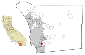
mapsize = 250x200px
map_caption = Location in San Diego County and the state ofCalifornia
mapsize1 =
map_caption1 =
subdivision_type = Country
subdivision_type1 = State
subdivision_type2 = County
subdivision_name =United States
subdivision_name1 =California
subdivision_name2 = San Diego
government_type =
leader_title =
leader_name =
established_date =
area_magnitude =
area_total_km2 = 16
area_total_sq_mi = 6.2
area_land_km2 = 14.5
area_land_sq_mi = 5.6
area_water_km2 = 1.5
area_water_sq_mi = 0.6
elevation_ft = 351
elevation_m = 107
population_as_of = 2000
population_footnotes =
population_total = 32721
population_metro =
population_density_km2 = 2045.1
population_density_sq_mi = 5277.6
timezone = PST
utc_offset = -8
latd = 32 |latm = 42 |lats = 43 |latNS = N
longd = 117 |longm = 0 |longs = 14 |longEW = W
timezone_DST = PDT
utc_offset_DST = -7
postal_code_type =ZIP code
postal_code = 91977
area_code = 619
blank_name = FIPS code
blank_info = 06-40326
blank1_name = GNIS feature ID
blank1_info = 0244447
footnotes =
website =La Presa is a
neighborhood in the community of Spring Valley in San Diego County,California ,United States .The population of the La Presa
census-designated place (CDP) was 32,721 at the 2000 census. The neighborhood was part of neighboring Spring Valley's census area from 1970 to 1990.The neighborhood is served by a 91977
ZIP code , which is considered Spring Valley according to the USPS.La Presa is Spanish for "The
Dam ".Geography
According to the
United States Geological Survey La Presa is loacated at coor dms|32|42|29|N|116|59|50|W|city (32.7081085, -116.9972487)GR|1. This is near the intersection of Jamacha Boulvard and Grand Avenue. Most maps place La Presa at this location.According to the
United States Census Bureau La Presa is located at coor dms|32|42|43|N|117|0|14|W|city (32.712057, -117.003862)GR|1. This is approximately 2,300 feet northwest of the USGS location. According to the United States Census Bureau, the CDP has a total area of 16.0km² (6.2 mi²). 14.5 km² (5.6 mi²) of it is land and 1.5 km² (0.6 mi²) of it (9.39%) is water.Demographics
As of the
census GR|2 of 2000, there were 32,721 people, 10,008 households, and 7,986 families residing in the CDP. Thepopulation density was 2,256.0/km² (5,843.6/mi²). There were 10,236 housing units at an average density of 705.7/km² (1,828.0/mi²). The racial makeup of the CDP was 50.21% White, 14.48% African American, 0.88% Native American, 9.83% Asian, 1.13% Pacific Islander, 16.35% from other races, and 7.13% from two or more races. Hispanic or Latino of any race were 33.05% of the population.There were 10,008 households out of which 43.5% had children under the age of 18 living with them, 57.6% were married couples living together, 16.5% had a female householder with no husband present, and 20.2% were non-families. 14.6% of all households were made up of individuals and 5.8% had someone living alone who was 65 years of age or older. The average household size was 3.25 and the average family size was 3.55.
In the CDP the population was spread out with 31.3% under the age of 18, 9.3% from 18 to 24, 30.5% from 25 to 44, 19.6% from 45 to 64, and 9.3% who were 65 years of age or older. The median age was 32 years. For every 100 females there were 95.2 males. For every 100 females age 18 and over, there were 91.3 males.
The median income for a household in the CDP was $45,939, and the median income for a family was $47,486. Males had a median income of $34,412 versus $26,210 for females. The
per capita income for the CDP was $15,998. About 9.4% of families and 10.7% of the population were below thepoverty line , including 15.5% of those under age 18 and 6.4% of those age 65 or over.Politics
In the state legislature La Presa is located in the 36th and 39th Senate District, represented by Republican
Dennis Hollingsworth and DemocratChristine Kehoe , and in the 78th Assembly District, represented by RepublicanShirley Horton . Federally, La Presa is located in California's 51st, 52nd, and 53rd congressional districts, which have Cook PVIs of D +7, R +9, and D +12 respectively [cite web | title = Will Gerrymandered Districts Stem the Wave of Voter Unrest? | publisher = Campaign Legal Center Blog | url=http://www.clcblog.org/blog_item-85.html | accessdate = 2008-02-10] and is represented by DemocratBob Filner , RepublicanDuncan Hunter , and DemocratSusan Davis respectively.External links
* [http://www.city-data.com/city/La-Presa-California.html Information on La Presa from city-data.com]
Wikimedia Foundation. 2010.